The best traffic-free bike rides in Justin P. Wilson Cumberland Trail State Park
5.0
(3)
93
riders
17
rides
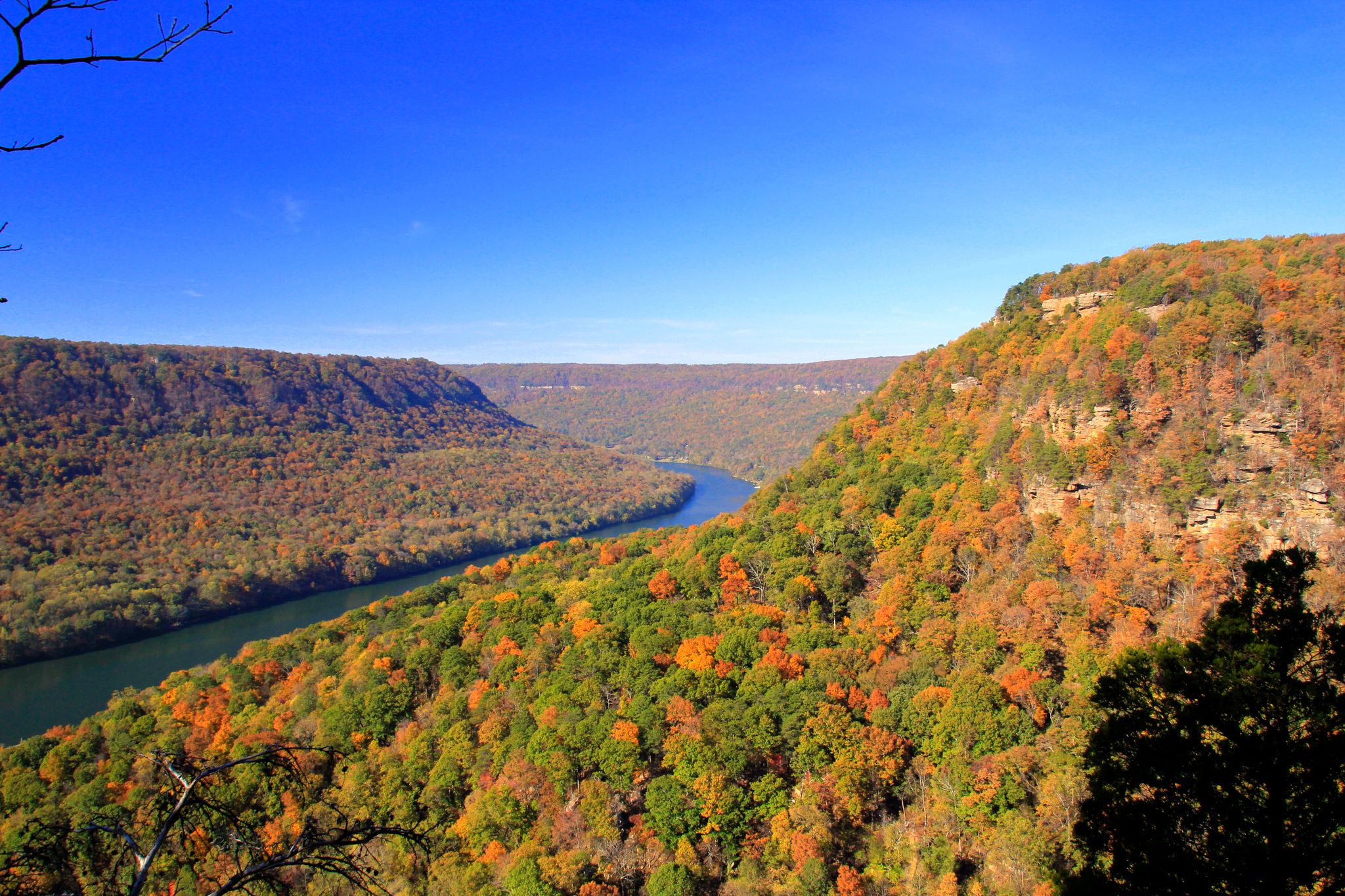
Road cycling in Justin P. Wilson Cumberland Trail State Park offers routes through the rugged beauty of the Cumberland Plateau. The region features dramatic gorges, panoramic vistas, and diverse ecosystems, with roads that traverse the plateau's edges. Cyclists can experience varied forest types and natural habitats, often with views of geological formations. While the main Cumberland Trail is for hiking, adjacent paved roads provide scenic no traffic road cycling routes.
Best no traffic road cycling routes in Justin P. Wilson Cumberland Trail State Park
- The most popular no traffic road cycling route is Bakewell Mountain loop from Soddy Municipal Park, a 38.8 miles (62.4 km) trail that takes 3 hours 21 minutes to complete. This moderate route features significant elevation gain through the Bakewell Mountain area.
- Another top favourite among local road cyclists is Bakewell Mountain & Chickamauga Reservoir loop, a difficult 62.8 miles (101.0 km) path. This route combines mountain terrain with views of the Chickamauga Reservoir.
- Local road cyclists also love the Read Lake loop from Falling Water, a 19.3 miles (31.1 km) trail leading through the local landscape, often completed in about 1 hour 34 minutes.
- Road cycling in Justin P. Wilson Cumberland Trail State Park is defined by dramatic gorges, panoramic vistas, and diverse ecosystems. The network offers options for different ability levels, from easy loops to challenging climbs.
- The routes in Justin P. Wilson Cumberland Trail State Park are highly rated by the komoot community with an average score of 4.8 stars from a few reviews. More than 100 road cyclists have used komoot to explore Justin P. Wilson Cumberland Trail State Park's varied terrain.
Last updated: September 30, 2026
4
riders
62.4km
03:16
700m
700m
Moderate road ride. Good fitness required. Mostly well-paved surfaces and easy to ride.
5.0
(1)
3
riders
43.1km
02:02
370m
370m
Moderate road ride. Good fitness required. Mostly well-paved surfaces and easy to ride.

5.0
(1)
5
riders
101km
05:03
1,020m
1,020m
Hard road ride. Very good fitness required. Mostly well-paved surfaces and easy to ride.
8
riders
31.1km
01:34
280m
280m
Easy road ride. Great for any fitness level. Mostly well-paved surfaces and easy to ride.
5
riders
31.5km
01:41
360m
360m
Moderate road ride. Good fitness required. Mostly well-paved surfaces and easy to ride.
Get access to more routes and recommendations from other explorers.
Already have an account?
Our route recommendations are based on thousands of hikes, rides, and runs completed by other people on komoot.
Start today with a free account
Your next adventure awaits.
Popular around Justin P. Wilson Cumberland Trail State Park
Other adventures in Justin P. Wilson Cumberland Trail State Park

Tips from the Community

Connor Toll House is a small but meaningful historical stop tucked along Anderson Pike. Built in the early 1900s, the house played a role as a strategic point for the Union Army and was later used as part of the development of a transportation network across Walden’s Ridge. It also served as a toll gate for travelers making their way up the mountain. Today, the house is not open to visitors, but you can still see the old wooden building contrasting with the modern homes in the neighborhood. It’s worth passing by for a closer look from the outside.
0
0

Catch lush & stunning views of the surrounding Appalachian Mountains from Bakewell Mountain!
0
0
Chickamauga Reservoir, nestled along the Tennessee River, captivates with its expansive waters and picturesque shores.
0
0
Frequently Asked Questions
How many no-traffic road cycling routes are available in the Justin P. Wilson Cumberland Trail State Park area?
There are 15 dedicated no-traffic road cycling routes in the area surrounding Justin P. Wilson Cumberland Trail State Park. These routes vary in difficulty, offering options for all skill levels.
What kind of terrain can I expect on these no-traffic road cycling routes?
The routes traverse the rugged beauty of the Cumberland Plateau, featuring varying elevation gains. You can expect a mix of climbs and descents, with some routes offering significant challenges. For example, the Bakewell Mountain & Chickamauga Reservoir loop includes over 1000 meters of elevation gain, while easier options like the Roadbike loop from The Pumpkin Patch have gentler profiles.
Are there any easy no-traffic road cycling routes suitable for beginners or families?
Yes, there are 4 easy routes available. The Roadbike loop from The Pumpkin Patch is a good option at approximately 19 km, and the Read Lake loop from Falling Water offers a pleasant 31 km ride with moderate elevation.
What natural features or viewpoints can I see along the no-traffic road cycling routes?
While the main Cumberland Trail is for hikers, the surrounding roads offer access to stunning regional landscapes. You might encounter panoramic vistas of the Cumberland Mountain Range. Specific highlights in the broader area include the Dunn Overlook and Leggett Point Overlook, offering expansive views. The Soddy Creek Resource Management Area also provides a glimpse into the diverse ecosystems of the region.
Are there any waterfalls accessible or visible from the no-traffic road cycling routes?
While direct access to waterfalls might require short detours from cycling routes, the region is known for its dramatic gorges and cascading waterfalls. Highlights like Hogskin Branch Waterfall and Laurel Falls are notable natural features in the broader area that you might consider exploring in conjunction with your ride.
What is the best time of year for no-traffic road cycling in this region?
The Cumberland Plateau offers beautiful cycling conditions during spring and fall, when temperatures are mild and the foliage is vibrant. Summer can be warm, but early mornings or late afternoons can still provide enjoyable rides. Winter cycling is possible but requires appropriate gear for colder temperatures.
Are there any circular no-traffic road cycling routes available?
Yes, all the no-traffic road cycling routes listed are designed as loops, allowing you to start and end at the same point. Examples include the Bakewell Mountain loop from Soddy Municipal Park and the Connor Toll House loop from The Pumpkin Patch.
What do other road cyclists enjoy most about cycling in the Justin P. Wilson Cumberland Trail State Park area?
The area is highly rated by the komoot community, with an average score of 4.8 stars. Reviewers often praise the quiet roads, scenic views, and the challenging yet rewarding climbs that characterize the Cumberland Plateau.
Is the main Cumberland Trail suitable for road cycling?
No, the main Cumberland Trail is a linear hiking trail designed for foot traffic only. Road cycling opportunities are found on the paved roads and scenic byways that traverse the wider Cumberland Plateau area, often adjacent to or connecting to access points of the state park.
Are there any historical sites or landmarks along these road cycling routes?
The region has historical significance, particularly areas connected to the Cumberland Trail, such as the Cumberland Gap National Historical Park. While the specific no-traffic routes focus on natural beauty, the broader area offers a blend of natural and historical significance, like the Wilderness Road Trail which traces Daniel Boone's historic path.
What are the typical distances for the no-traffic road cycling routes?
The routes vary significantly in length to accommodate different preferences. You can find shorter rides, such as the Roadbike loop from The Pumpkin Patch at approximately 19 km, up to longer, more challenging routes like the Bakewell Mountain & Chickamauga Reservoir loop, which is over 100 km.
Where can I find parking for these no-traffic road cycling routes?
Many routes start from established parking areas or public parks. For example, the Bakewell Mountain loop begins from Soddy Municipal Park, which typically offers parking facilities. Always check the specific route details for recommended starting points and parking information.
Most popular routes in Justin P. Wilson Cumberland Trail State Park
Most popular attractions in Justin P. Wilson Cumberland Trail State Park

Get inspired with the komoot mobile app


