The best hikes from bus stations in East Devon AONB
4.6
(1188)
12,032
hikers
150
hikes
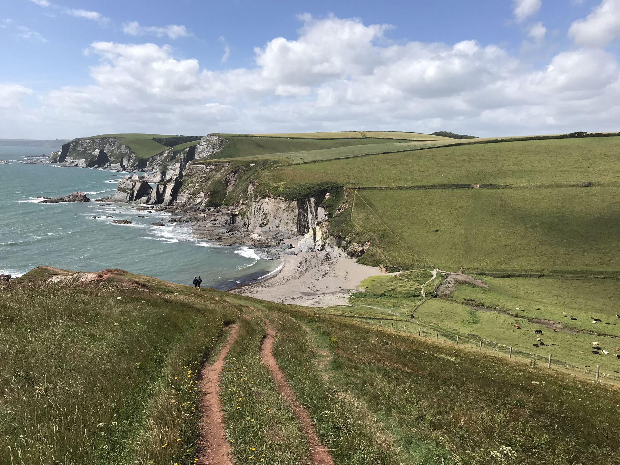
Hiking in East Devon AONB offers a diverse landscape for bus station hiking trails, characterized by its dramatic coastline, tranquil river valleys, and expansive heathlands. The region features striking red sandstone cliffs and pebble beaches along the Jurassic Coast, a UNESCO World Heritage Site. Inland, fertile river valleys like the Otter and Axe provide sheltered routes, while areas such as Woodbury Common present distinct lowland heath ecosystems. This varied terrain supports a network of trails suitable for different hiking preferences.
Best bus station hiking trails in East Devon AONB
- The most popular bus station hiking route is Otter Valley Walk, a 3.2 miles (5.2 km) trail that takes 1 hour 23 minutes to complete. This easy route follows the River Otter, offering riverside views and wildlife spotting opportunities.
- Another top favourite among local hikers is Beer Head – Branscombe Beach loop from Beer, a moderate 4.8 miles (7.7 km) path. This route features coastal paths with ascents to cliff tops, providing views of the English Channel and the distinctive white cliffs.
- Local hikers also love the Otterton Mill – River Otter loop from Otterton, a 5.0 miles (8.1 km) trail leading through the River Otter valley, often completed in about 2 hours 5 minutes.
- Hiking in East Devon AONB is defined by coastal paths, river valleys, and heathland, offering a range of experiences from gentle riverside strolls to more challenging coastal climbs. The network offers options for different ability levels.
- The routes in East Devon AONB are highly rated by the komoot community with an average score of 4.6 stars from over 1000 reviews. More than 11000 hikers have used komoot to explore East Devon AONB's varied terrain.
Last updated: July 10, 2026
4.7
(6)
78
hikers
5.21km
01:23
50m
50m
Easy hike. Great for any fitness level. Easily-accessible paths. Suitable for all skill levels.
4.7
(33)
212
hikers
7.65km
02:20
250m
250m
Moderate hike. Good fitness required. Easily-accessible paths. Suitable for all skill levels.

Sign up for free
4.8
(22)
286
hikers
8.52km
02:12
50m
40m
Moderate hike. Good fitness required. Easily-accessible paths. Suitable for all skill levels.
5.0
(20)
257
hikers
Moderate hike. Good fitness required. Easily-accessible paths. Suitable for all skill levels.
4.4
(20)
262
hikers
Moderate hike. Good fitness required. Easily-accessible paths. Suitable for all skill levels.
Get access to more routes and recommendations from other explorers.
Sign up for free
Already have an account?
Our route recommendations are based on thousands of hikes, rides, and runs completed by other people on komoot.
Start today with a free account
Your next adventure awaits.
Login or Signup



Tips from the Community

If you’re heading to Beer Beach in East Devon, don’t expect a sandy tropical paradise—and definitely don’t expect actual beer flowing from the cliffs (though the name is a great conversation starter). Instead, you get a quintessential, "old-school" British fishing cove that’s basically a natural suntrap tucked between towering white chalk cliffs. It’s part of the Jurassic Coast, so it’s millions of years of history served with a side of fish and chips. Why it’s a "Vibe": The Boats: This isn't a harbor with a pier; the local fishermen literally winch their colorful boats right up onto the shingle (pebble) beach. It’s like a live-action painting watching them bring in the daily catch of mackerel and crab. The "Pebble Massage": Forget sand in your shoes; here, you get smooth, grey pebbles. Pro-tip: Rent one of the iconic blue and white deckchairs. Your lower back will thank you, and you’ll look like a 1950s movie star. The Beach Cafes: There are little huts right on the shingle where you can grab a crab sandwich or a cream tea. Eating fresh seafood while your toes are three feet from the waves? Hard to beat. The Name: Sadly, "Beer" comes from the Old English word bearu, meaning "grove" or "wood." But don't let that stop you—the village has plenty of actual beer in its cozy pubs like The Anchor Inn, which has a cliff-top garden with elite views. Hidden Gems Nearby: Beer Quarry Caves: Just up the road, you can take a tour of the massive underground caverns where the famous "Beer Stone" was mined for cathedrals like Exeter and Westminster Abbey. It’s like a cool, damp cathedral hidden inside a hill. The Coastal Path: If you walk west toward Branscombe, you’ll tackle some steep "stairway to heaven" climbs, but the views of the white cliffs against the blue sea are pure magic.
0
0

Great view with some benches around, though most hidden in the shrubs 😊
0
0

Harnessing the power of moving water to drive a mill wheel is an ancient invention of human ingenuity, whose origins can be traced back to ancient times. Thanks to such a design, a watercourse – natural or artificial – made it possible to simply replace human or animal muscle power with the power of natural elements, for example, to grind grain into corn or press oil from fruit. There are essentially two drive variants for watermills: * Either the flowing water simply hits the blades of the water wheel from below to set it in motion; or * the water is guided above the wheel – usually through a so-called "mill channel" – and falls onto the blades. This design utilizes natural gravity to achieve greater efficiency.
2
0

Sometimes you have to stop and just take a moment.
0
0
A small stretch of path with chairs and plaques to our remember falling
0
0
Perfect location to rest and watch the world go by.
1
0
Frequently Asked Questions
How many bus-accessible hiking trails are available in East Devon National Landscape?
There are over 140 hiking routes in the East Devon National Landscape that are easily accessible by bus, offering a wide range of experiences from gentle riverside strolls to more challenging coastal paths.
What kind of terrain can I expect on bus-accessible hikes in East Devon National Landscape?
The region offers diverse terrain, including dramatic coastal paths along the Jurassic Coast with red sandstone cliffs, tranquil river valleys like the River Otter, and expansive lowland heaths such as Woodbury Common. You'll find a mix of paved paths, dirt trails, and some ascents, especially on coastal routes.
Are there any easy, family-friendly bus station walks in the area?
Yes, many routes are suitable for families. The Otter Valley Walk is an easy option, offering a pleasant stroll along the River Otter. These trails often feature relatively flat terrain and scenic views, perfect for all ages.
Can I bring my dog on these bus-accessible hikes?
Many trails in the East Devon National Landscape are dog-friendly, but it's always best to keep dogs on a lead, especially in areas with livestock or ground-nesting birds. Specific routes like the Otterton Mill – River Otter loop from Otterton are popular with dog walkers.
What notable landmarks or natural features can I see along bus-accessible routes?
You can explore a variety of natural wonders. Highlights include the Otter Estuary Nature Reserve, the striking red cliffs at Orcombe Point, and the unique rock formations at Ladram Bay Sea Stacks. Coastal routes also offer views of Budleigh Salterton Beach.
Are there any circular bus-friendly walks in East Devon National Landscape?
Absolutely. Many routes are designed as circular walks, allowing you to start and end at the same bus stop. An excellent example is the Beer Head – Branscombe Beach loop from Beer, which combines coastal paths with picturesque village exploration.
What is the best time of year for bus-accessible hiking in East Devon National Landscape?
Spring and autumn offer pleasant temperatures and beautiful scenery, with wildflowers in spring and vibrant foliage in autumn. Summer is also popular, especially for coastal walks, but can be busier. Winter walks can be invigorating, though some paths may be muddy, particularly in river valleys.
What do other hikers enjoy most about bus-accessible trails in East Devon National Landscape?
The East Devon National Landscape is highly rated by the komoot community, with an average score of 4.6 stars from over 1000 ratings. Reviewers often praise the stunning coastal views, the tranquility of the river valleys, and the convenience of accessing diverse trails directly from bus stops.
Are there pubs or cafes near bus stops along these hiking routes?
Yes, many of the picturesque villages in the East Devon National Landscape, such as Sidmouth, Beer, Branscombe, and Budleigh Salterton, are well-served by bus routes and offer a variety of pubs, cafes, and amenities where you can refresh yourself before or after your hike.
Which bus services provide access to popular hiking trailheads in East Devon National Landscape?
Local bus services connect many of the key towns and villages, providing access to numerous trailheads. Routes like the X51 and X53 are particularly useful for reaching coastal areas and linking to sections of the South West Coast Path and the East Devon Way. Always check current timetables for specific routes and stops.
Can I find longer, more challenging bus-accessible hikes?
Yes, for those seeking a greater challenge, routes like the West Down Beacon – Exmouth Lifeboat Station loop from Budleigh Salterton offer longer distances and more significant elevation changes, providing a rewarding experience with expansive views.
Most popular routes in East Devon AONB
Most popular attractions in East Devon AONB

Get inspired with the komoot mobile app


Explore more
Browse the best Hikes in other regions.
