The best traffic-free bike rides around Regentalaue zwischen Cham und Pösing
4.5
(3715)
16,059
riders
355
rides
No traffic touring cycling routes around Regentalaue zwischen Cham und Pösing traverse an expansive river valley and floodplain of the Regen river. This region features a mosaic of habitats including numerous ponds, wet meadows, and old river arms, shaped by the dynamic flooding of the Regen river. The landscape is characterized by a low gradient and largely flat, open terrain, making it suitable for relaxed cycling. Riparian forests adapted to wet conditions are also present throughout the area.
Best no…
Last updated: October 1, 2026
4.8
(354)
1,323
riders
51.9km
03:09
250m
250m
Moderate bike ride. Good fitness required. Mostly paved surfaces. Suitable for all skill levels.
4.7
(40)
188
riders
26.5km
01:37
80m
80m
Easy bike ride. Great for any fitness level. Mostly paved surfaces. Suitable for all skill levels.

4.7
(47)
182
riders
26.6km
01:36
110m
110m
Easy bike ride. Great for any fitness level. Mostly paved surfaces. Suitable for all skill levels.
4.8
(39)
134
riders
31.8km
02:01
220m
220m
Moderate bike ride. Good fitness required. Mostly paved surfaces. Suitable for all skill levels.
4.6
(16)
82
riders
56.8km
04:07
840m
840m
Hard bike ride. Very good fitness required. You may need to push your bike for some segments of this route.
Get access to more routes and recommendations from other explorers.
Already have an account?
Our route recommendations are based on thousands of hikes, rides, and runs completed by other people on komoot.
Start today with a free account
Your next adventure awaits.
Popular around Regentalaue zwischen Cham und Pösing

Other adventures around Regentalaue zwischen Cham und Pösing

Tips from the Community

... but whoever expects a spring here will be disappointed ...
0
0


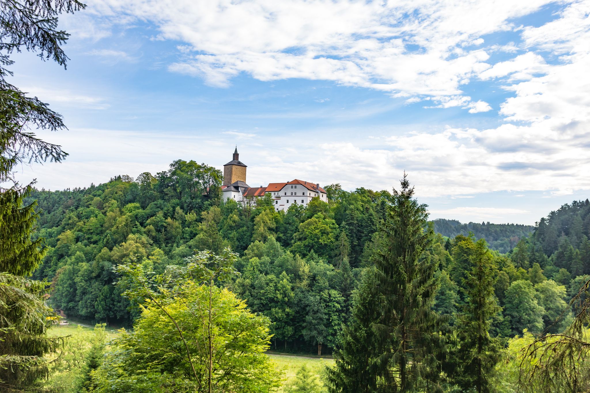
countless castles already hang there
0
0

There are not only delicious weapons👍 but also many other dishes and cakes🍰🍪🍩 and in the shop next door you can buy sweets 🍬🍭🧇of our own production
1
0
the large water wheel is clearly visible from the rain bridge
1
0
The cycle path runs directly along the Regen river and therefore naturally has no significant climbs.
1
0
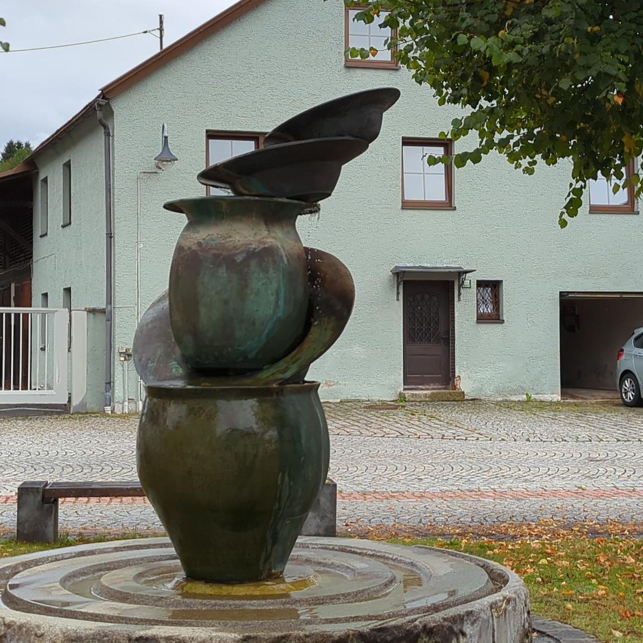
beautiful, almost car-free market square. The fountain has something in it. Those who don't know might get wet
0
0

Blue bridge with many locks from "Liebenfen", water management with beer garden right next to it
0
0
Frequently Asked Questions
How many no-traffic touring cycling routes are available in Regentalaue zwischen Cham und Pösing?
There are nearly 400 no-traffic touring cycling routes in the Regentalaue zwischen Cham und Pösing region. These routes cater to various skill levels, with 92 easy, 168 moderate, and 128 difficult options, ensuring a suitable ride for every cyclist.
What is the best time of year to go touring cycling in Regentalaue zwischen Cham und Pösing?
The Regentalaue is beautiful throughout the warmer months. However, it's crucial to note that from March 1st to June 30th, several paths within the nature reserve are closed to protect nesting birds during their breeding season. For the best experience, consider visiting outside this period or ensure you stick to designated open paths.
Are there any family-friendly no-traffic cycling routes in the area?
Yes, the largely flat and open terrain of the Regentalaue makes it ideal for relaxed cycling, including with families. Many routes feature mostly paved surfaces, offering a safe and enjoyable experience away from traffic. Look for the 'easy' rated routes on komoot for the most suitable options.
What kind of terrain can I expect on these no-traffic touring cycling routes?
The Regentalaue features an expansive river valley and floodplain of the Regen river, characterized by a low gradient and largely flat, open terrain. You can expect a rich mosaic of habitats including numerous ponds, wet meadows, and old river arms. Many routes are on mostly paved surfaces, making for comfortable touring.
What attractions or points of interest can I see along the no-traffic cycling routes?
The region offers several interesting sights. You can visit the historic Biertor in Cham, the only preserved gate of the city. For magnificent panoramic views over the floodplain, the Untertraubenbach Observation Tower is a must-see. Nature lovers will appreciate the Rötelseeweiher Nature Reserve and the Pösinger bathing pond.
Are dogs allowed on the no-traffic cycling routes in Regentalaue?
While dogs are generally welcome, it is crucial to keep them on a leash, especially within the nature reserve. The Regentalaue is a sensitive ecosystem and a crucial habitat for rare and endangered ground-nesting birds. Keeping dogs leashed helps protect this vulnerable wildlife.
Are there any circular no-traffic touring cycling routes available?
Yes, many of the routes are designed as loops. For example, the moderate Pullinger Lake and Dam – Satzdorf Lake loop from Cham (Oberpf) covers 51.6 km, offering views across the river valley. Another option is the Lake Satzdorf – Waffle Café in the Train Car loop from Cham (Oberpf), a 31.7 km moderate ride.
What do other touring cyclists enjoy most about cycling in Regentalaue zwischen Cham und Pösing?
The area is highly rated by the komoot community, with an average score of 4.6 stars from over 3,150 ratings. Reviewers often praise the peaceful, traffic-free environment, the beautiful natural landscapes, and the well-maintained paths that make for a relaxing and enjoyable touring cycling experience.
Can I access these no-traffic routes using public transport?
While the guide focuses on the routes themselves, the region around Cham and Pösing is generally accessible. For specific public transport connections to trailheads, it's advisable to check local bus and train schedules for Cham or nearby towns, as some routes might start or pass through areas with public transport links.
Where can I park my car if I want to start a no-traffic touring cycling route?
Parking is generally available in and around the towns of Cham and Pösing, which serve as common starting points for many routes. Specific parking information for individual trailheads can often be found in the route descriptions on komoot, or by checking local municipality websites.
Are there any longer, more challenging no-traffic touring routes for experienced cyclists?
Yes, for experienced cyclists seeking a challenge, there are difficult-rated routes. An example is the Steinmann Hut – Maria Hilf Monastery Church Cham loop from Cham (Oberpf), which spans 56.8 km and features significant elevation gain, offering a more demanding ride through the region's diverse landscapes.
Are there any routes that follow the Danube-Regen Cycle Path?
Yes, some routes incorporate sections of the broader cycling network. For instance, the moderate Danube-Regen Cycle Path – View of Altrandsberg Castle loop from Cham (Oberpf) is a 45.8 km route that offers scenic views and connects to this well-known path.
Most popular routes around Regentalaue zwischen Cham und Pösing
Most popular attractions around Regentalaue zwischen Cham und Pösing

Get inspired with the komoot mobile app


Explore more
Browse the best Cycling routes in other regions.
