The best hikes from bus stations around Corno alle Scale
4.5
(5308)
22,317
hikers
36
hikes
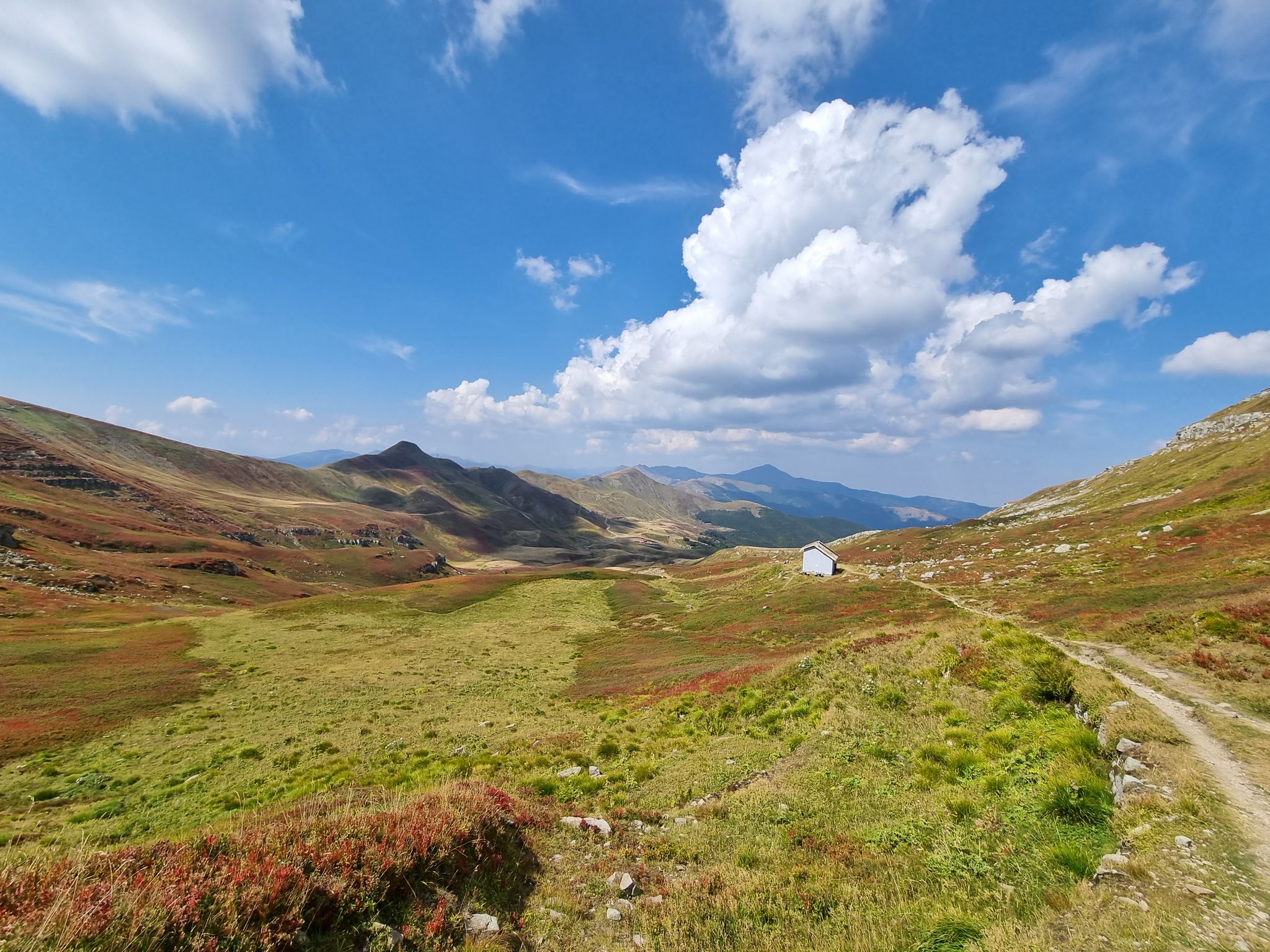
Bus station hiking trails around Corno alle Scale are situated within the Apennine Mountains, a region characterized by prominent ridges, diverse forests, and alpine lakes. The landscape features peaks such as Corno alle Scale itself, reaching 1,944 meters, alongside Monte La Nuda and Monte Gennaio. Hikers encounter dense beech forests, clear mountain streams, and high-altitude meadows, with trails ranging from gentle paths to challenging ascents. The area also includes notable features like Lago Scaffaiolo and the Dardagna Falls.
Best bus station hiking trails around Corno alle Scale
- The most popular bus station hiking route is Manservisi Castle loop from Unione dell'Alto Reno, a 2.6 miles (4.2 km) trail that takes 1 hour 11 minutes to complete. This easy route features minimal elevation gain and passes by historical architecture.
- Another top favourite among local hikers is View of the Apennine Mountains – Ruins in the Forest loop from Unione dell'Alto Reno, a moderate 4.3 miles (6.9 km) path. This trail offers views of the Apennine Mountains and leads through forested areas with historical ruins.
- Local hikers also love the Passo dello Strofinatoio – Sofia Peak loop from Orsigna, a 13.2 miles (21.3 km) trail leading through mountain passes and to Sofia Peak, often completed in about 9 hours 36 minutes.
- Hiking around Corno alle Scale is defined by mountain ridges, alpine lakes, and dense forests. The network offers options for different ability levels, from easy walks to difficult mountain ascents.
- The routes in Corno alle Scale are highly rated by the komoot community with an average score of 4.6 stars from more than 4,800 reviews. More than 20,000 hikers have used komoot to explore Corno alle Scale's varied terrain.
Last updated: July 13, 2026
4.5
(10)
49
hikers
Moderate hike. Good fitness required. Easily-accessible paths. Suitable for all skill levels.
4.7
(3)
9
hikers
Moderate hike. Good fitness required. Mostly accessible paths. Sure-footedness required.

Sign up for free
2
hikers
12.2km
05:05
750m
740m
Hard hike. Very good fitness required. Mostly accessible paths. Sure-footedness required.
5.0
(1)
6
hikers
4.14km
01:11
90m
90m
Easy hike. Great for any fitness level. Easily-accessible paths. Suitable for all skill levels.
5.0
(1)
5
hikers
10.8km
03:32
490m
490m
Embark on a moderate hike from Madonna del Faggio to Castelluccio Madonnina, following Route 147 through the Emilian Apennines. This 6.7-mile (10.8 km) journey involves a steady climb of 1595 feet (486 metres) and typically takes around 3 hours and 31 minutes to complete. You will experience diverse terrain, from peaceful forest paths to open meadows, with a notable stop at Vasca del Doccione, a tranquil mountain lake perfect for a brief rest.
Parking is conveniently available near both the Madonna del Faggio sanctuary and Castelluccio, allowing you to begin your hike from either end of the trail. The route is well-maintained by the CAI Porretta Terme section, ensuring clear signage throughout your adventure. Plan your visit during pleasant weather to fully enjoy the changing landscapes and the charm of the old stone villages along the way.
This trail offers a glimpse into the region's rich history and natural beauty, connecting ancient settlements with serene mountain environments. As you pass through Tresana, you will notice traditional stone houses, many adorned with vibrant hydrangeas, reflecting centuries of mountain life. The clear red and white trail markers of CAI trail 147 guide you through this authentic Apennine experience.
Get access to more routes and recommendations from other explorers.
Sign up for free
Already have an account?
Our route recommendations are based on thousands of hikes, rides, and runs completed by other people on komoot.
Start today with a free account
Your next adventure awaits.
Login or Signup
Popular around Corno alle Scale
Other adventures around Corno alle Scale

Tips from the Community

Small hamlet of Orsigna
0
0
One of the most beautiful villages in Italy
0
0

Truly beautiful and challenging excursion... very satisfying 🏞️💙
2
0

Iconic village in the Bolognese Apennines. The mill, symbol of the town, has been recently restored. In the past, the inhabitants of Monteacuto brought chestnuts here, dried and peeled, and the few cereals collected or purchased.
0
0

The Molino di Giamba, in the picturesque village of Orsigna, dates back to around 1820. It was used for grinding chestnuts, after their harvest and drying. Remained in operation until 1947, it was restored and reactivated in 2000.
2
0

Tresana
1
0

in the paths of Tiziano Terziani
0
0

Eighteenth century sanctuary in the middle of the woods. http://www.appenninobolognese.net/apbo/index.cfm?event=scheda&qpTemaID=0&qpTAS3=20203&qpGEO2=0&qpNEWS_ID=20002&qpRowNro=9
1
0
Frequently Asked Questions
How many hiking trails are accessible from bus stations in Corno alle Scale?
There are over 30 hiking trails in the Corno alle Scale region that are conveniently accessible from bus stations. These routes offer a diverse range of experiences, from easy strolls to challenging mountain ascents.
Are there any easy, family-friendly hikes accessible by bus in Corno alle Scale?
Yes, Corno alle Scale offers several easy routes suitable for families. For a gentle walk with historical interest, consider the Manservisi Castle loop from Unione dell'Alto Reno. This 4.2 km route is rated easy and explores the surroundings of a historic castle.
What kind of natural features can I expect to see on bus-accessible hikes?
The bus-accessible hikes in Corno alle Scale lead through diverse landscapes. You can expect to encounter dense beech forests, crystal-clear mountain streams, and potentially stunning waterfalls like the Dardagna Falls. Higher altitude routes may offer views of alpine lakes such as Laghetto del Cavone and dramatic mountain ridges.
Are there any challenging routes for experienced hikers starting from bus stops?
Absolutely. For experienced hikers seeking a challenge, the region provides demanding routes. The Passo dello Strofinatoio – Sofia Peak loop from Orsigna is a difficult 21.3 km route that takes you to significant peaks like Sofia Peak and across mountain passes.
Can I find circular hiking routes that start and end at a bus station?
Many of the trails accessible by bus in Corno alle Scale are circular, allowing you to return to your starting point without needing additional transport. An example is the View of the Apennine Mountains – Ruins in the Forest loop from Unione dell'Alto Reno, a moderate 6.9 km route offering scenic views and historical ruins.
What are some notable landmarks or points of interest along these trails?
Beyond natural beauty, you can discover historical and cultural landmarks. Routes might take you past ancient ruins, traditional mountain villages, or even sanctuaries. For instance, the Sanctuary of Madonna del Faggio – Stone Houses of Tresana loop from Unione dell'Alto Reno combines natural beauty with cultural heritage.
What do other hikers say about the bus-accessible trails in Corno alle Scale?
The komoot community highly rates the hiking experiences in Corno alle Scale, with an average score of 4.6 out of 5 stars. Reviewers often praise the diverse landscapes, from lush forests to panoramic mountain views, and the well-maintained trails that cater to various fitness levels.
Are there any routes that feature mountain passes or high-altitude views?
Yes, several routes accessible by bus ascend to mountain passes, offering expansive views. The Devil’s Footstep Pass – Giamba Mill loop from Orsigna is a moderate 11.7 km route that includes a significant mountain pass, providing a true Apennine experience.
When is the best time of year to hike these bus-accessible trails?
Corno alle Scale offers distinct beauty throughout the year. Spring brings blooming meadows, summer provides cool forest shades, and autumn transforms the landscape with vibrant foliage. Even winter offers unique experiences with frozen waterfalls and snowy peaks, though some higher routes may require specific gear and experience.
Are there any trails that lead to specific peaks or summits?
Yes, some of the more challenging bus-accessible routes will lead you to the region's peaks. For example, the difficult Passo dello Strofinatoio – Sofia Peak loop from Orsigna includes an ascent to Sofia Peak, offering rewarding panoramic views of the Apennines.
Can I expect to see any wildlife on these hikes?
The relatively undisturbed nature of Corno alle Scale makes it an excellent location for wildlife observation. Hikers might spot deer, foxes, wild boars, and various bird species. The park is also home to more elusive animals like wolves, indicating a healthy ecosystem.
Most popular routes around Corno alle Scale
Most popular attractions around Corno alle Scale

Get inspired with the komoot mobile app


Explore more
Browse the best Hikes in other regions.
