The best traffic-free bike rides around Campolongo Maggiore
4.4
(93)
1,140
riders
18
rides
Gravel biking around Campolongo Maggiore is characterized by its flat terrain, making it accessible for various skill levels. The region, part of the Po Valley, features extensive agricultural lands, a network of small canals, and the prominent Brenta River. This landscape provides numerous routes that wind through the tranquil Italian countryside, offering a distinct experience for no traffic gravel bike trails. The area also includes natural features like the Millecampi Valley, providing diverse scenery for cyclists.
Best no traffic gravel…
Last updated: October 17, 2026
4.4
(5)
100
riders
108km
05:45
120m
120m
Hard gravel ride. Very good fitness required. Mostly paved surfaces.
4.0
(12)
141
riders
Easy gravel ride. Mostly paved surfaces.

3.8
(6)
27
riders
Moderate gravel ride. Good fitness required. Mostly paved surfaces.
5.0
(1)
24
riders
68.3km
03:49
80m
80m
Hard gravel ride. Good fitness required. You may need to push your bike for some segments of this route.
3.0
(1)
23
riders
44.4km
02:31
40m
40m
Moderate gravel ride. Good fitness required. Mostly paved surfaces.
Get access to more routes and recommendations from other explorers.
Already have an account?
Our route recommendations are based on thousands of hikes, rides, and runs completed by other people on komoot.
Start today with a free account
Your next adventure awaits.
Popular around Campolongo Maggiore

Tips from the Community


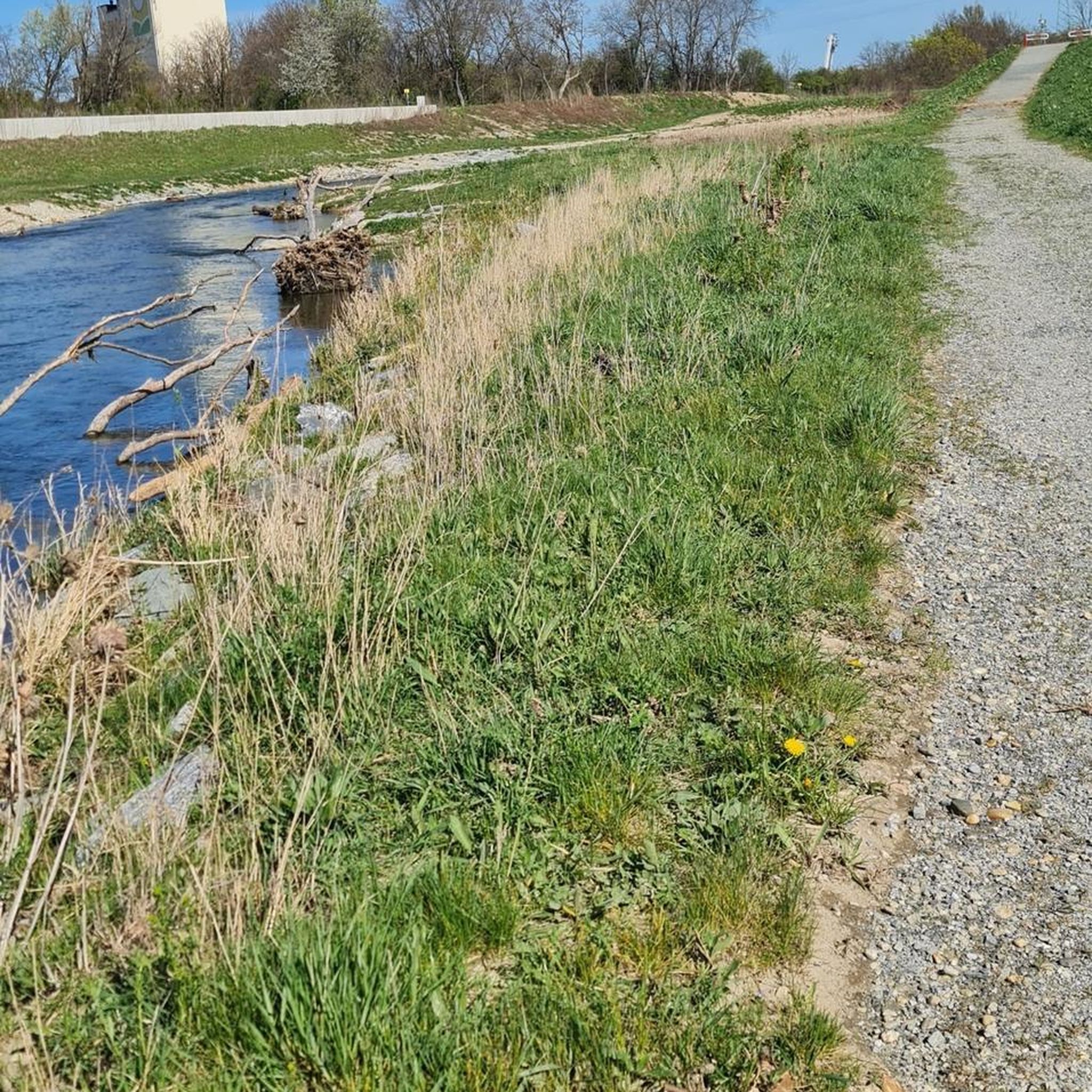
Cycling along the Brenta riverbank is a pleasant way to discover the Riviera away from the busier roads. The dirt path follows the course of the river between fields and small villages.
1
0

The system of bridges and the viability of the Isola dell'Unione in Chioggia (VE) historically connect the historic center of Chioggia with the nearby seaside resort of Sottomarina. The area is served by a translagunar bridge and the characteristic swing bridge that crosses the Canale San Domenico. The main details about the Isola dell'Unione infrastructure include: Ponte Translagunare (Ponte della Concordia): Inaugurated in 1931, it is about 700 meters long and directly connects Sottomarina to Chioggia by crossing the lagoon. Ponte Girevole (Canale San Domenico): Regulates internal traffic and allows boats to pass. It has recently been the subject of tenders for extraordinary maintenance and the reorganization of city traffic. Roads and Cycle Paths: The area is part of the Passeggiata del Lusenzo, a circular pedestrian and cycle path that connects the two centers passing through the Isola dell'Unione, ideal for tourist visits and excursions.
1
0

The Ponte dell'Isola dell'Unione is the key infrastructure that unites Chioggia and Sottomarina, connecting the historicity of "Little Venice" to the vibrancy of its seaside soul. Crossing the lagoon, this bridge is not just a crucial communication route for vehicular and pedestrian traffic, but a true umbilical cord that transforms two distinct realities into a single urban organism. Strolling along its sidewalks, you can enjoy a spectacular view of the southern lagoon, with the moored boats, the distant casoni, and the unmistakable profiles of the two towns. For residents and tourists, it represents a suggestive transit point, particularly fascinating at sunset, when the lights reflect on the water, summarizing in a single glance the maritime, historical, and tourist essence of this unique territory.
2
0

Connection between Chioggia and Sottomarina. The city's only green space.
3
0


Il Casone Ramei, also known as “Casone Bianco”, was built at the end of the 19th century by the Zecchin family, who lived there until 1979. Subsequently, the Municipality of Piove di Sacco purchased it to restore it in the 1980s. The interiors, such as original furniture and objects, were partly purchased by the Municipal Administration and partly donated by the population. The architectural characteristics are typical of the Veneto Casone, a construction found quite frequently in the Saccisica territory. Today, the Casone of Via Ramei houses the Museum of Popular Culture and Peasant Civilization and consists of two buildings: the main one is the old two-story dwelling (whose focal point is the kitchen, with its characteristic hearth “la cavarzerana”) to which a second body was added during World War II to accommodate the extended family, up to twelve people. The second building once housed the cellars and the tool shed, while the small attic was used as a hayloft. The casone is surrounded by an important park area. https://saccisica.it/item/casone-di-via-ramei-casone-bianco/
0
0
Frequently Asked Questions
How many no-traffic gravel bike trails are available around Campolongo Maggiore?
There are 18 dedicated no-traffic gravel bike trails around Campolongo Maggiore, offering a variety of experiences for different skill levels. You'll find 6 easy routes, 9 moderate, and 3 more challenging options.
Are there any easy, beginner-friendly gravel routes without traffic?
Yes, Campolongo Maggiore offers several easy, traffic-free gravel routes perfect for beginners. One excellent option is the Cycle Path on the Serraglio Canal – Gravel Path Along the Canal loop from Stra, which is just over 24 km long and features minimal elevation gain, making it very accessible.
What kind of scenery can I expect on these gravel trails?
The no-traffic gravel trails around Campolongo Maggiore offer a tranquil journey through the flat Italian countryside. You'll primarily experience extensive agricultural lands, small canals, and scenic paths along the Brenta River. The region's unique landscape, shaped by its agricultural heritage and waterways, provides picturesque backdrops throughout your ride.
Are there any family-friendly gravel biking options in the area?
Absolutely. The flat topography and dedicated no-traffic paths make many routes suitable for families. Look for the 'easy' graded tours, which typically have gentle terrain and shorter distances, ideal for a relaxed family outing. The serene canal paths are particularly well-suited for a safe and enjoyable ride with children.
What interesting landmarks or natural features can I see along the routes?
Many routes pass by significant natural and historical points of interest. You can explore the Casoni della Fogolana, Valle Millecampi, which are characteristic huts of the Saccisica area. The Confluence of the Brenta River, Piovego Canal, and Naviglio del Brenta is another scenic spot. Some routes, like the Brenta Canal lock in Stra – Casoni della Fogolana loop from Stra, will take you past these unique sights.
Are there any circular gravel bike routes available?
Yes, many of the no-traffic gravel routes around Campolongo Maggiore are designed as loops, allowing you to start and end at the same point. Examples include the Piovego Canal Gravel Path – Camin Bridge over the Piovego loop from Campolongo Maggiore and the Park of Thoughts – Brenta Riverside Path loop from Bojon.
What is the best season for gravel biking in Campolongo Maggiore?
The flat terrain of Campolongo Maggiore makes it enjoyable for gravel biking across multiple seasons. Spring and autumn offer pleasant temperatures and beautiful scenery. Summer can be warm, but the routes along canals and rivers provide some natural cooling. Winter riding is also possible, though conditions may be cooler and require appropriate gear.
Are there places to park near the gravel bike trails?
Yes, you'll find various parking options in and around Campolongo Maggiore, especially in the towns where many routes begin or pass through. It's advisable to check specific starting points of your chosen route for the most convenient parking facilities.
What do other gravel bikers enjoy most about the trails here?
The komoot community highly rates the gravel biking experience in Campolongo Maggiore, with an average score of 4.35 stars. Reviewers often praise the peaceful, traffic-free nature of the routes, the beautiful rural scenery along the canals and rivers, and the accessibility for various skill levels due to the flat terrain.
Can I access these gravel trails using public transport?
While Campolongo Maggiore is well-connected by local public transport, direct access to specific trailheads might require some planning. Buses serve the main towns in the area. We recommend checking local bus schedules and routes to see how they align with your chosen starting points for the gravel trails.
Are there any longer gravel routes for bikepacking or extended rides?
Yes, for those looking for longer adventures, routes like the Park of Thoughts – Brenta Riverside Path loop from Bojon stretch over 74 km, offering a substantial ride through the region's diverse landscapes. The flat terrain makes these longer distances manageable and enjoyable.
Most popular routes around Campolongo Maggiore
Most popular attractions around Campolongo Maggiore

Get inspired with the komoot mobile app


Explore more
Browse the best Gravel rides in other regions.
