The best traffic-free bike rides around Gerenzano
4.3
(609)
3,445
riders
108
rides
Gravel biking around Gerenzano offers routes through varied natural landscapes, characterized by river parklands and reclaimed natural areas. The region features the expansive Parco degli Aironi, a former gravel quarry now home to diverse flora and fauna, alongside the Lura River and Villoresi Canal. These areas provide a mix of unpaved sections and dedicated cycling paths, suitable for no traffic gravel bike trails. The terrain generally includes gentle gradients and flat sections, with some routes incorporating longer distances.
Best no…
Last updated: October 3, 2026
3.9
(7)
91
riders
76.4km
04:13
400m
400m
Moderate gravel ride. Good fitness required. Mostly paved surfaces. Suitable for all skill levels.
4.5
(4)
36
riders
Easy gravel ride. Great for any fitness level. Mostly paved surfaces. Suitable for all skill levels.

2.5
(2)
25
riders
53.0km
02:54
150m
150m
Moderate gravel ride. Good fitness required. Mostly paved surfaces. Suitable for all skill levels.
4.0
(1)
22
riders
97.5km
06:42
1,120m
1,120m
Hard gravel ride. Very good fitness required. Mostly paved surfaces. Suitable for all skill levels.
4.5
(2)
21
riders
26.0km
01:20
80m
80m
Easy gravel ride. Great for any fitness level. Mostly paved surfaces. Suitable for all skill levels.
Get access to more routes and recommendations from other explorers.
Already have an account?
Our route recommendations are based on thousands of hikes, rides, and runs completed by other people on komoot.
Start today with a free account
Your next adventure awaits.
Popular around Gerenzano
Tips from the Community

The Parco delle Groane e della Brughiera Briantea is an immense protected natural area in Lombardy that extends for about 8,249 hectares in the upper Lombardy plain, touching 28 or 29 municipalities distributed among the provinces of Milan, Como, and Monza and Brianza. [1, 2, 3, 4] Originally established in 1976, the park has doubled its surface area in recent years thanks to the incorporation of the PLIS della Brughiera Briantea and the Fontana del Guercio Nature Reserve. The term "groane" derives from the local historical name for heathlands, which here represent one of the southernmost heathlands in Europe.
0
0
The Villoresi canal takes water from the river Ticino, in the locality of Panperduto, in the municipality of Somma Lombardo. After travelling 86 kilometers, through the provinces of Milan and Monza Brianza, it flows into the river Adda in the municipality of Cassano d’Adda. Construction work began in 1881 and was completed in 1891 to a design by Eugenio Villoresi. Originally intended exclusively for irrigation, following the crisis in crops related to silk production, the canal now allows water distribution in a plain area of approximately 85,000 hectares, through a network that totals around 3,000 kilometers. The paths, which are free of difficulties, accessible to everyone and certainly of interest, are part of the investments made to enhance the towpaths of the waterways, and are also considered a fast connection route between the various Municipalities bordering the canal.
1
0

The Lura is a stream in Lombardy that originates near the Italian-Swiss border, in the municipality of Uggiate con Ronago, at an altitude of about 400 m. The Lura has a total length of 46.2 km and a drainage basin of 120 km², and is today the largest tributary of the Olona river.
0
0
The Villoresi Canal towpath connects Arese and the nearby municipalities via cycle paths and service roads, offering a convenient cycle-pedestrian route along the artificial canal that connects the Ticino and Adda rivers.
0
0

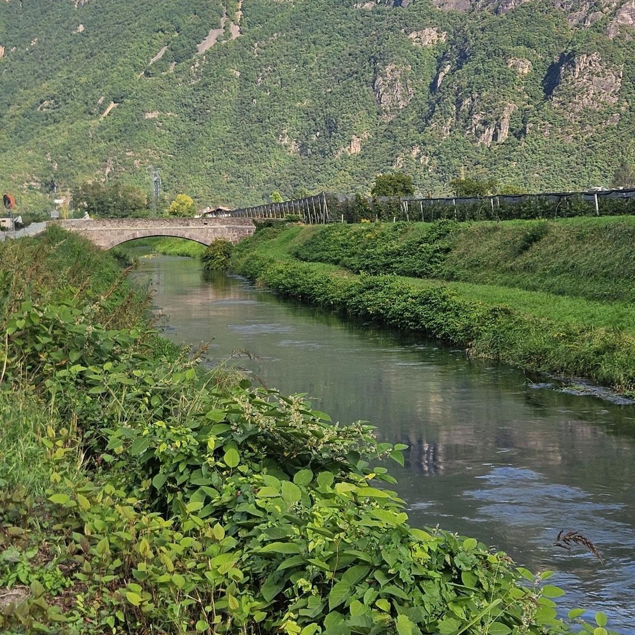
bridge over the Lura in the homonymous park
0
0

always very fun to cycle on these dirt roads!!
2
0
Il Parco del Lura is a local park of supramunicipal interest established for the protection and enhancement of the Lura stream valley in the stretch that extends from Cassina Rizzardi to Lainate. The municipalities adhering to the consortium are: Bregnano, Cadorago, Caronno Pertusella, Cassina Rizzardi, Cermenate, Garbagnate Milanese, Guanzate, Lainate, Lomazzo, Rovellasca, Rovello Porro and Saronno
0
0
Just be careful about the distances: the Canale Villoresi cycle path, which runs alongside the canal, is 85 kilometers long. It begins near the town of Somma Lombardo and ends near Cassano d'Adda, so unless you're very fit, we recommend doing it in stages! Along the way, the path has short sections where it merges with city streets.
0
0
Frequently Asked Questions
How many no traffic gravel bike trails are available around Gerenzano?
Komoot offers over 100 dedicated no-traffic gravel bike trails around Gerenzano. These routes vary in difficulty, ensuring there's something for every skill level, from easy rides to more challenging adventures.
What is the best time of year to explore Gerenzano's traffic-free gravel trails?
The spring and autumn months generally offer the most pleasant conditions for gravel biking around Gerenzano, with mild temperatures and beautiful natural scenery. While summer can be warm, many routes offer shaded sections. Winter rides are also possible, though some unpaved sections might be muddy after rain or snow.
Are there easy, beginner-friendly no traffic gravel routes in the area?
Yes, Gerenzano has several easy, beginner-friendly no-traffic gravel routes. For instance, the Lura River in the Parco del Lura loop from Saronno is an excellent choice, offering a gentle 17 km ride with minimal elevation gain, perfect for those new to gravel biking or looking for a relaxed outing.
Can I find circular gravel bike trails without cars near Gerenzano?
Absolutely. Many of the no-traffic gravel routes around Gerenzano are designed as circular loops, allowing you to start and finish at the same point. The Lura River in the Parco del Lura loop from Rovello Porro is a great example, providing a scenic 21 km circular route through natural landscapes.
What natural attractions can I discover along these routes?
The routes often pass through or near significant natural areas. The expansive Parco degli Aironi in Gerenzano, a former gravel quarry now a diverse natural park, is a highlight with its large lake basin and dense woods. You might also encounter features like the Rosa Camuna Pond or the Heathlands of the Seveso Plateau, offering serene natural beauty.
Are there any routes suitable for families with children?
Yes, several no-traffic gravel routes are suitable for families. Look for routes marked as 'easy' difficulty, which typically feature flatter terrain and shorter distances. The paths within the Parco degli Aironi and along the Lura River are generally well-maintained and offer a safe, enjoyable environment for family rides away from vehicle traffic.
Are the gravel trails around Gerenzano dog-friendly?
Many of the natural parks and trails around Gerenzano, including sections of the Parco degli Aironi and the Lura River paths, are dog-friendly. However, it's always recommended to keep dogs on a leash, especially in protected areas or near wildlife. Be sure to check local regulations for specific park sections.
Where can I find parking near the trailheads for these routes?
Parking is generally available in towns and villages close to the starting points of these routes. For example, if you're starting a route along the Lura River, you can often find parking in nearby Saronno or Rovello Porro. For routes accessing the Parco degli Aironi, there are designated parking areas within or adjacent to the park itself.
What do other gravel bikers enjoy most about Gerenzano's trails?
The komoot community highly rates the gravel biking experience around Gerenzano, with an average score of 4.3 out of 5 stars. Reviewers often praise the tranquility of the traffic-free paths, the beautiful natural landscapes, and the opportunity to explore diverse environments like the Parco degli Aironi and the Lura River parks.
Are there any cafes or refreshment stops along the no-traffic gravel routes?
While many routes are immersed in nature, some pass through or near small towns and villages where you can find cafes or bars. The Parco degli Aironi itself features a bar and restaurant, making it a convenient stop for refreshments. For longer routes like the Villoresi Canal – Groane Cycle Path loop from Rescaldina, planning your stops in advance is advisable.
How long are the traffic-free gravel trails near Gerenzano?
The length of traffic-free gravel trails near Gerenzano varies significantly. You can find shorter, easy loops like the 17 km Lura River in the Parco del Lura loop from Saronno, or longer, more challenging routes such as the 75 km Villoresi Canal – Magic Forest Trail loop from Rescaldina, offering options for different endurance levels.
Most popular attractions around Gerenzano

Get inspired with the komoot mobile app


Explore more
Browse the best Gravel rides in other regions.
