The best hikes from bus stations around Ogbourne St. George
4.6
(841)
7,161
hikers
12
hikes
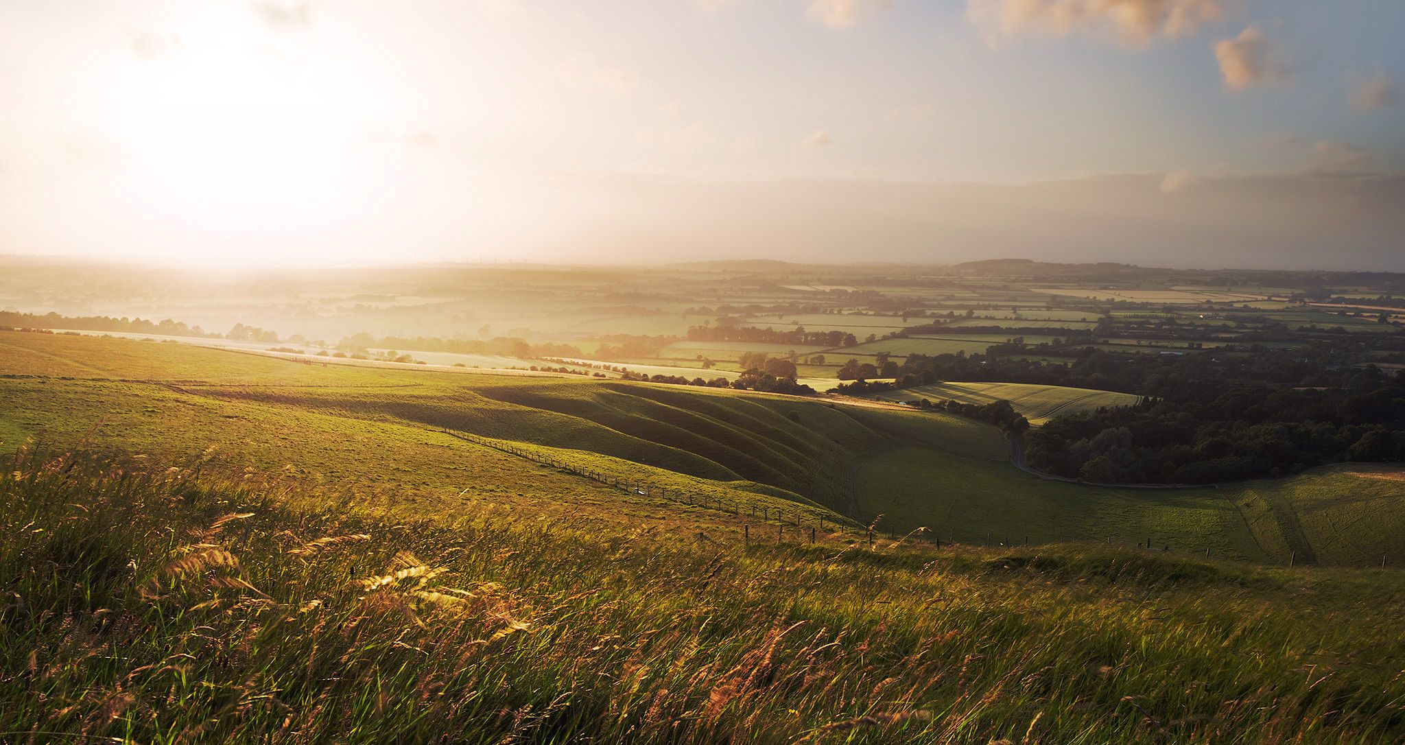
Bus station hiking trails around Ogbourne St. George offer access to the diverse landscapes of the North Wessex Downs National Landscape. The region is characterized by rolling chalk downlands, open grasslands, and sections of woodland, providing varied scenery for walkers. The village is situated in the valley of the River Og, with land rising to prominent features like Smeathe's Ridge and Coombe Down to the west. Hikers can expect paths that traverse these downlands, offering steady climbs and expansive views.
…Last updated: November 15, 2026
3.8
(6)
59
hikers
Moderate hike. Good fitness required. Easily walkable paths.
5.0
(2)
28
hikers
Moderate hike. Good fitness required. Easily walkable paths.

11
hikers
Moderate hike. Good fitness required. Easily walkable paths.
5.0
(1)
7
hikers
Moderate hike. Good fitness required. Easily walkable paths.
3.0
(2)
7
hikers
Easy hike. Easily walkable paths.
Get access to more routes and recommendations from other explorers.
Already have an account?
Our route recommendations are based on thousands of hikes, rides, and runs completed by other people on komoot.
Start today with a free account
Your next adventure awaits.
Popular around Ogbourne St. George
Other adventures around Ogbourne St. George

Tips from the Community

Barbury Castle’s earthworks are a spectacular showcase of Iron Age engineering, dominating the high ridge of the Marlborough Downs. Built around 2,500 years ago, these massive structures formed a heavily fortified tribal stronghold. The earthworks are defined by several key features: • The Double Ramparts: The fort is enclosed by two concentric rings of deep ditches and high banks. Ancient builders dug directly into the natural chalk, piling the white stone high to create steep, imposing walls that would have been topped with wooden palisades. • The East Gate: If you walk to the eastern side, you can see the remnants of a complex, baffled entrance. This design forced visitors into a narrow, twisting corridor, making it incredibly easy for defenders to protect the fort. • Surrounding Prehistory: Beyond the main fort, the hillsides are scarred with ancient "lynchets" (prehistoric farming terraces) and a Bronze Age burial barrow, proving the site was a bustling hub long before the fort walls went up. Today, walking between the massive grassy banks gives you a real sense of the scale of this ancient fortress, all while offering a beautiful, quiet spot to take in the Wiltshire landscape.
0
0
Barbury Castle is an impressive Iron Age hill fort nestled in Wiltshire's beautiful Marlborough Downs. Built 2,500 years ago, its massive double earthen ramparts once protected an ancient tribal village. Today, it’s a wonderfully peaceful spot to wander the historic Ridgeway and take in sweeping, panoramic countryside views.
0
0
Barbury Castle is an impressive Iron Age hill fort nestled in the beautiful Marlborough Downs of Wiltshire. Built over 2,500 years ago, it features massive double earthen ramparts that once protected an ancient tribal village. Today, it’s a wonderfully peaceful spot, perfect for a relaxing stroll. You can wander along the ancient Ridgeway path, take in the sweeping panoramic views of the countryside, and watch red kites soaring overhead. It’s history at its most laid-back.
0
0

Best approached from the east by mountain bike so that you get a nice downhill to the ridgeway trail after the fort!
0
0

Cycling down this section is sheer joy on a summer's day
1
0
Hike a bike for me on my gravel bike to get up here from the west but worth it, the views are stunning and the archeology very interesting
1
0

A decent byway in the dry weather, possibly more challenging in the wet. Ridden on a hybrid bike.
0
0
Frequently Asked Questions
How many bus-accessible hiking trails are available from Ogbourne St. George?
There are 12 hiking trails directly accessible from bus stations in and around Ogbourne St. George. These routes offer a variety of experiences, primarily focusing on the beautiful North Wessex Downs.
What kind of terrain can I expect on hikes around Ogbourne St. George?
The terrain primarily consists of rolling chalk downlands and open grasslands, offering panoramic views. You'll also find sections of woodland and gentle riverside paths along the River Og. While there are steady climbs, they are generally not overly strenuous, making the area suitable for various fitness levels.
Are there any easy hikes suitable for beginners or families starting from the bus station?
Yes, there are 3 easy routes available. A good option is the Ogbourne St Andrew Village loop from Ogbourne St. George, which is 6.5 km long with minimal elevation gain, making it ideal for a relaxed walk.
Can I find circular hiking routes that start and end at the bus station?
Many of the trails around Ogbourne St. George are designed as circular routes, allowing you to start and finish at the same point, often near public transport stops. For example, the Barbury Racecourse – View of North Wessex Downs loop is a moderate 13.6 km circular hike that incorporates sections of The Ridgeway National Trail.
What historical or natural landmarks can I see on these bus-accessible hikes?
The region is rich in history and natural beauty. Many hikes offer access to ancient paths like The Ridgeway National Trail. You might also encounter prehistoric barrows and enjoy views towards significant sites like Barbury Castle. While not directly on every route, the world-famous Avebury Stone Circle and Silbury Hill are within close proximity and can be incorporated into longer excursions.
Are the hiking trails around Ogbourne St. George dog-friendly?
Generally, the chalk downlands and open paths are suitable for dogs. However, always keep dogs under control, especially when passing through areas with livestock. It's advisable to check specific route details for any restrictions or recommendations regarding dogs.
What is the best time of year to go hiking in Ogbourne St. George?
The rolling chalk downlands offer pleasant hiking conditions for much of the year. Spring and summer provide vibrant landscapes and longer daylight hours, while autumn brings beautiful colours. Even in winter, the open nature of the trails can be invigorating, though paths might be muddy after rain. Always check local weather conditions before heading out.
Are there any pubs or cafes along the hiking routes from Ogbourne St. George bus stations?
Ogbourne St. George itself has local establishments. Some routes, like The Inn with the Well – Ridgeway to Chase Woods loop, may pass near or through villages with amenities. It's always a good idea to check the specific route details or local maps for refreshment stops before your hike.
What do other hikers say about the trails in Ogbourne St. George?
The komoot community highly rates the hiking experiences around Ogbourne St. George, with an average score of 4.6 out of 5 stars from over 670 ratings. Reviewers often praise the expansive views, the historical significance of The Ridgeway, and the sense of openness on the downlands.
How long do the bus-accessible hikes typically take?
The duration of hikes varies depending on the route and your pace. For example, the Hiking loop from Ogbourne St. George, which is 8.3 km, typically takes around 2 hours and 15 minutes. Longer routes, like the 13.6 km Barbury Racecourse – View of North Wessex Downs loop, can take over 3.5 hours.
Are there any viewpoints offering panoramic scenery on these trails?
Absolutely. The rolling chalk downlands are known for their expansive views. Hikes often lead to elevated points like Smeathe's Ridge and Coombe Down, offering vistas across the North Wessex Downs. On clear days, you might even catch glimpses of the Cotswolds from higher elevations like Barbury Castle.
Most popular routes around Ogbourne St. George
Most popular attractions around Ogbourne St. George
Get inspired with the komoot mobile app


Explore more
Browse the best Hikes in other regions.