The best traffic-free bike rides around San Sadurniño
4.1
(53)
2,191
riders
15
rides
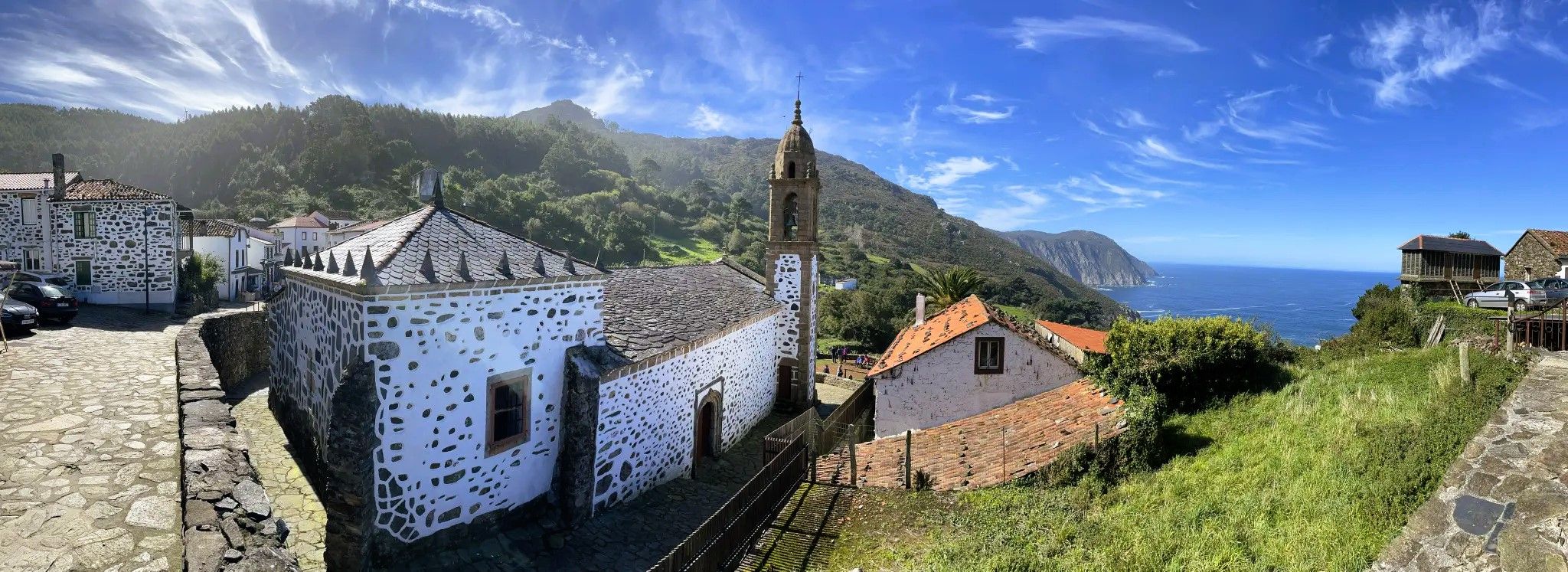
No traffic road cycling routes around San Sadurniño traverse a landscape characterized by green hills and valleys, with the Rio Grande de Xuvia flowing through the region. The terrain offers a mix of undulating hills and more demanding ascents, typical of Galicia. Cyclists can expect routes with considerable elevation changes, particularly in areas leading to viewpoints or historical sites. The nearby Fragas de Eume Natural Park provides additional varied terrain, including dense forests and river canyons.
Best no traffic road…
Last updated: November 2, 2026
53
riders
53.6km
02:52
780m
780m
Moderate road ride. Good fitness required. Mostly well-paved surfaces and easy to ride.
4.0
(1)
10
riders
Moderate road ride. Good fitness required. Mostly well-paved surfaces and easy to ride.

15
riders
43.2km
03:06
1,230m
1,230m
Hard road ride. Very good fitness required. Mostly well-paved surfaces and easy to ride.
5.0
(1)
14
riders
20.3km
01:24
440m
440m
Moderate road ride. Good fitness required. Mostly well-paved surfaces and easy to ride.
5
riders
37.9km
01:46
420m
420m
Moderate road ride. Good fitness required. Mostly well-paved surfaces and easy to ride.
Get access to more routes and recommendations from other explorers.
Already have an account?
Our route recommendations are based on thousands of hikes, rides, and runs completed by other people on komoot.
Start today with a free account
Your next adventure awaits.

Other adventures around San Sadurniño

Tips from the Community

Good climb and descents watch out for route through gravel quarry and 16% climb in forest!
0
0

Beautiful cliffs around
0
0

beautiful beach areas directly at Cedeira
0
0

Good viewpoint to appreciate the grandeur of the Capelada mountains
0
0
Good views of San Andrés de Teixido
0
0


Great viewpoint overlooking the beach of Frouxeira o Valdoviño
0
0

Beautiful golden sand beach, quite quiet. Next to the seafront.
0
0
Frequently Asked Questions
How many no-traffic road cycling routes are available in San Sadurniño?
There are over 10 dedicated no-traffic road cycling routes around San Sadurniño, offering a variety of distances and elevation gains for different skill levels.
What kind of terrain can I expect on these no-traffic road cycling routes?
The region around San Sadurniño features a diverse landscape. You'll find undulating green hills and valleys, offering a mix of flat stretches, especially along river valleys like the Rio Grande de Xuvia, and challenging ascents. Routes can include significant elevation changes, with some reaching over 2000 meters of gain, providing rewarding climbs with panoramic views.
Are there any family-friendly no-traffic road cycling routes in San Sadurniño?
While many routes in San Sadurniño feature moderate to difficult terrain with significant climbs, some sections along river valleys, such as the 'Paseo Fluvial do Río Xubia' mentioned in regional research, might offer more relaxed, flatter options suitable for families. Always check the route details for distance and elevation before heading out with children.
What natural attractions or landmarks can I see along these routes?
Cycling in San Sadurniño allows you to discover a blend of natural beauty and historical sites. You can find highlights like the Parque Natural das Fragas do Eume, a well-preserved Atlantic forest, or the impressive Belelle River Waterfall. Historical points of interest include the ruins of Naraío Castle and the Monastery of Saint John of Caaveiro within Fragas de Eume.
Are there any circular no-traffic road cycling routes?
Yes, many of the no-traffic road cycling routes around San Sadurniño are designed as loops. For example, the challenging Chao do Monte Viewpoint – Viewpoint over the Cedeira estuary loop from Cerdido offers a long circular ride, and the Paraño Viewpoint – Scenic road loop from Valdoviño provides a moderate circular option.
What is the best time of year to go road cycling in San Sadurniño?
Spring and autumn are considered ideal seasons for road cycling in San Sadurniño due to pleasant temperatures. The region's green landscapes are particularly vibrant during these times, offering comfortable conditions for longer rides.
Where can I park my car when starting a no-traffic road cycling route?
While specific parking areas for each route are not always listed, San Sadurniño's rural character often means less busy roads. Look for designated parking in towns or near popular trailheads. For routes starting from specific locations like Cerdido or Valdoviño, local parking options should be available.
What is the difficulty level of the no-traffic road cycling routes?
The no-traffic road cycling routes around San Sadurniño range from moderate to difficult. You'll find 9 moderate routes and 3 difficult routes. Expect significant climbs and descents on many of them, making them suitable for cyclists looking for a challenge. For instance, the Chao do Monte Viewpoint – Cruzeiro dos Carrís loop from Cemiterio de Esteiro is rated difficult with nearly 1000 meters of elevation gain.
What do other road cyclists enjoy most about cycling in San Sadurniño?
The komoot community rates the cycling experience in San Sadurniño highly, with an average score of 4.05 stars. Cyclists often praise the region's picturesque landscapes, the varied terrain that offers both serene riverside rides and challenging climbs, and the opportunity to explore historical landmarks like Naraío Castle.
Are there any longer distance no-traffic road cycling routes for experienced riders?
Yes, experienced riders seeking a longer challenge will find options. The Chao do Monte Viewpoint – Viewpoint over the Cedeira estuary loop from Cerdido is a difficult route spanning over 112 km with more than 2100 meters of elevation gain, perfect for a full day's adventure.
Are there any Vías Verdes (greenways) suitable for road cycling near San Sadurniño?
While the guide focuses on general no-traffic road cycling, the region research mentions the 'Paseo Fluvial do Río Xubia' as a tranquil path along the river, which might offer a similar experience to a Vía Verde. For specific Vías Verdes, you might need to check broader regional resources for Galicia, as they are not explicitly detailed within the immediate San Sadurniño routes.
Can I find cafes or places to stop for refreshments along the routes?
The rural nature of San Sadurniño means that while routes offer beautiful scenery, dedicated cafes directly on every no-traffic section might be sparse. It's advisable to plan your stops in the towns or villages you pass through, such as San Sadurniño itself, Cedeira, or Valdoviño, where you'll find local establishments.
Most popular routes around San Sadurniño
Most popular attractions around San Sadurniño

Get inspired with the komoot mobile app


Explore more
Browse the best Road cycling routes in other regions.
