The best walks and hikes around Matzenbach
4.6
(3369)
13,919
hikers
918
hikes
Hiking around Matzenbach offers diverse landscapes, with the region situated at an elevation of 210 meters and surrounding slopes climbing to 330 meters. The area features the Glan valley, natural forests, and the notable Lake Ohmbach. This varied terrain provides options for different fitness levels.
Best hiking trails around Matzenbach
- The most popular hiking route is Zigzag Trail on Potzberg – Schützenbrunnen loop from Föckelberg, a 9.0 miles (14.5 km) trail that takes 4 hours 26 minutes to complete.…
Last updated: June 27, 2026
4.1
(15)
96
hikers
14.4km
04:25
510m
510m
Moderate hike. Good fitness required. Easily-accessible paths. Suitable for all skill levels.
4.5
(10)
35
hikers
8.43km
02:26
220m
220m
Moderate hike. Good fitness required. Easily-accessible paths. Suitable for all skill levels.

Sign up for free
4.7
(9)
29
hikers
11.0km
03:18
340m
340m
Moderate hike. Good fitness required. Easily-accessible paths. Suitable for all skill levels.
4.3
(6)
25
hikers
12.7km
03:48
400m
400m
Moderate hike. Good fitness required. Easily-accessible paths. Suitable for all skill levels.
4.6
(8)
24
hikers
9.07km
02:56
420m
420m
Moderate hike. Good fitness required. Easily-accessible paths. Suitable for all skill levels.
Get access to more routes and recommendations from other explorers.
Sign up for free
Already have an account?
Our route recommendations are based on thousands of hikes, rides, and runs completed by other people on komoot.
Start today with a free account
Your next adventure awaits.
Login or Signup

Tips from the Community

The Zickzack-Trail on the Potzberg (also called President's Trail or Snake Path) in the Westpfalz is a popular, moderately difficult mountain bike trail with several hairpin turns. It leads in snake-like windings up the 562-meter-high "King of the Westrich" and offers a pleasant gradient.
2
0
Rest area with a sun lounger and two information boards. One for the Pfälzerwald-Verein and for the Potzberg hiking trail.
1
0
Altenburg (Deinsberg Castle Ruins) However, all that remains of it is a large stone labyrinth on a conglomerate rock at the edge of the forest, near the municipal border between Theisbergstegen and Rutsweiler. When the Altenburg was built is still unknown today. However, it can be assumed that its origin dates back to the second half of the 12th century. Because at that time Emperor Frederick I Barbarossa (reign: 1152-1190) had a whole ring of castles built to secure the borders of the old imperial land. At that time, Theisbergstegen still consisted of two separate villages, which also belonged to different lordships. The Altenburg probably previously bore the name 'Burg Deinsberg', as it was customary for castle lords and knights to name themselves after their castle seat. See: https://potzberg.de/index.php/altenburg
1
0
The old sessile oak, known as the „Dicke Eiche“ (Fat Oak), on the Potzberg, collapsed in early January 2018. potzberg.de potzberg.de Cause: The already dying tree presumably collapsed due to the storm „Burglind“ (called „Eleanor“ in other regions), after branches had previously broken off due to snow load. History: The tree was considered a natural monument and a testament to transience. Data: According to the Palatinate tree expert Horst Ohliger, the oak was approx. 16 m high in 1992 and had a trunk circumference of 3.33 m. Its age was estimated to be up to 300 years. Significance: It was a striking landmark, similar to the former Kalescheiche or the Hutbuchen of Föckelberg.
1
0
The Schützenbrunnen is a historic spring with a pond in the forest above Neunkirchen am Potzberg, created in 1894. The idyllic spot, redesigned in 1996 at approx. 430 m altitude, is a popular hiking destination with seating, surrounded by old trees, accessible via hiking trails.
1
0
The Potzbergturm is a 35-meter-high sandstone tower on the 562-meter-high Potzberg near Föckelberg (Kusel district). It was built in 1951 (inauguration 13.07.1952), offers a wide view over the Palatinate Forest to the Vosges and is a popular destination. Next to the tower, there is a wildlife park, a falconry, and a hotel-restaurant. It is located on the summit of Potzberg, near Föckelberg (Westpfalz) and offers a panoramic view over Westpfalz, the Palatinate Forest, and up to the Hunsrück/Vosges. Opening hours: There are no specific, official closing times for the tower.
1
0
The triangular boundary stone on the Potzberg, known as the "Dreieckstein", has marked the confluence of the municipal boundaries of Gimsbach, Theisbergstegen, and Rutsweiler since the original survey around 1840. It stands as a historical testament to former district boundaries and is a well-known excursion destination in the Palatinate. It served as a border point between the municipalities until the administrative reform in 1972 and also separated the districts of Kaiserslautern and Kusel.
1
0

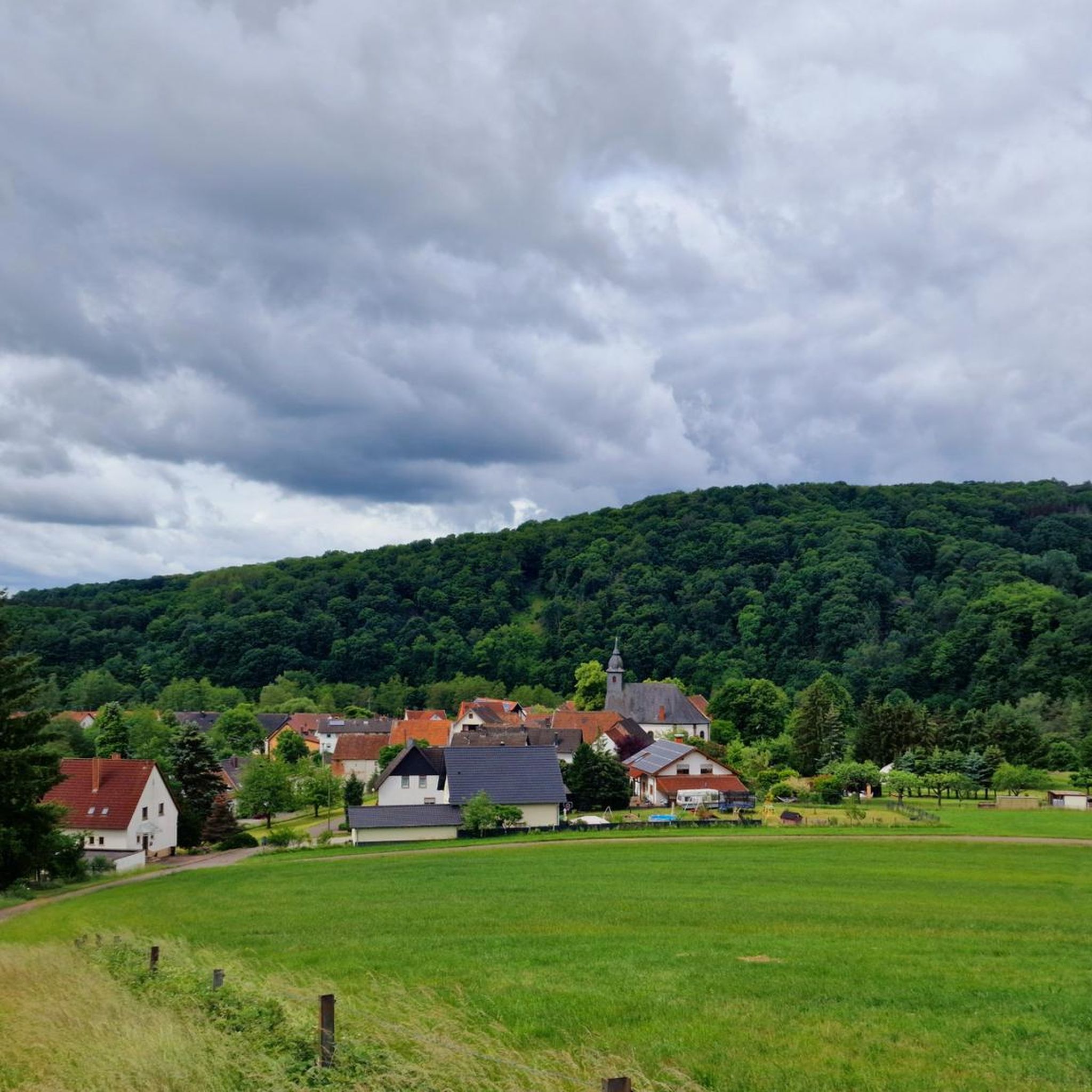
This lovely rest area with a table offers a wonderful view of Theisbergstegen and the surrounding villages and fields. The church is also clearly visible from up here.
3
1
Frequently Asked Questions
How many hiking trails are available in Matzenbach?
Matzenbach offers a wide selection of hiking opportunities, with over 900 routes available. These range from easy strolls to more challenging ascents, catering to various fitness levels.
What kind of terrain can I expect when hiking around Matzenbach?
The region features diverse terrain, with Matzenbach itself at 210 meters elevation and surrounding mountain slopes climbing steeply to 330 meters. You'll encounter natural forests, the scenic Glan valley, and picturesque lakes. Trails can vary from gentle paths to routes with significant elevation gains.
Are there any circular hiking routes in Matzenbach?
Yes, many of the trails around Matzenbach are designed as circular routes, allowing you to start and end at the same point. For example, the Zigzag Trail on Potzberg – Schützenbrunnen loop from Föckelberg is a popular circular option.
What do other hikers say about the trails in Matzenbach?
The hiking routes in Matzenbach are highly regarded by the komoot community, holding an average rating of 4.6 stars from over 3,000 reviews. Hikers often praise the varied terrain, the natural beauty of the forests, and the well-maintained paths.
Are there any notable natural features or landmarks to see on the trails?
Absolutely. You can explore natural monuments, canyons, and beautiful lakes. A significant highlight is Ohmbach Lake, known for its scenic 3-kilometer shore. The region also features ancient trees, natural springs, and the historical Galgenberg, which offers great photographic opportunities.
Can I find trails with water features like lakes or rivers?
Yes, Matzenbach is rich in water features. It lies at the mouth of the Straubenbach where it flows into the Glan River. Ohmbach Lake is a prominent natural feature, offering leisurely walks along its shore. You can also find trails leading past natural springs, such as the Schützenbrunnen – Zigzag Trail on Potzberg loop from Föckelberg.
Are there any historical sites or unique paths to explore?
Yes, the region offers unique historical paths. The former Glan Valley Railway Track has been converted into a scenic path, featuring the over 150-meter-long, 100-year-old Glantalbahn Tunnel, which provides a distinctive experience, especially when icicles form in winter.
Are there family-friendly hiking options in Matzenbach?
Many trails in Matzenbach are suitable for families. Lake Ohmbach, for instance, provides opportunities for leisurely walks along its shore and offers amenities like boat rentals and picnic spots, making it ideal for all ages. There are numerous easy paths designed for any fitness level.
Can I bring my dog on the hiking trails in Matzenbach?
Generally, dogs are welcome on the hiking trails in Matzenbach. It's always recommended to keep your dog on a leash, especially in nature reserves or areas with wildlife, and to follow local regulations to ensure a pleasant experience for everyone.
What is the best time of year to go hiking in Matzenbach?
Matzenbach offers enjoyable hiking experiences throughout the year. Spring and autumn provide pleasant temperatures and beautiful scenery with blooming flowers or colorful foliage. Summer is great for enjoying the lakes, while winter can offer unique views, especially around the Glantalbahn Tunnel with its icicles.
Where can I find parking for hiking trails, especially near popular spots like Potzberg Tower?
Parking is generally available near popular trailheads and attractions. For routes around Potzberg Tower, you can often find designated parking areas in nearby villages like Föckelberg or Theisbergstegen, which serve as starting points for trails such as the Zigzag Trail on Potzberg – Schützenbrunnen loop from Föckelberg.
What is the range of difficulty for hikes in Matzenbach?
Matzenbach offers a good mix of difficulties. Out of over 900 routes, more than 500 are considered easy, over 400 are moderate, and a smaller number (around 20) are difficult. This ensures options for everyone, from casual walkers to experienced hikers seeking a challenge.
Most popular routes around Matzenbach
Most popular attractions around Matzenbach

Get inspired with the komoot mobile app


Explore more
Browse the best Hikes in other regions.
