The best traffic-free bike rides around Bercloux
4.0
(5)
28
riders
6
rides
Gravel biking around Bercloux, France, offers diverse landscapes characterized by picturesque rural scenery, including vineyards, forests, and tranquil marshlands. The region features a mix of terrains, from paved surfaces to unpaved roads and "white paths" (chemins blancs). These firm, unpaved tracks are well-suited for gravel biking, providing a tranquil setting through rolling countryside. The area's gentle undulations make it accessible for various fitness levels.
Best no traffic gravel bike trails around Bercloux
- The most popular no traffic gravel bike trail…
Last updated: November 4, 2026
4.0
(2)
17
riders
Hard gravel ride. Very good fitness required. Mostly paved surfaces.
5
riders
Moderate gravel ride. Good fitness required. Mostly paved surfaces.

2
riders
45.5km
02:56
250m
250m
Moderate gravel ride. Good fitness required. Mostly paved surfaces.
2
riders
61.5km
03:55
420m
420m
Moderate gravel ride. Good fitness required. Mostly paved surfaces.
3.0
(1)
1
riders
43.9km
02:49
280m
280m
Moderate gravel ride. Good fitness required. Mostly paved surfaces.
Our route recommendations are based on thousands of hikes, rides, and runs completed by other people on komoot.
Start today with a free account
Your next adventure awaits.
Popular around Bercloux

Tips from the Community

The Chaniers ferry (Charente-Maritime) is one of the last traditional river ferries still in operation in France. It allows crossing the Charente River between Chaniers and Courcoury, a few kilometers downstream from Saintes. A crossing used for centuries History of the Chaniers ferry The ferry crossing at Chaniers is very old: it dates back to the Middle Ages. In the mid-17th century, it was already an important crossing point on the Charente. It was not only used to cross the river: it also allowed residents to access the meadows on the other side, particularly for agricultural activities. In the early 20th century, the Chaniers ferry was part of a much larger network of crossings on the Charente. In 1909, thirteen ferries were still recorded in Charente-Inférieure, including the one in Chaniers. Ferries were essential at the time before the proliferation of bridges. Why "chain ferry"? The principle consists of holding the ferry on a chain connecting the two banks. The ferryman uses this chain to move the boat forward and keep it on its course despite the current. In Chaniers, the current ferry is motorized, unlike the ferry in Dompierre-sur-Charente, which is operated manually. The Tourist Office, however, still describes it as a "chain ferry," and the municipality as the traditional crossing method connecting Chaniers to Courcoury. The ferry today The crossing takes place between Le Communal in Chaniers and the Courcoury bank. It is free and can transport pedestrians, cyclists, and motorized vehicles. Its operation depends in particular on the flow of the Charente River. The municipality of Chaniers officially presents "the port of Chaniers and its chain ferry" as an element of its local heritage. Important point: I am correcting my previous message: the Chaniers ferry is not simply a "19th-century ferry." The crossing has been attested since the Middle Ages; it is its mode of operation and its equipment that have evolved over the centuries.
0
0
🏛️ Construction: 18-19 AD The arch was built around 18-19 AD, during the reign of Emperor Tiberius. It stood at the entrance to the Roman bridge crossing the Charente, at the outlet of the Via Agrippa, which connected Lyon to Saintes. It is therefore not truly a "triumphal arch": it was both a road monument and a monumental gate marking the entrance to Mediolanum Santonum, the capital of Roman Aquitaine. 👤 Who had it built? The arch was financed by Caius Julius Rufus, a Romanized notable from Saintonge. He dedicated it to Tiberius as well as his nephew Germanicus. The inscriptions engraved on the entablature still allow us today to know the figures to whom it was dedicated. The name "Arch of Germanicus" therefore comes from this dedication, and not from the fact that Germanicus personally had the arch built or crossed it. 🏗️ A rather exceptional monument The arch has two bays, likely allowing for the differentiation of traffic flows. It measures approximately 15 m high by 16 m wide. Its Corinthian and composite capitals bear witness to particularly meticulous Roman architecture. It constituted a true demonstration of the power and Romanization of Saintes. ⚠️ The moment the arch almost disappeared This is probably the most interesting episode in its history. For centuries, the arch was always located at the level of the Roman bridge and then the medieval bridge, on the right bank of the Charente. In the 19th century, the old bridge had become dilapidated. When it was decided to demolish it, around 1843, the arch was also threatened with destruction. It was then that Prosper Mérimée, Inspector General of Historical Monuments, intervened. He advocated for its preservation and arranged for its dismantling, relocation, and reassembly on the new bank. Another figure is also associated with this preservation: Victor Hugo, who stayed in Saintes in September 1843 and intervened in favor of the monument's conservation with Mérimée. 📍 Why is the arch no longer exactly in its ancient location? The arch we see today, on Place Bassompierre, is therefore no longer in its original location. It was moved a few dozen meters during the transformation of the quays and the disappearance of the old bridge. It was dismantled stone by stone and then reassembled in order to preserve it. It is now located in the immediate vicinity of the ancient Roman bridge crossing. 🏛️ Protection The Arch of Germanicus was finally classified as a historical monument in July 1905. An interesting detail The Crazannes quarries, located near Saintes, supplied a limestone widely used in the region's ancient constructions. Crazannes stone was notably used for monuments such as the Arch of Germanicus. In summary: 18-19 → construction of the arch at the entrance to the Roman bridge ↓ Antiquity → Middle Ages → the arch remains associated with the crossing of the Charente ↓ 1843 → demolition of the old bridge and threat to the arch ↓ 1843-1844 → Mérimée's intervention and relocation of the arch ↓ 1905 → classified as a Historical Monument
0
0

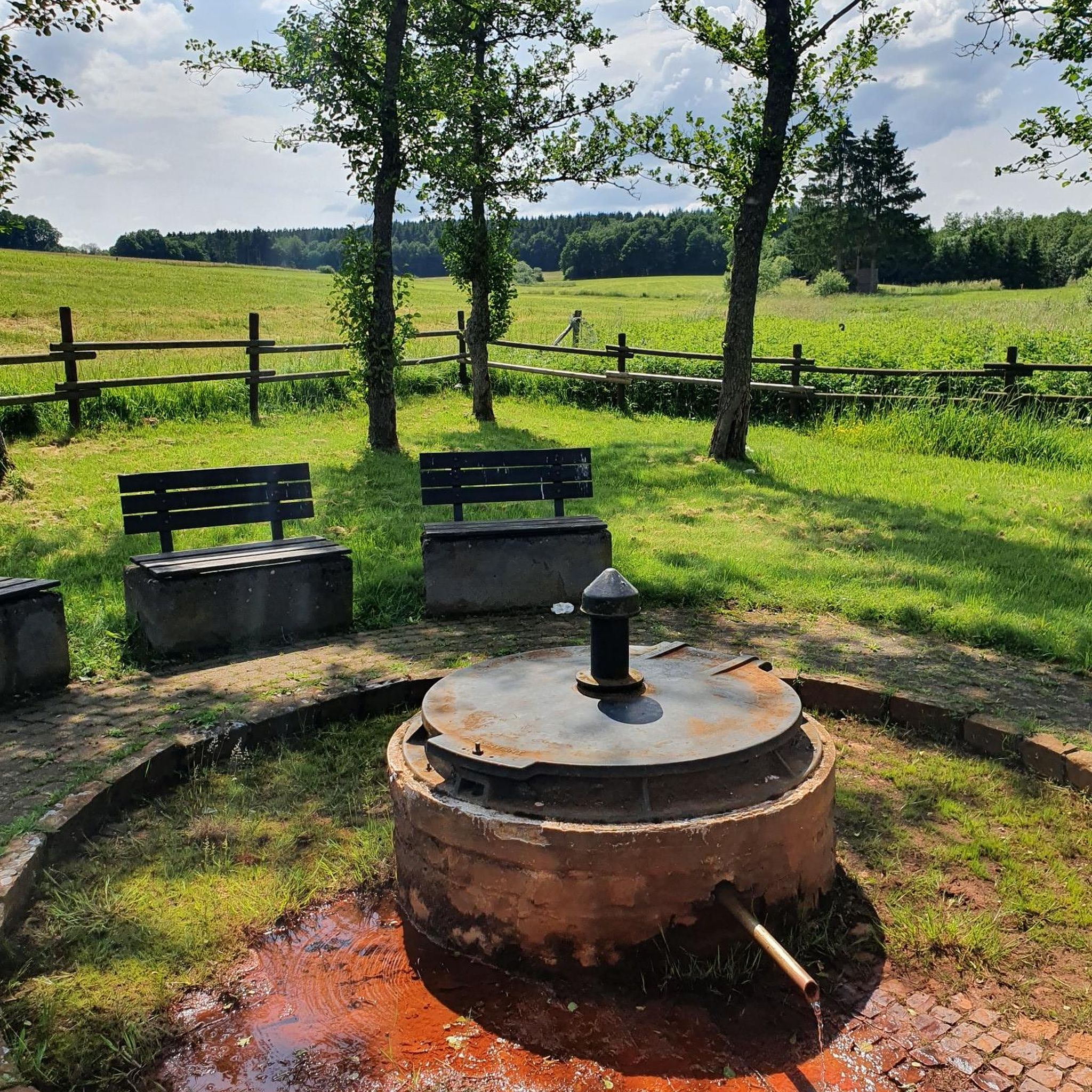
Guided tours possible from April 2026! These two fountains were developed by the inhabitants in the 18th and 19th centuries, using the water source of the aqueduct built by the Romans in the 1st century BC. A washhouse and a mill were built there. At the bottom of the mill, restored in 1993 by the village inhabitants, you can discover the "Roman slab" pipeline. The water no longer flows through this aqueduct but disappears into a fault to join the natural underground conduit. Until around 1935, this fountain was owned by a miller who, at his will, prohibited access to the inhabitants, which forced the municipality at the time to build another washhouse upstream in an old quarry.
0
0

I really enjoyed this ride. I’m 46, I did it on a 40 year old road bike, it’s more suited to a cyclocross bike!
1
0

Magnificent We can also have a picnic
0
0

A must-see visit alongside this abbey on a magnificent circuit
0
0
Very pretty wash house and fountain in a typical village
0
1
He tells us that the chapel of pots was a hub of pottery in other times
2
0
Frequently Asked Questions
How many no-traffic gravel bike trails are available around Bercloux?
You can discover several dedicated no-traffic gravel bike trails around Bercloux. Our guide features 4 carefully selected routes, offering a range of experiences for different skill levels.
What kind of landscapes can I expect on the gravel bike trails in Bercloux?
The trails around Bercloux offer a diverse and picturesque landscape. You'll cycle through charming vineyards, tranquil forests like the Forêt de Pons, and open prairies. Many routes utilize 'white paths' (chemins blancs), which are unpaved tracks perfect for gravel biking, providing a truly immersive experience in the Charente-Maritime countryside.
What is the general difficulty level of the no-traffic gravel bike trails?
The no-traffic gravel bike trails around Bercloux cater to various fitness levels. Most routes are classified as moderate, offering a good balance of challenge and enjoyment. There is also one more difficult route for experienced riders seeking a longer adventure.
Are there any family-friendly no-traffic gravel bike routes in Bercloux?
While the routes in this guide are generally moderate to difficult, the region's rolling countryside and 'white paths' can be adapted for family outings. For a moderate option that explores vineyards, consider the Vineyard Trail – Beautiful view. loop from Aujac, which offers scenic views and a manageable distance.
What interesting sights or landmarks can I explore along the gravel bike trails?
The routes often pass by historical and natural points of interest. For example, the Abbaye de Fontdouce – Port of the Lys loop from Saint-Hilaire-Brizambourg takes you near the beautiful Abbaye de Fontdouce. Another route, the Douhet Castle – Gallo-Roman Aqueduct loop from Le Douhet, offers glimpses of historical structures like the Douhet Castle and a Gallo-Roman Aqueduct.
When is the best time of year to go gravel biking in Bercloux?
Spring and autumn are generally ideal for gravel biking in Bercloux. The weather is pleasant, and the landscapes are vibrant, with blooming vineyards in spring and rich colors in autumn. Summer can also be enjoyable, especially if you start early to avoid the midday heat, while winter offers a quieter experience, though some paths might be muddier.
Are the gravel bike trails around Bercloux circular?
Yes, all the no-traffic gravel bike routes featured in this guide are designed as circular loops. This means you'll start and finish at the same point, making logistics straightforward for your ride.
What do other gravel bikers enjoy most about riding in Bercloux?
The komoot community highly rates the gravel biking experience in Bercloux, with an average score of 3.5 stars. Riders often praise the tranquility of the 'no traffic' routes, the scenic beauty of the vineyards and forests, and the opportunity to explore the authentic Charente-Maritime countryside away from busy roads.
Are there options for longer, more challenging no-traffic gravel bike rides?
Absolutely. For those seeking a significant challenge, the Abbaye de Fontdouce – Port of the Lys loop from Saint-Hilaire-Brizambourg is a difficult route spanning over 111 km with substantial elevation gain, offering a full day's adventure through varied terrain.
Can I find places to stop for refreshments or food along the routes?
While the routes focus on no-traffic areas, many pass through or near small villages where you might find local cafes or bakeries. It's always a good idea to check the route details and plan your stops in advance, especially for longer rides, or carry sufficient water and snacks.
Is parking available near the starting points of these gravel bike trails?
Yes, the starting points for these routes are typically located in or near villages such as Saint-Hilaire-Brizambourg, Le Douhet, Burie, and Aujac, where public parking is generally available. We recommend checking local parking regulations upon arrival.
Are the no-traffic gravel bike trails around Bercloux dog-friendly?
Many of the rural paths and 'chemins blancs' are suitable for cycling with a well-behaved dog, especially if they are accustomed to running alongside a bike or can be carried in a suitable trailer. However, always ensure your dog is under control, respect local wildlife, and be mindful of private property or agricultural areas. It's advisable to check specific trail regulations if available.
Most popular attractions around Bercloux

Get inspired with the komoot mobile app


Explore more
Browse the best Gravel rides in other regions.
