The best family-friendly hikes and walks in St. Charles County
4.8
(41)
747
hikers
35
hikes
Family friendly hiking trails in St. Charles County offer diverse landscapes, including extensive wooded areas, scenic river bluffs overlooking the Missouri River, and serene lakes. The terrain features gentle slopes along waterways and some varied elevation through forested sections. This region provides a range of experiences from easy, paved paths to more moderate trails suitable for families.
Best family friendly hiking trails in St. Charles County
- The most popular family friendly hiking route is Katy Trail, a moderate 5.1 miles (8.3 km) trail that takes about 2 hours 5 minutes to complete, offering views of the Missouri River and limestone bluffs.
- Another top favourite among local hikers is Brommelsiek Betty's Lake, an easy 0.9 miles (1.4 km) path. This route winds around a lake, providing a tranquil setting for a short walk.
- Local hikers also love the Lewis & Clark Trail, a 0.6 miles (1.0 km) trail leading through wooded areas, often completed in about 15 minutes.
- Hiking in St. Charles County is defined by river bluffs, wooded areas, and numerous lakes, offering a mix of natural beauty. The network provides options for various ability levels, from short, easy walks to longer, moderate hikes.
- The routes in St. Charles County are highly rated by the komoot community with an average score of 4.8 stars from more than 40 reviews. More than 700 hikers have used komoot to explore St. Charles County's varied terrain.
Last updated: July 22, 2026
8.25km
02:05
20m
20m
The Katy Trail offers a wonderfully accessible hiking experience, tracing a historic rail-trail that hugs the Missouri River for much of its length. You'll find yourself immersed in diverse scenery, from the tranquil flow of the river to towering bluffs and dense woodlands, all on a mostly flat, crushed limestone path. This particular section provides a taste of the trail's charm, allowing you to enjoy the natural beauty and perhaps spot some local wildlife.
Planning your visit to the Katy Trail is straightforward, with many access points and 26 trailheads along its full 240-mile span. Parking is generally available at trailheads like Pittman Hill, making it easy to start your hike. The trail's gentle terrain means it's suitable for all ages and abilities, and you'll find amenities in the charming small towns it passes through, though it's always wise to carry water, especially on warmer days.
Beyond its scenic appeal, the Katy Trail holds significant historical importance as the longest developed rail-trail in the United States, built on the former Missouri-Kansas-Texas Railroad corridor. A substantial portion is even part of the Lewis and Clark National Historic Trail, offering a unique connection to American history. It's a haven for nature lovers, with opportunities for birdwatching and wildlife sightings, making it a popular route for both local and visiting hikers.
21.1km
05:19
30m
20m
Embark on a journey along the Katy Trail from Weldon Spring to Augusta, a 13.1-mile (21.1 km) hike that offers a delightful mix of natural beauty and historical charm. You'll trek beneath a leafy canopy, catch glimpses of the Missouri River, and pass through picturesque farmlands. The route, rated difficult primarily due to its length, features a modest 83 feet (25 metres) of elevation gain and takes about 5 hours and 18 minutes to complete, making it a rewarding option for a longer day out.
Start your adventure at the Weldon Spring trailhead, where you'll find shaded parking and facilities. As you progress, you'll encounter the historic iron bridge near Defiance and the eye-catching Sunflower Silo murals. The trail is popular in the warmer months, especially July, August, and October, and dogs are welcome on a leash. Plan for a full day to truly soak in the scenery and explore the towns along the way.
This section of the Katy Trail is a gateway to Missouri's wine country, with Augusta offering numerous wineries and breweries right off the trail. Beyond the scenic river views and charming small-town architecture, you can also access Klondike Park for additional trails and unique quarry pit views. It's a fantastic way to experience the region's agricultural heritage and enjoy a long, varied hike.

Sign up for free
643m
00:11
20m
20m
The Klondike Overlook Trail offers a unique blend of easy access and stunning scenery, leading you through a landscape shaped by a former silica sand quarry. You'll walk on a paved path that gently climbs, revealing the distinctive powdery white sand and high cliffs before opening up to the main attraction. The highlight is undoubtedly the Missouri River overlook, where you can take in expansive views of the river valley and its sandy riverbank beaches.
This easy 0.4-mile (0.6 km) out-and-back hike involves a gentle 64 feet (19 metres) of elevation gain and takes only about 11 minutes to complete. It's an ideal choice if you're looking for a quick, rewarding outdoor experience without a strenuous effort. The trail is easily accessible within Klondike Park, making it simple to find and enjoy.
Klondike Park itself is a fascinating area, having been transformed from an industrial quarry into a vibrant outdoor destination. Beyond the scenic views, keep an eye out for local wildlife like turkey vultures, white-eyed vireos, and red-tailed hawks soaring above. This trail provides a perfect glimpse into the park's unique environment and its successful repurposing for recreation.
940m
00:15
0m
10m
This easy Lewis & Clark Trail offers a brief but pleasant escape into nature, perfect for a quick leg-stretch or a family outing. You'll follow a gentle path for 0.6 miles (0.9 km), gaining only 16 feet (5 metres) in elevation, which means you can comfortably complete it in about 14 minutes. The route meanders through a landscape that evokes the natural beauty encountered by the historic expedition, with the Klondike Park Quarry as a point of interest.
Being such a short and easy route, planning your visit is straightforward. You won't need any special permits, and it's suitable for all ages and fitness levels. Consider visiting in the spring for wildflowers or in the fall for colorful foliage, though its accessibility makes it a good option year-round for a spontaneous walk.
While this specific trail is brief, it serves as a tangible link to the monumental Lewis and Clark National Historic Trail, commemorating the 1804-1806 expedition. It offers a small glimpse into the diverse ecosystems and historical significance of the broader trail, allowing you to connect with a pivotal moment in American history through a simple, enjoyable hike.
1.39km
00:22
10m
10m
Embark on an easy hike around Betty's Lake, a paved loop spanning 0.9 miles (1.4 km) with a gentle elevation gain of 31 feet (9 metres). This route offers a peaceful experience, taking approximately 21 minutes to complete. As you follow the smooth path, you'll find yourself surrounded by serene lake views, with a notable long boardwalk extending over the water. This section provides an excellent vantage point for observing ducks and geese, making it a pleasant and accessible outdoor escape.
Planning your visit is straightforward, as the trail is located within Broemmelsiek Park. The paved surface makes it particularly family-friendly and accessible for strollers and wheelchairs. You will find a Visitor's Center overlooking the lake, which can be a good starting point for your trip. Information boards near the dam offer additional details about the area, and kayak rentals are available on the east side of Betty's Lake if you wish to extend your outdoor activities.
This trail is notable for its excellent opportunities for wildlife viewing, especially around the lake and its swampy western side. Keep an eye out for frogs and turtles in these areas. The presence of a long boardwalk allows for closer observation of the natural features and local birdlife, such as ducks and geese, making it a rewarding spot for nature enthusiasts.
Get access to more routes and recommendations from other explorers.
Sign up for free
Already have an account?
Our route recommendations are based on thousands of hikes, rides, and runs completed by other people on komoot.
Start today with a free account
Your next adventure awaits.
Login or Signup





Tips from the Community

Tricky to get to but a great access to the KATY Trail.
0
0

Bike repair stand, all the necessary tools and a working air pump. Bathroom and shelter too. No water.
0
0

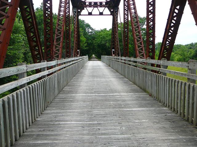
Here you will reach a historic iron bridge that spans over Femme Osage Creek just before entering Defiance. This is a particularly significant part of the Katy Trail, adding to its historical charm.
0
0


This scenic park on the banks of the Misouri River has about 4 miles of natural surface and paved trails. The MTB trails are mainly short but fun and challenging runs that can be ridden multiple times if you use the pavement and connector trails between them.
0
0
Betty's Lake sits amidst Missouri's rolling hills and wide prairies. In the summertime, it's a hotspot for kayakers and sunbathers looking for a place to cool down.
0
0
A sight for sore eyes! Two local artists painted a mural on three abandoned 40-foot-tall silos that can be seen right off the trail. They capture the essence of Missouri's farmland and bright blue skies.
0
0
Matson is a small town situated right along the trail. Within the town, you can discover an antique shop and a sizable parking lot. This spot is popular for people to either start or finish their journey along the trail due to its easy accessibility.
0
0
Frequently Asked Questions
How many family-friendly hiking trails are available in St. Charles County?
St. Charles County offers a wide selection of family-friendly hiking trails. You'll find over 30 routes, with more than 20 specifically rated as easy, perfect for families with children.
What kind of terrain can we expect on family-friendly hikes in St. Charles County?
Family-friendly hikes in St. Charles County feature diverse terrain, from lush wooded paths to scenic river bluffs overlooking the Missouri River. Many trails also wind past serene lakes and picturesque creeks, offering varied natural beauty suitable for all ages.
Are there any easy, short trails suitable for toddlers or strollers?
Yes, for shorter, easier walks, consider the Klondike Overlook Trail, which is less than a kilometer and offers scenic views. Another great option is the Lewis & Clark Trail, also under a kilometer and rated easy, making it ideal for families with young children or strollers.
What are some scenic viewpoints or natural features to look out for on these trails?
Many trails offer stunning views, especially along the Missouri River bluffs. You can find a fantastic Missouri River Overlook. Additionally, the region is rich with lakes, such as Betty's Lake, and extensive wooded areas like Weldon Spring Conservation Area, providing beautiful natural backdrops for your family hike.
Are there any trails that feature lakes or water views?
Absolutely! Many parks in St. Charles County offer trails with beautiful lake views. For example, the Brommelsiek Betty's Lake route takes you around a serene lake, perfect for a peaceful family outing. Klondike Park also features a fishing lake and river views.
What is the best time of year to go hiking with family in St. Charles County?
Spring and fall are generally the most pleasant seasons for family hiking in St. Charles County. The weather is milder, and the natural scenery is vibrant with spring blooms or colorful autumn foliage. Summer can be warm and humid, so early mornings or late afternoons are best if hiking during that time.
Are dogs allowed on family-friendly hiking trails in St. Charles County?
Many parks and trails in St. Charles County are dog-friendly, though leash laws are typically enforced. It's always a good idea to check specific park regulations before you go, but generally, you'll find plenty of options to bring your furry family member along.
What do other hikers enjoy most about family-friendly trails in St. Charles County?
The area is highly rated by the komoot community, with an average score of 4.8 stars. Reviewers often praise the well-maintained paths, diverse natural beauty, and the accessibility of trails for various skill levels, making it a favorite for family outings.
Are there any circular routes suitable for families?
Yes, many parks offer loop trails that are great for families, allowing you to start and end at the same point without retracing your steps. While specific loop routes are not detailed here, parks like Quail Ridge Park and Broemmelsiek Park are known for their circular trail systems.
Where can we find parking for these family-friendly trails?
Most major parks and trailheads in St. Charles County, such as Klondike Park, Broemmelsiek Park, and Weldon Spring Conservation Area, offer dedicated parking facilities. These are generally well-marked and conveniently located near the trail access points.
Can we spot any wildlife on these family-friendly hikes?
Yes, St. Charles County's diverse natural habitats, including wooded areas, lakes, and river corridors, provide opportunities for wildlife spotting. Keep an eye out for various bird species, deer, and smaller mammals. Early mornings or late afternoons are often the best times for wildlife viewing.
Most popular routes in St. Charles County
Most popular attractions in St. Charles County

Get inspired with the komoot mobile app


Didn’t find what you were looking for?
Check out more Hikes throughout St. Charles County below and find the perfect route in your destination.
Explore more
Browse the best Hikes in other regions.
