The best road cycling routes around Río Guadamatilla Y Arroyo Del Tamujar
28
riders
6
rides
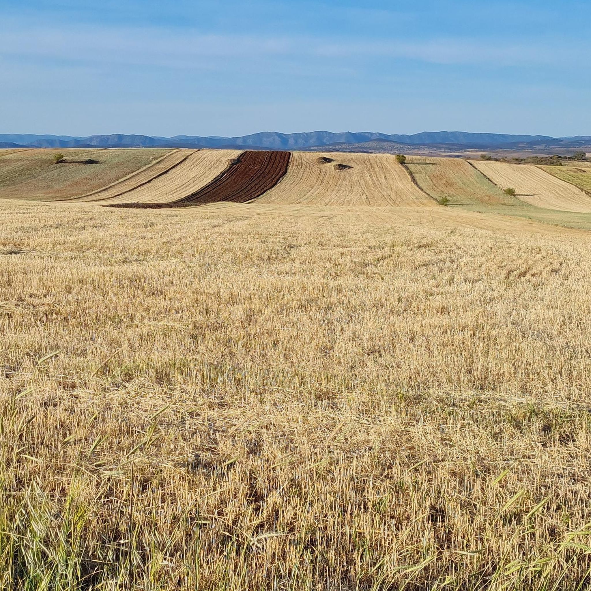
Road cycling around Río Guadamatilla Y Arroyo Del Tamujar offers diverse landscapes within the Pedroches region of Córdoba. The area features long, straight sections ideal for road cycling, particularly around Belalcázar. While much of the Pedroches area is generally flat, the terrain becomes more challenging and rugged towards the Sierra de Santa Eufemia, with some northern slopes reaching significant gradients. This region is defined by the Guadamatilla River and the Tamujar stream, contributing to a rich riparian ecosystem.
Best road…
Last updated: August 20, 2026
7
riders
88.5km
03:47
760m
760m
Moderate road ride. Good fitness required. Mostly well-paved surfaces and easy to ride.
73.6km
03:12
640m
640m
Moderate road ride. Good fitness required. Some segments of this route may be unpaved and difficult to ride.

Sign up for free
126km
05:33
1,190m
1,190m
Hard road ride. Very good fitness required. Some segments of this route may be unpaved and difficult to ride.
15
riders
64.4km
02:44
530m
530m
Moderate road ride. Good fitness required. Mostly well-paved surfaces and easy to ride.
4
riders
54.0km
02:18
450m
450m
Moderate road ride. Good fitness required. Mostly well-paved surfaces and easy to ride.
2
riders
37.5km
01:34
260m
260m
Easy road ride. Great for any fitness level. Mostly well-paved surfaces and easy to ride.
Our route recommendations are based on thousands of hikes, rides, and runs completed by other people on komoot.
Start today with a free account
Your next adventure awaits.
Login or Signup



Tips from the Community

La Puerta de la Villa de Santa Eufemia is one of the most notable remains of the municipality's old walled enclosure. This stone arch, of medieval origin, gave access to the interior of the villa and today is integrated into the urban area, preserving its historical and heritage value.
0
0

It is a tribute to the miners who worked in the Almadén mercury mines, protagonists of more than 2,000 years of mining history. The idea arose in 1953, but it did not materialize until 1996, thanks to a public subscription and institutional contributions. It was inaugurated on September 8, 1996, coinciding with the feast day of Our Lady of the Mines.
7
0
Today it houses the Mining Museum and the Historical Archive of the Almadén Mines, with documents dating back to the 17th century. The visit includes: Room 1: History of the hospital and its role in occupational health. Room 2: The mercury metallurgy process and its technological evolution. Room 3: Life and customs of the region. Audiovisual displays, dioramas, and panels on diseases such as hydrargyrism and innovative treatments (the sauna-box, "the beach"). Dungeons where sick prisoners were treated. Exhibition of mining tools, machinery, and artifacts.
8
0

The Hermitage of San Antonio, located at the northern end of Pozoblanco, dates back to the 16th century and was restored in the 18th century, preserving its portico and lintelled doorway. From this spot, you can enjoy beautiful sunsets and it houses historical and cultural artifacts of great interest.
1
0

This is one of the stage destinations where pilgrims on the Camino Mozarabe can find accommodation for the night.
0
0


The only place in town to have a drink. We ate a wonderful grilled tenderloin sandwich and a portion of small snails. They also have accommodation.
0
0

A town with history and cobblestones where you can stop to learn a little more about it and the neighbors are delighted to tell you
0
0
Frequently Asked Questions
What are the typical terrain and difficulty levels for road cycling in the Río Guadamatilla Y Arroyo Del Tamujar region?
The region offers a varied topography. The broader Los Pedroches area is generally flat, providing long, straight sections ideal for road cycling. However, as you approach the Sierra de Santa Eufemia, the terrain becomes more challenging and rugged, with some northern slopes reaching gradients of up to 40%. You'll find routes ranging from easy to difficult, with 1 easy, 6 moderate, and 2 difficult routes available.
Are there road cycling routes suitable for beginners in this area?
Yes, there is at least one easy road cycling route. For a gentler ride, consider the Belalcázar – Hinojosa del Duque loop from Belalcázar, which is 20.4 miles (32.9 km) long and takes approximately 1 hour 21 minutes to complete.
Where can I find more challenging road cycling routes in the Río Guadamatilla Y Arroyo Del Tamujar region?
For more demanding rides, look towards the Sierra de Santa Eufemia. Routes like Villages of La Serena: Peñalsordo and Capilla — circular from Cabeza Del Buey, at 60.1 miles (96.7 km) with significant elevation gain, or Almaden from Belalcazar — circular via Hinojosa del Duque, which is 78.4 miles (126.2 km) long, offer a good challenge.
What natural features or landmarks can I expect to see while road cycling here?
The region is defined by the Guadamatilla River and the Tamujar stream, offering rich riparian ecosystems with ash trees and bramble thickets. You'll also experience the varied landscapes of the Los Pedroches region and the more abrupt Sierra de Santa Eufemia. While specific landmarks are not detailed in the routes, the natural beauty of these waterways and the changing topography are key attractions.
Are there circular road cycling routes available in the Río Guadamatilla Y Arroyo Del Tamujar area?
Yes, many of the routes are circular. Examples include Monterrubio de la Serena from Bellacázar — circular via Cabeza del Buey, Santa Eufemia Loop from Belalcázar, and Villages of La Serena: Peñalsordo and Capilla — circular from Cabeza Del Buey.
What are the typical lengths of road cycling routes in the region?
Route lengths vary significantly, catering to different preferences. You can find shorter routes around 20 miles (32 km), such as the Belalcázar – Hinojosa del Duque loop from Belalcázar, up to longer rides exceeding 70 miles (110 km), like Almaden from Belalcazar — circular via Hinojosa del Duque.
Is the Río Guadamatilla Y Arroyo Del Tamujar region suitable for family-friendly road cycling?
While the region offers varied terrain, some parts of the Los Pedroches area are generally flat, which could be suitable for families. For a family-friendly option, consider the easier routes, such as the Belalcázar – Hinojosa del Duque loop from Belalcázar, which is shorter and less challenging.
What is the best time of year for road cycling in Río Guadamatilla Y Arroyo Del Tamujar?
Given the climate of the Córdoba province, spring and autumn generally offer the most pleasant temperatures for road cycling. Summers can be very hot, and winters might bring cooler, wetter conditions, making spring and autumn ideal for comfortable rides.
Are there any cafes or places to stop for refreshments along the road cycling routes?
The routes often pass through or near towns and villages in the Los Pedroches region, such as Belalcázar, Cabeza del Buey, Hinojosa del Duque, and Santa Eufemia. These settlements typically offer local cafes and establishments where you can stop for refreshments and experience local hospitality.
What is the policy on cycling with dogs in the Río Guadamatilla Y Arroyo Del Tamujar area?
The Río Guadamatilla Y Arroyo Del Tamujar is a Site of Community Importance (LIC) within the Natura 2000 network, indicating its ecological value. While specific dog policies for cycling routes are not provided, it's generally advisable to keep dogs on a leash in natural protected areas to minimize disturbance to wildlife, especially given the presence of diverse fauna like otters and raptors. Always check local regulations before you go.
How many road cycling routes are available in the Río Guadamatilla Y Arroyo Del Tamujar region?
There are 9 road cycling routes available for exploration in the Río Guadamatilla Y Arroyo Del Tamujar region, offering a range of distances and difficulty levels.
Most popular routes around Río Guadamatilla Y Arroyo Del Tamujar

Get inspired with the komoot mobile app


Explore more
Browse the best Road cycling routes in other regions.
