The best MTB trails around Rhäzüns
4.5
(2586)
17,899
riders
194
rides
Mountain biking around Rhäzüns offers diverse terrain within the Swiss canton of Graubünden, characterized by impressive alpine landscapes and the significant Rhine river. The region features varied trails that traverse dense forests, open meadows, and the unique Rhäzünser Rheinauen wetlands. Riders can expect routes that combine challenging alpine sections with more accessible paths along riverbanks and through local hills.
Best mountain bike trails around Rhäzüns
- The most popular mountain bike trail is Bonaduzer Wald (256), a 8.3 miles (13.4…
Last updated: September 29, 2026
4.7
(10)
58
riders
13.4km
01:18
340m
340m
Moderate mountain bike ride. Good fitness required. Suitable for all skill levels.
4.3
(35)
189
riders
59.7km
03:31
430m
430m
Moderate mountain bike ride. Good fitness required. Suitable for all skill levels.

4.4
(12)
83
riders
54.6km
05:21
1,630m
1,630m
Hard mountain bike ride. Very good fitness required. Advanced riding skills necessary. Some portions of the route may require you to push your bike.
4.8
(18)
88
riders
21.8km
01:40
360m
360m
Moderate mountain bike ride. Good fitness required. Suitable for all skill levels.
4.6
(18)
72
riders
75.5km
05:36
1,290m
1,290m
Hard mountain bike ride. Very good fitness required. Advanced riding skills necessary. Some portions of the route may require you to push your bike.
Get access to more routes and recommendations from other explorers.
Already have an account?
Our route recommendations are based on thousands of hikes, rides, and runs completed by other people on komoot.
Start today with a free account
Your next adventure awaits.

Tips from the Community

A place of power in a special class
0
0

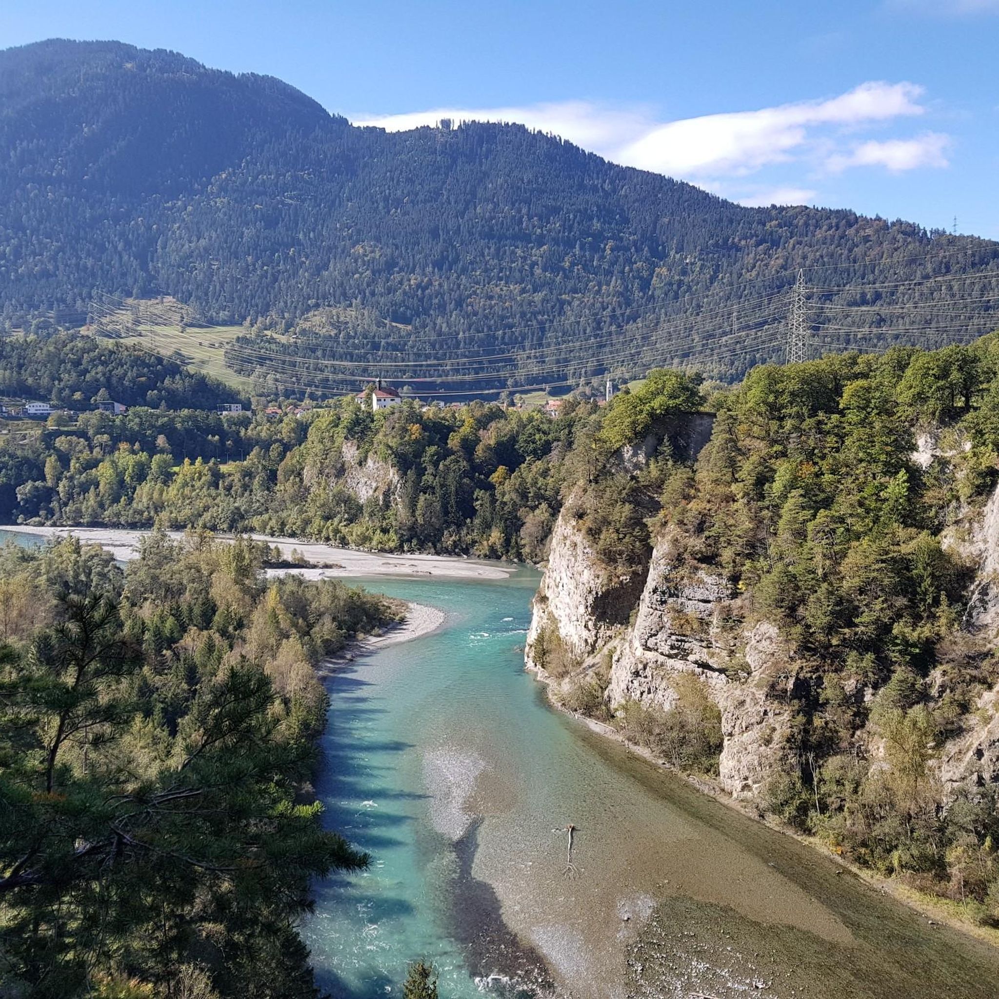
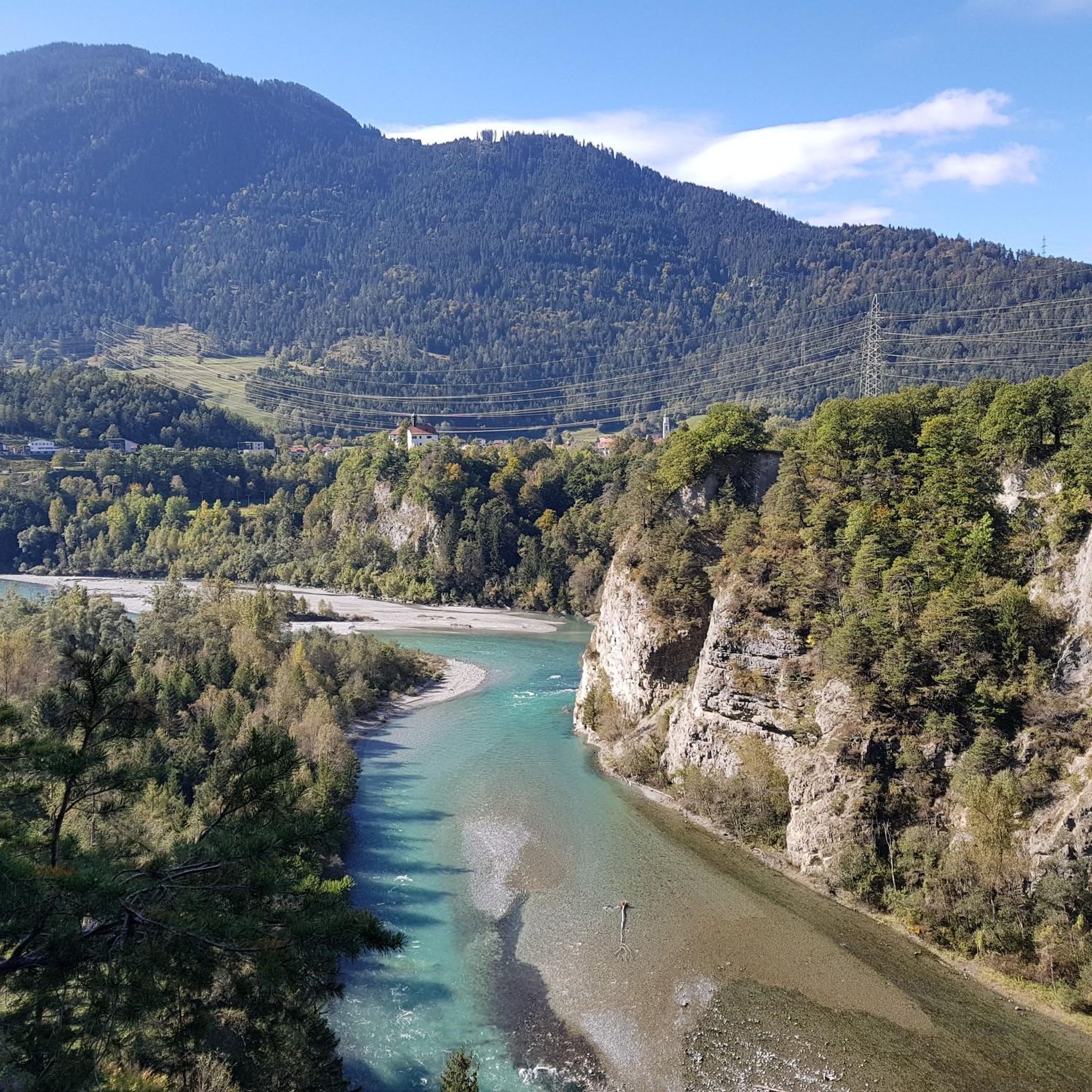
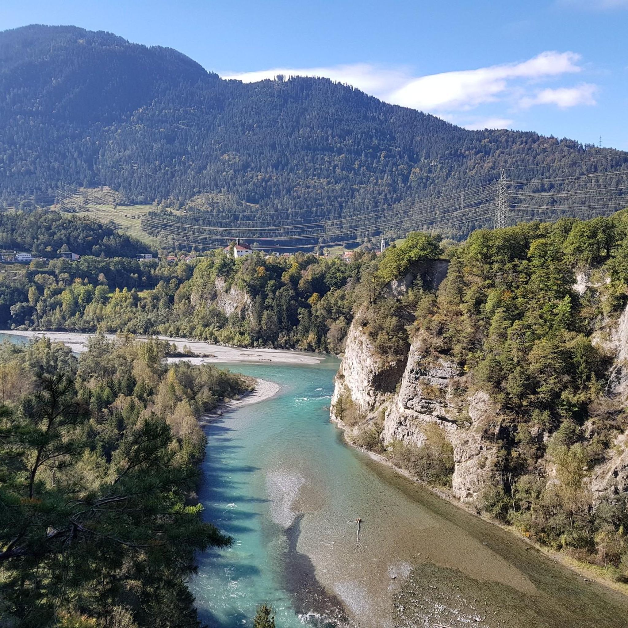
Ruinaulta Rhine Gorge The Ruinaulta, or Rhine Gorge, is a gorge of the Vorderrhein River, up to 400 meters deep and approximately 13 kilometers long, between Ilanz and the mouth of the Hinterrhein River near Reichenau in the canton of Graubünden in Switzerland. The Romansh name 'Ruinaulta' is composed of the two words ruina (scree slope, quarry) and aulta (high). The Ruinaulta was formed after the Flims Landslide almost 10,000 years ago. At that time, over 10 billion cubic meters of rock broke off between the Flimserstein and Piz Grisch, burying the Vorderrhein Valley between the present-day villages of Castrisch and Reichenau under a mass of debris several hundred meters thick. Because the Vorderrhein River could no longer drain away, a lake was dammed over a length of approximately 25 kilometers. Over time, the river cut deep into the landslide, and the resulting lake drained away completely. What remained was the Ruinaulta, with its steep limestone scree cliffs in impressive erosion formations. Text / Source: Wikipedia https://de.wikipedia.org/wiki/Ruinaulta
16
0
Confluence of the Vorderrhein and Hinterrhein, Reichenau Dominated by Reichenau Castle, the hamlet lies at the confluence of the Vorderrhein and Hinterrhein rivers, making it virtually the birthplace of the Rhine. It all began 10,000 years ago. Between the Flimserstein (a high plateau) and Piz Grisch, over 10,000 cubic meters of rock broke off and thundered down into the valley. Towards Reichenau, the Vorderrhein valley disappears under a gigantic mass of rubble. From there, the Rhine diligently ate its way through the rock, creating the spectacular Swiss "Grand Canyon" – the Ruinaulta. Text / Source: myswitzerland.com https://www.myswitzerland.com/de-ch/erlebnisse/route/vom-zusammenfluss-der-rheine-in-die-rheinschlucht/
16
0

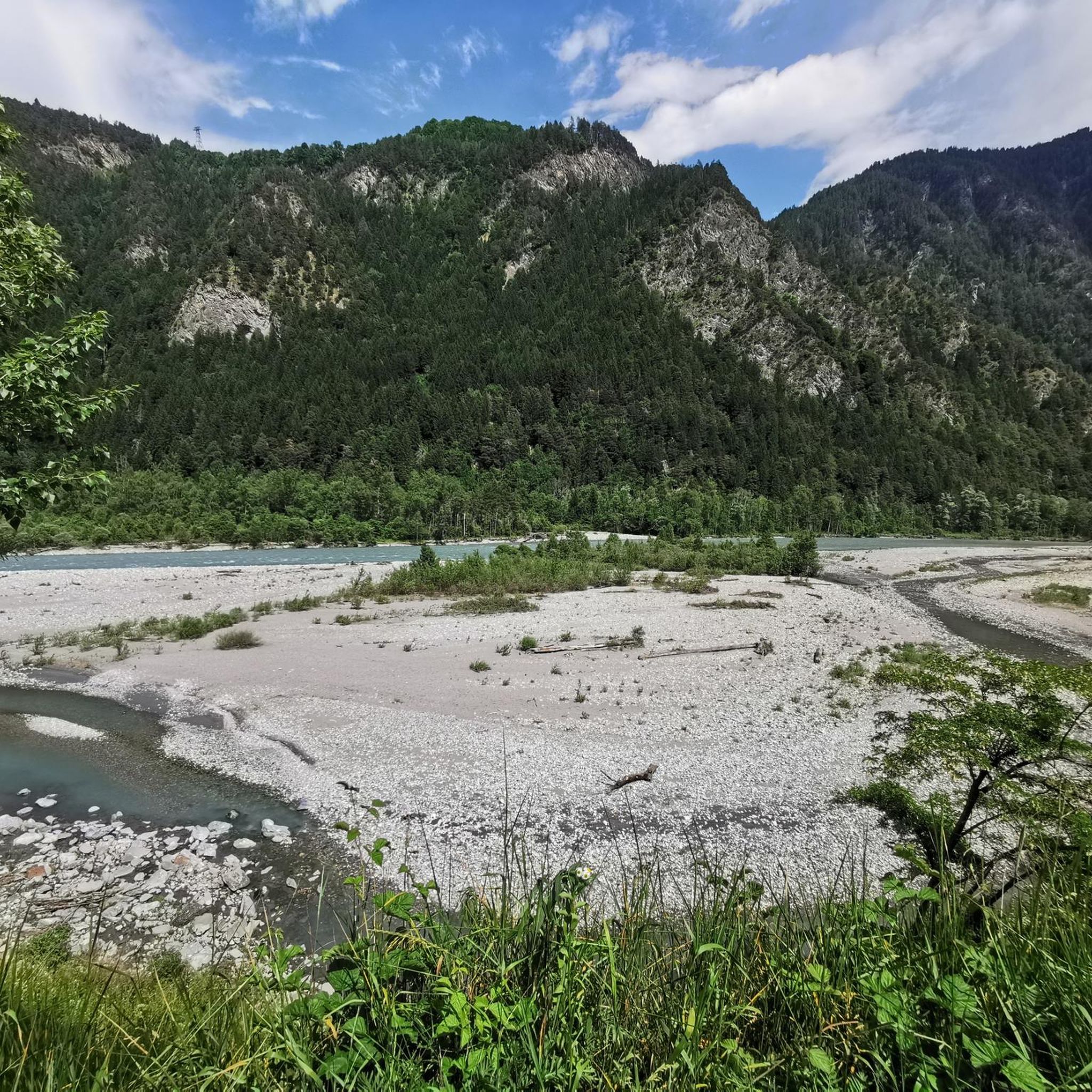
It's impressive how much wood there is in here!
1
0
A truly eerily beautiful sight!
2
0

Fantastic trail. Only a 20 meter section requires attention and it is better to get off and push.
0
0

Super nice view
0
0
Frequently Asked Questions
How many mountain bike trails are available around Rhäzüns?
There are over 200 mountain bike routes around Rhäzüns listed on komoot, offering a wide variety of experiences. These include everything from moderate forest paths to challenging alpine ascents.
What types of terrain can I expect on mountain bike trails in Rhäzüns?
The Rhäzüns region, nestled in Graubünden, offers diverse terrain. You'll find routes traversing impressive alpine landscapes, dense forests, open meadows, and the unique wetlands of the Rhäzünser Rheinauen. Some trails also feature sections alongside the Rhine river.
Are there easy mountain bike trails suitable for beginners or families in Rhäzüns?
Yes, Rhäzüns offers a good selection of easier routes. Approximately 25 of the trails are rated as easy, providing less challenging options perfect for beginners or families looking for a more relaxed ride. For example, the Bonaduzer Wald (256) is a moderate route through forested areas.
What are some notable natural attractions to see while mountain biking near Rhäzüns?
The region is rich in natural beauty. You can explore the nationally important Rhäzünser Rheinauen wetlands, where the Hinterrhein river meanders freely, or ride towards the confluence of the Hinterrhein and Vorderrhein rivers near Reichenau. The picturesque, spring-fed Cresta Lake is also a beautiful spot. For a significant natural junction, consider visiting the Confluence of the Vorderrhein and Hinterrhein.
Are there any cultural or historical landmarks accessible by mountain bike in the Rhäzüns area?
Yes, you can combine your ride with visits to historical sites. The ancient Romanesque Church at Sogn Gieri (St. Georg), known for its exceptionally preserved murals, is a significant landmark. Additionally, the area features several castles. You might pass by the Reichenau Castle or catch a View of Hohen Rätien Castle Ruins on some routes.
What do other mountain bikers say about the trails in Rhäzüns?
The mountain bike routes in Rhäzüns are highly rated by the komoot community, with an average score of 4.5 stars from over 2,000 reviews. More than 18,000 mountain bikers have used komoot to explore the varied terrain, often praising the diverse landscapes and well-maintained paths.
Are there any long-distance or challenging mountain bike routes for experienced riders?
Absolutely. Rhäzüns and its surroundings offer challenging routes for experienced riders, with over 100 trails rated as difficult. For instance, the Ausser Glas (1,846 m) – Egschisee Reservoir loop from Bonaduz is a demanding 54.7 km trail leading through alpine landscapes with significant elevation gain.
Can I find mountain bike routes that follow the Rhine river?
Yes, the Rhine river is a prominent feature of the region. The Flow Trail Above the Rhine – Pardisla Bridge loop from Bonaduz offers varied terrain alongside the Rhine, including sections of flow trail. The Rhäzünser Rheinauen wetlands also provide routes along the river's banks.
Are there any circular mountain bike routes around Rhäzüns?
Many of the mountain bike routes in the Rhäzüns area are designed as loops, allowing you to start and finish at the same point. Examples include the Hinterrhein Alluvial Landscape – View of Chur loop from Bonaduz and the Via Mala Gorge (Hinterrhein) – Lake Sufers loop from Bonaduz.
What is the best time of year for mountain biking in Rhäzüns?
The prime mountain biking season in the Graubünden region, including Rhäzüns, typically runs from late spring through early autumn (May to October). During these months, trails are generally clear of snow, and the weather is most favorable for exploring the diverse landscapes.
Are there options for public transport access to mountain bike trails?
The Graubünden region has a well-developed public transport network. While specific trailheads might vary, many areas are accessible by train or bus. Additionally, a cableway transports visitors across the Rhine gorge to the idyllic mountain village of Feldis, which can be a starting point for some routes.
Most popular routes around Rhäzüns
Most popular attractions around Rhäzüns

Get inspired with the komoot mobile app


Explore more
Browse the best MTB trails in other regions.
