Top 20 Mountain Passes around Campodenno
Best mountain passes around Campodenno are located within the Val di Non in Trentino, Italy, providing access to the Brenta Dolomites, a UNESCO World Heritage site. This region features a landscape of dramatic rock formations, green mountain meadows, and significant high-altitude saddles. The area offers diverse opportunities to experience its natural features and explore various mountain environments.
Best mountain passes around Campodenno
- The most popular mountain passes is Brenta Pass, a mountain pass that connects Val Rendena to Valle…
Last updated: July 10, 2026
Passo Campo Carlo Magno
Highlight • Mountain Pass
Translated by Google •
Tip by

Brenta Pass
Highlight • Mountain Pass
Translated by Google •
Tip by

Sign up now to discover places like this
Get recommendations on the best single tracks, peaks, & plenty of other exciting outdoor places.
Sign up for free
Grosté Cable Car
Highlight • Rest Area
Other destinations …
Translated by Google •
Tip by

Grostè Pass
Highlight • Mountain Pass
Translated by Google •
Tip by

Vidi Trail Via Ferrata
Highlight (Segment) • Climb
Translated by Google •
Tip by

Sign up for free to discover even more mountain passes around Campodenno.
Sign up for free
Already have an account?
Start today with a free account
Your next adventure awaits.
Login or Signup

Tips from the Community

Arriving at the Carlo Magno Pass, heading towards Madonna di Campiglio. A nice climb, albeit busy.
0
0

Partly secured with ropes and footholds. A steep ascent to the pass, still covered in a vast snowfield in June 2025.
0
0

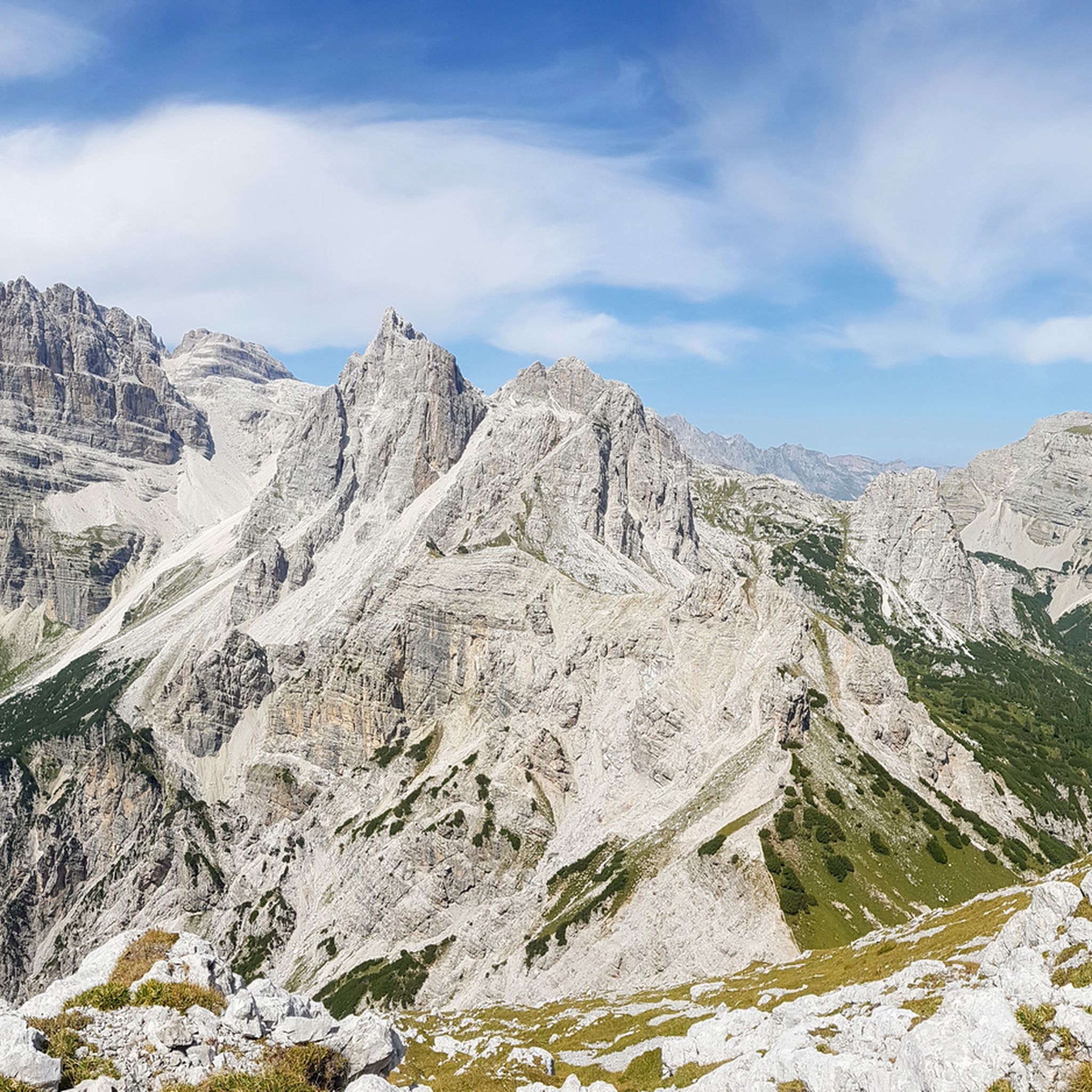
Bocca di Brenta is a saddle located in the heart of the Brenta Dolomites, which connects Val Rendena to Valle di Non. Reachable along the path that starts from Madonna di Campiglio and passes by the Brentei refuge, Bocca di Brenta is about an hour's walk from the refuge itself. This crossing point offers an excellent view of the Brenta massif and is an important stop for hikers heading towards Crozzon di Brenta, one of the most famous peaks in the area.
1
0

Beautiful trekking with a breathtaking view...at the Bocca del Brenta you can continue towards the Pedrotti refuge or take the Bocchette Centrali via ferrata.
0
0

From the Grostè Pass, take path 390 which turns northwest and skirts the Pietra Grande massif, climbing steps and metal ropes. Near the Orti della Regina (1 hour 30 minutes from the Grostè Pass), path 390 joins path 336 (Costanzi), which you follow through the Upper Val Gelada to the Bocca dei Tre Sassi (2614 m), 1 hour 30 minutes; 3 hours from the Grostè Pass. Once you have left path 336, follow the sign 334 downhill through the Val delle Giare to the junction with path 306, Palete path (just under an hour's walk - 4 hours from the start). Continue uphill on the path to the Grostè Pass, 1 hour 20 minutes - 5 hours 20 minutes in total.
1
0

https://youtu.be/k0KOxT-ZYC0 Last proper pass before Garda
1
1

You reach the Grosté pass from which you can enjoy an unmissable panorama. Departure for many excursions.
0
0

Via the Campiglio state road 239 you go up to the Campo Carlo Magno Pass, an Alpine pass in Trentino that connects the Val di Sole with the Val Rendena, between the Brenta Dolomites and the Presanella Group. Legend (without great historical foundations) has it that the toponymy may derive from the passage of Charlemagne during his descent towards Rome in the year 800.
2
1
Frequently Asked Questions
What are some of the most challenging mountain passes for experienced hikers near Campodenno?
For experienced hikers seeking a challenge, Bocca di Brenta is a prominent saddle in the heart of the Brenta Dolomites. It's renowned for dramatic rock formations and offers extraordinary views of the Brenta massif. Some routes to Bocca di Brenta can be demanding and may require specialized equipment. Another challenging option is Passo Termoncello, which is part of the strenuous Dolomiti Brenta Trek and features scree and rhododendrons along its trails.
Are there any mountain passes near Campodenno that offer historical significance?
Yes, Passo Campo Carlo Magno is notable for its historical context. Tradition, though undocumented, suggests Charlemagne camped here in 800 AD during his descent to Rome. This pass connects Val di Sole with Val Rendena and serves as a watershed between the Sarca and Noce basins.
What kind of natural features can I expect to see around the mountain passes near Campodenno?
The mountain passes around Campodenno, particularly within the Brenta Dolomites, offer a stunning array of natural features. You'll encounter dramatic rock formations, a unique mixture of red and gray rock faces, and lush green mountain meadows. Passes like Bocca di Brenta provide panoramic views of the Brenta massif, while trails to Passo Termoncello showcase beautiful Val di Tovel and vibrant rhododendron fields.
What are the best options for accessing higher mountain passes, especially for those who prefer not to hike the entire way?
For easier access to higher elevations, the Grosté Cable Car is an excellent option. It can take you to Rifugio Boch (middle station) and Rifugio Stoppani (mountain station), offering incredible views of the Adamello Glacier and surrounding peaks. From the mountain station, you can also reach Rifugio Graffer or embark on further hikes like the Cima del Grostè.
Are there any family-friendly mountain passes or activities near Campodenno?
While many high mountain passes require some hiking, Grosté Cable Car is listed as family-friendly, providing an accessible way to enjoy mountain views without strenuous hiking. Additionally, Passo della Mendola is accessible by road and offers cycling paths and easier hikes in the surrounding areas, making it suitable for families looking for less demanding activities.
What outdoor activities can I do near these mountain passes, besides hiking?
Beyond hiking, the region around Campodenno offers diverse outdoor activities. You can find numerous MTB Trails, with options ranging from moderate to difficult, such as the 'Sporminore Cliffside Trail – Mountain Stream loop'. There are also various Running Trails, including the 'Laghetto del Sole loop' and routes around Lake Tovel. For those seeking more intense experiences, there are also Mountaineering routes and via ferratas like the Vidi Trail.
What is the best time of year to visit the mountain passes around Campodenno?
The best time to visit the mountain passes around Campodenno for hiking and outdoor activities is generally during the warmer months, from late spring to early autumn (May to October). During this period, the trails are typically free of snow, and the weather is more favorable for exploring. Some passes, like Grostè Pass, are particularly pleasant for walking in the summer.
Are there any specific viewpoints or panoramic spots among the mountain passes?
Many passes offer exceptional viewpoints. Bocca di Brenta provides an excellent view of the Brenta massif, including peaks like Crozzon di Brenta. From Passo Termoncello, you can admire the beautiful Val di Tovel. Passo della Mendola offers views over Val d'Adige and the Dolomites, while Passo Campo Carlo Magno is also recognized as a viewpoint.
What are some of the longer, more strenuous hiking routes that incorporate these mountain passes?
The Dolomiti Brenta Trek (DBT) is a significant long-distance trekking path that incorporates several passes. For instance, the route from Malga Spora to Malga Flavona via Passo Termoncello and Sella del Montoz is a moderate to hard mountain hike, covering about 15.9 km with significant elevation changes and taking approximately 6 hours and 50 minutes. This route offers diverse terrain and rewarding vistas.
What do visitors enjoy most about the mountain passes near Campodenno?
Visitors frequently praise the incredible landscapes of the Brenta Dolomites, highlighting the breathtaking mixture of red and gray rock faces with green mountain meadows. The panoramic views, especially from saddles like Brenta Pass, are a major draw. The sense of adventure on challenging trails and the accessibility of some passes for cycling and easier walks are also highly appreciated.
How accessible is Passo della Mendola, and what activities can be done there?
Passo della Mendola is highly accessible as it's reachable by road, connecting Val di Non with Val d'Adige. It's a popular starting point for various activities, including cycling on dedicated paths that pass through forests, meadows, and villages with panoramic views. You can also find easier hikes in the surrounding areas of Monte Roen and Monte Penegal, making it a versatile destination.
Are there any via ferratas or climbing routes associated with these mountain passes?
Yes, the area offers challenging climbing opportunities. The Vidi Trail Via Ferrata is accessible from Grostè Pass. This route involves climbing steps and metal ropes, skirting the Pietra Grande massif, and connecting to other paths like the Costanzi trail. It's a demanding route suitable for experienced climbers.
Most popular routes around Campodenno
Most popular attractions around Campodenno

Get inspired with the komoot mobile app


Explore more
See even more epic mountain passes by checking out these guides around Campodenno:
