The best walks and hikes around San Vito Chietino
4.3
(49)
620
hikers
18
hikes
Hiking around San Vito Chietino offers diverse landscapes, from the Adriatic coastline to inland hills. The region is characterized by its rocky spur overlooking the sea, the unique Trabocchi Coast with its traditional fishing huts, and stretches of pine forests. To the west, the distant Majella and Gran Sasso mountains provide a scenic backdrop, while coastal paths offer views of the deep blue Adriatic Sea.
Best hiking trails around San Vito Chietino
- The most popular hiking route is Via Verde…
Last updated: October 26, 2026
4.9
(11)
84
hikers
Moderate hike. Good fitness required. Easily walkable paths.
4.4
(7)
80
hikers
Moderate hike. Good fitness required. Easily walkable paths.

4.2
(5)
57
hikers
12.1km
03:12
110m
110m
Moderate hike. Good fitness required. Easily walkable paths.
5.0
(1)
45
hikers
Easy hike. Easily walkable paths.
3.0
(1)
7
hikers
Moderate hike. Good fitness required. Easily walkable paths.
Get access to more routes and recommendations from other explorers.
Already have an account?
Our route recommendations are based on thousands of hikes, rides, and runs completed by other people on komoot.
Start today with a free account
Your next adventure awaits.
Tips from the Community


Location where you can quickly replenish your burnt sugars. Plenty of choices!
4
0
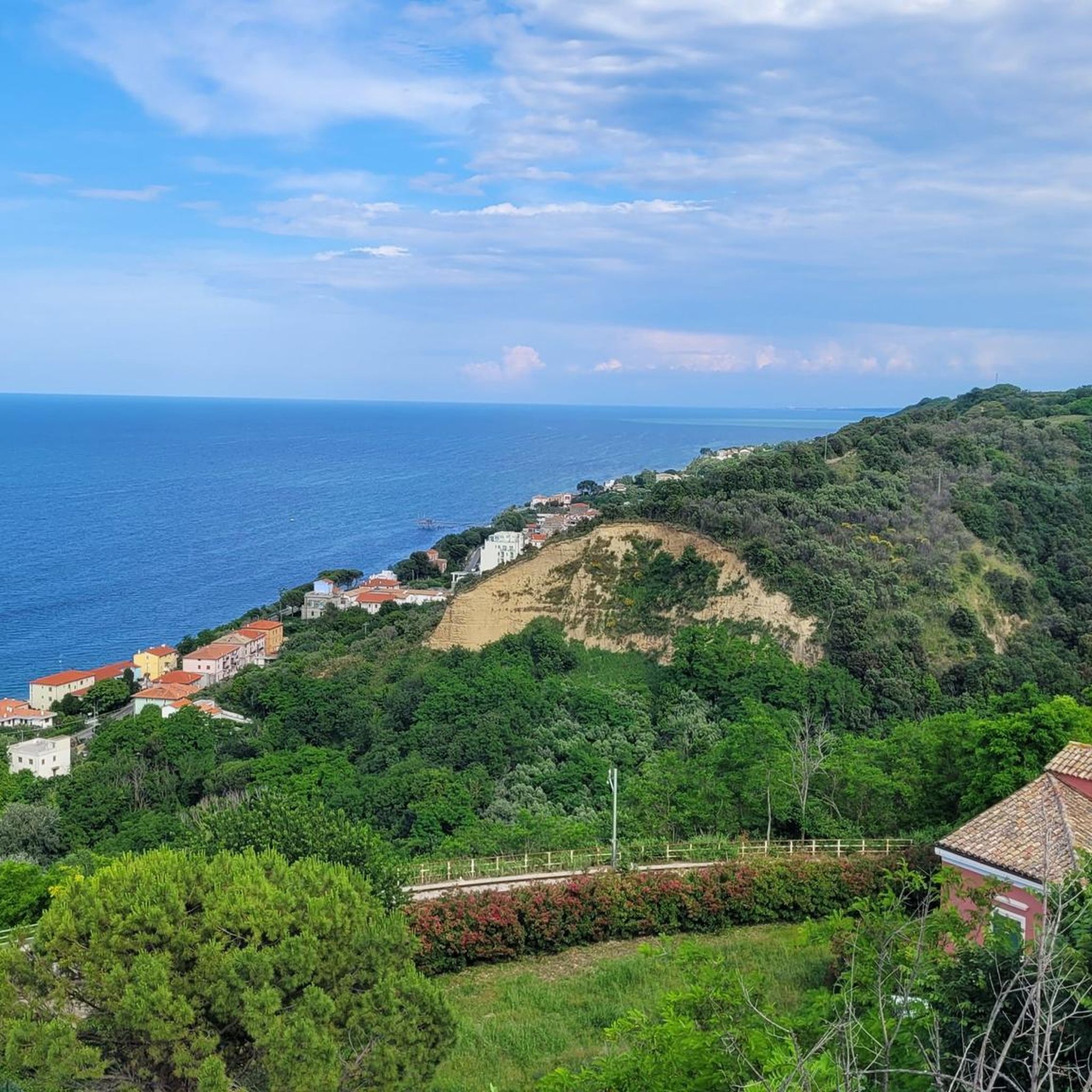
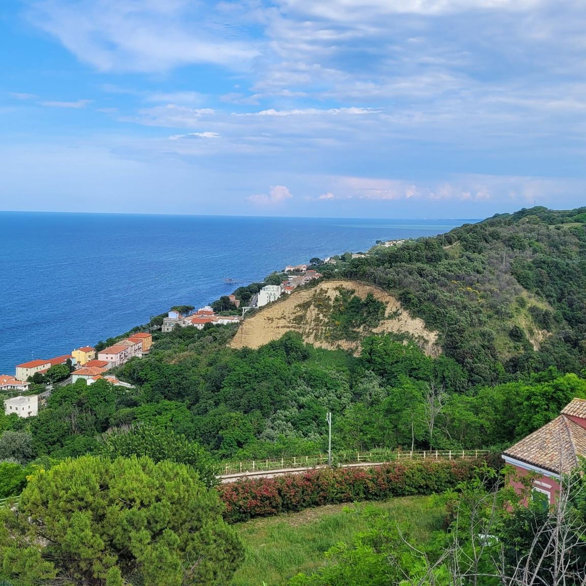
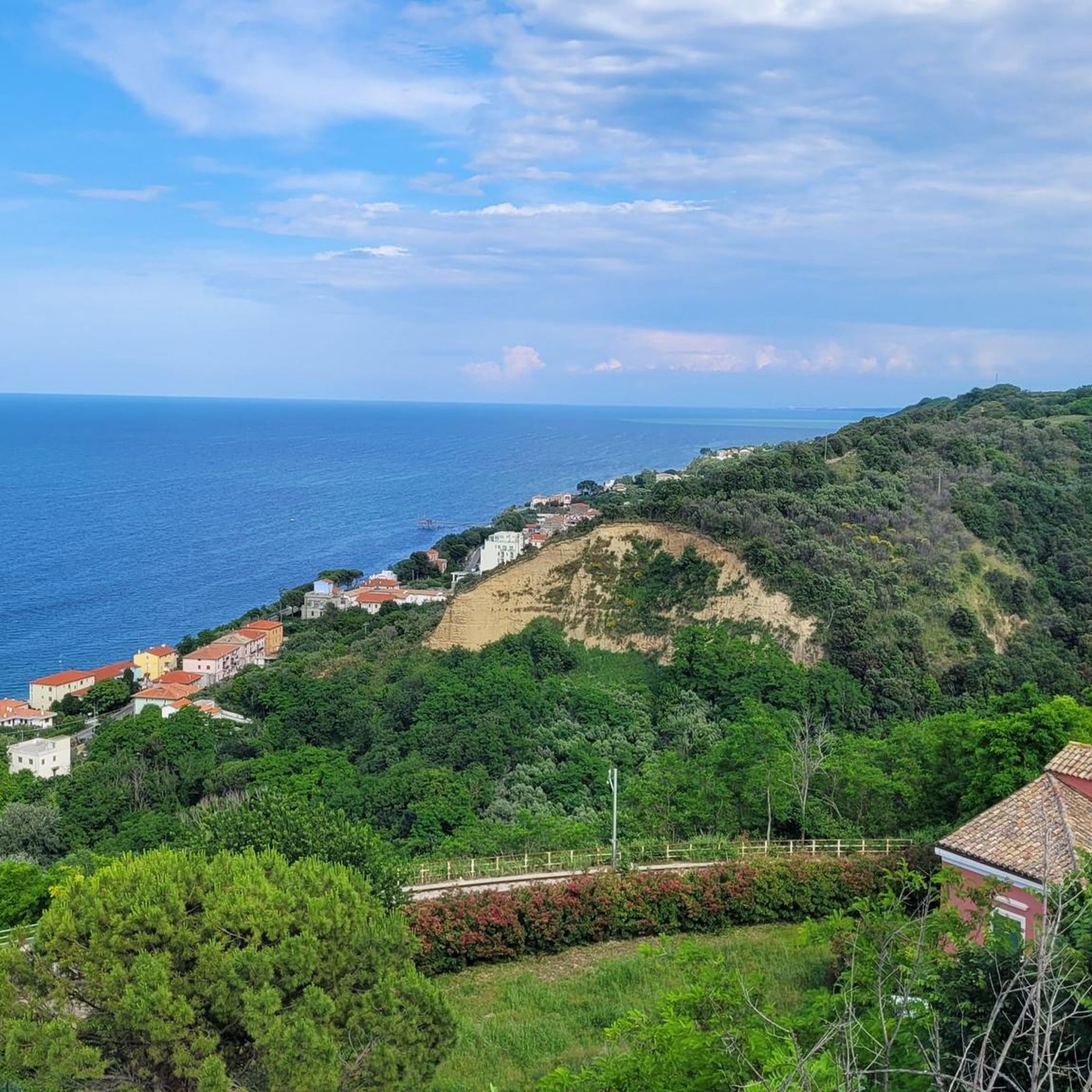
This is one of the most authentic and hidden gems right along the Via Verde: the Porticciolo di Vallevò. Where the coastline is often wild and rocky, this small cove with its long, stone breakwater forms a safe haven for the traditional wooden fishing boats of the local community. The boats resting on wooden cradles ashore exude pure maritime nostalgia. To the right in the sea, you will also see the beautiful Trabocco Sasso della Cajana. This is the ideal photo stop to experience the true, undefined fishing culture of the Abruzzo region. A beautiful view from the cycle path that you should not miss!
2
0
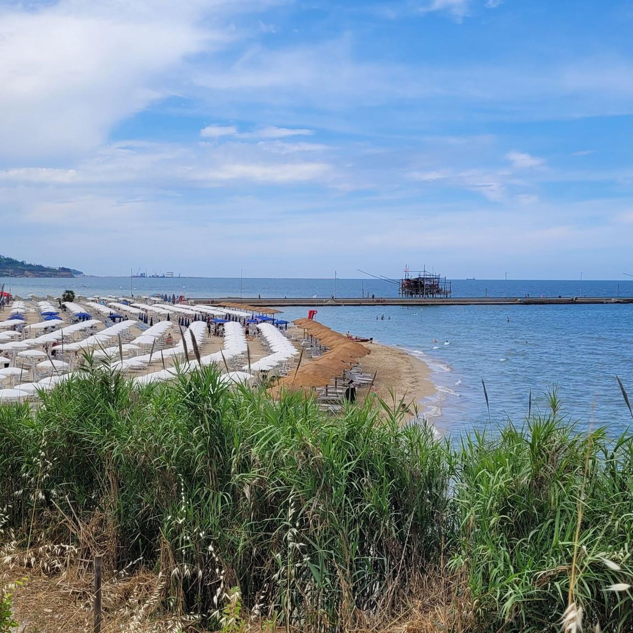
Those cycling or walking the famous Via Verde della Costa dei Trabocchi should not miss a stop at the sandy beach of San Vito Chietino (Marina di San Vito). This atmospheric beach is hidden in a quiet bay and offers a beautiful contrast to the rugged, rocky cliffs that characterise this Italian coastline. The photo was taken from the southern pier (Molo Sud). This is the perfect place to get off your bike for a moment and enjoy the sea breeze. From here, you look straight out at the cosy promenade (Lungomare di Gualdo) and the typically Italian, colourful lido beaches. The shallow, clear water immediately invites you for a refreshing dip during a warm summer tour. Inspiring tip for outdoor enthusiastsAfter your beach visit, be sure to walk the pier all the way to the end. From there, you not only have a wide view of the Adriatic Sea, but you also see the iconic wooden fishing installations (trabocchi) on stilts in the water just around the corner. In the harbour mouth, you will also find a few excellent fish restaurants and ice cream parlours for a well-deserved break.
1
0
The Trabucchi cycle path (officially known as the Via Verde dei Trabocchi) is a beautiful, largely flat cycle path over 50 kilometers long that runs along the Adriatic coast of the Italian region of Abruzzo on a former railway line. The path owes its name to the trabocchi (singular: trabocco): unique, monumental wooden fishing platforms on stilts that rise above the water like giant spiders.
5
0
Trabocco Mucchiola – Picnic with sea view Trabocco Mucchiola is a lovely place to take a break during your tour along the Via Verde dei Trabocchi. Next to the cycle path, there is a shady picnic area with tables, ideal for resting, eating something, or simply enjoying the view of the Adriatic Sea. The charming wooden trabocco stands on the rocky Punta Mucchiola and is one of the first fishing platforms you will encounter south of Ortona. Thanks to its splendid location, this is also a beautiful stop along the route to capture a beautiful memory.
4
0
Via Verde dei Trabocchi – Enjoyment along the Adriatic Sea Get on your bike and discover one of Italy's most beautiful coastal routes. The Via Verde dei Trabocchi follows a former railway line and is completely flat, car-free, and perfectly asphalted. Ideal for a relaxing tour, whether you cycle sportily or just want to enjoy the view. Along the way, you'll cycle past the iconic trabocchi: centuries-old wooden fishing platforms that rise like giant works of art above the Adriatic Sea. Today, several trabocchi are atmospheric seafood restaurants where you can stop for a delicious lunch or dinner with fresh fish and a beautiful sea view.
5
0
Frequently Asked Questions
How many hiking trails are available in San Vito Chietino?
San Vito Chietino offers a diverse selection of 17 hiking trails. These routes cater to various preferences, with 10 easy trails perfect for leisurely strolls and 7 moderate options for those seeking a bit more challenge.
What kind of terrain can I expect on hikes around San Vito Chietino?
The terrain around San Vito Chietino is quite varied. You'll find many coastal paths along the Adriatic Sea, trails winding through serene pine forests, and routes offering panoramic views of the unique Trabocchi Coast. The town itself is situated on a rocky spur, adding to the diverse landscape.
Are there any family-friendly hiking options in San Vito Chietino?
Yes, San Vito Chietino has several easy trails suitable for families. For instance, the Spiaggia di Cala Turchino loop from San Vito Chietino is an easy 3.8 km route that takes about an hour, perfect for a pleasant family outing to a beautiful beach. Many coastal paths are generally flat and accessible.
Can I find circular walks in the area?
Absolutely. Many of the trails around San Vito Chietino are designed as circular routes, allowing you to start and end in the same location. An example is the Trabocco on the Adriatic Coast loop from San Vito Chietino, an easy 6 km path that offers beautiful coastal scenery.
What natural features or landmarks can I see while hiking?
Hiking in San Vito Chietino offers views of the iconic Trabocchi, traditional wooden fishing huts along the coast. You can explore the Via Verde dei Trabocchi, a dedicated path along the coast, or visit the Punta dell'Acquabella Nature Reserve with its high cliffs and pine forests. Distant views of the Majella and Gran Sasso mountains are also a common sight.
Are there any waterfalls near San Vito Chietino that I can hike to?
While not directly on the coastal trails of San Vito Chietino, the Bocca di Valle Waterfall is a notable natural attraction a short distance away. It provides a serene spot for relaxation amidst nature and can be incorporated into a day trip from the area.
What do other hikers say about the trails in San Vito Chietino?
The trails in San Vito Chietino are highly regarded by the komoot community, boasting an average rating of 4.5 stars from over 50 reviews. Hikers frequently praise the stunning coastal views, the unique experience of walking past the trabocchi, and the well-maintained paths, especially along the Via Verde dei Trabocchi.
Are there any longer, more challenging hikes available?
For those looking for a longer moderate hike, the Ortona Weekly Market – Via Verde dei Trabocchi loop from San Vito-Lanciano covers 16.5 km and takes approximately 4 hours 20 minutes. This route offers a more extended exploration of the coastal area and its surroundings.
What is the best time of year to go hiking in San Vito Chietino?
The best time for hiking in San Vito Chietino is generally during the spring (April-June) and autumn (September-October) months. During these periods, the weather is pleasant, temperatures are mild, and the natural scenery is vibrant, making for comfortable and enjoyable walks along the coast and through the reserves.
Are there specific points of interest along the Via Verde dei Trabocchi?
Yes, the Via Verde dei Trabocchi is dotted with interesting sights. You can encounter several traditional fishing huts, such as Trabocco Punta Torre and Trabocco Spezzacatene, many of which offer opportunities to learn about local fishing traditions or even dine. The path itself provides continuous views of the Adriatic Sea.
Is public transport available to reach hiking trailheads?
San Vito Chietino is accessible by public transport, particularly by train to the San Vito-Lanciano station. From there, local buses or walking can connect you to various trailheads, especially those along the Via Verde dei Trabocchi. It's advisable to check local bus schedules for specific routes and times.
Where can I find parking for hiking trails in San Vito Chietino?
Parking is generally available in and around San Vito Chietino, particularly near popular access points for the Via Verde dei Trabocchi and other coastal trails. Look for designated parking areas in the town center or near beaches like Marina di San Vito. Some trailheads might have smaller, informal parking spots.
Most popular attractions around San Vito Chietino

Get inspired with the komoot mobile app


Explore more
Browse the best Hikes in other regions.
