The best walks and hikes around Ovaro
4.5
(483)
1,481
hikers
52
hikes
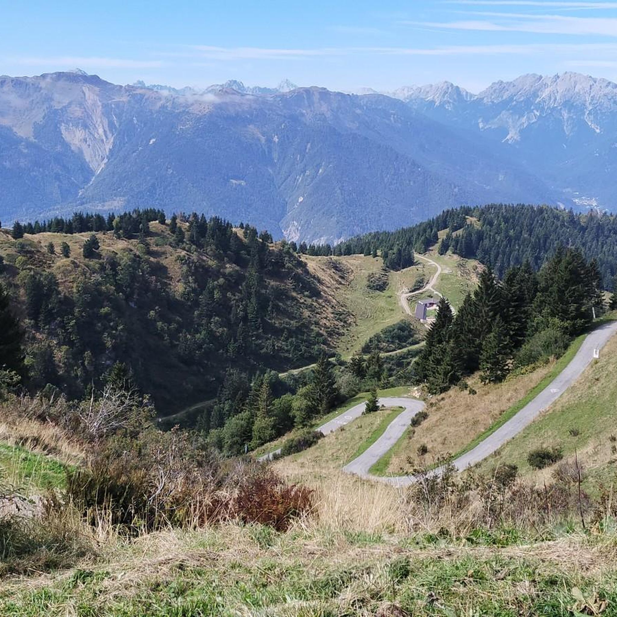
Hiking around Ovaro offers access to a mountainous landscape in the Friuli-Venezia Giulia region of Italy. The area is characterized by alpine terrain, including peaks like Monte Zoncolan, Mount Tamai, and Monte Arvenis. Trails often feature significant elevation changes and lead through forested areas and open mountain slopes. The region provides a range of hiking experiences from moderate ascents to more challenging routes.
Best hiking trails around Ovaro
- The most popular hiking route is Mount Tamai – Monte Arvenis loop from Monte Zoncolan / Il Çoncolàn, a 7.1 miles (11.5 km) trail that takes 4 hours 17 minutes to complete. This moderate route features significant elevation gain through alpine scenery.
- Another top favourite among local hikers is Arvenis Saddle – Monte Arvenis loop from Monte Tribil, a moderate 4.9 miles (7.8 km) path. This trail offers views of the surrounding mountains and can be completed in approximately 2 hours 52 minutes.
- Local hikers also love the Mount Tamai – Tamai Hut loop from Monte Claupa, a 5.7 miles (9.1 km) trail leading through mountain forests and open slopes, often completed in about 3 hours 42 minutes.
- Hiking around Ovaro is defined by mountainous terrain, including prominent peaks and forested slopes, with routes offering options for different ability levels.
- The routes in Ovaro are highly rated by the komoot community with an average score of 4.6 stars from over 400 reviews. More than 1300 hikers have used komoot to explore Ovaro's varied terrain.
Last updated: July 9, 2026
4.6
(8)
71
hikers
11.5km
04:17
650m
650m
Moderate hike. Good fitness required. Mostly accessible paths. Sure-footedness required.
4.6
(11)
68
hikers
7.83km
02:52
430m
430m
Moderate hike. Good fitness required. Mostly accessible paths. Sure-footedness required.

Sign up for free
4.6
(19)
91
hikers
11.3km
03:28
400m
400m
Moderate hike. Good fitness required. Easily-accessible paths. Suitable for all skill levels.
4.9
(16)
71
hikers
9.13km
03:42
550m
550m
Moderate hike. Good fitness required. Mostly accessible paths. Sure-footedness required.
4.4
(16)
34
hikers
9.89km
03:23
510m
510m
Moderate hike. Good fitness required. Easily-accessible paths. Suitable for all skill levels.
Get access to more routes and recommendations from other explorers.
Sign up for free
Already have an account?
Our route recommendations are based on thousands of hikes, rides, and runs completed by other people on komoot.
Start today with a free account
Your next adventure awaits.
Login or Signup


Other adventures around Ovaro

Tips from the Community

A great route for cyclists and hikers with a forest road and mountain road character. The ground is mostly rocky, concreted in exposed sections. For breaks, the partially managed mountain huts located directly on the route are suitable.
0
0
A great route for cyclists and hikers with the character of a forest path and mountain road. The ground is mostly rocky, concreted in exposed places. The partially managed mountain huts located directly on the route are suitable for breaks.
0
0
The "Malga Tamai" is located on the edge of a wide basin above the tree line along the mountain hut trail route.
0
0
The "Malga Tamai" is located on the edge of a wide basin above the tree line along the mountain hut trail.
0
0
A fantastic 360-degree panoramic view of the mountain worlds in all directions rewards the ascent/ride.
0
0

The hike is best done in the direction as indicated in Komoot. So, do the ascending part first because that path is very narrow and much more difficult to descend. The Rifugio Tamai is very nice, a pleasant place to stay a bit longer, beautiful view, natural playground for children, llamas and donkeys in the pasture, a large swing overlooking the mountains, delicious coffee, …
0
0

"Tamai" originally meant a place where shepherds sheltered from storms and sheltered their flocks. Today, instead of sheep, tourists, skiers, and cyclists gather here to relax with a frico and admire the panoramic view of the Alps.
1
0
The menu features typical Carnic and Friulian dishes, including frico (fried cheese with potatoes), polenta, cold cuts, and local cheeses. The mountain hut also serves as a rest stop for cyclists conquering the Zoncolan, one of the most challenging passes of the Giro d'Italia.
1
0
Frequently Asked Questions
How many hiking trails are available around Ovaro?
Ovaro offers a diverse range of hiking experiences with over 45 trails documented on komoot. These routes vary in difficulty, catering to different skill levels.
Are there any easy hiking trails suitable for beginners or families in Ovaro?
Yes, Ovaro has several easy trails. For instance, the Mount Tamai – Tamai Loop loop from Monte Zoncolan / Il Çoncolàn is an easy 3.96 km path that can be completed in about 1 hour 24 minutes, offering a gentle introduction to the alpine scenery.
What kind of terrain can I expect on hikes around Ovaro?
Hiking around Ovaro is characterized by mountainous alpine terrain, featuring prominent peaks like Monte Zoncolan, Mount Tamai, and Monte Arvenis. Trails often include significant elevation changes, leading through dense mountain forests and open, panoramic slopes.
Are there any circular hiking routes in Ovaro?
Many routes in Ovaro are designed as loops, allowing you to start and finish at the same point. Examples include the moderate Mount Tamai – Monte Arvenis loop from Monte Zoncolan / Il Çoncolàn, or the Mount Tamai – Tamai Hut loop from Monte Claupa.
What are some notable natural features or landmarks to see while hiking in Ovaro?
The region boasts stunning alpine landscapes. You can explore areas around peaks like Monte Zoncolan and Mount Tamai. Highlights include the Lake Volaia, Lake Festons, and the scenic Panoramica Delle Vette. You might also encounter mountain huts like Lambertenghi-Romanin Hut or Almendhütte 1640 m.
What do other hikers enjoy most about hiking in Ovaro?
The komoot community highly rates the trails in Ovaro, with an average score of 4.6 stars from over 400 reviews. Hikers often praise the stunning alpine scenery, the well-maintained paths, and the variety of routes suitable for different fitness levels.
Are there any challenging hikes for experienced trekkers in Ovaro?
Yes, Ovaro offers 5 difficult trails for those seeking a greater challenge. These routes typically feature significant elevation gains and more rugged terrain, providing a rewarding experience for seasoned hikers.
Can I find places to rest or eat along the trails in Ovaro?
Yes, some routes pass by mountain huts where you can rest and potentially find refreshments. For example, the Mount Tamai – Tamai Hut loop from Monte Claupa includes a hut, and the Tamai Hut – Monte Dauda loop from Monte Zoncolan / Il Çoncolàn also features a hut along its path.
What is the typical duration for a moderate hike in Ovaro?
Moderate hikes in Ovaro can vary in length and duration. For example, the Arvenis Saddle – Monte Arvenis loop from Monte Tribil is a moderate 7.8 km path that takes approximately 2 hours 52 minutes to complete, while longer moderate routes can take over 4 hours.
Is public transport available to reach hiking trailheads in Ovaro?
While specific public transport details for individual trailheads are not always readily available, Ovaro is a small municipality in a mountainous region. It's advisable to check local bus schedules or consider driving to access the various starting points for hikes.
Are there any other attractions near Ovaro that I can visit after a hike?
Absolutely! Beyond the trails, you can visit the Arta Thermal Park for relaxation, or explore other natural highlights like Laghetto di Villa Santina. The region also offers cultural and historical points of interest in nearby towns.
Most popular attractions around Ovaro

Get inspired with the komoot mobile app


Explore more
Browse the best Hikes in other regions.
