The 14 Most Amazing Peaks around Cellio con Breia
Best mountain peaks around Cellio con Breia offer diverse landscapes and elevated perspectives of the surrounding region. This area features summits providing panoramic views of Valsesia, Monte Rosa, Lake Orta, and Lake Maggiore. The terrain includes both challenging climbs and more accessible routes, often leading to historical or religious sites. The peaks are characterized by their natural beauty and cultural significance, providing varied experiences for outdoor enthusiasts.
Best mountain peaks around Cellio con Breia
- The most popular mountain peaks is…
Last updated: June 24, 2026
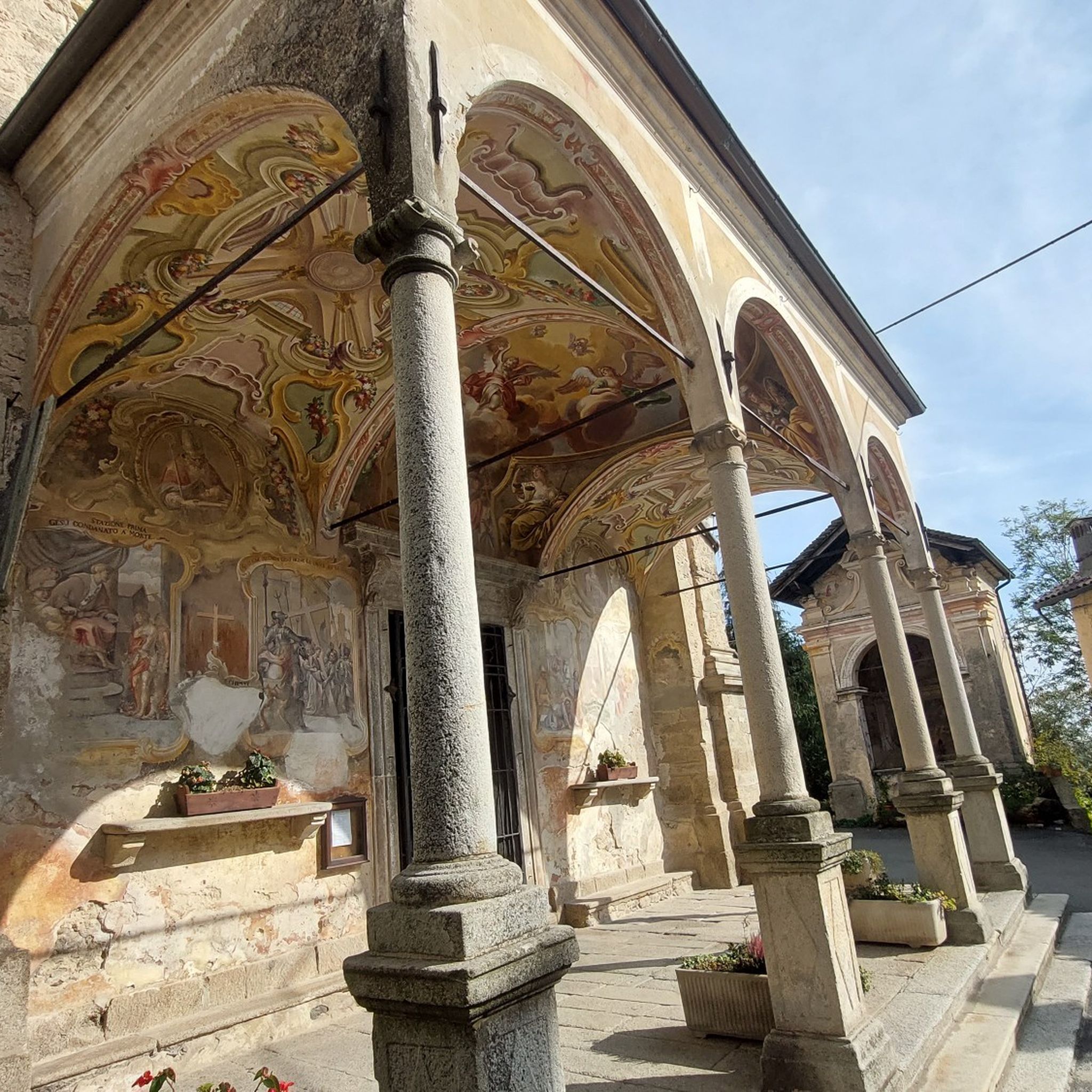
Sacro Monte of Orta
Highlight • Religious Site
Translated by Google •
Tip by

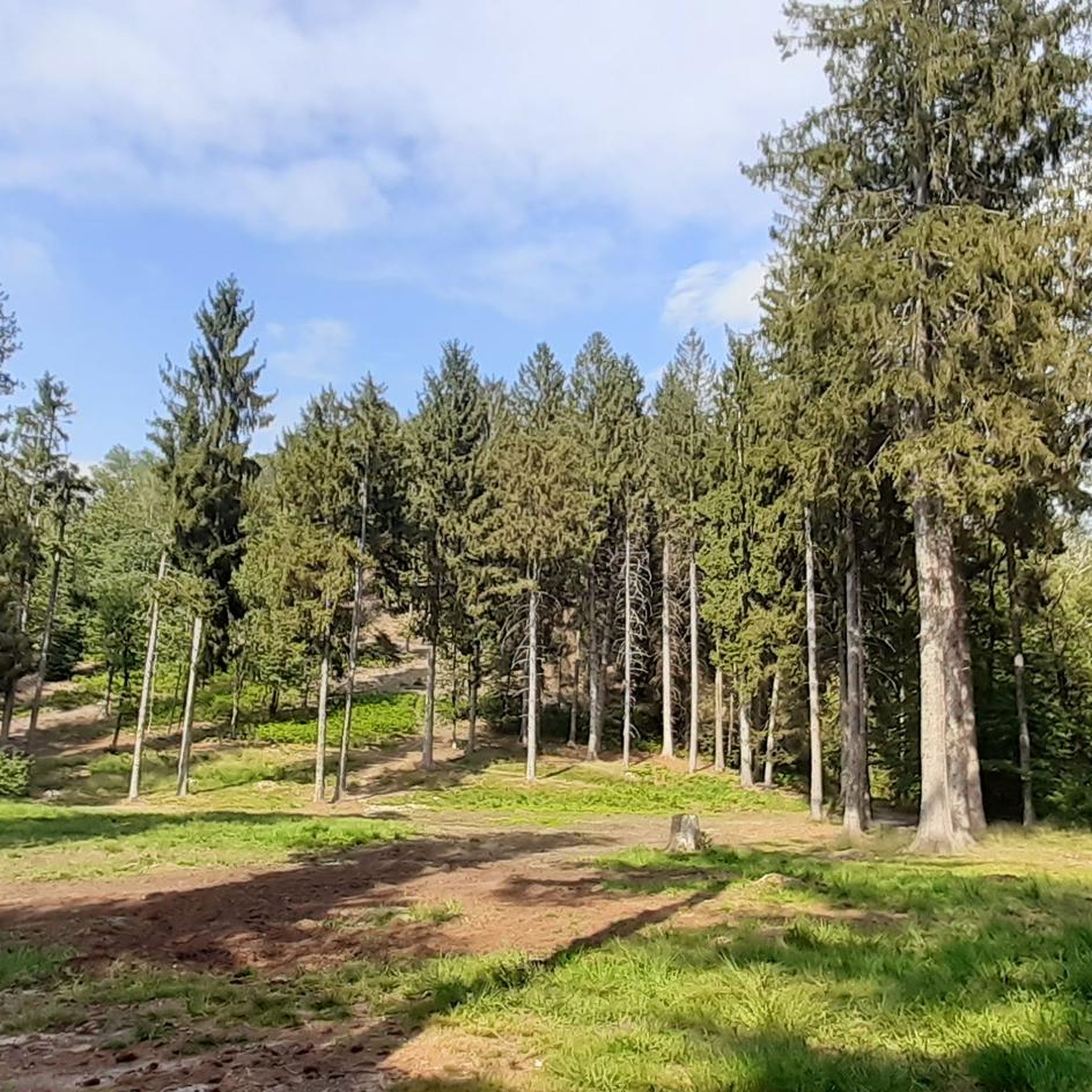
Mottarone Climb from Armeno
Highlight (Segment) • Climb
Handsome.
Translated by Google •
Tip by

Sign up now to discover places like this
Get recommendations on the best single tracks, peaks, & plenty of other exciting outdoor places.
Sign up for free
Mount Fenera
Highlight • Summit
Translated by Google •
Tip by

Santuario Madonna del Sasso
Highlight • Religious Site
Translated by Google •
Tip by

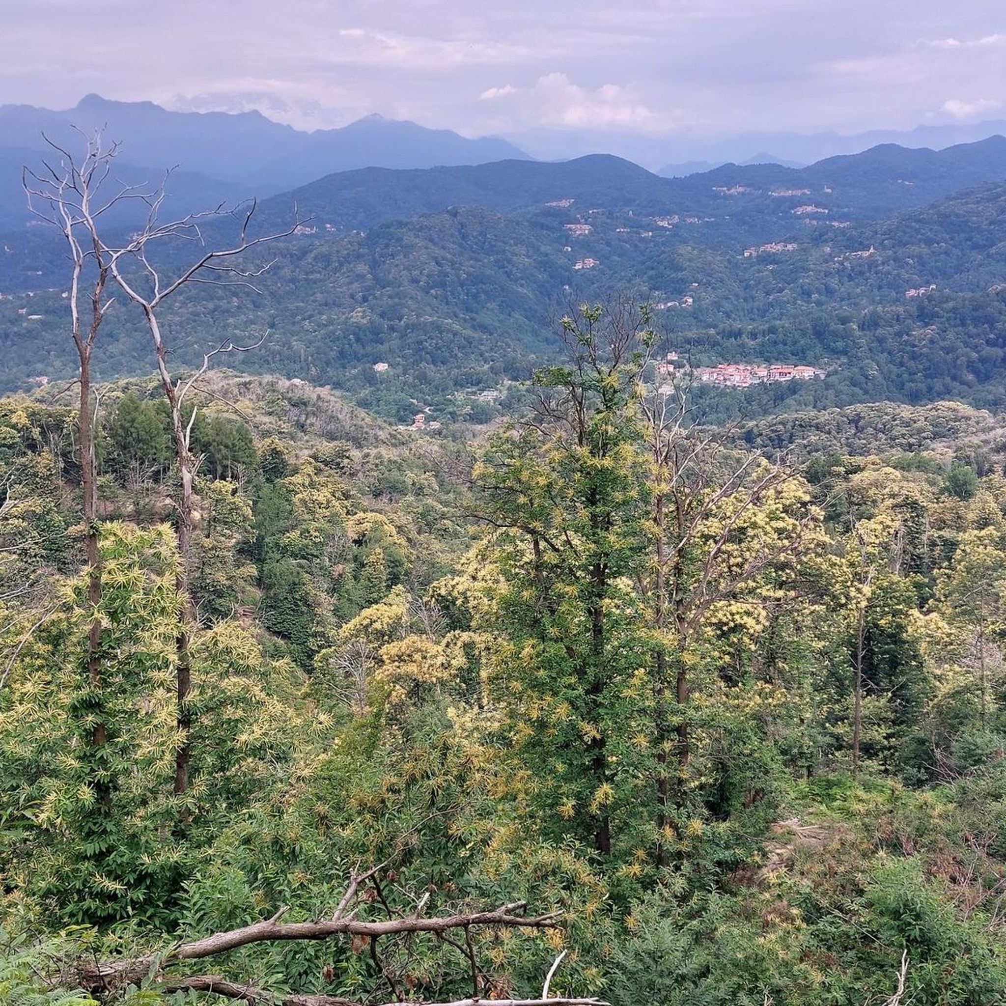
Bec d'Ovaga
Highlight • Summit
Translated by Google •
Tip by

Sign up for free to discover even more peaks around Cellio con Breia.
Sign up for free
Already have an account?
Start today with a free account
Your next adventure awaits.
Login or Signup

Tips from the Community

small chapel with a cross at the top
0
0

Not on weekends. It's too crowded then.
0
0

Breathtaking view of Lake Orta, from up there you can see everything, Mottarone, Omegna, Orta San Giulio etc etc
0
0

nice place also great for pet picnic
0
0

I don't count the times... everything is easy, pay attention from the refuge to the summit, a few meters here and there of steep rock, no stumbling or getting distracted, very dangerous. Done well, however, it is for everyone. I have done the return trip several times along the southern ridge, right in front of the refuge, rare signs for almost 400 meters of altitude difference, stay on the ridge on the back of the ridge until you exit at 1250 meters of altitude on the road that ends on the right at Alpe Passarina and on the left goes down to Selle di Parone and further on to Casavei. Instead of going down the road, I have taken the path several times (on the hairpin bend where it comes out) that, here too, staying on the back of the ridge, turning left when it ends, and paying attention to the few signs on the plants, goes down to the ancient Arcacce Alps, then Pometto (ruins), Uccello (ruins), Pra, where the dirt road begins and some renovated farmhouses, then Parone etc.
1
0

The road is quiet, through the forest and climbs steadily.
0
0

The climb is definitely worth it!
0
0

Great climb! Pay attention to the last 4 km after the Adventure Park which never gives up. Hydration and nutrition must be taken care of well so as not to be caught unprepared.
1
0
Frequently Asked Questions
What are some of the most popular mountain peaks to visit around Cellio con Breia?
Visitors frequently enjoy the Mottarone Climb from Armeno, which offers increasingly scenic views of Lago Maggiore and Lago d'Orta as you ascend. Another highly regarded spot is the Monte Fenera summit and summit cross, providing a beautiful panorama of Valsesia and Monte Rosa.
Are there any mountain peaks with historical or religious significance in the area?
Yes, the Sacro Monte of Orta is a notable religious site. It features 20 chapels depicting the life of St. Francis, built in the 16th century, which visitors can explore. Additionally, the Santuario Madonna del Sasso is a beautiful church perched on a rock, offering stunning views and a challenging climb to reach it.
What kind of views can I expect from the mountain peaks around Cellio con Breia?
The peaks offer diverse and expansive views. From the Mottarone Climb from Armeno, you can see both Lago Maggiore and Lago d'Orta. The Monte Fenera summit provides a panorama of Valsesia and the magnificent Monte Rosa. From Bec d'Ovaga, the panorama is exceptional, extending over the entire Valsesia, the eastern side of Monte Rosa, Alphubel, Stralhorn, and even further to Leone, Adamello, Lake Orta, Lake Maggiore, and Lake Varese.
Are there any easy or family-friendly mountain walks around Cellio con Breia?
While many peaks involve intermediate to challenging climbs, the walk through the 20 chapels at the Sacro Monte of Orta offers a more accessible and culturally rich experience. The Mottarone Climb from Armeno is also described as 'not very demanding' and becomes more scenic as you ascend, making it a good option for those seeking a less strenuous climb with rewarding views.
What outdoor activities can I do near these mountain peaks?
Beyond peak bagging, the region offers various outdoor activities. You can find numerous running trails, such as the 'View of Monte Fenera loop from Valduggia' or 'Running loop from Quarona'. For cycling enthusiasts, there are routes like the 'Collegiate Church of San Gaudenzio – Historic center of Varallo loop'. Hiking is also popular, with trails like 'Monte San Grato and Monte Tre Croci Loop from Cellio'. You can explore more options on the Running Trails around Cellio con Breia, Cycling around Cellio con Breia, and Hiking around Cellio con Breia guide pages.
What is the best time of year to hike the mountain peaks near Cellio con Breia?
The best time to hike the mountain peaks in this region is generally from spring through autumn. During these seasons, the weather is typically milder, and trails are more accessible. Spring offers blooming flora, while autumn provides vibrant fall colors. Winter hiking is possible but requires appropriate gear and experience due to snow and colder conditions.
Are there challenging climbs for experienced hikers?
Yes, several peaks offer challenging ascents. The final stretch to the Monte Fenera summit is described as 'very hard' with steep gradients. Similarly, the climb to Santuario Madonna del Sasso is challenging, especially if you include the village of Boleto on your route. The Bec d'Ovaga also has sections with steep rock near the summit that require careful attention.
What should I wear for hiking the peaks in Cellio con Breia?
For hiking in the Cellio con Breia peaks, it's advisable to wear layers of clothing suitable for varying temperatures and weather conditions. Sturdy hiking boots with good ankle support are essential, especially for challenging terrain. Depending on the season, consider waterproof outerwear, sun protection, and a hat. Always check the local weather forecast before heading out.
What do visitors enjoy most about the mountain peaks around Cellio con Breia?
Visitors particularly appreciate the panoramic views of the surrounding lakes and valleys, including Lago Maggiore, Lago d'Orta, and Valsesia. The combination of natural beauty with cultural and historical sites, such as the chapels at Sacro Monte of Orta, also adds a unique dimension to the experience. Many enjoy the sense of accomplishment from reaching summits like Monte Fenera and being rewarded with breathtaking vistas.
Are there any circular mountain walks available?
While specific circular routes for individual peaks aren't detailed in the highlights, the nearby hiking guide offers options like the 'Monte San Grato and Monte Tre Croci Loop from Cellio' which provides a circular experience through the mountain landscape. You can find more loop trails on the Hiking around Cellio con Breia guide page.
Can I find places to eat or drink near the mountain trails?
The provided data does not explicitly list cafes or restaurants directly on the mountain trails. However, it's common for towns and villages at the base of popular hiking areas, such as Armeno near Mottarone or Orta San Giulio near Sacro Monte, to have dining options. For longer hikes, it's always recommended to carry your own snacks and water.
Most popular routes around Cellio con Breia
Most popular attractions around Cellio con Breia

Get inspired with the komoot mobile app


Explore more
See even more amazing summits around Cellio con Breia with these guides:
