The 20 Most Amazing Peaks around Ingria
Best mountain peaks around Ingria are primarily modest hills and elevated areas within a generally flat landscape. This historical region, encompassing the area around Saint Petersburg and the Leningrad Oblast, features forests, hills, and numerous lakes. The highest point in the Leningrad Oblast is Gapselga, reaching an elevation of 291 meters. These elevated areas provide opportunities for outdoor activities and offer views across the rolling hills and woodlands.
Best mountain peaks around Ingria
- The most popular mountain peaks is Cima…
Last updated: August 17, 2026
Cima Mares
Highlight • Summit
Translated by Google •
Tip by

Pian delle Nere
Highlight • Viewpoint
Translated by Google •
Tip by

Sign up now to discover places like this
Get recommendations on the best single tracks, peaks, & plenty of other exciting outdoor places.
Sign up for free
Punta Quinseina Sud Summit Cross
Highlight • Summit
Translated by Google •
Tip by

Monte Soglio Summit and Madonna Statue
Highlight • Summit
Translated by Google •
Tip by
Punta Verzel summit (2,406 m)
Highlight • Summit
Translated by Google •
Tip by

Sign up for free to discover even more peaks around Ingria.
Sign up for free
Already have an account?
Start today with a free account
Your next adventure awaits.
Login or Signup
Other adventures around Ingria

Tips from the Community

Reached several times from the Corio side and from the Alpette side. Below the summit from the Corio side, near Alpe Rossolo, there are always horses.
0
0

You can see everything and it can be reached from several different places
0
0

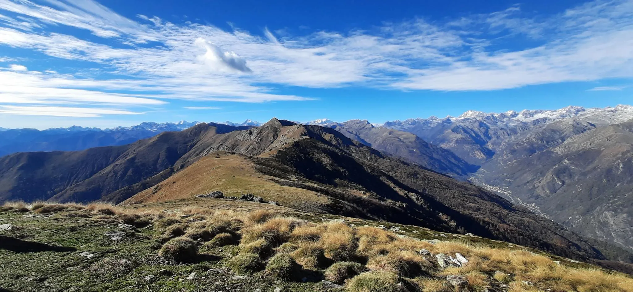
On Cima Mares there isn't much, apart from a cross and the repeaters, but the panorama is worth the effort to climb it, the view actually ranges from the Maritime Alps, which are very clearly distinguishable in conditions of good visibility, then moving your gaze to the right you encounter Monviso, a good part of the peaks of Cuneese and the lower Susa valley, because the upper part is screened by the silhouette of Monte Soglio, which forms the watershed between the Orco valley and the Lanzo valleys. To the right, overlooking the upper part of the valley towards Ceresole, you can admire the satellites of G. Paradiso and other minor peaks, which however almost all exceed 2500 meters and offer a grandiose spectacle.
0
0

the blooming of Narcissus and Monte Val o in the background
2
0

Accessible by car via a somewhat narrow but recently restored paved road, it is in excellent condition. Ample parking is available. It has a barbecue and picnic area. It's also an excellent starting point for reaching the surrounding peaks.
2
0

A natural spectacle to enjoy in the month of May
2
0
Easily accessible on a paved road (unfortunately). Breathtaking view of the plain. In May, the spectacle of the daffodils blooming is unmissable.
2
0

Very panoramic, 360 degree view
0
0
Frequently Asked Questions
What are the highest points or 'mountain peaks' in the Ingria region?
The Ingria region, primarily encompassing the area around Saint Petersburg and the Leningrad Oblast, is characterized by a generally flat landscape. Its 'mountain peaks' are modest hills and elevated areas. The highest point is Gapselga, reaching an elevation of 291 meters (955 feet) above sea level, located in the Vepsian Upland. Other notable elevated areas include Gora Kivisyurya (203 meters), Gora Popova (180 meters), and Orehovaya Gora (184 meters).
What kind of landscape can I expect when visiting these elevated areas in Ingria?
Visitors to Ingria's elevated areas can expect serene forested areas, numerous lakes, and peaceful hikes. The landscape features rolling hills and woodlands, offering scenic views rather than dramatic, rugged mountain ranges. It's a unique natural environment that blends natural beauty with historical significance.
Is Gapselga accessible for hiking?
Yes, Gapselga offers a chance to experience the natural beauty of the region. However, reaching the summit requires walking due to many fallen trees, and the road leading to it can be challenging even for off-road vehicles. It provides opportunities for peaceful hikes and appreciating the unique natural environment.
What kind of outdoor activities are suitable for the 'mountain peaks' of Ingria?
The elevated areas in Ingria are well-suited for outdoor activities such as peaceful hikes and enjoying scenic views across the rolling hills and woodlands. The region's appeal lies in its serene forested areas and numerous lakes, providing a tranquil setting for exploration.
What is the geographical context of Ingria?
Ingria is a historical region located in present-day northwestern European Russia, primarily around Saint Petersburg and the Leningrad Oblast. It borders the southeastern shore of the Gulf of Finland and Lake Ladoga, featuring a landscape of forests, hills, and many lakes. You can learn more about its history on Wikipedia.
Are there any challenging routes or are the trails generally easy in Ingria's elevated areas?
Given that Ingria's 'mountain peaks' are modest hills, the trails are generally considered to offer gentle ascents. While some routes might present a bit more challenge, they do not typically involve the ruggedness of traditional mountain ranges. For example, reaching the summit of Gapselga requires walking through fallen trees, which can be an obstacle.
What makes the Ingria region unique for outdoor enthusiasts?
Ingria's uniqueness for outdoor enthusiasts comes from its blend of serene forested areas, numerous lakes, and rolling hills. It offers a peaceful escape and a chance to appreciate a natural environment that is distinct from typical mountain ranges, providing opportunities for quiet exploration and scenic views.
What is the highest mountain in Russia, and how does it compare to Ingria's peaks?
Russia's true highest mountain is Mount Elbrus, located in the Caucasus range, reaching 5,642 meters. This is significantly higher than Ingria's highest point, Gapselga, which is 291 meters. Ingria's elevated areas offer a very different, more gentle outdoor experience compared to the dramatic landscapes of the Caucasus or the Ural Mountains.
Can I find information about the Vepsian Upland where Gapselga is located?
Gapselga, the highest point in the Leningrad Oblast, is situated in the Vepsian Upland. This area is known for its natural beauty and contributes to the rolling hills and woodlands that define the Ingrian landscape. It's a key area for experiencing the region's elevated terrain.
What are the general characteristics of the Ingrian landscape?
The Ingrian landscape is generally flat, characterized by extensive forests, numerous lakes, and modest hills. It borders the southeastern shore of the Gulf of Finland and Lake Ladoga, offering a mix of water features and wooded terrain rather than towering peaks.
Are there any specific viewpoints among Ingria's hills?
While specific named viewpoints are not detailed, the elevated areas like Gora Kivisyurya, Gora Popova, and Orehovaya Gora, along with Gapselga, provide opportunities for scenic views across the rolling hills and woodlands that define the Ingrian landscape. These spots are ideal for appreciating the region's natural beauty.
Most popular attractions around Ingria

Get inspired with the komoot mobile app


Explore more
See even more amazing summits around Ingria with these guides:
