The best running trails around Leonessa
5.0
(7)
308
runners
35
runs
Jogging routes around Leonessa, located in Italy's Lazio region, offer a diverse range of terrain for outdoor enthusiasts. The area is characterized by a hilly and mountainous topography, providing varied landscapes for different fitness levels. Trails often feature natural and unpaved sections, including steep grassy slopes, stony paths, and dirt roads, ensuring a dynamic running experience. Many routes provide panoramic views of Monte Terminillo and the Reatini Mountains.
Best jogging routes around Leonessa
- The most popular jogging route is Leonessa…
Last updated: July 7, 2026
2
runners
9.12km
01:39
660m
660m
Jog the difficult 5.7-mile Leonessa - Monte Tilia Loop, gaining 2171 feet of elevation with panoramic views and varied terrain.
11
runners
14.4km
02:06
590m
590m
Hard run. Very good fitness required. Sure-footedness, sturdy shoes and alpine experience required.

Sign up for free
15
runners
Hard run. Good fitness required. Sure-footedness, sturdy shoes and alpine experience required.
5
runners
31.9km
05:02
1,470m
1,480m
Hard run. Very good fitness required. Sure-footedness, sturdy shoes and alpine experience required.
6
runners
Hard run. Very good fitness required. Sure-footedness, sturdy shoes and alpine experience required.
Get access to more routes and recommendations from other explorers.
Sign up for free
Already have an account?
Our route recommendations are based on thousands of hikes, rides, and runs completed by other people on komoot.
Start today with a free account
Your next adventure awaits.
Login or Signup

Tips from the Community


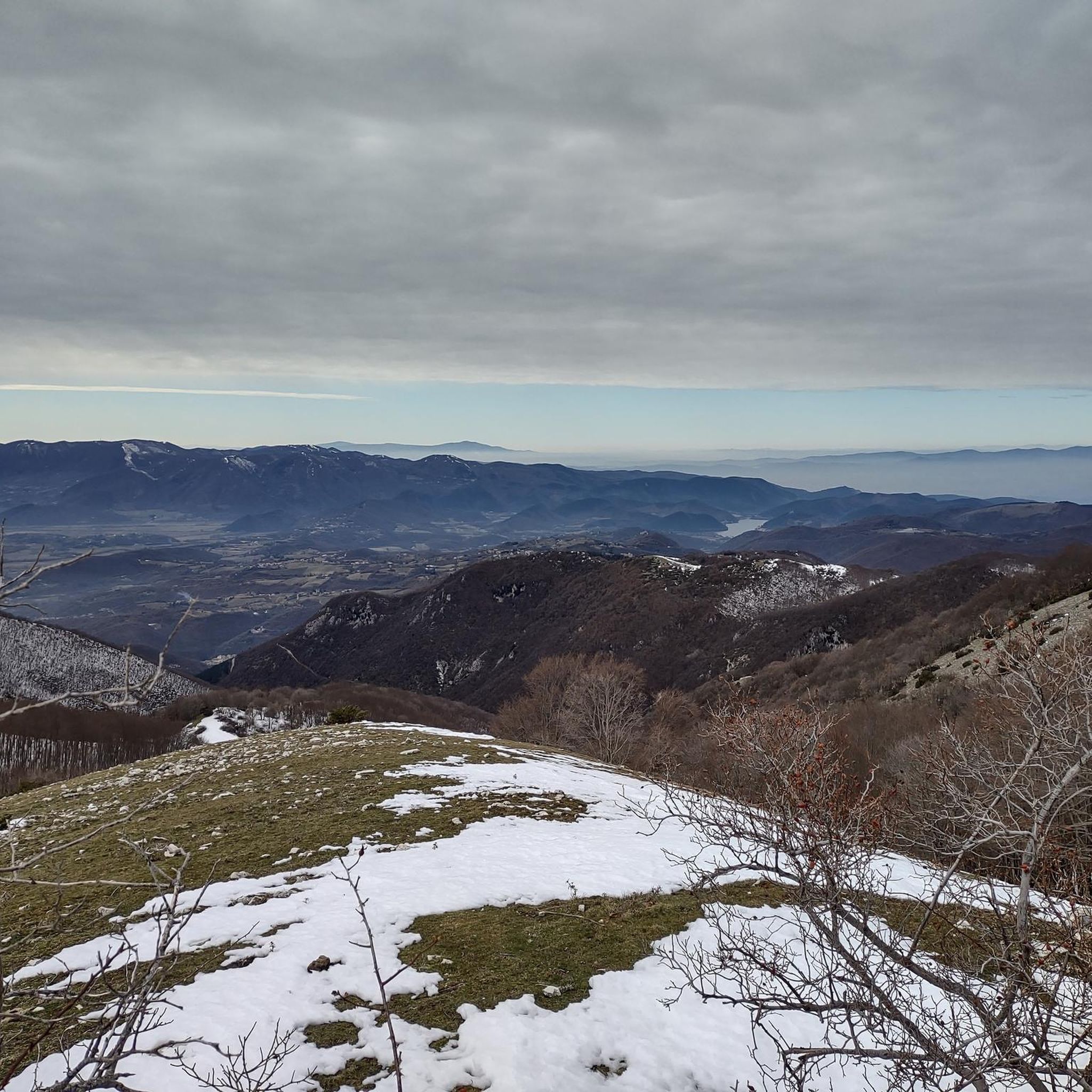
From the summit of Mount Terminillo, 2,216 meters, you can enjoy a breathtaking 360-degree panorama. You can admire the crests of Mount Elefante, Mount Brecciaro, Mount Valloni, Corno Grande, the Laga mountains, the Velino/Sirente massif, and on clear days even Mount Vettore and Gran Sasso. The view of the valleys below is fantastic, and from the highest point, it offers a unique panorama of the Sassetelli ridge, Mount Terminelletto, and the narrow saddle connecting the two peaks. On clear days, the view allows you to glimpse the magnificent mountains of the Central Apennines and the Gran Sasso.
0
0
From the summit of Mount Terminillo, at 2,216 meters, you can enjoy a breathtaking 360-degree panorama. You can admire the crests of Mount Elefante, Mount Brecciaro, Mount Valloni, Corno Grande, the Laga mountains, the Velino/Sirente massif, and on clear days even Mount Vettore and Gran Sasso. The view of the valleys below is spectacular; from the summit, you can admire the spectacular Sassetelli ridge and the ridge leading to Mount Terminelletto, as well as the magnificent mountains of the Central Apennines and the Sibillini Mountains.
1
0

The bar looks good with the two tarts. Last stop before reaching the top
0
0

The town of Pian de’ Valli, is located in the municipality of Rieti, stands at the foot of Terminillo, at an altitude of 1620 meters, hosts many accommodation and commercial activities, and the departure station of the ski lifts is located a few steps from the center. The famous Terminillo cable car is still in operation today both in the winter and summer seasons and is the historical symbol of Pian de’ Valli.
2
0

For the climb, poles are necessary, considering the slope....
0
0

Wait for the sunset and you will cry :)
0
0
Frequently Asked Questions
How many running routes are available around Leonessa?
There are over 30 running routes around Leonessa, offering a wide range of options for different fitness levels and preferences. The komoot community has explored 33 routes in total.
What kind of terrain can I expect on the running trails in Leonessa?
The running trails in Leonessa are characterized by a hilly and mountainous topography. You can expect diverse terrain, including natural and unpaved sections, steep grassy slopes, stony paths, and dirt roads, providing a dynamic and engaging workout.
What are the difficulty levels of running routes in Leonessa?
Leonessa offers a variety of difficulty levels. While there are no easy routes, you'll find 8 moderate routes and 25 difficult routes, ensuring options for both experienced trail runners and those looking for a significant challenge.
Are there any running routes in Leonessa that offer panoramic views?
Yes, many routes in Leonessa provide stunning panoramic views. For example, the Leonessa - Monte Tilia Loop offers breathtaking vistas of Monte Terminillo and the Reatini Mountains, making for a very scenic run.
What do other runners enjoy most about jogging in Leonessa?
The running routes in Leonessa are highly rated by the komoot community, with an average score of 5.0 stars from 5 reviews. Runners often praise the diverse terrain, the challenging mountainous landscapes, and the rewarding panoramic viewpoints.
Are there any circular running routes around Leonessa?
Yes, Leonessa features several excellent circular running routes. A popular choice is the Pian de' Valli, Terminillo loop from Pian de' Valli, which is a moderate 6.7-mile (10.7 km) trail through diverse hilly landscapes.
What landmarks or points of interest can I see along the running trails near Leonessa?
Along the running trails near Leonessa, you can encounter various points of interest. Notable highlights include mountain passes like Sella di Leonessa and Torre Fuscello Pass. You might also spot historical sites such as the Border between the Papal States and the Kingdom of the Two Sicilies, or enjoy scenic viewpoints like the Scenic Viewpoint Over the Valley.
Are there any particularly challenging running routes for advanced runners?
Absolutely. For advanced runners seeking a significant challenge, the Monte Terminillo – Monte Terminilletto loop from Pian de' Valli is a difficult 9.5-mile (15.3 km) path with substantial elevation gain through mountainous terrain. Another demanding option is the Cima di Vall'Organo – Monte Cardito loop from Pian de' Valli.
Are there any shorter, moderate running options available?
Yes, for those looking for a moderate run without extreme difficulty, the Colle delle Porrare loop from Pian de' Valli is a great choice. It's a 7.1 km (4.4 miles) route with less elevation gain, making it suitable for a steady jog.
What is the typical elevation gain on running trails in Leonessa?
The elevation gain on running trails in Leonessa varies significantly due to the mountainous topography. Difficult routes can feature over 1000 meters of ascent, such as the Monte Terminillo – Monte Terminilletto loop. Moderate routes, like the Pian de' Valli, Terminillo loop, have more manageable gains around 170 meters.
When is the best time of year to go trail running in Leonessa?
Leonessa's mountainous environment means that spring, summer, and early autumn generally offer the most favorable conditions for trail running. During these seasons, you can expect more stable weather and accessible trails. Winter can bring snow and ice, making some routes more challenging or impassable without proper gear.
Most popular attractions around Leonessa

Get inspired with the komoot mobile app


Explore more
Browse the best Running Trails & Routes in other regions.
