The best walks and hikes around Sindìa/Sindia
4.2
(29)
119
hikers
8
hikes
Hiking around Sindìa/Sindia offers a variety of trails that explore the local landscape. The region features routes that traverse historical sites, coastal areas, and gentle hills. Hikers can experience a mix of terrain, from paths leading to ancient structures to trails offering views of the surrounding countryside.
Best hiking trails around Sindìa/Sindia
- The most popular hiking route is Nuraghe Ponte and Riu Murtazzolu Loop, a 9.9 miles (15.9 km) trail that takes 4 hours 13 minutes to complete. This…
Last updated: July 8, 2026
2.0
(1)
2
hikers
15.9km
04:14
160m
160m
Moderate hike. Good fitness required. Mostly accessible paths. Sure-footedness required.
5
hikers
9.80km
02:45
200m
200m
Moderate hike. Good fitness required. Easily-accessible paths. Suitable for all skill levels.

Sign up for free
4.7
(3)
8
hikers
6.14km
01:49
170m
160m
Easy hike. Great for any fitness level. Easily-accessible paths. Suitable for all skill levels.
3
hikers
20.2km
05:42
430m
430m
Hard hike. Very good fitness required. Easily-accessible paths. Suitable for all skill levels.
4.0
(1)
3
hikers
6.53km
01:47
90m
90m
Easy hike. Great for any fitness level. Easily-accessible paths. Suitable for all skill levels.
Get access to more routes and recommendations from other explorers.
Sign up for free
Already have an account?
Our route recommendations are based on thousands of hikes, rides, and runs completed by other people on komoot.
Start today with a free account
Your next adventure awaits.
Login or Signup
Tips from the Community

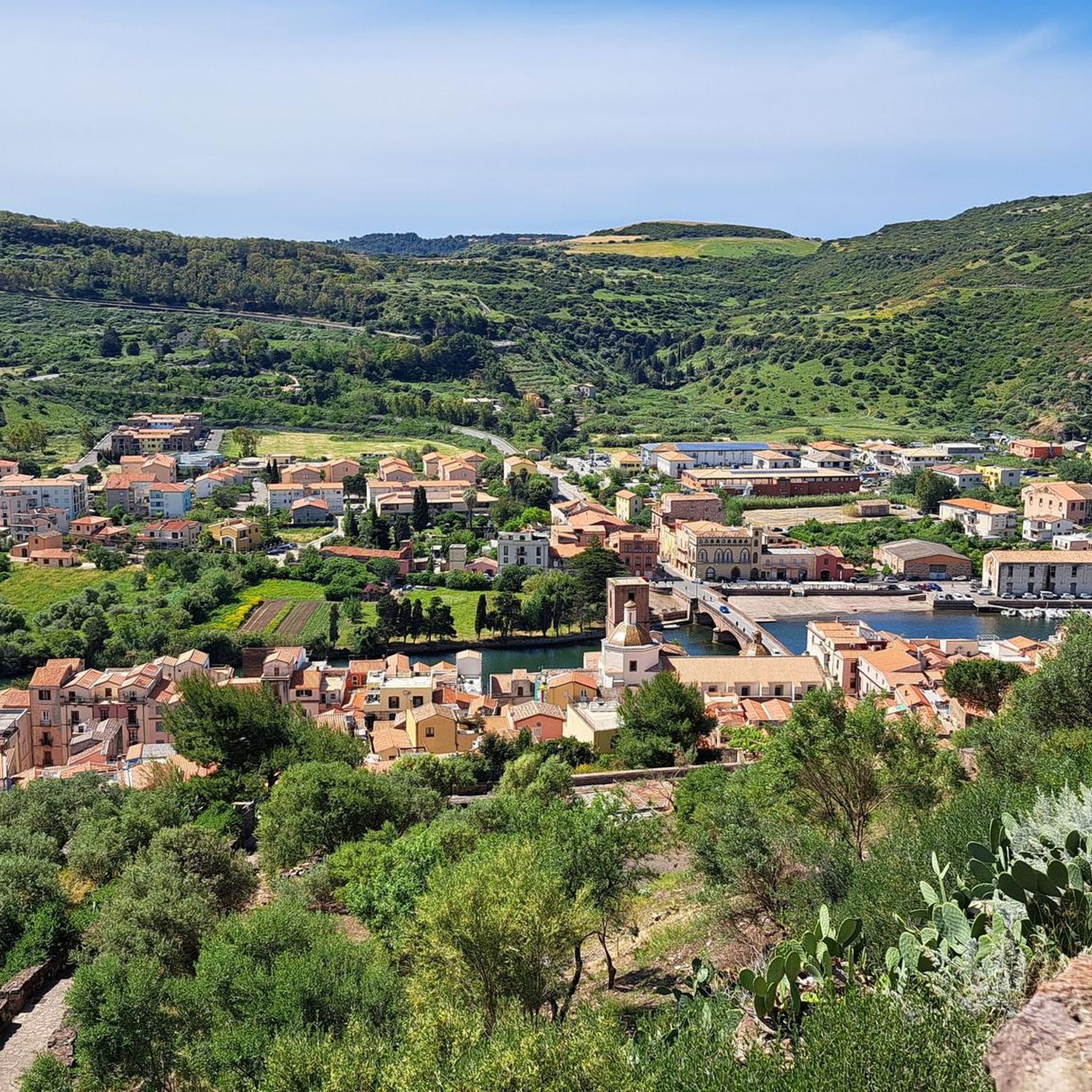
Bosa is an Italian municipality with 7,539 inhabitants (as of December 31, 2022) in the province of Oristano in western Sardinia. It is located about two kilometers from the sea in a wide valley on the Temo River and belongs to the association I borghi più belli d'Italia (The Most Beautiful Places in Italy).
3
0

you can also visit
0
1

Beautiful hikes on the beach and in the hinterland
0
0

The Columbargia tower, also known as "Pesquellas", is the oldest of the three towers in the Tresnuraghes territory (already existing in 1572). It stands on a promontory of red trachyte, dominating the almost uncontaminated landscape of Sa Marinedda beach. This tower represents one of the points of the defensive system conceived by the Aragonese to protect the Sardinian coasts. In particular, together with the nearby towers of Ischia Ruggia, Foghe and Bosa, it is part of the fortifications built in the second half of the sixteenth century, during the government of King Philip II of Spain.
4
0

The houses to your left and right glow in every color imaginable, as if an artist had spilled his palette over them. Welcome to Bosa, the hidden gem on Sardinia's west coast. Start your walk in the beating heart of the Centro Storico. Here, every step takes you deeper into the maze of narrow streets that wind their way up the slope. Flower pots made from old tin cans, creatively and lovingly designed by local residents, line your path and give the alleys a unique flair. As you continue to stroll through the old town, you will be accompanied by an ensemble of historic buildings, cozy restaurants and small shops. Every corner, every niche invites you to discover and linger. And despite its beauty, Bosa has retained its authentic charm and remains a place that is not overrun with tourists. But the real highlight awaits you at the end of your exploration tour: the climb to Castello Malaspina. Even if the way up requires a little effort, you will be rewarded with an incomparable panorama at the top. The view sweeps over the roofs of Bosa, along the Temo River to the horizon.
2
0

Sonnenuntergang am Spiaggia S'Umbra
0
0

Parking is legal and free across the river.
3
1
Frequently Asked Questions
How many hiking trails are available in Sindìa/Sindia?
There are 5 hiking trails in Sindìa/Sindia, offering a range of experiences from easy walks to more challenging routes. These trails are highly rated by the komoot community.
What kind of terrain can I expect on hikes in Sindìa/Sindia?
Hiking in Sindìa/Sindia features a mix of terrain, including paths that traverse historical sites, coastal areas, and gentle hills. You'll find varied landscapes from ancient structures to routes offering views of the surrounding countryside.
Are there any circular hiking routes in Sindìa/Sindia?
Yes, Sindìa/Sindia offers several circular routes. A popular option is the Nuraghe Ponte and Riu Murtazzolu Loop, which is a moderate 9.9-mile (15.9 km) trail exploring historical sites and natural waterways. Another is the Bosa's Ponte Vecchio – Bosa Old Town loop from Agricampeggio Mattagiana, a 6.5-mile (10.4 km) route through historical towns and along riverbanks.
What are some historical landmarks I can explore while hiking in Sindìa/Sindia?
The region is rich in historical landmarks. You can explore the Archaeological Area of Tamuli, a moderate 6.1-mile (9.8 km) path that offers insights into the region's past. Additionally, the Tamuli Archaeological Site and the Nuragic Site of Tamuli are notable points of interest.
Are there any challenging hikes for experienced hikers?
Yes, for experienced hikers seeking a challenge, the Columbargia Tower – Torre di Columbargia loop from Tresnuraghes is a difficult 12.3-mile (19.8 km) route with significant elevation gain, offering a rewarding experience.
What do other hikers enjoy most about hiking in Sindìa/Sindia?
The area is highly rated by the komoot community, with an average score of 3.8 stars from over 16 reviews. Hikers often praise the diverse terrain, from historical sites to coastal paths, and the options available for different ability levels.
Are there any easy hiking trails suitable for a relaxed walk?
Yes, for an easier experience, consider the Monte Sant'Antonio loop from Su Cantareddu. This easy 4.1-mile (6.5 km) trail offers a pleasant walk with gentle elevation changes.
Can I find any natural monuments or viewpoints along the trails?
Yes, the region features natural monuments and viewpoints. You can visit Monte Agudu (Sa Rocca de Tiu Antoni Gana) and Monte Sant'Antonio, both summits offering scenic views. The View of the Ponte Vecchio and Castello Malaspina in Bosa also provides a picturesque vista.
Are there any castles or historical towns to visit near the hiking routes?
Absolutely. The Bosa Old Town is a charming historical settlement. You can also explore the Malaspina Castle, Bosa, which is a prominent historical site in the area.
What is the typical duration for hikes in Sindìa/Sindia?
Hiking durations vary depending on the trail's length and difficulty. For example, the moderate Nuraghe Ponte and Riu Murtazzolu Loop typically takes around 4 hours and 13 minutes, while the easier Monte Sant'Antonio loop from Su Cantareddu can be completed in about 1 hour and 46 minutes.
Most popular attractions around Sindìa/Sindia

Get inspired with the komoot mobile app


Explore more
Browse the best Hikes in other regions.
