The best cycling routes around Loreo
4.3
(631)
3,967
riders
19
rides
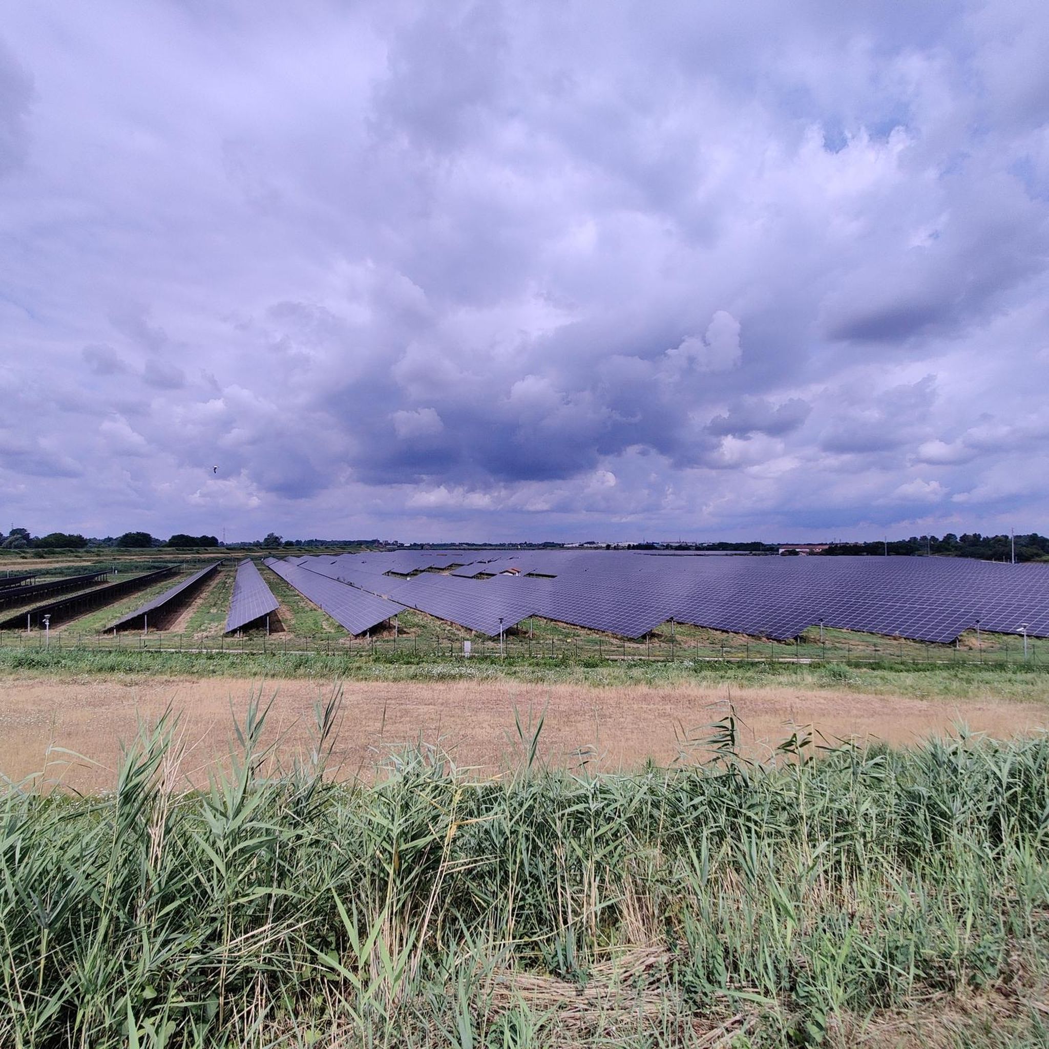
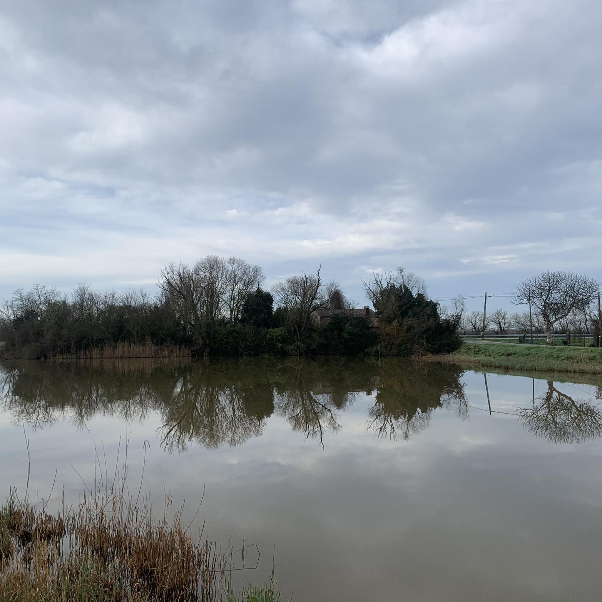
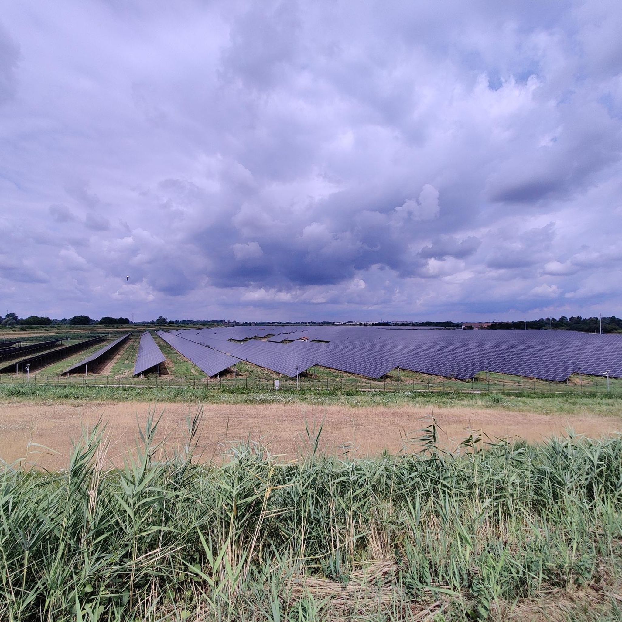
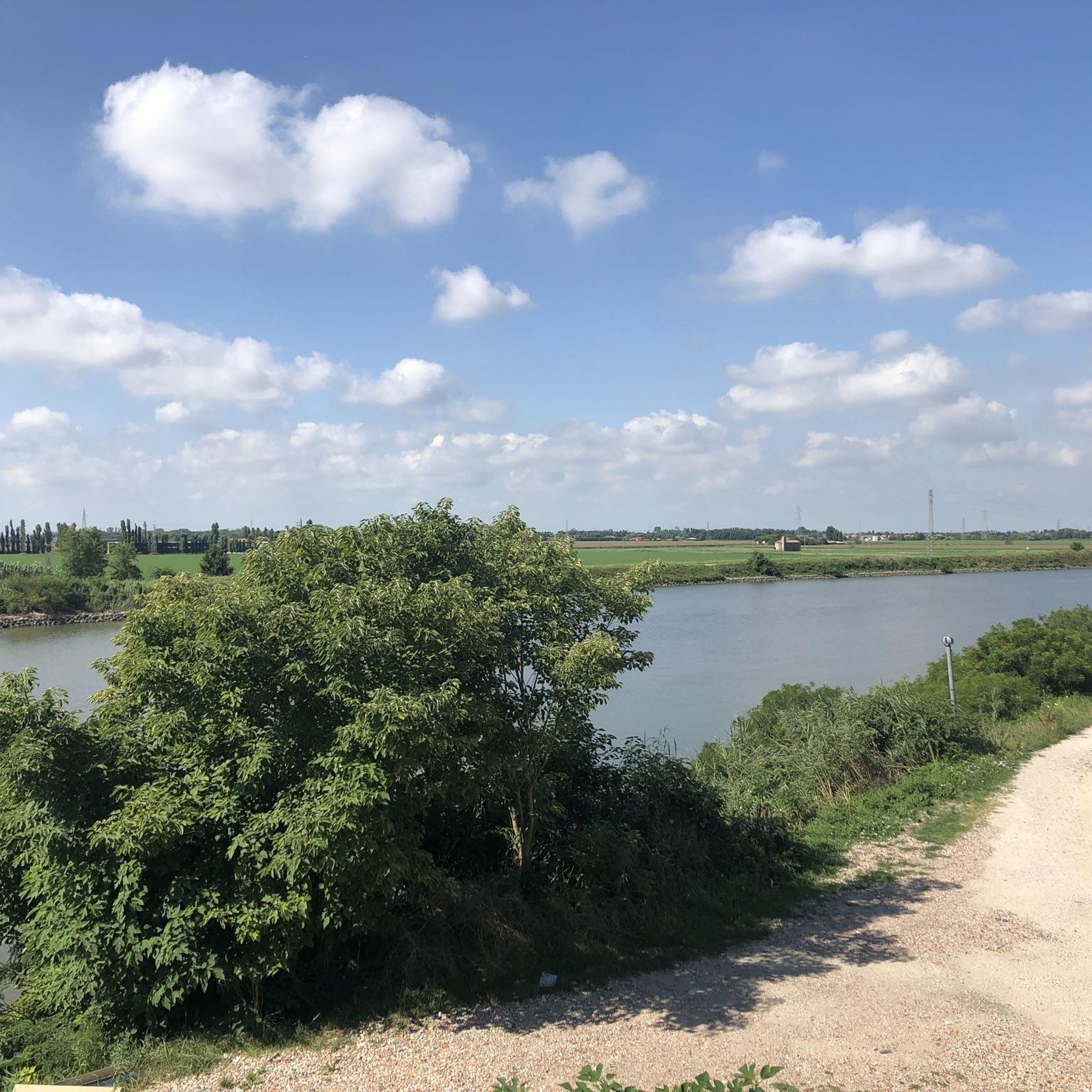
Touring cycling routes around Loreo are primarily characterized by the flat landscape of the Po Delta Regional Park, a MAB-UNESCO Biosphere Reserve. The region features an extensive network of country roads and dedicated cycle paths, making it suitable for various cycling abilities. Cyclists will encounter diverse environments where land and water intertwine, including lagoon and wetland ecosystems, river embankments, and canals. These natural features provide a unique backdrop for exploring the area.
Best touring cycling routes around Loreo
- The most popular touring cycling route is Po di Venezia – Boccasette Pontoon Bridge loop from Loreo, a 51.9 miles (83.5 km) trail that takes 5 hours 9 minutes to complete. This route explores the Po Delta's unique blend of land and water, including river branches and coastal elements.
- Another top favourite among local touring cyclists is Po Delta Cycle Path – Po di Venezia loop from Loreo, a moderate 33.6 miles (54.1 km) path. It offers views of the Po di Venezia and the diverse ecosystems of the Po Delta.
- Local touring cyclists also love the Loreo Canal and Clock Tower – Po River loop from Loreo, a 37.5 miles (60.3 km) trail leading through river embankments and past local landmarks, often completed in about 3 hours 28 minutes.
- Touring cycling around Loreo is defined by lagoon and wetland ecosystems, river embankments, and coastal environments. The extensive network of cycle paths offers options for different ability levels, from leisurely rides to longer circular routes.
- The routes in Loreo are highly rated by the komoot community with an average score of 4.3 stars from over 300 reviews. More than 2000 touring cyclists have used komoot to explore Loreo's varied terrain.
Last updated: July 1, 2026
4.2
(20)
132
riders
82.6km
05:05
100m
100m
Hard bike ride. Very good fitness required. Mostly paved surfaces. Suitable for all skill levels.
4.4
(27)
207
riders
61.5km
03:34
80m
80m
Moderate bike ride. Good fitness required. Mostly paved surfaces. Suitable for all skill levels.

Sign up for free
4.1
(7)
41
riders
60.5km
03:30
80m
80m
Hard bike ride. Good fitness required. You may need to push your bike for some segments of this route.
5.0
(1)
43
riders
Moderate bike ride. Good fitness required. Mostly paved surfaces. Suitable for all skill levels.
8
riders
125km
07:15
150m
150m
Hard bike ride. Very good fitness required. Mostly paved surfaces. Suitable for all skill levels.
Get access to more routes and recommendations from other explorers.
Sign up for free
Already have an account?
Our route recommendations are based on thousands of hikes, rides, and runs completed by other people on komoot.
Start today with a free account
Your next adventure awaits.
Login or Signup

Tips from the Community

The Ponte dell'Isola dell'Unione is the key infrastructure that unites Chioggia and Sottomarina, connecting the historicity of "Little Venice" to the vibrancy of its seaside soul. Crossing the lagoon, this bridge is not just a crucial communication route for vehicular and pedestrian traffic, but a true umbilical cord that transforms two distinct realities into a single urban organism. Strolling along its sidewalks, you can enjoy a spectacular view of the southern lagoon, with the moored boats, the distant casoni, and the unmistakable profiles of the two towns. For residents and tourists, it represents a suggestive transit point, particularly fascinating at sunset, when the lights reflect on the water, summarizing in a single glance the maritime, historical, and tourist essence of this unique territory.
0
0

Here you cross the 45th parallel north, the imaginary line that marks the exact halfway point between the Equator and the North Pole, 5,000 kilometers away from each.
0
0
This historic bridge spans the Po di Maistra, connecting Boccasette to the island of Ca' Venier. Crossing is restricted to pedestrians, bicycles, and hand-propelled motorcycles. The bridge was restored and reopened in recent years. It is generally open between 8:00 a.m. and 8:00 p.m., but opening hours and times vary depending on flooding and are not always signposted. Unfortunately, it's difficult to find up-to-date information online. Before arriving, it's advisable to check locally and plan an alternative if the bridge is closed.
2
0
This trail immerses you in the lagoon landscape of the Po Delta, among embankments, canals, salt marshes, and fish farms. Birdlife is frequently spotted along the route, particularly flamingos, herons, and other species typical of wetlands. It runs through an open and quiet environment, with long stretches of sparse shade: bring plenty of water and protect yourself from mosquitoes, especially in the evening.
0
0

One of the major projects completed during the Fascist era is the Sottomarina Dam, which, together with the Ca' Roman Dam built a few years earlier, completes the mouth of the Port of Chioggia. Construction began in the years following the First World War. Like the Murazzi (sea walls), the dam was constructed of brick and boulders of local Istrian stone and, in addition to finally completing the entrance to the Port of Chioggia, also allowed for a further expansion of the beach. The inauguration, as mentioned, took place in the midst of the Fascist regime on April 28, 1935, in the presence of the Duke of Aosta. The dam was immediately embraced by the local population, especially the residents of Sottomarina, a popular destination for their walks, so much so that many refer to it as "Sailors' Square." Text / Source: Lidi di Chioggia https://www.lididichioggia.it/la-diga-murazzi/
15
0
The Dam and the Walls, Sottomarina The Dam and the Walls The Walls are Istrian stone walls built by the Republic of Venice starting in the late 18th century to protect the inhabited centers of the lagoon from marine erosion. They are divided into three sections: one on the island of Lido, a second on the island of Pellestrina as far as Cà Roman, and a third along the coast of Sottomarina, running from Forte San Felice to the center of Sottomarina at a height of approximately 1200 meters. The famous War of Chioggia led to the complete destruction of Sottomarina, which became an uninhabited area, exposed to the sea without any protection and subject to frequent flooding. Reconstruction, which included the construction of the Walls, did not begin until 1600. The Walls along Via San Felice were more than 5 kilometers long and over 300 meters wide. They were built from square stones, primarily Istrian stone, erected on stilts extending to the Pellestrina coast and, of course, the Sottomarina coast. Initially, given the scale of the project and the lack of adequate equipment, construction seemed impossible, so it took thirty-eight years to complete in 1770. Legend has it that the inscription "Ausu romano, aere veneto" (With Roman boldness, with Venetian money) was already in place. The inscription is still visible when passing by on the Chioggia-Pellestrina vaporetto. The Murazzi ceased to function between the late 19th and early 20th centuries when the receding sea revealed an unexpected beach, thus forming a symbolic dividing line between "old" and "new" Sottomarina. Today, the Murazzi di Sottomarina are located about one kilometer from the sea: this has allowed for a large-scale revival of coastal tourism. The Murazzo now connects the entire Venetian coast, especially the outer islands, like a cordon, leaving only the three bays open, thus preserving the lagoon's waters. Text / Source: Lidi di Chioggia https://www.lididichioggia.it/la-diga-murazzi/
15
0

Connection between Chioggia and Sottomarina. The city's only green space.
1
0

pedaling in the Scardovari bag
0
1
Frequently Asked Questions
What kind of terrain can I expect when cycling around Loreo?
Loreo is situated within the Po Delta Regional Park, offering a predominantly flat landscape. You'll find an extensive network of country roads and dedicated cycle paths, making it suitable for various cycling abilities. The routes often follow river embankments, canals, and pass through lagoon and wetland ecosystems.
Are there routes suitable for beginners or families with children?
Yes, the flat terrain of the Po Delta makes it ideal for easy and family-friendly rides. While many routes are longer, there are options for shorter, safe itineraries. For example, the region offers routes like the 'DA 2 Delta del Po anello piccolo Loreo' which is around 17.4 km, perfect for a leisurely outing.
What are some notable natural features or wildlife I might encounter?
The Po Delta Regional Park is a MAB-UNESCO Biosphere Reserve, rich in diverse environments. You can expect to see extensive mirrors of brackish water, lagoons, and salt marshes. The wetlands are a haven for birdlife, including flamingos and herons, offering excellent opportunities for birdwatching during your ride. You might also encounter coastal elements like dunes and forests.
Are there any circular cycling routes available from Loreo?
Yes, many of the touring cycling routes around Loreo are designed as loops, allowing you to start and end in the same location. Examples include the Po di Venezia – Boccasette Pontoon Bridge loop from Loreo (83.5 km) or the Po Delta Cycle Path – Po di Venezia loop from Loreo (54.1 km).
What do other touring cyclists say about the routes in Loreo?
The touring cycling routes in Loreo are highly rated by the komoot community, with an average score of 4.3 stars from over 380 reviews. Cyclists often praise the unique blend of land and water, the scenic views of the Po Delta, and the well-maintained paths along river embankments and through natural areas.
What are some interesting places to explore or landmarks along the routes?
Beyond the natural beauty, you can discover various points of interest. Consider visiting the Caleri Lagoon, or the Wildlife Observation Deck at the Fishing Lagoon for birdwatching. The Panoramic Tower at the Mouth of the Adige River offers great views, and the Veneto Coastal Botanical Garden is another highlight.
How many touring cycling routes are available around Loreo?
There are over 15 touring cycling routes available around Loreo, catering to various skill levels. This includes 2 easy routes, 9 moderate routes, and 5 difficult routes, ensuring there's something for everyone.
Is it possible to combine cycling with other activities, like boat tours?
Yes, the Po Delta region encourages 'slow tourism,' and some experiences combine cycling with boat trips. This allows visitors to explore the waterways of the 'Grande Fiume' (Great River) and gain a 360-degree perspective of this unique landscape, enhancing your touring cycling adventure.
Are there any long-distance cycle paths that pass through or near Loreo?
Yes, Loreo is well-connected to significant cycle paths. One of the most famous is 'La Destra Po' (the Right Po) cycle route, which is approximately 123 km long and offers an immersive cycling tourism experience through the Ferrara area. You can also connect to sections of the VENTO Cycle Route, as seen in the Conca di Volta Grimana – VENTO Cycle Route – Adria Section loop from Loreo.
What is the best time of year to go touring cycling in Loreo?
The Po Delta region, with its flat terrain and extensive network of paths, is generally pleasant for cycling for much of the year. Spring and autumn offer mild temperatures and beautiful scenery, making them ideal. Summers can be warm, but the coastal breezes and proximity to water can provide some relief.
What is the longest touring cycling route from Loreo?
The longest touring cycling route listed from Loreo is the Scardovari Lagoon – Strada dei Casoni loop from Loreo, which covers approximately 124.6 km. This challenging route offers extensive exploration of the delta's unique landscapes.
Most popular attractions around Loreo

Get inspired with the komoot mobile app


Explore more
Browse the best Cycling routes in other regions.
