The best walks and hikes around Comazzo
4.3
(384)
2,790
hikers
164
hikes
Hiking around Comazzo offers accessible trails through tranquil agricultural landscapes and along historical waterways in the Lombardy region of Italy. The terrain is primarily characterized by open countryside, with limited elevation changes, making it suitable for various fitness levels. Key natural features include the historic Canale della Muzza and proximity to the Parco dell'Adda Sud. The area provides pleasant routes for walks rather than challenging mountain climbs.
Best hiking trails around Comazzo
- The most popular hiking route is Muzza Canal…
Last updated: October 10, 2026
4.3
(27)
84
hikers
10.9km
02:45
20m
20m
Moderate hike. Good fitness required. Easily-accessible paths. Suitable for all skill levels.
4.4
(8)
33
hikers
10.00km
02:31
20m
20m
Moderate hike. Good fitness required. Easily-accessible paths. Suitable for all skill levels.

3.5
(4)
9
hikers
11.7km
02:58
30m
20m
Moderate hike. Good fitness required. Easily-accessible paths. Suitable for all skill levels.
4.5
(4)
23
hikers
Moderate hike. Good fitness required. Easily-accessible paths. Suitable for all skill levels.
4.0
(3)
9
hikers
Easy hike. Great for any fitness level. Easily-accessible paths. Suitable for all skill levels.
Get access to more routes and recommendations from other explorers.
Already have an account?
Our route recommendations are based on thousands of hikes, rides, and runs completed by other people on komoot.
Start today with a free account
Your next adventure awaits.
Tips from the Community

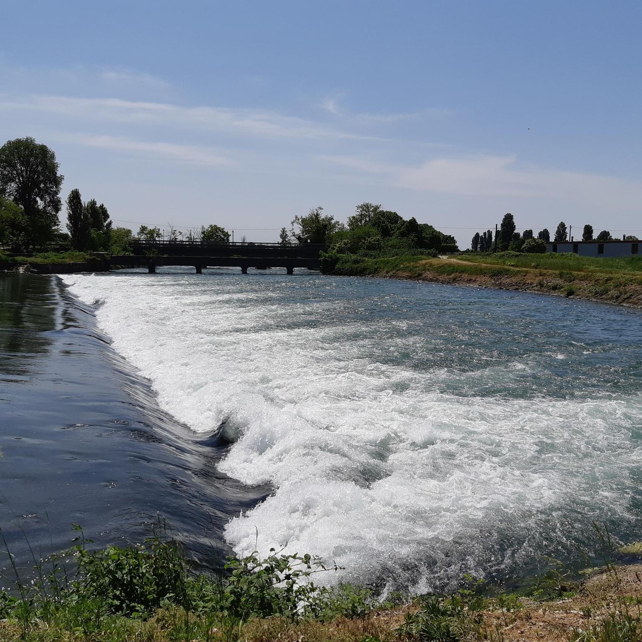
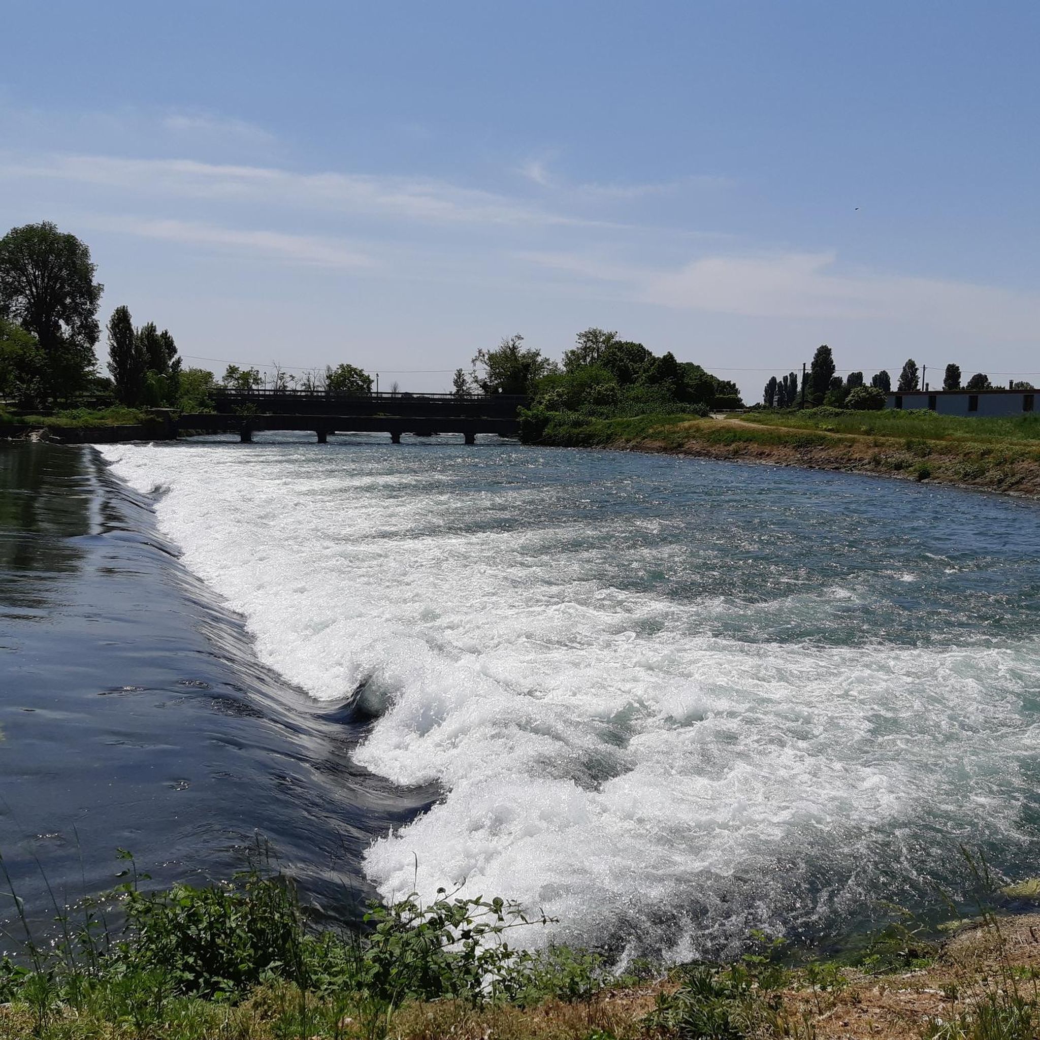
The Muzza Canal, also known as Canale della Muzza, originates near the Castle of Cassano d’Adda, where it draws water from the Adda river. After a course of about 39 km, it flows back into the Adda near Castiglione
1
0
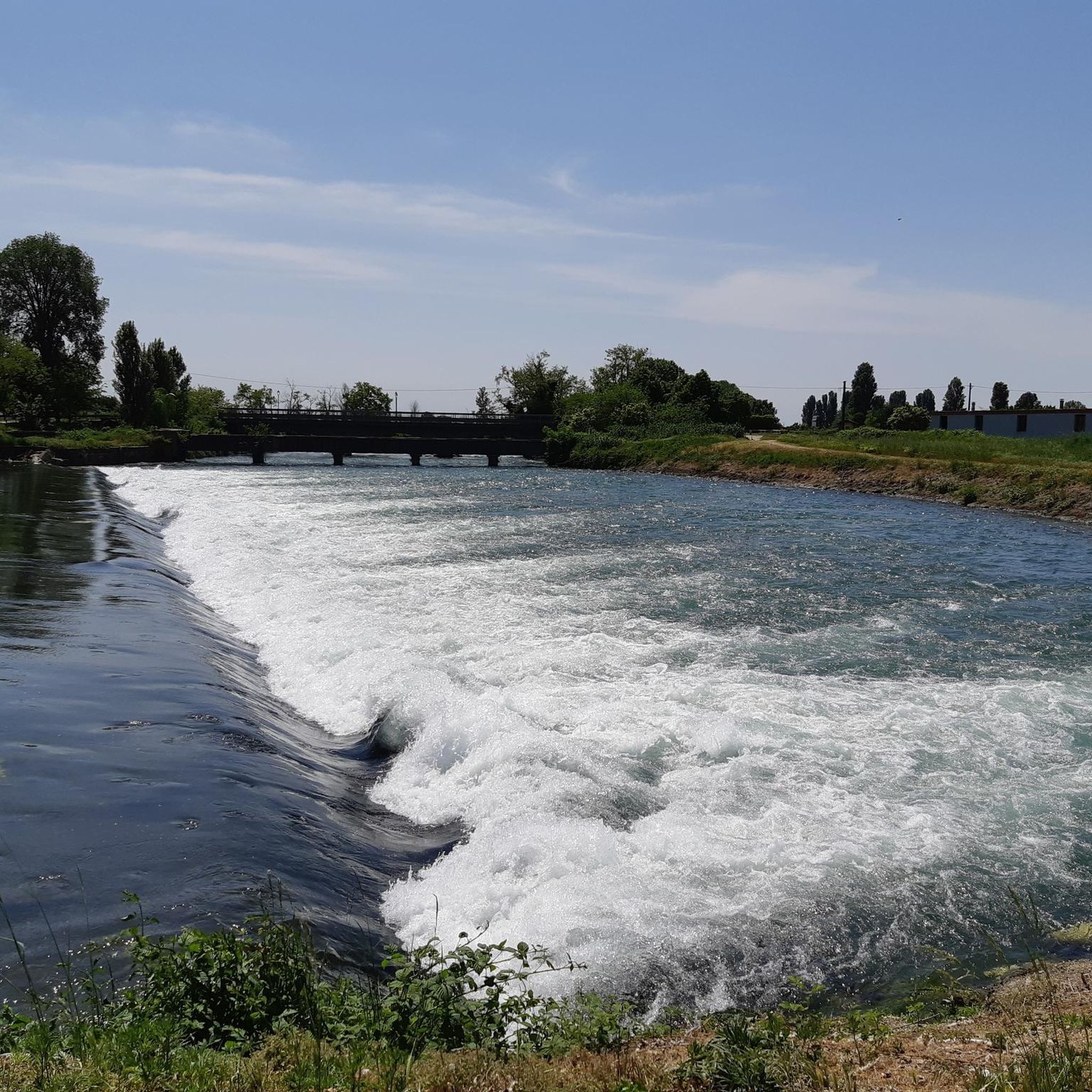
The Muzza Canal, also known as Canale della Muzza, originates near the Castello di Cassano d’Adda, where it draws water from the Adda river. After a course of about 39 km, it flows back into the Adda near Castiglione. Considered an important hydraulic engineering work at a European level, the Muzza Canal is among the oldest in Europe, with about 800 years of history, and is the largest in Northern Italy. Crossing the landscapes of the Po Valley, the canal contributes to the irrigation of the surrounding lands of the Lodi area and preserves precious patches of woodland vegetation, which characterize the Lombard territory. An ideal place to explore the beauty of nature and discover the agricultural history of the region!
1
0

beautiful place, I highly recommend it
1
0
The bridge over the Muzza Canal, located in Lavagna (a hamlet of the municipality of Comazzo in the province of Lodi), is a historical landmark for crossing this ancient artificial waterway. The Muzza is a branch of the Adda river, known for being one of the oldest canals in Europe. Lavagna Lodigiana is a small rural village immersed in the countryside that develops right next to the canal. The bridge area is frequented by cyclists and hikers who travel along the Muzza cycle path or the Muzza-Ponte di Lavagna route, enjoying the river landscape.
1
0

The Muzza Canal is the oldest in Europe and just this year, its 800th anniversary was celebrated by the Municipality of Paullo in collaboration with the Pro Loco and other Municipalities. Its origin dates back to the year 1220, when Frederick II of Swabia, crowned emperor of the Holy Roman Empire, issued an imperial edict that granted the people of Lodi the right to use the waters flowing within their territory. The current route, about 60 km long, receives the waters of the Adda River at Cassano d’Adda, at an altitude of 120 m above sea level, crosses the Lodi territory for about 40 km until near Castiglione d’Adda, at an altitude of 45 m above sea level, and here it releases them back into the Adda River. It has a regulated water regime, with a flow rate, depending on the season, of about 200 thousand liters of water per second; an initial width of 50 meters which reduces to a few meters at the end of its course and an average depth of 2 meters.
2
0
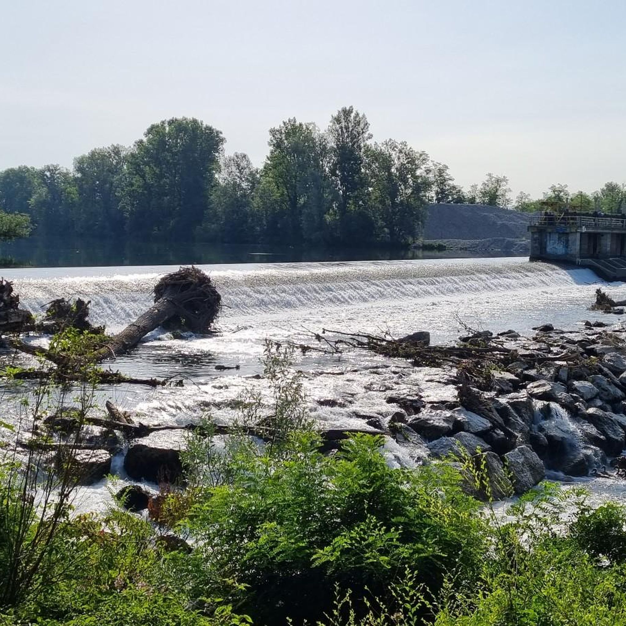
The Muzza canal (61 km long in total) is a branch of the Adda River and has recently celebrated its 800th anniversary, making it one of the oldest in Europe. Its name, with slight variations over the centuries, still recalls the Roman family Mutia who moved here in 90 BC, starting the first land reclamation works. Smaller watercourses branch off from the wide canal, winding through the countryside for a total length of about 1000 kilometers, mainly intended for agricultural irrigation. The surrounding landscape of countryside and farmhouses is evocative, with a succession of tree-lined rows and open fields. It is also very interesting from a naturalistic point of view as it attracts many aquatic birds that can be observed along the route.
2
0
The Muzza canal (61 km long in total) is a branch of the Adda River and recently celebrated its 800th anniversary, making it one of the oldest in Europe. Its name, with slight variations over the centuries, still recalls the name of the Roman Mutia family who moved here in 90 BC, initiating the first land reclamation works. Minor watercourses branch off from the wide canal, winding through the countryside for a total length of about 1000 kilometers, and are mainly intended for agricultural irrigation. The surrounding landscape of countryside and farmhouses is evocative, with rows of trees and open fields. It is also very interesting from a naturalistic point of view as it attracts many waterfowl that can be observed along the route.
2
0
The Muzza canal (61 km long in total) is a branch of the Adda River and recently celebrated its 800th anniversary, making it one of the oldest in Europe. Its name, with slight variations over the centuries, still recalls the name of the Roman Mutia family who moved here in 90 BC, initiating the first land reclamation works. From the wide canal branch off smaller watercourses which, winding through the countryside for a total length of about 1000 kilometers, are mainly intended for agricultural irrigation. The landscape of countryside and farmhouses surrounding it is evocative, with alternating rows of trees and open fields. It is also very interesting from a naturalistic point of view as it attracts many water birds that can be observed along the route.
1
0
Frequently Asked Questions
What is the general terrain like for hiking around Comazzo?
The terrain around Comazzo is primarily characterized by tranquil agricultural landscapes and historical waterways, notably the Canale della Muzza. You'll find open countryside with limited elevation changes, making for generally accessible and pleasant walks rather than challenging mountain climbs.
What are the typical difficulty levels of hikes in Comazzo?
Comazzo offers a range of trails suitable for various fitness levels. Most routes are classified as easy or moderate. Out of over 140 available tours, 62 are considered easy and 77 are moderate, with only a few difficult options.
Are there any circular hiking routes in Comazzo?
Yes, several circular routes are available. A popular option is the Muzza Canal and Corneliano Bertario Loop, which follows the historic canal. Another is the Bridge over the Muzza – Bend on the Muzza Canal loop from Cavaione, offering a scenic journey along the waterway.
What natural features can I expect to see on hikes near Comazzo?
You'll encounter the historic Canale della Muzza, which is a central feature of many trails, and agricultural fields that define the Lombardy countryside. Some routes also lead through or near the Parco dell'Adda Sud, offering flat paths and scenic views.
Are there historical landmarks or attractions along the trails?
Yes, some trails incorporate historical points of interest. For instance, the Muzza Canal and Corneliano Bertario Loop passes by the impressive Corneliano Bertario Castle. Other nearby castles include Castello di Peschiera Borromeo and Visconti Castle of Cassano d'Adda.
Are the hiking trails in Comazzo suitable for families?
Many trails in Comazzo are well-suited for families due to their accessible nature and limited elevation changes. The generally flat and well-maintained paths through agricultural fields and along canals provide a pleasant environment for walkers of all ages. Consider easier routes like the Riverside Path Along the Muzza – Bridge over the Muzza loop from Cavaione.
Can I bring my dog on the hiking trails in Comazzo?
While specific regulations can vary, the open countryside and agricultural paths around Comazzo are generally dog-friendly. It's always recommended to keep your dog on a leash, especially near livestock or in populated areas, and to carry waste bags to maintain the cleanliness of the trails.
What do other hikers enjoy most about hiking in Comazzo?
The komoot community highly rates the hiking experience in Comazzo, with an average score of 4.4 stars from over 270 reviews. Hikers often praise the tranquil atmosphere, the scenic views of the Canale della Muzza, and the accessibility of the paths for relaxed walks.
Are there any trails that explore the agricultural surroundings of Lombardy?
Yes, many routes offer a glimpse into the agricultural heartland. The Giro di Corneliano Bertario e Canale della Muzza is a great example, tracing the canal and winding through the picturesque fields of Lombardy.
What is the best time of year to go hiking in Comazzo?
The best time to hike in Comazzo is typically during spring and autumn when the weather is mild and pleasant. Spring brings blooming landscapes, while autumn offers comfortable temperatures and beautiful colors. Summer can be warm, but early mornings or late afternoons are still enjoyable. Winter hikes are also possible, though some paths might be muddy after rain.
How many hiking trails are available in the Comazzo area?
There are over 140 hiking trails and walking routes available around Comazzo, offering a wide variety of options for different preferences and fitness levels.
Are there any long-distance trails or parks to explore near Comazzo?
Comazzo is in proximity to the Parco dell'Adda Sud. Within this park, you can explore routes like the Dorsale dell'Adda Trail, which offers a longer journey through scenic countryside.
Most popular attractions around Comazzo

Get inspired with the komoot mobile app


Explore more
Browse the best Hikes in other regions.
