The best MTB trails around Montenero Di Bisaccia
4.4
(219)
897
riders
75
rides
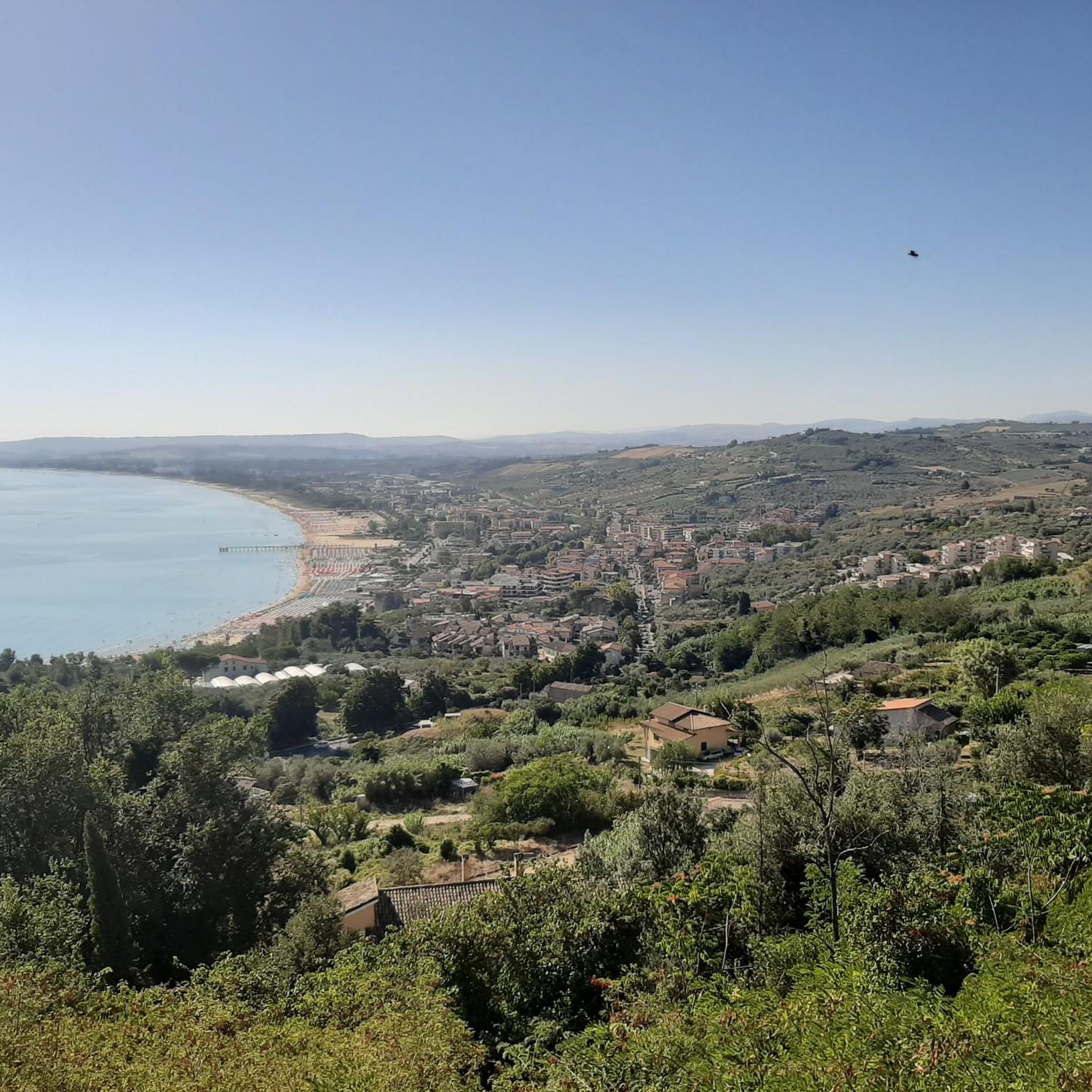
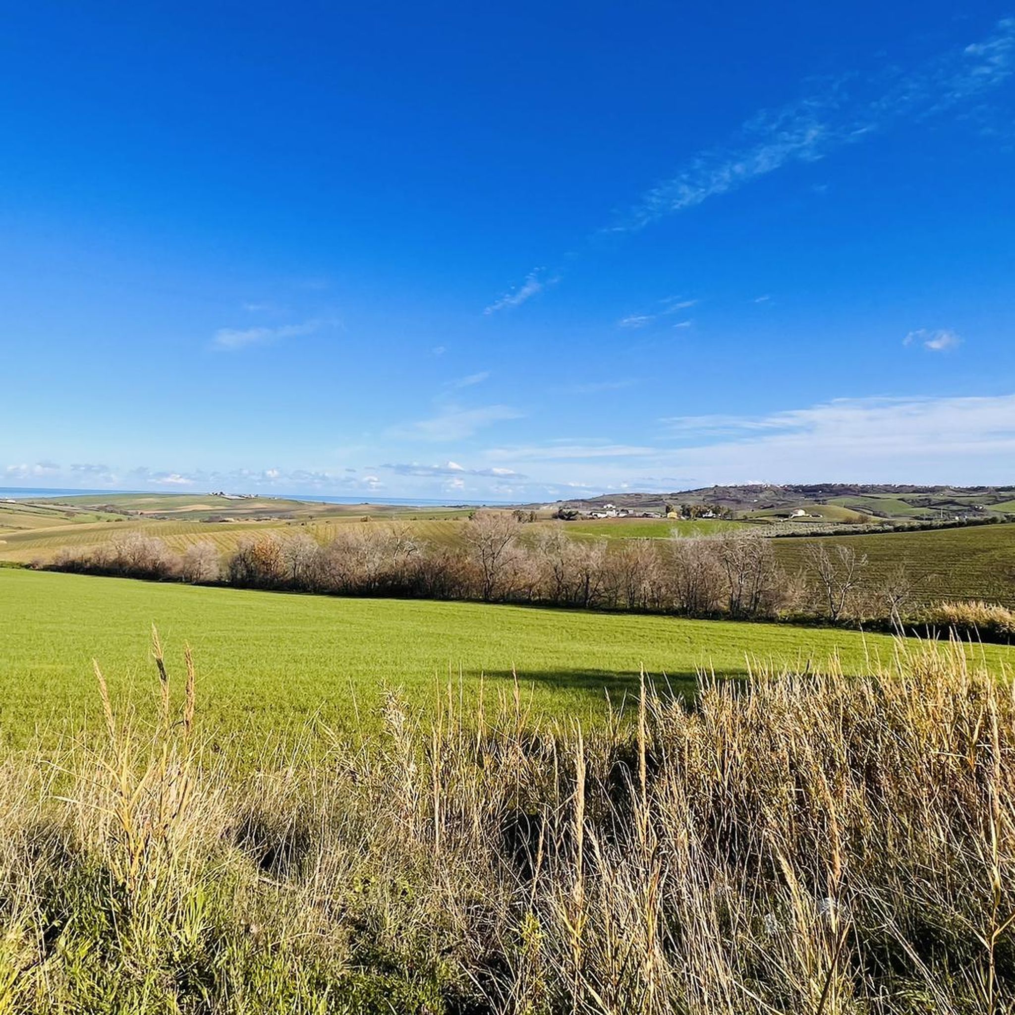
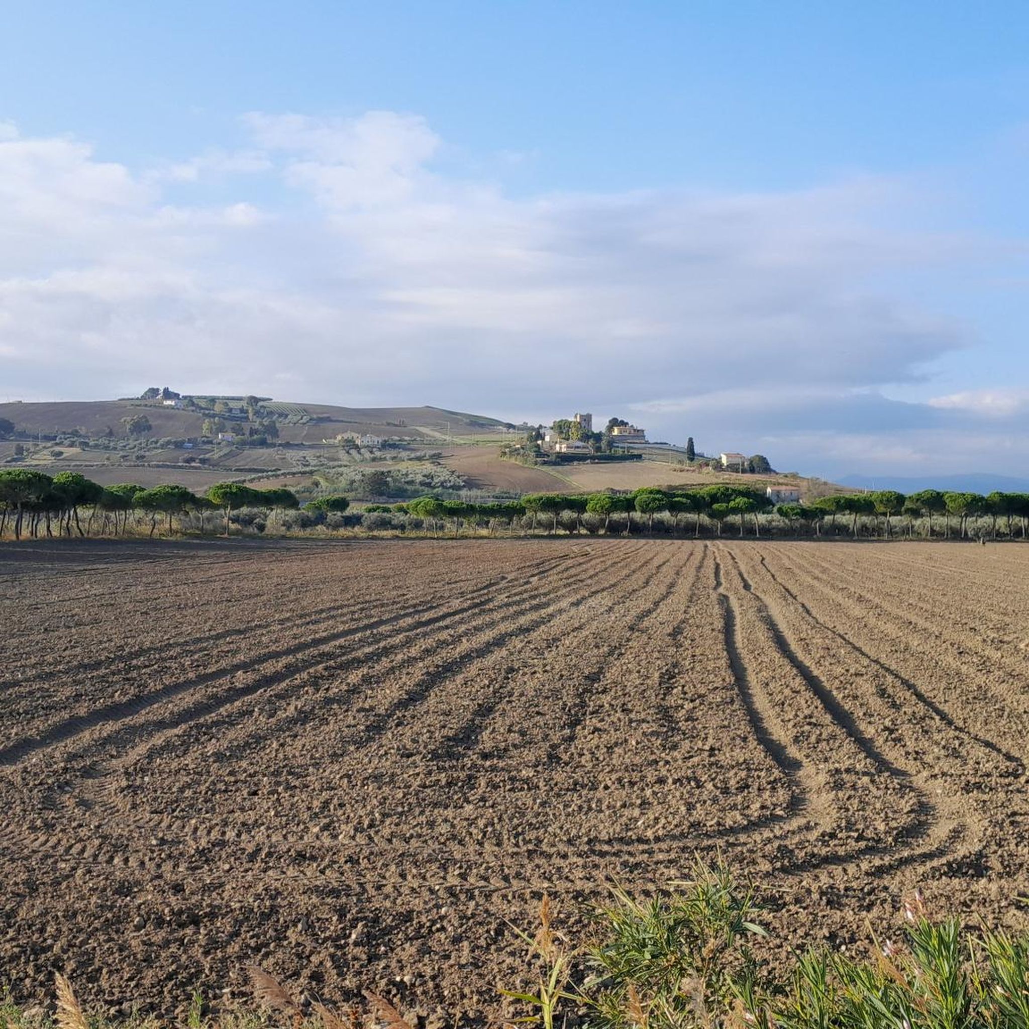
Mountain biking around Montenero Di Bisaccia offers diverse landscapes and panoramic views across the Biferno Valley and the Adriatic Sea. The region is characterized by a mix of olive groves, vineyards, and wheat fields, providing a scenic backdrop for routes. A notable feature is the Montenero Ravines, extensive erosive formations that create a rugged and varied terrain. Proximity to Marina di Montenero also allows for coastal trails.
Best mountain bike trails around Montenero Di Bisaccia
- The most popular mountain bike trail is Montenero di Bisaccia e Petacciato giro ad anello – giro ad anello, a 17.0 miles (27.3 km) moderate route that takes 1 hour 56 minutes to complete, offering scenic countryside and coastal views.
- Another top favourite among local mountain bikers is Calanchi di Montenero e Grotta della Madonna di Bisaccia – giro ad anello, an easy 3.3 miles (5.3 km) path that explores the unique geological formations of the Montenero Ravines.
- Local mountain bikers also love the Monteodorisio Castle – Castello Aragona loop from Nidi di Fratino, a 23.5 miles (37.9 km) moderate trail leading through agricultural lands and past historical points of interest, often completed in about 2 hours 27 minutes.
- Mountain biking around Montenero Di Bisaccia is defined by hilltop views, agricultural lands, dramatic ravines, and coastal paths. The network offers options for different ability levels, from easy loops to more challenging routes.
- The routes in Montenero Di Bisaccia are highly rated by the komoot community with an average score of 4.6 stars from over 170 reviews. More than 740 mountain bikers have used komoot to explore Montenero Di Bisaccia's varied terrain.
Last updated: July 18, 2026
1
riders
27.3km
01:56
500m
500m
Embark on the Montenero di Bisaccia e Petacciato loop, a moderate mountain biking route in Italy's Molise region. This trail covers 17.0 miles (27.3 km) with an elevation gain of 1637 feet (499 metres), typically taking around 1 hour and 56 minutes to complete. As you ride, you will encounter diverse terrain, including asphalt and paved paths, alongside sections of loose ground, all while enjoying panoramic views of the Biferno Valley and the Adriatic Sea. The landscape features picturesque olive groves, vineyards, and grain fields, with the distinctive geological formations of the Calanchi di Montenero adding to the visual interest.
This loop is considered suitable for mountain bikers with good training due to its varied surfaces and elevation changes. While much of the route is on roads and secondary roads, you should exercise caution on steep descents where the path may be uneven. The trail's loop nature allows for flexible starting points within the Montenero di Bisaccia area, making it convenient to plan your ride. Prepare for a rewarding experience that combines physical activity with stunning natural beauty.
The Montenero di Bisaccia e Petacciato loop stands out as the most popular mountain biking route in its area, highly regarded by the Komoot community. Its appeal comes from the unique blend of countryside and coastal views, offering a chance to explore the striking Calanchi di Montenero badlands. Beyond the ride, the region is also known for local products like olive oil and ventricina, providing a taste of Molise's culinary heritage.
5.34km
00:32
150m
150m
Embark on the Calanchi di Montenero e Grotta della Madonna di Bisaccia loop, an easy mountain bike trail spanning 3.3 miles (5.3 km) with 498 feet (152 metres) of elevation gain. You can complete this route in about 32 minutes, riding through varied terrain that includes unpaved paths, asphalt, and singletrack. As you ride, you will encounter the dramatic Calanchi, extensive clay hills sculpted by wind and rain, creating a unique, almost lunar landscape. The trail also offers panoramic views of the Biferno Valley and the distant Adriatic Sea, passing through picturesque olive groves, vineyards, and grain fields.
This trail is suitable for all skill and fitness levels, making it an accessible option for a wide range of riders looking for an enjoyable outing. The varied surfaces, including nearly 900 meters of singletrack, provide an engaging experience without being overly challenging. While specific details on trailhead access or parking are not provided, the trail's easy designation suggests it is designed for broad appeal. Consider riding during pleasant weather to fully appreciate the open landscapes and geological formations.
Discover the unique features that make this route special, including the Grotta della Madonna di Bisaccia, an ancient natural cave where early Christians once venerated a Byzantine painting. You will also find the Big Bench Scipione 369, installed in September 2024, which offers an enchanting panoramic viewpoint over the rolling hills and the sea. The calanchi themselves stretch along the historic Tratturo Centurelle-Montesecco, an ancient pastoral route, and the entire area is recognized as a Site of Community Importance for its rare landscapes and protected flora and fauna.

Sign up for free
4.6
(10)
40
riders
Easy mountain bike ride. Great for any fitness level. Suitable for all skill levels.
4.0
(1)
16
riders
47.7km
02:54
470m
470m
Moderate mountain bike ride. Good fitness required. Suitable for all skill levels.
16
riders
44.2km
03:26
850m
860m
Moderate mountain bike ride. Good fitness required. Advanced riding skills necessary.
Get access to more routes and recommendations from other explorers.
Sign up for free
Already have an account?
Our route recommendations are based on thousands of hikes, rides, and runs completed by other people on komoot.
Start today with a free account
Your next adventure awaits.
Login or Signup
Tips from the Community

From the highest point of the Punta Aderci promontory, you have a beautiful view of the trabocco and the small pebble beach.
0
0


Punta Aderci, located along the Abruzzo coast near Vasto, is one of the most fascinating nature reserves on the Adriatic. With its breathtaking views and biodiversity, the reserve offers unspoiled landscapes, pebble beaches and dunes, perfect for nature and sea lovers. The promontory of Punta Aderci overlooks crystal clear waters and offers spectacular views of the coast, including the famous Punta Penna beach and several other hidden coves.
4
0

This part of the route of the cycle/pedestrian path of the Via Verde Costa dei Trabocchi which lies in the territory of San Salvo Marina represents the southern Abruzzo section of the Adriatica cycle path, Bicitalia network number 6. The cycle path in the two-way direction was resined and then painted green and the same in the pedestrian section, but in reality it had to be made in blue to distinguish it from the cycle path and to make it clear to cyclists and pedestrians where to pass within a mixed pedestrian and cycle path and to avoid unnecessary accidents linked to the lack of chromatic distinction of the two sections.
0
0

Punta Aderci promontory. From this uncontaminated place, the panorama is truly splendid with a 360° view of the entire coast and the fascinating cliffs.
1
0

Part of the Trabocchi Cycle Path is located inside the Nature Reserve... the paths are dirt!
0
0

Exceptional landscape, absolutely worth visiting. You can start from either Vasto or San Salvo, in both cases it is easy to find parking and it is free.
0
0

Simply fantastic, go to the top, the view is spectacular!
0
0
Frequently Asked Questions
How many mountain bike trails are available around Montenero Di Bisaccia?
There are over 60 mountain bike trails around Montenero Di Bisaccia listed on komoot, offering a wide range of options for different skill levels and preferences.
What kind of terrain can I expect on mountain bike trails in Montenero Di Bisaccia?
The terrain is highly varied, ranging from scenic agricultural lands with olive groves, vineyards, and wheat fields, to the dramatic erosive formations of the Montenero Ravines. You'll also find coastal paths leading down to Marina di Montenero, offering a mix of challenging and picturesque rides.
Are there easy mountain bike trails suitable for beginners or families?
Yes, Montenero Di Bisaccia offers several easy mountain bike trails. For instance, the Calanchi di Montenero e Grotta della Madonna di Bisaccia – giro ad anello is an easy 5.3 km loop that explores the unique geological formations of the Montenero Ravines. Another easy option is The Bather Monument loop from San Salvo, which is 23.3 km long.
Where can I find trails with panoramic views?
Many trails in the region offer panoramic views, particularly those on the hilltop positions of Montenero di Bisaccia. You can expect expansive vistas across the Biferno Valley and the Adriatic Sea, with some routes potentially offering views as far as the Tremiti Islands. The Montenero di Bisaccia e Petacciato giro ad anello – giro ad anello route, for example, provides scenic countryside and coastal views.
Are there any circular mountain bike routes in the area?
Yes, many of the mountain bike routes around Montenero Di Bisaccia are circular. Examples include the moderate Montenero di Bisaccia e Petacciato giro ad anello – giro ad anello and the easy Calanchi di Montenero e Grotta della Madonna di Bisaccia – giro ad anello, both designed as loops for convenient exploration.
What interesting natural features or landmarks can I see along the trails?
The region is rich in natural and historical landmarks. You can explore the unique geological formations of the Montenero Ravines, also known as 'blades', which are extensive erosive features. Some trails pass by Paleolithic troglodytic caves. Near the coast, you might encounter the Mouth of the Trigno River. For historical interest, the Monteodorisio Castle – Castello Aragona loop from Nidi di Fratino leads past historical points of interest.
What do other mountain bikers say about the trails in Montenero Di Bisaccia?
The mountain bike routes in Montenero Di Bisaccia are highly rated by the komoot community, with an average score of 4.6 stars from over 170 reviews. Many riders praise the varied terrain, from agricultural landscapes to dramatic ravines and coastal paths, and the stunning hilltop views.
Are there any challenging or advanced mountain bike routes?
Yes, for experienced riders seeking a challenge, there are 17 difficult mountain bike routes in the area. An example is The Bather Monument – View of the Coast loop from Vasto-San Salvo, a demanding 70.1 km trail with significant elevation changes.
What is the best time of year to go mountain biking in Montenero Di Bisaccia?
Montenero di Bisaccia offers pleasant conditions for mountain biking for much of the year. Spring and autumn generally provide mild temperatures and beautiful scenery. Summer can be warm, especially in July and August, so early morning or late afternoon rides are recommended. The varied terrain means conditions can change, so checking local weather before heading out is always a good idea.
Are there any trails that lead to the coast or beaches?
Yes, the region's proximity to Marina di Montenero means you can find trails that lead down to the coast. The Montenero di Bisaccia e Petacciato giro ad anello – giro ad anello route, for example, offers scenic coastal views and access to the Adriatic Sea.
Can I find trails that combine natural beauty with historical sites?
Absolutely. The region is rich in history. The Monteodorisio Castle – Castello Aragona loop from Nidi di Fratino is a moderate trail that takes you through agricultural lands and past historical points of interest, allowing you to combine your ride with cultural exploration.
Most popular attractions around Montenero Di Bisaccia

Get inspired with the komoot mobile app


Explore more
Browse the best MTB trails in other regions.
