The best cycling routes around Alveringem
4.3
(110)
672
riders
56
rides
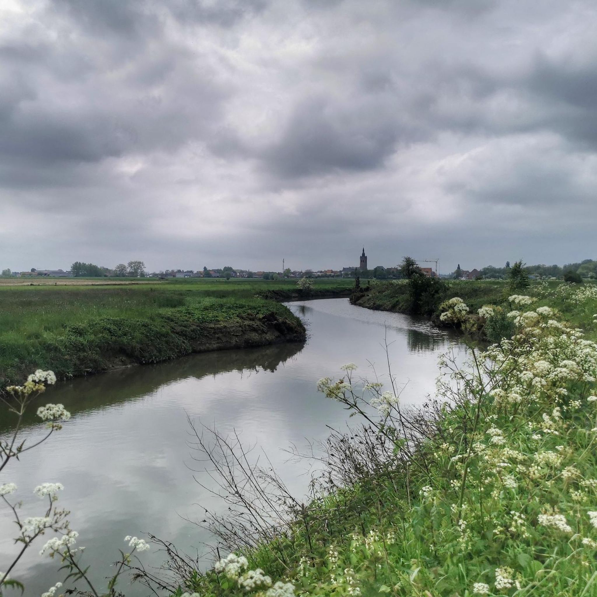
Touring cycling around Alveringem features a predominantly flat to gently rolling landscape, characterized by open countryside and a network of canals. The region's low elevation gains make it suitable for accessible cycling. Routes often connect rural areas with small towns and market squares, offering varied scenery. Proximity to coastal areas is also a feature of some routes.
Best touring cycling routes around Alveringem
- The most popular touring cycling route is De Doornpanne – Veurne Market Square loop from Alveringem,…
Last updated: October 22, 2026
4.7
(23)
143
riders
47.7km
02:53
70m
70m
Moderate bike ride. Good fitness required. Mostly paved surfaces.
4.5
(18)
84
riders
Moderate bike ride. Good fitness required. Mostly paved surfaces.

4.3
(11)
32
riders
43.0km
02:29
60m
60m
Moderate bike ride. Good fitness required. Mostly paved surfaces.
3.0
(1)
24
riders
Moderate bike ride. Good fitness required. Mostly paved surfaces.
4.8
(4)
19
riders
52.1km
02:59
80m
80m
Moderate bike ride. Good fitness required. Mostly paved surfaces.
Get access to more routes and recommendations from other explorers.
Already have an account?
Our route recommendations are based on thousands of hikes, rides, and runs completed by other people on komoot.
Start today with a free account
Your next adventure awaits.

Other adventures around Alveringem

Tips from the Community

Stavelebrug: from French riders to a lively war camp 🐎 Today, the Stavelebrug is a quiet passage for hikers and cyclists along the Yser. During the First World War, it looked very different here. A historical photo on the information board shows French soldiers on horseback wading through the Yser at this strategic crossing point. Stavele grew into a large army camp during the war, where thousands of soldiers stayed, rested, or were on their way to the front. The bridges over the Yser were also of great importance for the supply of troops, food, and ammunition. Nice detail: in June 1915, the French Zouaves even organised a big party with theatre and music here to boost the soldiers' morale. A beautiful spot to stop for a moment and compare today's peaceful landscape with the activity of more than a hundred years ago.
5
0

Bridge closure: The bridge at Fintele is closed to all traffic until October 2, 2026 due to works. New lock gates are being installed, among other things. I came from the Diksmuide direction, had to turn back and continued cycling along Reninge. I haven't seen the situation on the other side yet (whether you can continue to Veurne, for example)
0
0

Starting point of our bike tour along the Belgian coast...
0
0

Next to this church, there is also a small parking lot, so you can easily start your tour from here in all directions.
1
0

The harbor in Ypres, known locally as "De Kaaie," is actually the Ieperlee, which runs beneath the city of Ypres and becomes visible again there. At the Drie Grachten (Three Canals), the Ieperlee is joined by the Martjevaart canal, which originates in Merkem. Drie Grachten is a hamlet in the west of Merkem where the three canals converge: the Martjevaart canal, the Ypres-IJzer canal (also known as the Ieperlee Canal), and the Ieperlee itself. Drie Grachten is also known for the battles during World War I, in which the French, including the Zouaves, fought against the Germans. After a failed attack on the German outpost at Luigem, the Germans captured a number of Zouaves. They launched a counterattack but hid behind the captured Zouaves to prevent the French Zouaves from firing on them, thinking they were their own men returning. At one point, one of the captured Zouaves reportedly shouted: "Tirez donc au nom de Dieu, ce sont les Boches!" (For God's sake, these are the Boches!). Immediately after the warning, a French salvo erupted, mowing down both the Germans and the captured Zouaves. The Zouaves of Northern France (Union des Zouaves du Nord) continued to commemorate this after the war. Luigem is a hamlet 1 kilometer east of Drie Grachten and 1 kilometer west of the center of Noordschote. The Zouaves (French: zouaves) were a light infantry unit of the French Army, associated with French North Africa.
1
0

The Caesarsboom is an old yew tree (also known as poison tree) in the town of Lo in the Belgian Westhoek region. The tree is one of Lo's typical symbols and is located next to the medieval Westpoort gate. The name refers to a legend about Julius Caesar, who is said to have taken a nap under the tree in 55 BC on his way to Britain and tied his horse to it. The story goes back to the historian Jean-Baptiste Gramaye, who was the first to allow Caesar to pass through Lo in 1612. In reality, the Caesarsboom is approximately 250 years old. A painting from the late 18th century depicts its predecessor in full maturity. https://nl.wikipedia.org/wiki/Caesarsboom
2
0
The mill was built in 1797. The base of the mill was closed off in 1927, creating a sixteen-sided brick building with entrance doors. The last miller was Joseph Markey, to whom the mill owes its current name. He ceased milling in 1962. The mill gradually fell into disrepair. As early as 1949, the mill was designated a protected monument. In 1980, it was purchased by the province of West Flanders, which carried out restoration work so that the mill was operational again in 2003. The mill has three lofts, three pairs of millstones, and a building structure. https://nl.wikipedia.org/wiki/Markeymolen
4
0
A well-maintained bike path that can get busy at times. Courtesy is key. Enjoy together, each at their own pace.
2
0
Frequently Asked Questions
Are there easy touring cycling routes suitable for beginners in Alveringem?
Yes, Alveringem is an excellent region for beginners and those seeking easy rides. The landscape is predominantly flat to gently rolling, with low elevation gains. Out of 54 touring cycling routes, 25 are classified as easy, making them ideal for a relaxed cycling experience.
Are there family-friendly cycling routes in Alveringem?
Absolutely. The flat terrain and extensive network of quiet roads and canal paths make many routes in Alveringem suitable for families. These routes often connect rural areas with small towns, providing safe and enjoyable cycling for all ages. Consider routes that pass through villages for convenient stops.
What kind of scenery can I expect on touring cycling routes around Alveringem?
Touring cycling around Alveringem offers varied scenery, characterized by open countryside, picturesque canal networks, and connections between small towns and market squares. You'll often find yourself cycling through rural areas, past historic locks, and occasionally near coastal landscapes.
What interesting landmarks or attractions can I see along the touring cycling routes in Alveringem?
Many routes in Alveringem pass by notable attractions. For example, you might cycle past the historic Veurne Market Square, or explore natural areas like the Krakeelduinen Nature Reserve. Other points of interest include the Maerebrug (Maere Bridge) over the Nieuwpoort–Dunkirk Canal and the Yser Tower and Pax Gate Memorial in Diksmuide.
Are there circular touring cycling routes available in Alveringem?
Yes, many touring cycling routes in Alveringem are designed as loops, allowing you to start and end at the same point. Examples include the De Doornpanne – Veurne Market Square loop from Alveringem and The Three Canals Point – Fintele Lock loop from Alveringem, which offer convenient round trips.
What do other touring cyclists enjoy most about cycling in Alveringem?
The touring cycling routes in Alveringem are highly rated by the komoot community, with an average score of 4.5 stars from over 80 reviews. Cyclists often praise the flat terrain, the extensive canal networks, and the charming connections between small towns and open fields, making for a pleasant and accessible experience.
Are there any long-distance touring routes in the Alveringem area?
While many routes are moderate in length, Alveringem's flat landscape and interconnected paths allow for longer rides by combining sections or extending existing loops. Routes like the South Abbey Mill – Veurne Market Square loop from Leisele cover over 50 km, and you can easily link them for an extended tour through the region's scenic countryside and towns.
Can I find routes that include scenic viewpoints or natural reserves?
Yes, Alveringem offers routes that pass through or near scenic natural areas. For instance, the De Panne Beach Promenade – Leopold I Monument loop from Leisele offers coastal views. You can also find routes that lead to natural highlights such as De Doornpanne or the Viconia Clay Pits, which provide opportunities for birdwatching and enjoying the tranquil landscape.
What is the best time of year for touring cycling in Alveringem?
The spring, summer, and early autumn months generally offer the most pleasant conditions for touring cycling in Alveringem. During these seasons, the weather is typically mild, and the countryside is at its most vibrant. The flat terrain means routes are generally accessible year-round, but warmer months provide the best experience.
Are there touring cycling routes that pass through towns with cafes or places to stop?
Many routes in Alveringem are designed to connect rural areas with small towns and market squares, providing ample opportunities for cafe stops and refreshments. For example, the De Doornpanne – Veurne Market Square loop from Alveringem takes you directly to the historic Veurne Market Square, which is known for its cafes and shops.
How many touring cycling routes are available in Alveringem?
There are over 50 touring cycling routes available around Alveringem, offering a wide variety of options for different skill levels and preferences. This extensive network ensures there's always a new path to explore, whether you're looking for an easy ride or a more moderate challenge.
Is public transport accessible for reaching bike trails in Alveringem?
Alveringem is a rural municipality, and while public transport options exist, they might be less frequent than in larger cities. It's advisable to check local bus schedules or train connections to nearby towns like Veurne, which may offer better access points to the cycling network. Many cyclists prefer to drive to a starting point with parking.
Are there any specific routes that highlight the region's canal system?
Yes, the region's extensive canal system is a defining feature of many routes. The The Three Canals Point – Fintele Lock loop from Alveringem is an excellent example, specifically traversing waterways and locks, offering direct views of the local canal infrastructure and its historical significance.
Most popular routes around Alveringem
Most popular attractions around Alveringem

Get inspired with the komoot mobile app


Explore more
Browse the best Cycling routes in other regions.
