The best walks and hikes around Hægebostad
4.4
(358)
1,148
hikers
23
hikes
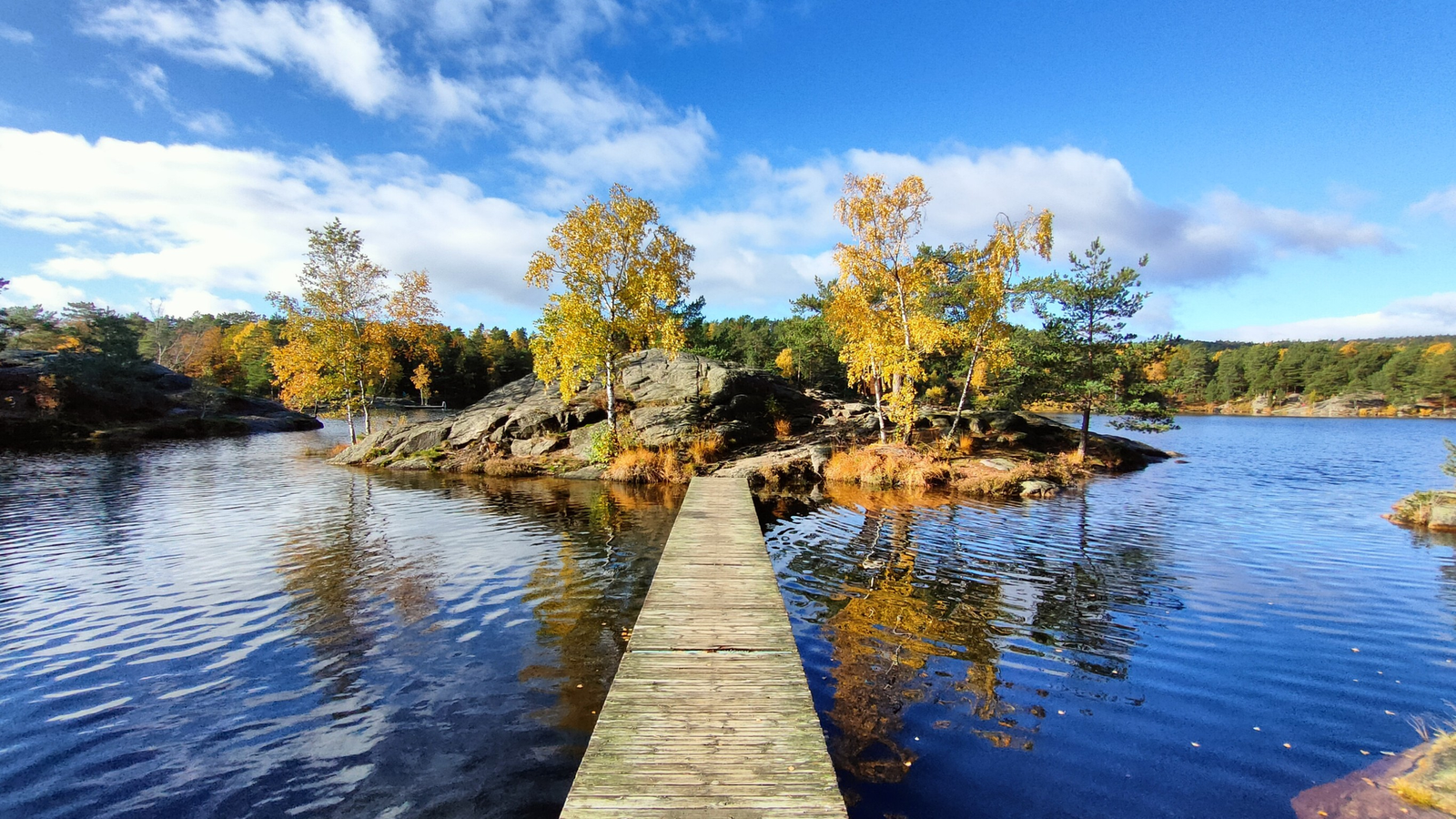
Hiking around Hægebostad offers varied terrain, characterized by deep valleys, extensive forests, and numerous lakes. The region encompasses the upper Lyngdalen valley, following the Lygna river, and features a serene mountain environment with peaks like Hekkfjell (704 meters) and Blomliknuten (547 meters). This landscape provides diverse opportunities for outdoor exploration, from forest paths to mountain trails.
Best hiking trails around Hægebostad
- The most popular hiking route is Neseknipen Trail, an easy 2.6 miles (4.2 km) trail that takes 1 hour 25 minutes to complete, offering views over the local landscape.
- Another top favourite among local hikers is Eikerapen Waterfall – Grill Cabin by the Lake loop from Eikerapen, a moderate 5.4 miles (8.7 km) path. This trail leads past the Eikerapen Waterfall and a grill cabin by the lake.
- Local hikers also love the Kvåsfossen Waterfall – Rapids loop from Kvås kirke, an 8.0 miles (12.9 km) trail leading through varied terrain including the Kvåsfossen Waterfall, often completed in about 3 hours 55 minutes.
- Hiking around Hægebostad is defined by deep valleys, extensive forests, and numerous lakes. The network offers options for different ability levels, from short walks to longer mountain excursions.
- The routes in Hægebostad are highly rated by the komoot community with an average score of 4.4 stars from more than 300 reviews. More than 1000 hikers have used komoot to explore Hægebostad's varied terrain.
Last updated: June 28, 2026
4.5
(36)
156
hikers
4.19km
01:26
230m
230m
Hike the easy 2.6-mile Neseknipen trail to a viewpoint overlooking Kvåsfossen waterfall, gaining 752 feet in elevation.
4.3
(78)
177
hikers
8.69km
02:40
290m
290m
Moderate hike. Good fitness required. Easily-accessible paths. Suitable for all skill levels.

Sign up for free
4.7
(53)
155
hikers
12.9km
03:55
400m
400m
Moderate hike. Good fitness required. Easily-accessible paths. Suitable for all skill levels.
4.9
(12)
35
hikers
4.09km
01:21
180m
180m
Easy hike. Great for any fitness level. Easily-accessible paths. Suitable for all skill levels.
4.8
(6)
19
hikers
6.63km
02:05
250m
250m
Moderate hike. Good fitness required. Easily-accessible paths. Suitable for all skill levels.
Get access to more routes and recommendations from other explorers.
Sign up for free
Already have an account?
Our route recommendations are based on thousands of hikes, rides, and runs completed by other people on komoot.
Start today with a free account
Your next adventure awaits.
Login or Signup
Other adventures around Hægebostad

Tips from the Community

The molybdenum mineralizations of Flottorp were discovered in 1910. A processing plant was already installed in 1911, and by 1919, a total of approx. 37 tons of concentrate with a MoS₂ content of 70% had been produced. The deposit was mined from 1916 to 1919 by the company Undalens Molybdengruver. A maximum of 150 to 250 people were employed there. After the First World War, the demand for molybdenum decreased, and the mine was closed in 1920. In 1941/42, the occurrence was investigated and approx. 1600 m were drilled with diamond cores. It was concluded that the deposit was uneconomical. Numerous traces of mining operations are still preserved, although heavily overgrown. In 2012, access to the mine was still possible. There are remains of some buildings, presumably a rock crusher. Molybdenum ore samples can be easily taken from the heaps. In fact, there are numerous individual mines/quarries/prospecting areas, but they are smaller than the main mine. The longest open-cast mine has a total length of approx. 120 m. From Flottorp, you can hike to the mine and also take a circular route over Ørnemyrfjellet, which also has an impressive shelter hut.
0
0

Not an easy hike. Partly very steep, trails difficult to see due to lack of markings. Some trails are scree-covered. Hiking poles and sturdy footwear are required, as are some steep climbs.
1
0

Here, too, there is a summit book box where you can sign the “Turboka”.
1
0
Here, too, there is a summit book box where you can sign the “Turboka”.
0
0

Is this art or can it be thrown away?😉
0
0

Very beautiful waterfall, but often very slippery, so be careful!
0
0

We took the path above the shore. Even that was sometimes difficult to find
0
0
Rocky but beautiful climb
0
0
Frequently Asked Questions
What types of hiking trails can I expect in Hægebostad?
Hægebostad offers a diverse range of hiking experiences, from easy walks through forests and fields to more challenging mountain excursions. The landscape is characterized by deep valleys, extensive forests, and numerous lakes, providing varied terrain for all skill levels. You'll find 12 easy routes and 9 moderate routes available.
Are there any family-friendly hiking options in Hægebostad?
Yes, Hægebostad has several trails suitable for families. For example, the hike to Blomliknuten (547 meters above sea level) is noted as a relatively easy climb with a well-used trail, parts of which run over easy-to-navigate boulders, offering fantastic views. Many of the 12 easy routes in the area are also great for families.
Can I find trails that feature waterfalls in Hægebostad?
Absolutely! Hægebostad is home to several scenic waterfalls. You can explore routes like the Eikerapen Waterfall – Grill Cabin by the Lake loop from Eikerapen, which passes the impressive Eikerapen Waterfall. Another popular option is the Kvåsfossen Waterfall – Rapids loop from Kvås kirke, which takes you past the beautiful Kvåsfossen Waterfall.
What are some notable viewpoints or landmarks I can discover on a hike?
Hægebostad offers stunning natural viewpoints. The mountain Hekkfjell, at 704 meters, provides impressive views, rising significantly above Lake Lygne and the village of Eiken. Blomliknuten also offers fantastic panoramic views of the surrounding mountains and valley. For a historical perspective, consider exploring parts of the "Barnevandrerstien" (Child Wanderer Path), which passes through the area.
Are there any circular hiking routes available?
Yes, many trails in Hægebostad are designed as loops, allowing you to start and end at the same point. Examples include the Eikerapen Waterfall – Grill Cabin by the Lake loop from Eikerapen and the Kvåsfossen Waterfall – Rapids loop from Kvås kirke. These circular routes offer a convenient way to experience the diverse landscapes.
What do other hikers enjoy most about hiking in Hægebostad?
The hiking trails in Hægebostad are highly rated by the komoot community, with an average score of 4.4 stars from over 300 reviews. Hikers often praise the quiet, untouched wilderness, the varied terrain encompassing deep valleys, extensive forests, and numerous lakes, and the opportunities for both serene walks and more challenging mountain excursions.
What is the best time of year to go hiking in Hægebostad?
The best time for hiking in Hægebostad is typically during the warmer months, from late spring to early autumn (May to September), when the trails are clear of snow and the weather is most pleasant. This period allows for full enjoyment of the region's diverse landscapes, including its many lakes and mountain views.
Are dogs allowed on the hiking trails in Hægebostad?
Generally, dogs are welcome on hiking trails in Norway, but it's important to keep them on a leash, especially during the bird nesting season (April 1 to August 20) and in areas with grazing livestock. Always ensure your dog is under control and that you clean up after them to preserve the natural environment for everyone.
Are there places to stay or eat near the hiking areas?
Yes, Hægebostad offers some options for accommodation and dining. For instance, Heddan Gjestegard is mentioned as a base for exploring marked hiking trails, with 5 different routes totaling 25 km in its vicinity. It's a good idea to check local listings for current availability of cafes, pubs, and accommodation in the area.
How can I get to the hiking trails in Hægebostad using public transport?
While Hægebostad is a rural area, some public transport options might connect to larger towns. However, direct access to many trailheads often requires a car. It's advisable to check local bus schedules or consider car rental for maximum flexibility when planning your hiking trips in the region.
Is parking available at the trailheads?
Parking availability varies by trailhead. In general, many popular hiking areas in Norway have designated parking spots, often small and sometimes requiring a small fee. It's recommended to check specific route details or local information for parking arrangements at your chosen trailhead before you go.
What kind of distances and durations can I expect for hikes in Hægebostad?
Hikes in Hægebostad vary significantly in length and duration. You can find shorter, easier routes like the Neseknipen Trail, which is about 4.2 km and takes around 1 hour 25 minutes. Longer, moderate trails, such as the Breiarskor – Scenic Nature Cabin loop from Hægebostad, can be around 6.7 km and take over 2 hours to complete, depending on your pace and breaks.
Most popular routes around Hægebostad
Most popular attractions around Hægebostad

Get inspired with the komoot mobile app


Explore more
Browse the best Hikes in other regions.
