The best cycling routes around Waltensburg/Vuorz
4.5
(423)
5,819
riders
137
rides
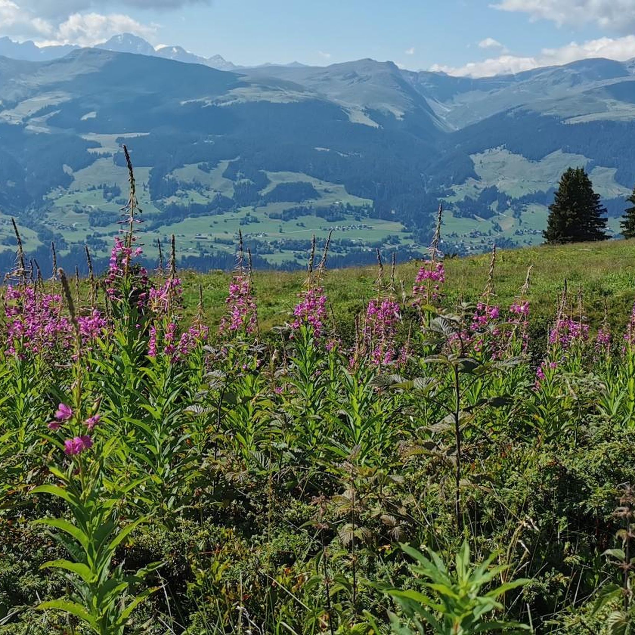
Touring cycling routes around Waltensburg/Vuorz are situated on a high mountain terrace in the canton of Graubünden, Switzerland. The region offers diverse landscapes, characterized by expansive forests, verdant mountain pastures, and a mountain panorama featuring peaks over 3000 meters. Cyclists can navigate varied terrain, from paved surfaces to unpaved segments, often encountering significant elevation changes. Natural features like Brigelsersee and Val Frisal contribute to the area's scenic environment.
Best touring cycling routes around Waltensburg/Vuorz
- The most popular touring cycling route…
Last updated: October 10, 2026
3.7
(6)
110
riders
42.4km
03:15
840m
840m
Hard bike ride. Very good fitness required. Mostly paved surfaces. Suitable for all skill levels.
4.8
(33)
317
riders
33.9km
03:35
1,230m
1,230m
Hard bike ride. Very good fitness required. Mostly paved surfaces. Suitable for all skill levels.

5.0
(2)
127
riders
34.2km
02:34
570m
570m
Hard bike ride. Very good fitness required. Mostly paved surfaces. Suitable for all skill levels.
5.0
(10)
54
riders
37.3km
03:11
930m
930m
Hard bike ride. Very good fitness required. Mostly paved surfaces. Suitable for all skill levels.
4.8
(4)
48
riders
17.8km
01:47
710m
710m
Hard bike ride. Very good fitness required. Mostly paved surfaces. Suitable for all skill levels.
Get access to more routes and recommendations from other explorers.
Already have an account?
Our route recommendations are based on thousands of hikes, rides, and runs completed by other people on komoot.
Start today with a free account
Your next adventure awaits.
Popular around Waltensburg/Vuorz
Other adventures around Waltensburg/Vuorz

Tips from the Community

The small chapel of Sogn Martin is one of the oldest sacred buildings in Brigels and presumably dates back to the early Middle Ages. The Romanesque tower is particularly striking, while a beautiful late Gothic wooden ceiling can be discovered inside. A special highlight is the Gothic winged altarpiece from 1518 with Saint Martin as the centerpiece. The wall paintings from 1515 also make the chapel particularly interesting from an art historical perspective. A small, but very worthwhile testament to the long history of Brigels.
0
0
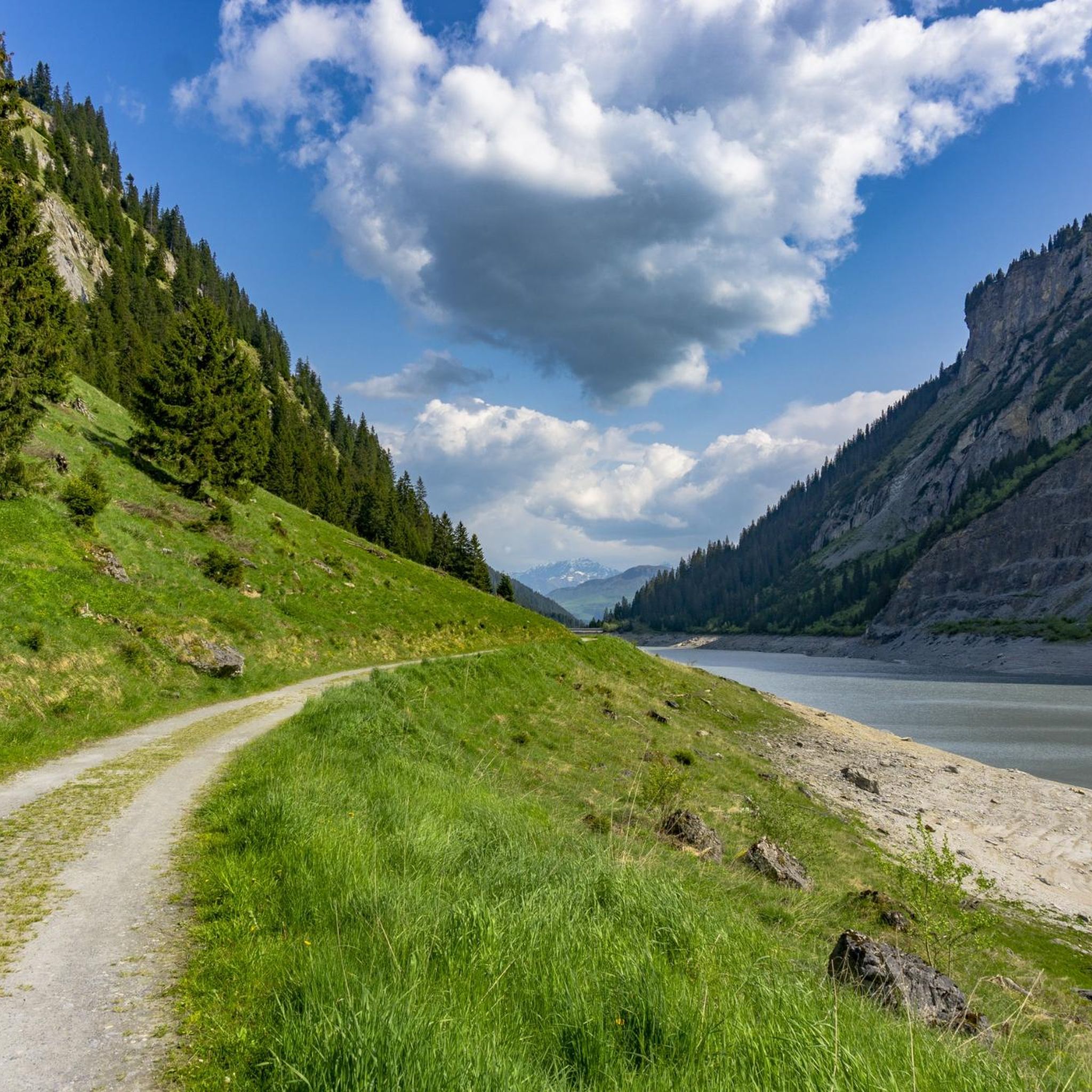
The Lag da Breil, or Brigelsersee in German, lies at around 1,255 m above sea level, directly above Brigels. The lake, approximately 500 meters long and up to 140 meters wide, was created as a reservoir in 1946 and is used for energy production. The lake is fed and drained by the Flem river. Despite its function as a reservoir, the Lag da Breil appears very idyllic and blends beautifully into the landscape around Brigels. A pleasant walking path leads all the way around the lake. Important: Swimming is not allowed in the reservoir.
0
0
The Lag da Breil, in German Brigelsersee, lies at around 1,255 m above sea level, directly above Brigels. The lake, approximately 500 meters long and up to 140 meters wide, was created as a reservoir in 1946 and is used for energy production. The Flem feeds and drains the lake. Despite its function as a reservoir, the Lag da Breil appears very idyllic and blends beautifully into the landscape around Brigels. A pleasant walking path leads all the way around the lake. Important: Swimming is not allowed in the reservoir.
0
0
The Lag da Breil, in German Brigelsersee, lies at around 1,255 m above sea level, directly above Brigels. The lake, approximately 500 meters long and up to 140 meters wide, was created as a reservoir in 1946 and is used for energy production. The lake is fed and drained by the Flem. Despite its function as a reservoir, the Lag da Breil appears very idyllic and blends beautifully into the landscape around Brigels. A pleasant walking path leads all the way around the lake. Important: Swimming is not permitted in the reservoir.
0
0

Wonderful gravel section, almost entirely in the forest and very quiet. Nevertheless, easy to ride as there are hardly any climbs.
0
0

The rest of the "Old Town" doesn't need to be seen as it has too many architectural sins.
0
0

easy to drive and scenically spectacular
0
0

The restaurant is located at an altitude of 1,725 meters directly on the winter hiking trail and near the Crest Falla ski lifts. The large sun terrace offers a unique view across the Rhine Valley to the Signina mountain range.
0
0
Frequently Asked Questions
How many touring cycling routes are available in Waltensburg/Vuorz?
There are over 140 touring cycling routes around Waltensburg/Vuorz. These routes cater to various skill levels, including 7 easy, 30 moderate, and 104 difficult options, offering diverse terrain from paved surfaces to unpaved segments.
What kind of landscapes can I expect to see on a touring cycling trip around Waltensburg/Vuorz?
Touring cycling in Waltensburg/Vuorz offers a breathtaking natural environment. You'll encounter expansive forests, verdant mountain pastures, and a captivating mountain panorama featuring majestic peaks like Pez Tumpiv and Bifertenstock. Notable natural features include the picturesque Brigelsersee (Lake Brigels) and a waterfall in Val Frisal.
Are there any routes that offer scenic viewpoints or natural attractions?
Yes, many routes provide stunning vistas and access to natural attractions. For example, the Old Versamer Tobel Bridge – View of the Rhine Gorge loop from Rueun offers views of the Rhine Gorge. You can also explore areas near Lake Brigels, a significant attraction, or ride along the Panoramaweg for wide-ranging views.
What do other touring cyclists enjoy the most about touring cycling in Waltensburg/Vuorz?
The area is highly rated by the komoot community, with an average score of 4.6 stars from over 300 reviews. Touring cyclists often praise the varied terrain, the stunning mountain panoramas, and the well-maintained paths that lead through expansive forests and verdant mountain pastures.
Are there any family-friendly touring cycling routes in the region?
While many routes in Waltensburg/Vuorz are rated as difficult due to significant elevation changes, there are 7 easy routes that might be more suitable for families or those seeking a less strenuous ride. It's always recommended to check the route details for specific elevation profiles and terrain before heading out with children.
What are some cultural or historical points of interest near the cycling routes?
Beyond the natural beauty, you can explore cultural and historical sites. These include Jörgenberg Castle, a medieval castle with a rich history, and the Museum Waltensburger Meister & Arcun ds tradiziun. In nearby Brigels/Breil, the Living Museum Tegia Rasuz offers insights into local life and heritage.
Are there any circular touring cycling routes available?
Yes, many of the touring cycling routes in Waltensburg/Vuorz are designed as loops. For instance, the Cuolm Sura – Alp Nova loop from Meierhof and the Falera – Rheinschwelle loop from Rueun are popular circular options, allowing you to start and end at the same point.
What is the best time of year for touring cycling in Waltensburg/Vuorz?
The region is ideal for touring cycling during the warmer months when the mountain passes are clear of snow. During winter, the area transforms into a snow paradise, making cycling challenging. Summer offers pleasant conditions to enjoy the expansive forests and verdant mountain pastures.
Are there opportunities for wildlife observation along the cycling routes?
Yes, the natural environment of Waltensburg/Vuorz provides opportunities for wildlife observation. The region is known for events like Wildbeobachtung «Röhrende Hirsche» (Roaring Stags Wildlife Observation), offering nature enthusiasts a chance to observe stags in their natural habitat.
Can I find places to eat or drink along the touring cycling routes?
While specific cafes or pubs directly on every route are not detailed, the region has amenities for visitors. For example, the Excursion kiosk at the bathing lake near Lake Brigels is one such spot. The villages themselves, including Waltensburg/Vuorz and nearby Brigels/Breil, offer various dining options.
Are there any long-distance touring cycling routes in the area?
Many routes in Waltensburg/Vuorz are substantial in length, offering a good challenge for long-distance touring cyclists. The Old Versamer Tobel Bridge – View of the Rhine Gorge loop from Rueun, for example, covers over 50 kilometers and involves significant elevation, making it suitable for a longer ride.
What are the typical elevation changes on touring cycling routes in Waltensburg/Vuorz?
Given its location on a high mountain terrace, touring cycling routes in Waltensburg/Vuorz often feature significant elevation changes. Many routes involve ascents and descents of over 900 meters. For instance, the Cuolm Sura – Alp Nova loop from Meierhof has an elevation gain of over 1200 meters.
Most popular routes around Waltensburg/Vuorz
Most popular attractions around Waltensburg/Vuorz

Get inspired with the komoot mobile app


Explore more
Browse the best Cycling routes in other regions.
