The best walks and hikes around Stanfield
4.5
(53)
347
hikers
52
hikes
Hiking trails around Stanfield are characterized by a network of paths winding through rural landscapes, often featuring gentle undulations and open countryside. The region offers a mix of longer routes that explore multiple villages and shorter loops suitable for a leisurely walk. Hikers can expect to encounter varied terrain, including footpaths through fields, quiet lanes, and areas with historical points of interest.
Best hiking trails around Stanfield
- The most popular hiking route is Mileham & Beetley loop from Gressenhall,…
Last updated: September 30, 2026
4.0
(2)
4
hikers
27.1km
06:58
120m
120m
Hard hike. Very good fitness required. Easily-accessible paths. Suitable for all skill levels.
4.5
(2)
16
hikers
Moderate hike. Good fitness required. Easily-accessible paths. Suitable for all skill levels.

3.8
(6)
11
hikers
Moderate hike. Good fitness required. Easily-accessible paths. Suitable for all skill levels.
3.5
(4)
7
hikers
Moderate hike. Good fitness required. Easily-accessible paths. Suitable for all skill levels.
4.0
(3)
12
hikers
10.0km
02:35
50m
50m
Moderate hike. Good fitness required. Easily-accessible paths. Suitable for all skill levels.
Get access to more routes and recommendations from other explorers.
Already have an account?
Our route recommendations are based on thousands of hikes, rides, and runs completed by other people on komoot.
Start today with a free account
Your next adventure awaits.



Tips from the Community

Village with a lovey green with benches alongside the ponds, a village shop and pub, nice rest stop.
0
0
Shaded ford with nice clear water with a good footbridge alternative, but was ridable (at least in April). The trails either side are also pleasant, only a few slippery muddy patches.
0
0

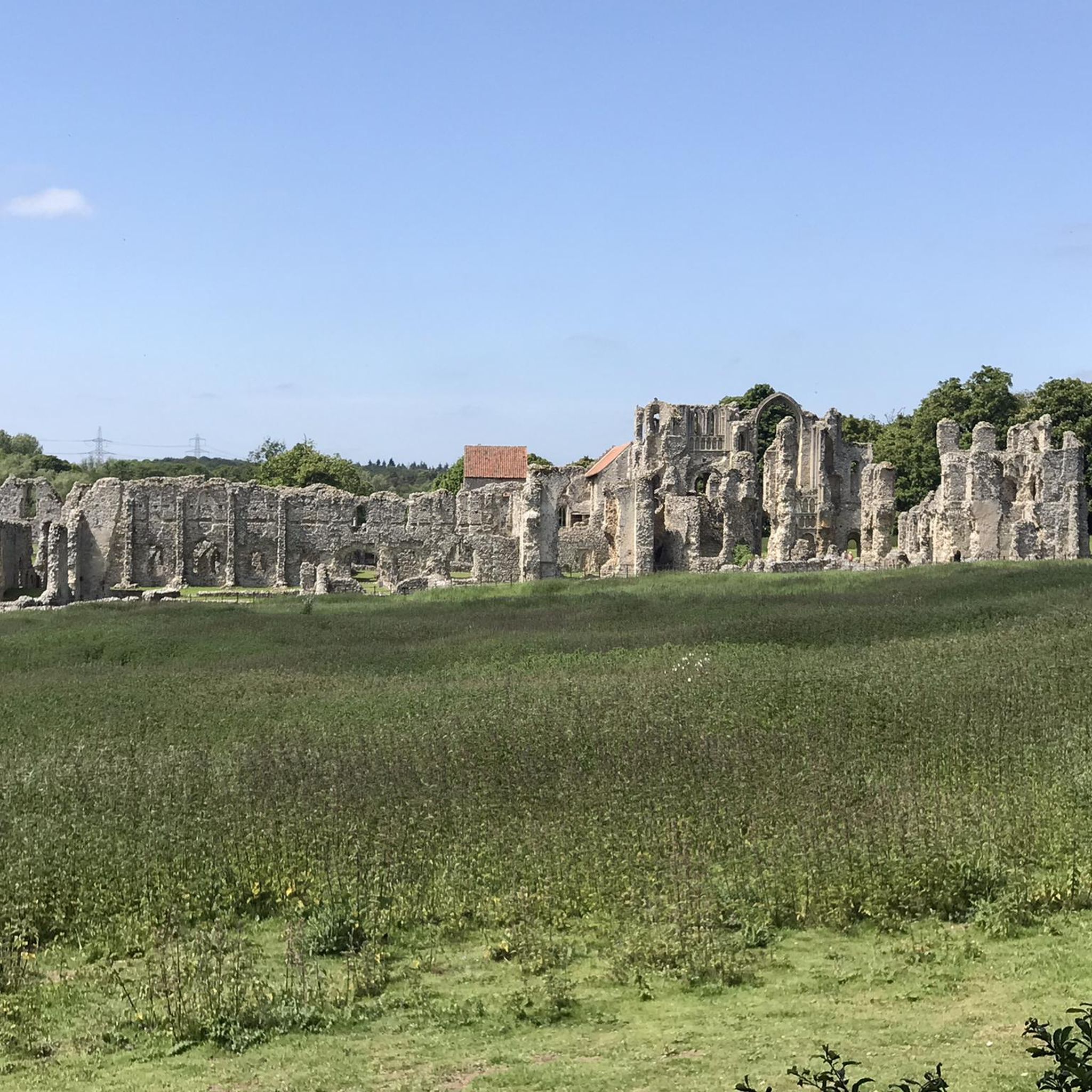
All Saints Church dates from at least the 12th century. Until 1981, the tower was largely complete, having been turned into a folly in the 17th century. Sadly, it suddenly collapsed leaving what we can still see today. The lost medieval village of Godwick is also on this site and is open to the public for free with information boards providing more information about the village streets and buildings that you can see in the landscape. For more details see the website https://www.lostvillageofgodwick.co.uk/
0
1
Until recently, Mileham Castle was covered in undergrowth and forgotten. However, it is the largest motte and bailey castle in Norfolk. Dating from the 12th century, the ruins are open to the public. You can clearly see the layout of the castle from the top of the mound and the moat around its edge.
1
0
Gressenhall Farm and Workhouse is home to the Museum of Norfolk Life, a rare breeds farm and a recreated workhouse. At the farm you can see the very rare Suffolk Punch Horse, a traditional working horse dating of which there are estimated to be only 400 in existence. You have to pay to go in, but there is a short footpath outside with information boards. For further details, see the website https://www.museums.norfolk.gov.uk/gressenhall-farm-and-workhouse
0
0

Frequently Asked Questions
What kind of hiking experience can I expect around Stanfield?
Hiking trails around Stanfield offer a network of paths through rural landscapes, characterized by gentle undulations and open countryside. You'll find a mix of longer routes exploring multiple villages and shorter loops, with varied terrain including footpaths through fields, quiet lanes, and areas with historical interest.
How many hiking trails are available in the Stanfield area?
There are over 50 hiking routes available around Stanfield on komoot, catering to various preferences and fitness levels. These include easy strolls, moderate excursions, and some more challenging long-distance options.
Are there easy hiking options suitable for beginners in Stanfield?
Yes, Stanfield offers plenty of easy hiking options. Approximately half of the available routes are classified as easy, providing pleasant walks with minimal elevation gain, perfect for beginners or a leisurely stroll.
What are some popular moderate hiking trails in Stanfield?
For moderate hikes, you might enjoy the Wildflower Footpath loop from Brisley, which is about 5.5 miles (8.9 km) with minimal elevation. Another popular choice is the Mileham Castle Ruins – Poorly Maintained Footpath loop from Whissonsett, a 7.7-mile (12.4 km) trail through open countryside and historical sites.
Are there any challenging long-distance hikes in Stanfield?
Yes, for those seeking a more challenging experience, the Mileham & Beetley loop from Gressenhall is a notable option. This route spans 16.8 miles (27.1 km) and offers a demanding distance through varied rural scenery.
What do other hikers enjoy most about the trails in Stanfield?
The trails in Stanfield are highly rated by the komoot community, with an average score of 4.5 stars from over 40 reviews. Hikers often praise the varied rural scenery, the quiet village paths, and the gentle ascents that define the region's routes.
Are there any circular hiking routes in Stanfield?
Many of the trails around Stanfield are designed as circular routes, allowing you to start and end in the same location. Examples include the Wildflower Footpath loop from Brisley and the Mileham Castle Ruins – Poorly Maintained Footpath loop from Mileham.
What interesting landmarks or attractions can I see along the hiking trails?
While hiking around Stanfield, you can discover several interesting points. Consider visiting the Godwick Church Tower and Lost Medieval Village for a historical perspective, or the River Wensum Bridge Rest Spot for a scenic break. The area also features natural highlights like Pensthorpe Natural Park.
Are there any cafes or places to eat near the hiking trails in Stanfield?
Yes, you can find places to refuel. For example, the Litcham Deli is a local spot that hikers might find convenient for a break or refreshments.
What is the best time of year to go hiking in Stanfield?
The rural landscapes of Stanfield are enjoyable throughout much of the year. Spring and summer offer lush greenery and wildflowers, while autumn brings vibrant colors. The gentle terrain generally makes it accessible, but always check local conditions, especially during winter, for muddy paths.
Are the hiking trails in Stanfield suitable for families with children?
Many of the easier and moderate routes in Stanfield, particularly those with minimal elevation and through open fields, are suitable for families. The shorter loops provide a great way to enjoy the outdoors with children. Always check the specific route details for distance and terrain to ensure it matches your family's capabilities.
Are dogs allowed on the hiking trails around Stanfield?
Generally, dogs are welcome on many public footpaths and trails in rural areas like Stanfield. However, it's crucial to keep dogs on a lead, especially when passing through fields with livestock or during nesting seasons, and to always clean up after them. Specific rules may vary by landowner or nature reserve, so look for signage.
Is parking available at the trailheads in Stanfield?
Parking availability varies depending on the specific trailhead or starting point. Many routes begin in or near villages which may offer public parking. It's advisable to check the route details on komoot for information on recommended starting points and parking options before you set out.
Most popular attractions around Stanfield

Get inspired with the komoot mobile app


Explore more
Browse the best Hikes in other regions.
