The best mountain hikes around Krieglach
4.8
(22)
506
hikers
17
hikes
Mountaineering routes around Krieglach offer diverse landscapes in the heart of Styria, Austria. The region features significant peaks, extensive trail networks, and picturesque green forests. Mountaineers can explore a range of elevations, from rolling hills to challenging summits like Windberg and Hohe Veitsch. This area provides a varied backdrop for outdoor activities, characterized by its natural formations and scenic views.
Best mountaineering routes around Krieglach
- The most popular mountaineering route is Hohe Veitsch Summit (1,981 m) – Graf-Meran-Haus loop from…
Last updated: October 5, 2026
5.0
(1)
32
hikers
14.4km
06:12
1,080m
1,080m
Hard mountaineering route. Very good fitness required. Sure-footedness, sturdy shoes and alpine experience required.
4.5
(2)
43
hikers
11.8km
05:13
920m
920m
Hard mountaineering route. Very good fitness required. Mostly accessible paths. Sure-footedness required.

4.3
(3)
26
hikers
5.20km
02:01
220m
220m
Hard mountaineering route. Good fitness required. Sure-footedness, sturdy shoes and alpine experience required.
5.0
(2)
20
hikers
13.7km
05:35
900m
910m
Hard mountaineering route. Very good fitness required. Sure-footedness, sturdy shoes and alpine experience required.
5.0
(1)
3
hikers
9.23km
03:42
540m
540m
Moderate mountaineering route. Good fitness required. Mostly accessible paths. Sure-footedness required.
Get access to more routes and recommendations from other explorers.
Already have an account?
Our route recommendations are based on thousands of hikes, rides, and runs completed by other people on komoot.
Start today with a free account
Your next adventure awaits.


Other adventures around Krieglach

Tips from the Community

The Seebodenhütte (1,810 m) is picturesquely situated on the high plateau of the Hohe Veitsch and is a beautiful resting spot on the way to the summit. Around the hut, the landscape opens up, offering wide views over the surrounding mountain world of the Hochsteiermark. After a longer ascent, the hut is an ideal place for a break before continuing across the plateau. The quiet, open landscape, which already has a distinctly alpine character, is particularly beautiful here.
2
0
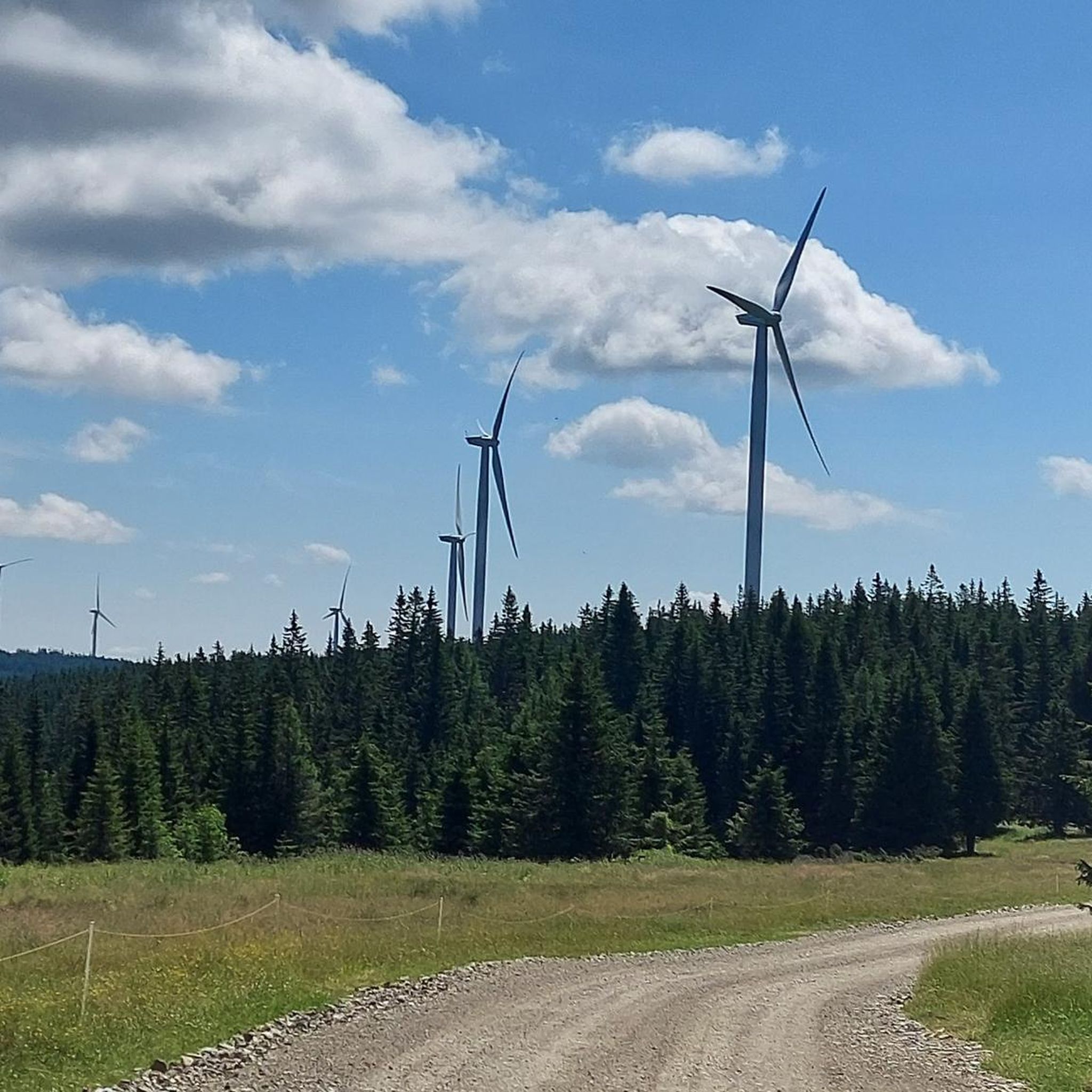
The Hohe Veitsch (1,981 m) is the highest point of the Veitsch massif and a magnificent summit destination in Hochsteiermark. Around the summit cross, the landscape opens up and, with good visibility, the view extends far beyond the surrounding mountains – including towards Hochschwab, Schneealpe, and Rax. Particularly beautiful is the contrast between the wooded ascents and the vast, almost high-alpine landscape on the plateau. A summit where the altitude meters are definitely worth it and where you'll gladly take a longer break.
2
0
The Hohe Veitsch (1,981 m) is the highest point of the Veitsch massif and a great summit destination in the Hochsteiermark region. Around the summit cross, the landscape opens up and, with good visibility, the view extends far over the surrounding mountain world – including towards Hochschwab, Schneealpe, and Rax. The contrast between the wooded ascents and the vast, almost high-alpine landscape on the plateau is particularly beautiful. A summit where the altitude meters are definitely worth it and where you like to take a longer break.
3
0

The summit cross of the Veitsch is easy to climb, technically completely unproblematic. A fantastic all-round view of the neighboring mountain world awaits you. Caution is advised in fog, orientation is very difficult!
1
0
The Seebodenhütte is located in the middle of the Veitsch plateau and is a shepherd's hut. Opening hours in summer only on weekends, however, drinks should also be available on other days. No guarantee of correctness, please always inform yourself.
1
0
From the summit cross, fantastic panoramic view of the surrounding mountains, partly very spectacular
0
0
The plateau is not as flat as the Schneealpe, rather somewhat rugged, with several elevations. In fog, orientation is extremely difficult and quite exposed to the wind. Very beautiful views in all directions and wonderful nature.
0
0

A nice opportunity to seek shelter
3
0
Frequently Asked Questions
How many mountaineering routes can I find around Krieglach?
Krieglach offers a diverse network of over 15 mountaineering routes. These range from moderate trails to more challenging ascents, providing options for various skill levels.
Are there any easy mountaineering routes suitable for beginners in Krieglach?
While many routes in Krieglach are rated moderate to difficult, there are options suitable for beginners. For instance, the region offers trails through alpine pastures like the Falkensteinalm loop from Krampen, which is a shorter, less strenuous option. You'll also find numerous leisurely walks through meadows, forests, and streams.
What are some of the most scenic viewpoints or landmarks I can discover on these routes?
The Krieglach region is rich in natural beauty and interesting landmarks. You can reach the Windberg Summit (Schneealpe), which offers expansive panoramic views across several mountain ranges. Another notable spot is the Große Scheibe Summit Cross, providing wonderful views of the Mürztal valley. Don't miss the legendary Graf-Meran-Haus, a hut often encountered on routes to Hohe Veitsch.
Are there any circular mountaineering routes in the Krieglach area?
Yes, many of the mountaineering routes around Krieglach are designed as loops, allowing you to start and end at the same point. For example, the challenging Hohe Veitsch Summit (1,981 m) – Graf-Meran-Haus loop from Burscher is a popular circular option for experienced mountaineers.
What is the best season for mountaineering in Krieglach?
The region is beautiful year-round, but the best season for mountaineering is typically from late spring to early autumn when the weather is most stable and trails are clear of snow. However, Krieglach also offers opportunities for winter and snowshoe hikes in the colder months.
Are there any dog-friendly mountaineering trails around Krieglach?
Many trails in the Krieglach region are suitable for hiking with dogs, especially those through forests and alpine pastures. Always ensure your dog is on a leash where required, particularly near livestock or in protected areas. It's advisable to check specific route details for any restrictions before you go.
What are the typical durations for mountaineering routes in Krieglach?
The duration of routes varies significantly based on difficulty and distance. Shorter trails, like the Falkensteinalm loop from Krampen, can be completed in about 2 hours. More demanding routes, such as the Graf-Meran-Haus – Hohe Veitsch Summit (1,981 m) loop from Die Gams, can take around 5 hours or more to complete.
Are there places to eat or rest along the mountaineering routes?
Yes, you'll find mountain huts like the Graf-Meran-Haus and the Leopold-Wittmaier Hut along some of the routes, offering refreshments and a place to rest. These huts are great spots to refuel and enjoy the local hospitality.
What do other mountaineers enjoy the most about mountaineering in Krieglach?
The area is highly rated by the komoot community, with an average score of 4.8 stars. Reviewers often praise the diverse landscapes, from picturesque green forests and rolling hills to challenging summits, and the extensive network of well-maintained trails that offer varied experiences.
Are there any family-friendly mountaineering options in Krieglach?
While some routes are challenging, there are also easier paths suitable for families, especially those with older children. Look for trails that are shorter in distance and have less elevation gain, often found in the rolling hills and forest areas. The region's natural ponds and cultural sites like Peter Rosegger's birthplace also offer engaging experiences for families.
Can I access mountaineering routes in Krieglach using public transport?
While some starting points might be accessible by public transport, many mountaineering routes in more remote areas of Krieglach may require private vehicle access. It's best to check local bus schedules and connections to specific trailheads in advance if you plan to rely on public transport.
Where can I find parking for mountaineering routes in Krieglach?
Many popular trailheads and starting points for mountaineering routes, especially those leading to significant peaks or attractions, offer designated parking areas. For example, the Bärenkogelsattel Parking Area is a known spot. It's always a good idea to check the specific route details on komoot for information on parking availability near the trailhead.
Are there any long-distance hiking trails that pass through the Krieglach region?
Yes, Krieglach is part of several significant long-distance hiking routes. The Windberg Summit – Schneealpenhaus loop from Schneealpe is part of a larger network. The region is also traversed by the ZAW 02/East, which crosses the Hochwechsel and Fischbach Alps, and the Alpannonia Austrian-Hungarian route. The Carinthian Mariazellerweg also passes through, connecting Klagenfurt to Mariazell.
Most popular routes around Krieglach
Most popular attractions around Krieglach

Get inspired with the komoot mobile app


Explore more
Browse the best Mountain Hikes & Routes in other regions.
