The best mountain hikes around Forbach
4.7
(77)
244
hikers
27
hikes
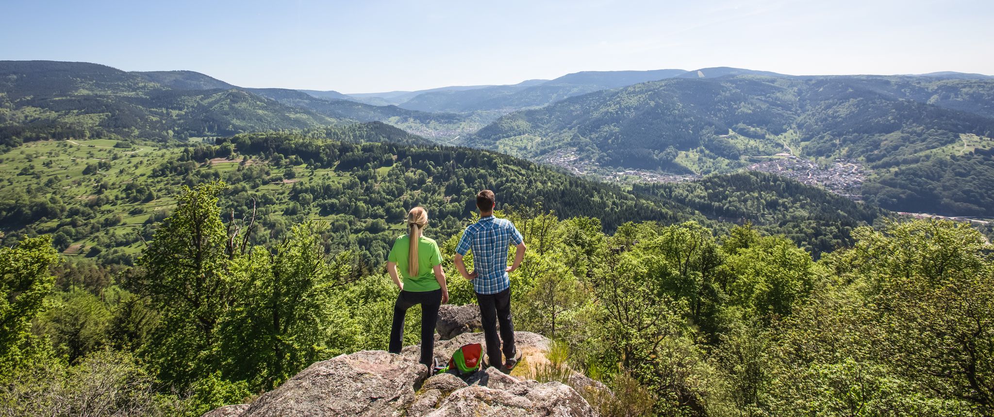
Mountaineering routes around Forbach are primarily found within the Northern Black Forest, characterized by its diverse mountainous terrain and deep valleys. The region features prominent peaks like Hornisgrinde and dramatic ridges such as the Karlsruhe Ridge, which offers alpine-like sections with steep cliffs. Significant elevation changes and unique geological formations define the landscape, providing varied challenges for mountaineers.
Best mountaineering routes around Forbach
- The most popular mountaineering route is Edelfrauengrab Waterfalls – Edelfrauengrab Waterfalls loop from Gottschlägtal - Karlsruher Grat…
Last updated: August 11, 2026
4.7
(30)
77
hikers
Hard mountaineering route. Good fitness required. Sure-footedness, sturdy shoes and alpine experience required.
5.0
(3)
17
hikers
Hard mountaineering route. Good fitness required. Sure-footedness, sturdy shoes and alpine experience required.

Sign up for free
5.0
(6)
16
hikers
Hard mountaineering route. Good fitness required. Sure-footedness, sturdy shoes and alpine experience required.
5.0
(2)
8
hikers
Moderate mountaineering route. Great for any fitness level. Mostly accessible paths. Sure-footedness required.
5.0
(1)
4
hikers
20.7km
07:31
1,190m
1,190m
Hard mountaineering route. Very good fitness required. Sure-footedness, sturdy shoes and alpine experience required.
Get access to more routes and recommendations from other explorers.
Sign up for free
Already have an account?
Our route recommendations are based on thousands of hikes, rides, and runs completed by other people on komoot.
Start today with a free account
Your next adventure awaits.
Login or Signup
Popular around Forbach
Murgleiter Trail – Experience the diverse Murg Valley in 5 stages
Barrier-free hikes in the Black Forest National Park

Coolcation in the Black Forest – hiking and cooling off in summer
Exploring Southern Germany – Karlsruhe to Constance by bike
Deep in the Black Forest - Crossing on the Westweg
Trekking Schwarzwald 8-day tour from Forbach to Alpirsbach
Trekking Black Forest 7-day tour from Forbach to Biberach
Trekking Schwarzwald 6-day tour from Forbach to Gengenbach
Trekking Black Forest 4-day tour to camps Grimbach, Seibelseckle & Erdbeerloch
Trekking in the Black Forest 4-day tour to camps Seibelseckle, Grimbach & Schwarzenbach
Other adventures around Forbach


Tips from the Community

Coming from the west, the first point with a great view and also easily accessible from the west - the difficult sections come further east.
0
0
Schnappsbrunnen with a smaller selection, but certainly lovingly made. Cooling is not done electrically but with cold (spring?) water flowing between the drink crates.
0
0

During the last ice age (approx. 70,000 to 10,000 years ago), the entire Hornisgrinde area was covered by a firn cap, i.e. snow that became denser and more compact due to the pressure of new snow masses and repeated melting and freezing. On the eastern flank of the Hornisgrinde, more snow accumulated in the area of (spring) niches than in the immediate surroundings. Over time, small hanging glaciers formed, which carved out two hollows (cirques) from the Bunter Sandstone cliff: the Kleine and Große Biberkessel. After the ice retreated, a lake formed in both cirques. The lake in the Große Biberkessel has long since silted up, whereas in the Kleine Biberkessel – in a moorland area – a small remnant lake still exists. Like many other silting-up or endorheic lakes in the Black Forest, it is called a "Blindsee" (blind lake).
0
0

During the "Seebach - Hornisgrinde-MTB Panoramatour", here was a welcome opportunity for a refreshing drinking break. The Grinde-Hütte is characterized by its attractive scenic location and a very inviting and friendly area, which also offers gastronomic services.
0
0

a must if you like drinking schnapps
0
0
very nice wide view
1
0

a beautiful place to recharge
0
0

Really beautiful viewpoint, worth the hike
2
0
Frequently Asked Questions
How many mountaineering routes are available around Forbach?
There are over 25 mountaineering routes around Forbach, primarily located in the Northern Black Forest, offering a range of difficulties from moderate to difficult.
What kind of terrain can I expect on mountaineering routes near Forbach?
The mountaineering routes near Forbach are characterized by the diverse and rugged terrain of the Northern Black Forest. You can expect significant elevation changes, deep valleys, and prominent peaks like Hornisgrinde. Dramatic ridges, such as the Karlsruher Grat, feature alpine-like sections with steep cliffs and unique geological formations, including granite.
Are there any routes suitable for beginners or those looking for a less strenuous mountaineering experience?
Yes, while many routes are challenging, there are options for those seeking a more moderate experience. For example, the Bismarck Tower on Hornisgrinde – Mummelsee loop from Hornisgrinde-Biberkessel is a moderate 2.7-mile path that offers panoramic views without extreme difficulty.
What natural landmarks or viewpoints can I discover along the routes?
The region is rich in natural landmarks. You can explore the stunning Edelfrauengrab Waterfalls, the glacial Mummelsee, and enjoy panoramic views from the Bismarck Tower on Hornisgrinde. The Hornisgrinde Tower also offers extensive views across the Northern Black Forest.
Are there any circular mountaineering routes available?
Yes, many of the mountaineering routes around Forbach are designed as circular tours. A popular option is the Hornisgrinde Summit – Mummelsee loop from Unterstmatt, which is a moderate 12.9 km trail.
What is the best time of year for mountaineering in this region?
The best time for mountaineering around Forbach is typically from late spring through early autumn (May to October) when the weather is generally stable and trails are clear of snow. Summer offers lush landscapes, while autumn provides vibrant foliage. Winter mountaineering is possible but requires appropriate gear and experience due to snow and ice conditions, especially at higher elevations.
Are the mountaineering routes around Forbach suitable for families?
While many mountaineering routes can be challenging, some are suitable for families with older children who are accustomed to hiking. Look for routes described as 'moderate' and check their distance and elevation gain. The area also offers other family-friendly activities like the Ecopark Adventures Forbach for tree-climbing.
Can I bring my dog on the mountaineering trails?
Generally, dogs are welcome on trails in the Black Forest region, but it's crucial to keep them on a leash, especially in nature reserves, near wildlife, or in areas with livestock. Always check local signage for specific rules and be prepared to carry out waste.
What do other mountaineers enjoy most about the routes in Forbach?
The mountaineering routes around Forbach are highly rated by the komoot community, with an average score of 4.8 stars. Reviewers often praise the diverse mountainous terrain, the dramatic ridges, and the stunning natural features like glacial lakes and waterfalls. The challenging sections and panoramic views are frequently highlighted as favorite aspects.
Are there any cafes or places to eat near the mountaineering routes?
Yes, you'll find various options for refreshments. For instance, the Seibelseckle Rest Hut is a highlight near some mountain passes, offering a place to stop. The areas around popular spots like Mummelsee also have cafes and restaurants.
Where can I find parking for the mountaineering trailheads?
Parking is generally available at popular trailheads and attractions. For routes starting near Mummelsee or Hornisgrinde, designated parking areas are usually provided. It's advisable to check specific route descriptions for detailed parking information.
Are there any routes that feature waterfalls?
Absolutely! The Edelfrauengrab Waterfalls – Edelfrauengrab Waterfalls loop from Gottschlägtal - Karlsruher Grat is a prime example, directly incorporating the beautiful Edelfrauengrab Waterfalls into the experience. You can also find the Gaishöll Waterfalls and All Saints Waterfalls in nearby gorges.
Most popular routes around Forbach
Most popular attractions around Forbach

Get inspired with the komoot mobile app


Explore more
Browse the best Mountain Hikes & Routes in other regions.
