The best walks and hikes around Carravindoon
4.6
(121)
732
hikers
23
hikes
Hiking around Carravindoon, located on Rathlin Island in Northern Ireland, offers routes through rugged coastal scenery and diverse natural features. The island is characterized by prehistoric volcanic basalt formations overlying Cretaceous-aged limestone, with imposing cliffs reaching up to 70 meters. Its distinctive "L" shape spans four miles from east to west, with the highest point being Slieveard, a hill at 134 meters above sea level. This landscape provides varied terrain for outdoor activities.
Best hiking trails around Carravindoon
- The most…
Last updated: June 25, 2026
4.7
(26)
154
hikers
7.76km
02:10
150m
150m
Moderate hike. Good fitness required. Easily-accessible paths. Suitable for all skill levels.
4.5
(22)
111
hikers
9.18km
02:28
80m
80m
Moderate hike. Good fitness required. Mostly accessible paths. Sure-footedness required.

Sign up for free
4.5
(22)
106
hikers
13.7km
03:44
200m
200m
Moderate hike. Good fitness required. Mostly accessible paths. Sure-footedness required.
3.0
(1)
10
hikers
23.3km
06:19
280m
280m
Hard hike. Very good fitness required. Mostly accessible paths. Sure-footedness required.
4.8
(10)
66
hikers
3.57km
01:00
70m
70m
Easy hike. Great for any fitness level. Easily-accessible paths. Suitable for all skill levels.
Get access to more routes and recommendations from other explorers.
Sign up for free
Already have an account?
Our route recommendations are based on thousands of hikes, rides, and runs completed by other people on komoot.
Start today with a free account
Your next adventure awaits.
Login or Signup
Popular around Carravindoon
Tips from the Community

One of the real classic seacliff climbing areas with decades of histors and the tradiitonal climbing meet-up on the first weekend in June.
1
0

Close to Northern Ireland's most northerly point, Fair Head has brilliant views of Scotland and Rathlin Island. Stunning on a clear day, fearsome when the weather sets in!
3
0

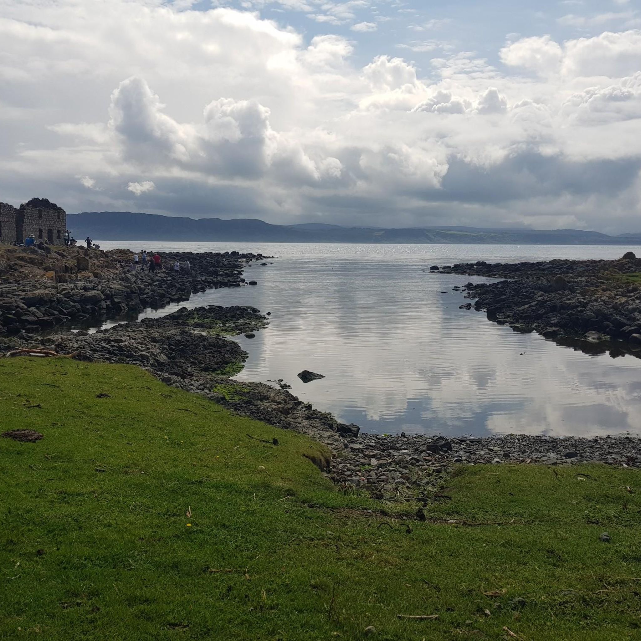
This is an excellent lookout point to view the east leg of Rathlin, Rathlin harbour and across to the Northern Ireland coast. There are two large picnic tables here, and it's easily accessible for families with kids.
2
0
From here, you can enjoy fantastic views of the beautiful Rathlin Island, located off the northeast coast of Ireland (and Ireland's most northern point).
4
0

Rathlin Island, an island between Ireland and Scotland, can only be reached by sailors within a narrow time window, outside of which it gets bumpy because of the races and overfalls. About 100 people live here, some of whom we met yesterday in the pub. If you want to move here, you have to accept a poll and a vote from those who already live here, I don't know whether that will take place in the pub or the church.
2
0

Accessible by ferry from Ballycastle.
1
2
Fair Head is a cliff top approximately 3 miles long and 200m high with sweeping views of Ballycastle.
2
0
Magnificent view of one of the two lakes with wonderful colors.
1
0
Frequently Asked Questions
How many hiking trails are available in Carravindoon?
Carravindoon, on Rathlin Island, offers a diverse network of over 20 hiking trails. These routes cater to various interests and fitness levels, allowing you to explore the island's unique landscapes.
What is the best time of year to go hiking on Rathlin Island?
The best time to visit Rathlin Island for hiking is generally from late April to early August. During this period, you can witness the island's internationally significant seabird colonies, including puffins, at their peak breeding season. The weather is also typically milder, making for more enjoyable walks.
Are there family-friendly hiking options around Carravindoon?
Yes, Rathlin Island offers several routes suitable for families. For an easier walk, consider the View of Ballycastle – View of Rathlin Island loop from Cross, which is just over 3.5 km long and takes about an hour to complete. These trails provide a great way to experience the island's beauty with children.
Can I bring my dog on the hiking trails?
While Rathlin Island is a haven for wildlife, it's important to keep dogs under strict control, especially during nesting seasons for seabirds and around livestock. Some areas, particularly nature reserves, may have specific restrictions. Always check local signage and consider keeping your dog on a lead to protect the island's unique ecosystem.
What kind of terrain can I expect on the hikes?
Hiking around Carravindoon means encountering a variety of rugged and dramatic terrain. You'll find routes traversing imposing cliffs, some reaching 70 meters high, as well as rich meadows, heathland, and boggy mosses. The island's prehistoric volcanic origin means you'll also see distinctive basalt formations.
Are there any circular hiking routes?
Yes, many of the trails on Rathlin Island are designed as circular routes, offering varied scenery without retracing your steps. For example, the Fairhead Loch Na Crannóige Walk — Antrim Coast & Glens is a popular loop that provides excellent views.
What wildlife can I expect to see while hiking?
Rathlin Island is a wildlife enthusiast's dream. Along the trails, especially near the coast, you can spot tens of thousands of seabirds like puffins, guillemots, and razorbills. Keep an eye out for seals lounging in Mill Bay, Irish hares, and if you're lucky, even minke whales in the surrounding waters.
What interesting landmarks or attractions can I visit near the hiking trails?
Rathlin Island is rich in natural and historical attractions. You can visit the unique RSPB West Light Seabird Centre, known as Ireland's only 'upside-down' lighthouse, to observe seabirds. Other notable sites include Kinbane Castle and the Kelp House, offering glimpses into the island's past.
How do I get to Rathlin Island, and is there public transport or parking?
Rathlin Island is accessible by ferry from Ballycastle on the mainland. While on the island, exploration is encouraged on foot or by bicycle, with bike hire available. For ferry schedules and parking information on the mainland, it's best to consult the official ferry operator's website.
What do other hikers enjoy most about hiking in Carravindoon?
The hiking routes around Carravindoon are highly rated by the komoot community, with an average score of 4.5 stars from over 100 reviews. Hikers often praise the dramatic coastal scenery, the opportunity to spot diverse wildlife, and the varied terrain that makes each walk a unique experience.
Are there any trails suitable for beginners?
Yes, there are easy trails perfect for beginners. For instance, the View of Ballycastle – View of Rathlin Island loop from Cross is an easy 3.5 km hike, offering a gentle introduction to the island's beauty. There are 10 easy routes in total, providing accessible options for those new to hiking.
Where can I find food, drinks, or accommodation on Rathlin Island?
Rathlin Island has limited but welcoming facilities. You'll find a few cafes, pubs, and accommodation options, primarily concentrated around the harbour area. It's advisable to book accommodation in advance, especially during peak season, due to the island's small size.
What are the unique geological features of Rathlin Island?
Rathlin Island's geology is quite distinctive, being primarily of prehistoric volcanic origin. This results in impressive basalt formations, which overlay Cretaceous-aged Ulster White Limestone containing belemnite fossils. The island's imposing cliffs, some 70 meters tall, are a direct result of these geological processes.
Most popular routes around Carravindoon
Most popular attractions around Carravindoon

Get inspired with the komoot mobile app


Explore more
Browse the best Hikes in other regions.
