The best running trails around Obergriesbach
4.5
(303)
6,554
runners
465
runs
Jogging routes around Obergriesbach are set amidst rolling hills, extensive woodlands, and lush green meadows, offering diverse and scenic running experiences. Located west of Augsburg, the region features varied terrain with gentle inclines and shaded paths. The landscape is characterized by open fields and the nearby Lech River, providing picturesque views for runners. This natural setting makes Obergriesbach well-suited for outdoor activities, particularly running.
Best jogging routes around Obergriesbach
- The most popular jogging route is Blumenthal Castle – Blumenthal Castle Beer Garden loop from Gallenbach, a 7.6 miles (12.1 km) trail that takes 1 hour 16 minutes to complete. This route passes by the historic Blumenthal Castle, offering scenic views.
- Another top favourite among local runners is Old Bavarian Oxen Trail loop from Dasing, a moderate 6.3 miles (10.1 km) path. This trail winds through traditional Bavarian landscapes, showcasing the region's rural charm.
- Local runners also love the View of Marienplatz, Friedberg – Marienbrunnen Friedberg loop from Haberskirch, a 14.1 miles (22.7 km) trail leading through areas with historic town views, often completed in about 2 hours 22 minutes.
- Jogging around Obergriesbach is defined by rolling hills, extensive woodlands, and lush meadows. The network of running routes offers options for various ability levels, from relaxed runs to more challenging paths.
- The routes in Obergriesbach are highly rated by the komoot community with an average score of 4.5 stars from over 300 reviews. More than 6000 runners have used komoot to explore Obergriesbach's varied terrain.
Last updated: July 11, 2026
23
runners
Moderate run. Good fitness required. Mostly paved surfaces. Suitable for all skill levels.
12
runners
Moderate run. Good fitness required. Mostly paved surfaces. Suitable for all skill levels.

Sign up for free
10
runners
Moderate run. Good fitness required. Mostly paved surfaces. Suitable for all skill levels.
9
runners
6.40km
00:40
30m
30m
Moderate run. Good fitness required. Mostly paved surfaces. Suitable for all skill levels.
7
runners
5.86km
00:36
10m
10m
Moderate run. Good fitness required. Mostly paved surfaces. Suitable for all skill levels.
Get access to more routes and recommendations from other explorers.
Sign up for free
Already have an account?
Our route recommendations are based on thousands of hikes, rides, and runs completed by other people on komoot.
Start today with a free account
Your next adventure awaits.
Login or Signup

Tips from the Community

The Teutonic Knights likely acquired the manor of Blumenthal around 1254 and managed it through a commandery. It was first documented in 1296 under the name "Blümenthal." Even at this early stage, Blumenthal received lower jurisdiction from the Duke of Bavaria. It initially served as a commandery (leading commandery) of the Order within the Franconian bailiwick of the Teutonic Order, and after the Aichach commandery was abandoned in 1396, it became the headquarters of the commanders (heads of the commandery). In 1405, the castle received the right to operate a tavern from Duke Stephen III of Bavaria-Ingolstadt. ...
1
0


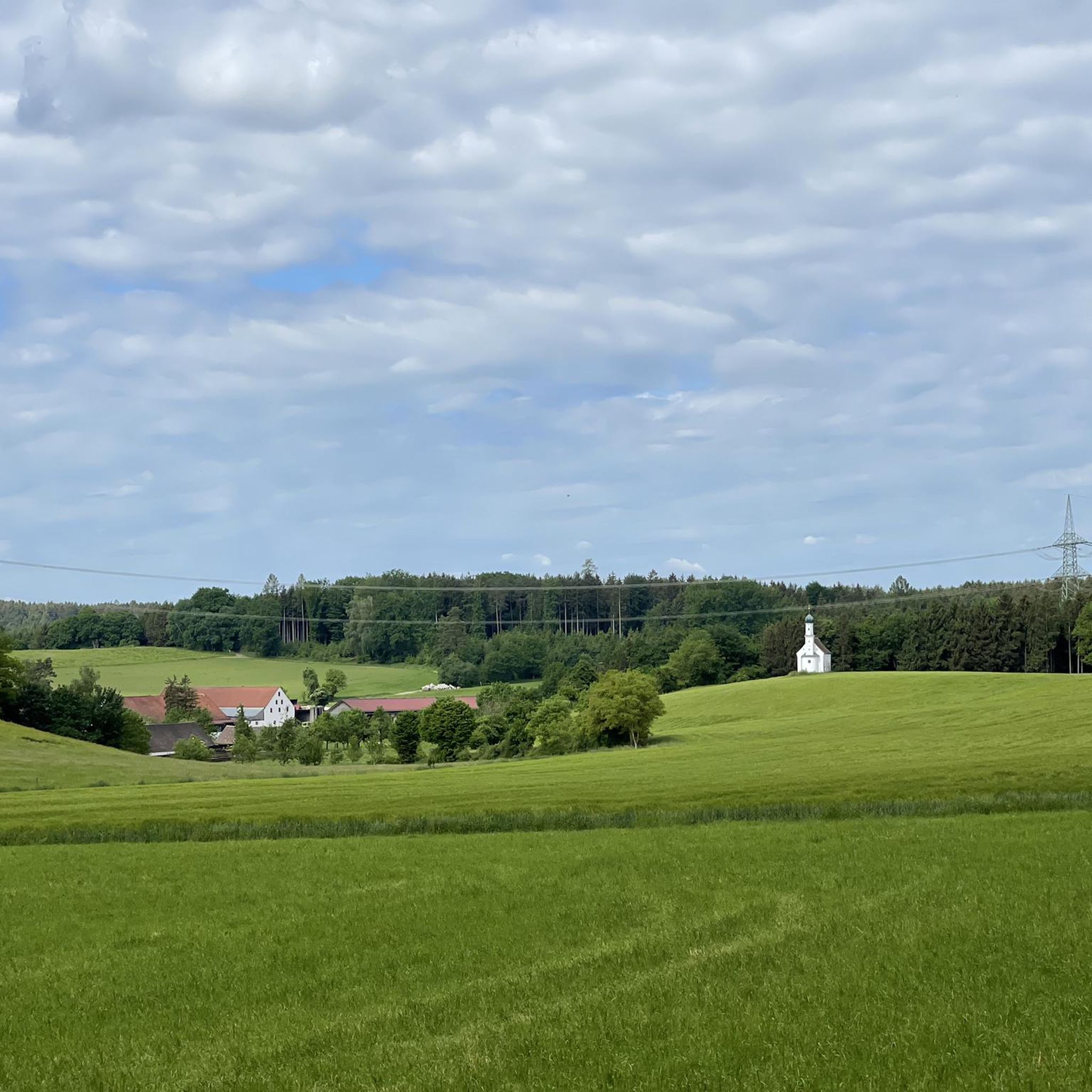
A site worth seeing, which is currently home to 47 adults and 29 children... and has four cars of its own.
7
0
Every second Saturday you can take a guided tour with tasting in the cheese factory.
6
0

The geographical center of the Aichach-Friedberg district is located near the town of Zahling, a district of the municipality of Obergriesbach. This point is in the so-called Wittelsbacher Land, a region known for its historical significance and scenic beauty. For hiking enthusiasts, the district center circular trail is ideal, which leads through the municipalities of Obergriesbach, Griesbeckerzell, Edenried and Zahling. This approximately 11.5 kilometer long circular trail starts at the sports field in Obergriesbach and leads along numerous sights, including historic churches and picturesque landscapes. The parish church of St. Stephan in Obergriesbach, for example, houses valuable gravestones from the time of the noble Weichs family. In Zahling, the parish church of St. Gregory the Great can be visited, which was built in 1778 with the support of the Counts of Thurn and Taxis. This circular trail not only offers insights into the region's cultural treasures, but also the opportunity to experience the scenic diversity of the Aichach-Friedberg district. The well-signposted trails and the proximity to the villages make it an ideal destination for hikers and those interested in culture.
1
0
The Schlossgut Blumenthal, a remarkable complex with a brewery building and the baroque castle chapel of St. Mary, dates back to the Teutonic Order. Today, the renovated castle complex houses a hotel, conference and event rooms, as well as restaurants, a solidarity farm with a farm shop and a cheese dairy.
1
0
The center of the district is marked with a memorial stone. It was determined by the specialty innkeepers in the Wittelsbacher Land.
2
0

Frequently Asked Questions
How many running routes are available around Obergriesbach?
There are over 450 running routes around Obergriesbach, offering a wide variety of options for all skill levels. The komoot community has mapped 67 easy, 348 moderate, and 37 difficult trails for you to explore.
What kind of terrain can I expect on jogging routes in Obergriesbach?
Jogging routes in Obergriesbach feature a diverse landscape of rolling hills, extensive woodlands, and lush green meadows. You'll find varied inclines and shaded paths, as well as open fields and picturesque views along the Lech River, providing a stimulating environment for runners.
Are there any family-friendly running paths in Obergriesbach?
Yes, Obergriesbach offers several routes suitable for families. Many of the easy and moderate trails wind through meadows and forests, providing a pleasant and safe environment for a family run. While specific family-friendly routes aren't highlighted by name, the region's generally gentle terrain makes it ideal for all ages.
Can I bring my dog on the running trails in Obergriesbach?
Obergriesbach's natural surroundings, with its extensive woodlands and open fields, are generally welcoming for dogs. While specific rules may vary by trail section or protected area, it's always recommended to keep your dog on a leash, especially near wildlife or other trail users, and to clean up after them.
What are some notable landmarks or natural features I might see while running in Obergriesbach?
Many routes offer scenic views and pass by interesting sights. For example, the Blumenthal Castle – Blumenthal Castle Beer Garden loop from Gallenbach takes you past the historic Blumenthal Castle. You might also encounter natural features like the Fish ladder on the Lech or the Paardurchbruch (Paar River Gorge) on other trails.
Are there any circular running routes in the Obergriesbach area?
Yes, many of the running routes around Obergriesbach are designed as loops, allowing you to start and finish at the same point. Examples include the popular Old Bavarian Oxen Trail loop from Dasing and the Derchinger Forst loop from Abschnittsbefestigung im Taitinger Holz, which are both moderate-difficulty circular trails.
What is the best time of year for jogging in Obergriesbach?
Obergriesbach offers beautiful running conditions throughout the year. The natural surroundings transform with the seasons, from blossoming orchards in spring to vibrant foliage in autumn, providing a fresh and engaging backdrop. Summer offers lush green landscapes, while winter can provide serene, snow-dusted trails, though conditions may require appropriate gear.
How long are the running routes around Obergriesbach typically?
The running routes vary significantly in length. You can find shorter, easier paths for a quick jog, or longer, more challenging trails. For instance, the Blumenthal Castle – Blumenthal Castle Beer Garden loop from Gallenbach is about 12.1 km (7.6 miles), while the View of Marienplatz, Friedberg – Marienbrunnen Friedberg loop from Haberskirch is a longer 22.7 km (14.1 miles) route.
What do other runners enjoy most about jogging in Obergriesbach?
The running routes in Obergriesbach are highly rated by the komoot community, with an average score of 4.5 stars from over 300 reviews. Runners often praise the varied terrain, the picturesque views of rolling hills and forests, and the peaceful atmosphere that makes for an enjoyable outdoor experience.
Are there any places to eat or drink near the running trails in Obergriesbach?
Yes, you can find options for refreshments. For example, the Blumenthal Castle – Blumenthal Castle Beer Garden loop from Gallenbach specifically mentions the Blumenthal Castle Beer Garden, offering a convenient stop for a post-run meal or drink. The region's villages also provide local cafes and pubs.
What are the difficulty levels of the running trails in Obergriesbach?
The trails around Obergriesbach cater to all fitness levels. You'll find a good mix of easy, moderate, and difficult routes. There are 67 easy routes for beginners or relaxed jogs, 348 moderate routes for those seeking a bit more challenge, and 37 difficult routes for experienced runners looking for a demanding workout with more elevation.
Is public transport available to access running routes in Obergriesbach?
While Obergriesbach is well-suited for outdoor activities, specific public transport links directly to trailheads may vary. It's advisable to check local bus or train schedules for connections to Obergriesbach or nearby towns like Dasing or Friedberg, from where many routes begin. Parking is generally available near popular starting points.
Most popular routes around Obergriesbach
Most popular attractions around Obergriesbach

Get inspired with the komoot mobile app


Explore more
Browse the best Running Trails & Routes in other regions.
