The best running trails around Kempter Wald
4.4
(930)
21,166
runners
517
runs
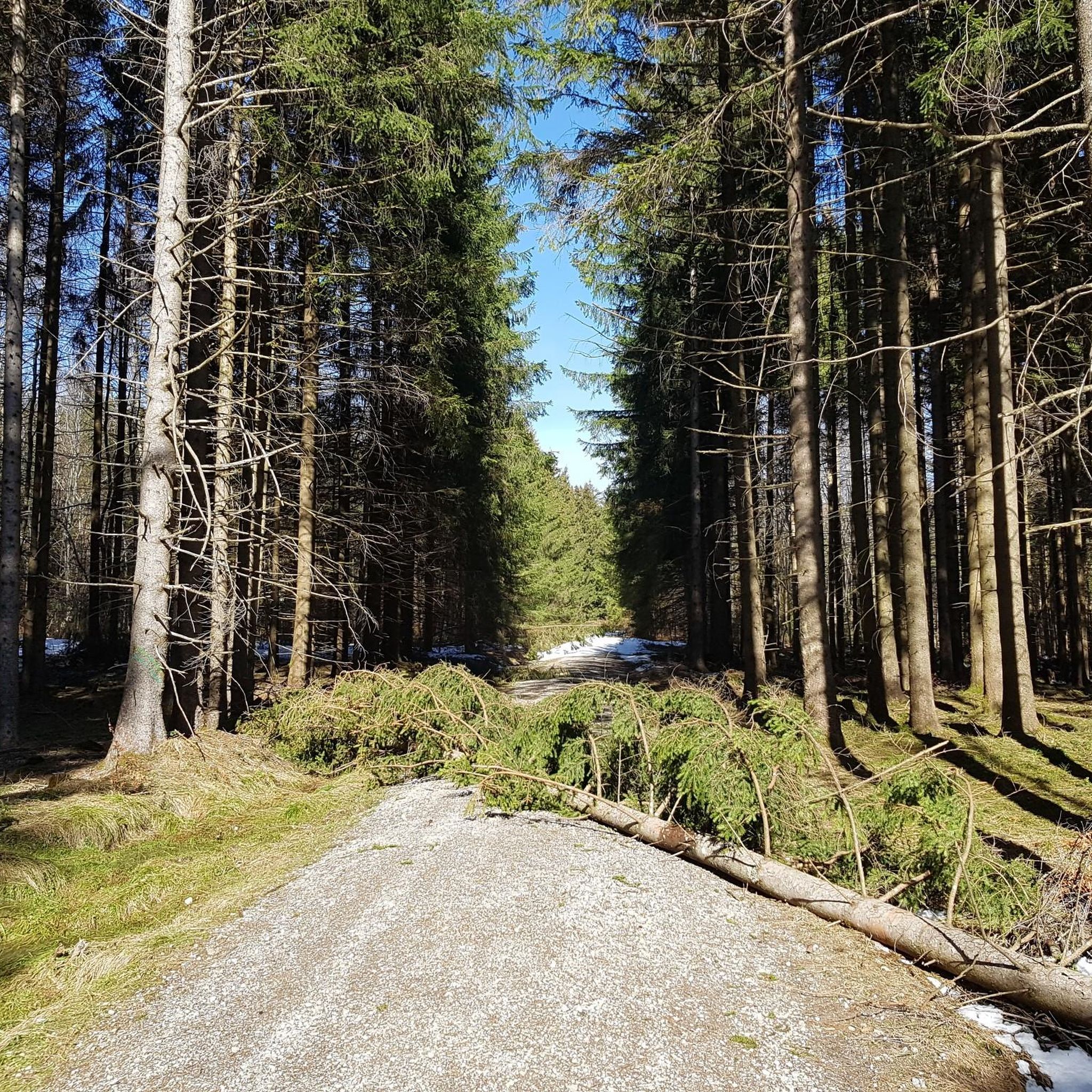
Jogging routes around Kempter Wald offer a diverse range of terrains within the scenic Allgäu region. The area is characterized by extensive forest cover, providing a natural and often shaded environment for running. Routes vary from pleasant, slightly hilly paths on firm surfaces to more challenging sections with steeper gradients. Water features like nearby rivers and streams contribute to the natural landscape, enhancing the outdoor experience.
Best jogging routes around Kempter Wald
- The most popular jogging route is Schönberg Castle…
Last updated: September 29, 2026
16
runners
11.1km
01:09
100m
100m
Moderate run. Good fitness required. Mostly paved surfaces. Suitable for all skill levels.
31
runners
4.89km
00:31
50m
50m
Easy run. Great for any fitness level. Mostly paved surfaces. Suitable for all skill levels.

5.0
(1)
23
runners
4.98km
00:31
50m
50m
Easy run. Great for any fitness level. Mostly paved surfaces. Suitable for all skill levels.
5.0
(1)
9
runners
Moderate run. Good fitness required. Mostly paved surfaces. Suitable for all skill levels.
9
runners
7.37km
00:49
100m
100m
Moderate run. Good fitness required. Mostly paved surfaces. Suitable for all skill levels.
Get access to more routes and recommendations from other explorers.
Already have an account?
Our route recommendations are based on thousands of hikes, rides, and runs completed by other people on komoot.
Start today with a free account
Your next adventure awaits.
Tips from the Community

In Schönberg there is still the "Hildegardis-Eiche". There is a plaque, don't ask me about the text, I unfortunately forgot it.
0
0
You can still stay at Pension Mittelallgäu, but they have stopped operating the restaurant.
0
0
I'm always looking for chapels or churches, but I missed this one; the cattle must have fled. I think the short route is nice, even though it's on tarmac. The forest loop around the Notzenweiher pond is great.
0
0

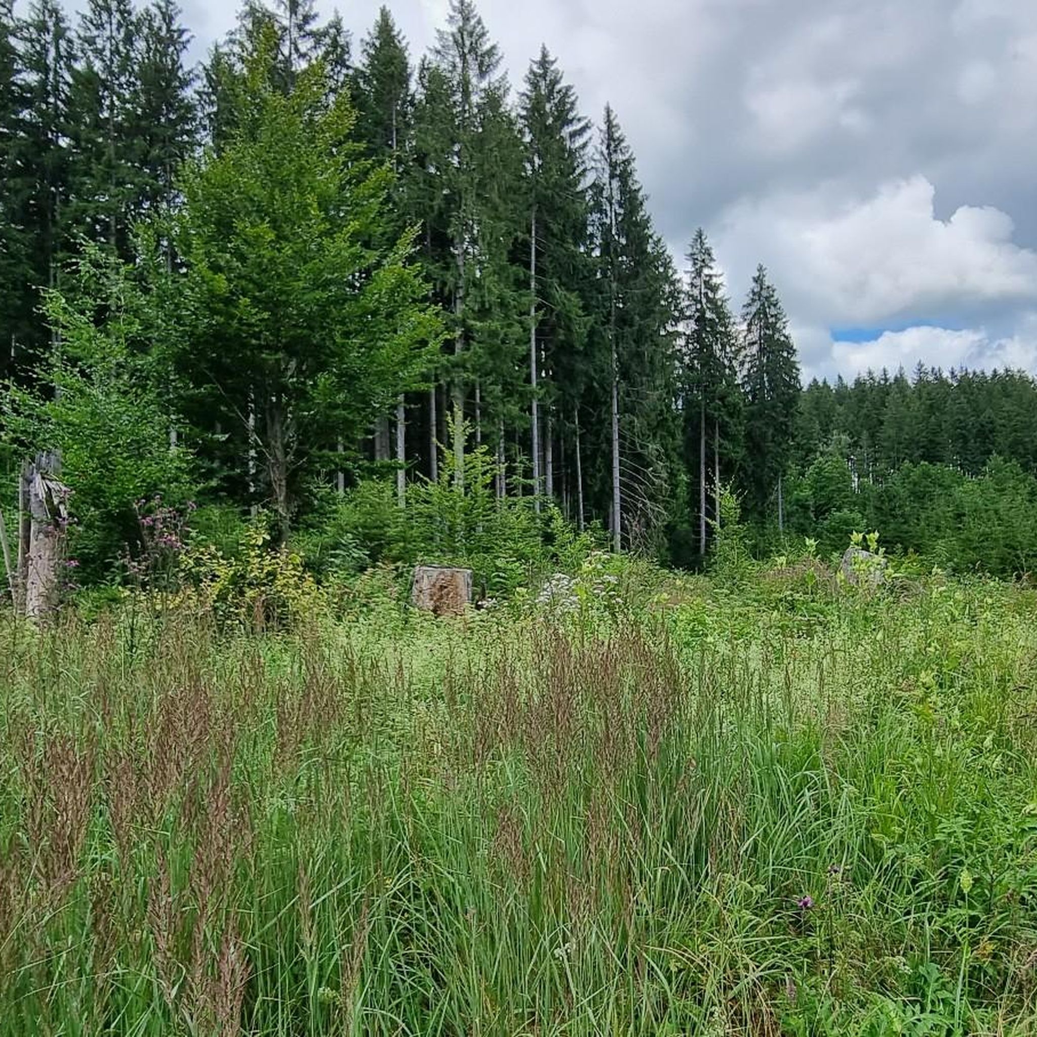
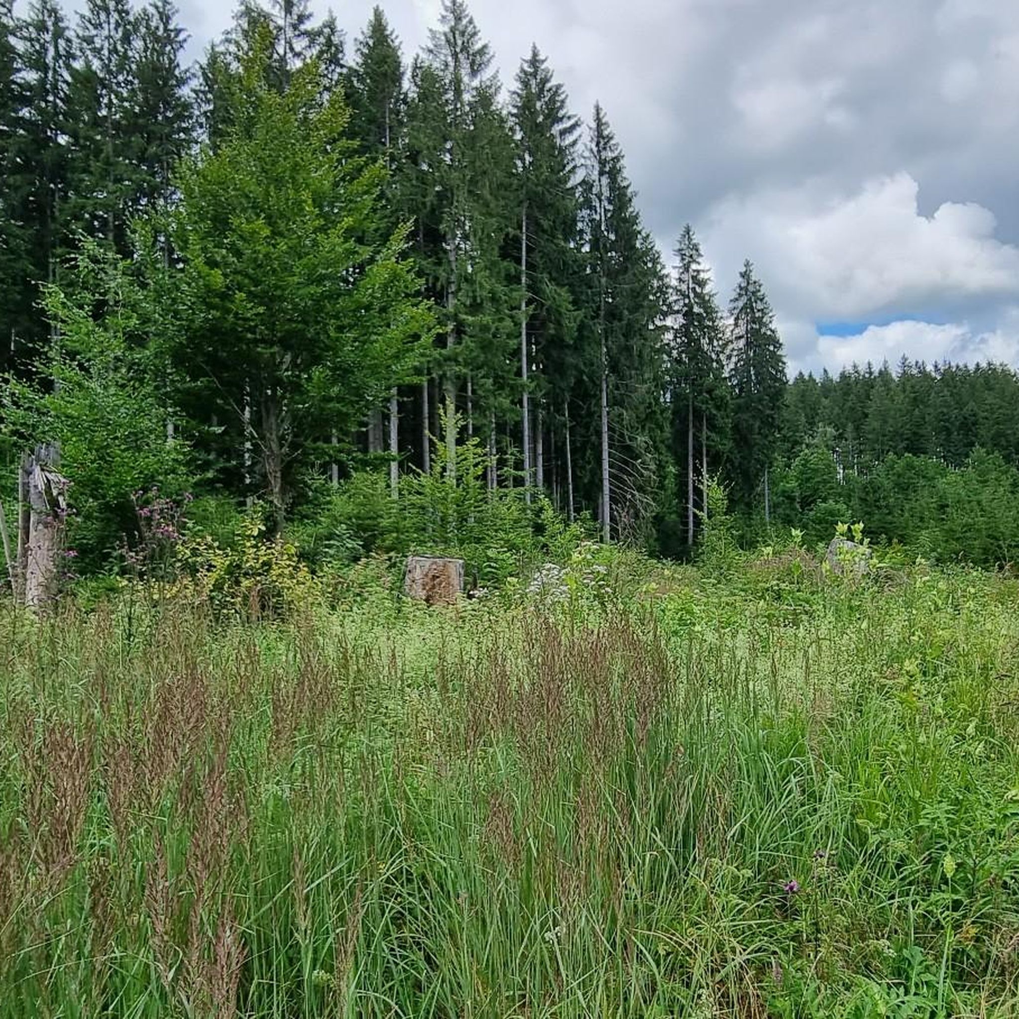
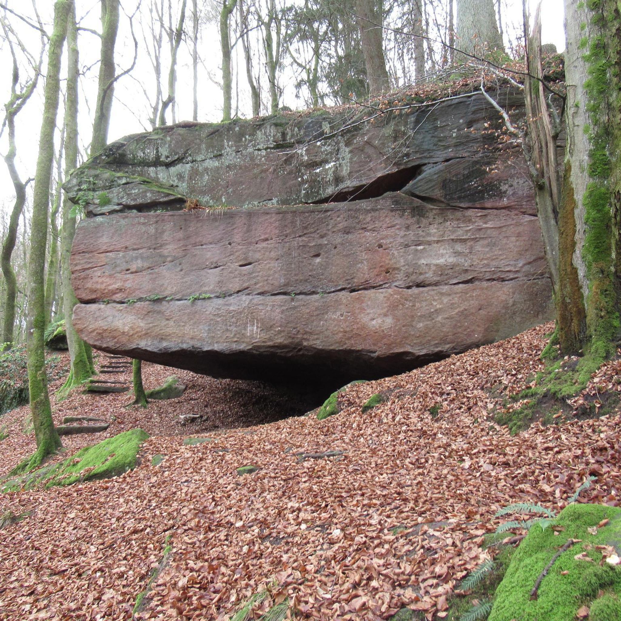
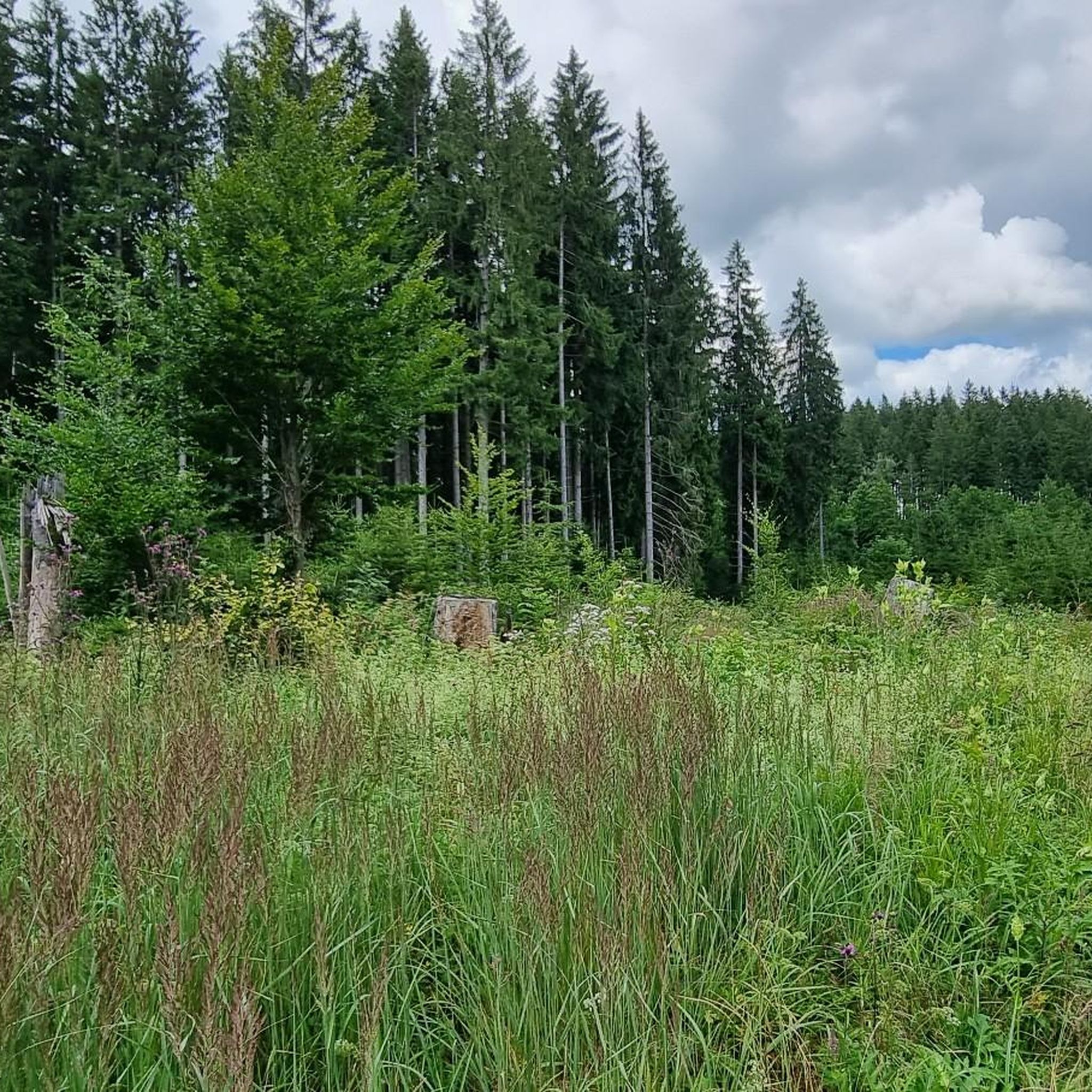
The Kempter Forest (also Kempten Forest) is a large forest area east of Kempten (Allgäu) in the districts of Ober- and Ostallgäu. The Kempter Forest reaches heights of up to approx. 960 m above sea level south of Hauptmannsgreut and near Bodelsberg. The Kempter Forest is part of the pre-alpine Allgäu moor and hill landscape, which was shaped during the last ice age. One of the largest boulder collections in the entire Northern Alps dates from this period, with over 4000 boulders, the largest of which (Dengelstein, Beichelstein, Baltenstein, the Stein) reaching impressive sizes of over 3000 m³ and 20 m in diameter. The forest is the source of several streams and small rivers (e.g. the Kirnach and the Durach), whose waters then flow into the Iller or the Wertach. The Swabian-Allgäu hiking trail leading from Augsburg to Lake Constance (also a section of the Munich Way of St. James) crosses the Kempter Forest. It leads past the forest chapel, built in 1938, which stands in the middle of the forest. Excerpt from: WIKIPEDIA, accessed April 15, 2020
4
0

Nice place with a view of the Ammer Mountains
0
0

These beautiful cattle can also be admired in Unterhalden.
1
0

Very nice chapel in the Kempten forest. Nice to pause for a moment. Sometimes caution is advised, the gravel road is often used by cars as a racetrack and you get extremely dusty. The dust can then be washed down in the Alpe flour block 4 km away 😉
3
0

An oasis of peace and quiet in the middle of the forest!
3
0
Frequently Asked Questions
How many running routes are available in Kempter Wald?
Kempter Wald offers a wide selection of over 460 running routes. These trails cater to various fitness levels, with 77 easy routes, 343 moderate routes, and 46 more challenging options.
What kind of terrain can I expect on the jogging trails in Kempter Wald?
The terrain in Kempter Wald is quite varied. You'll find pleasant, slightly hilly paths, often on firm surfaces away from traffic, ideal for a relaxed run. For those seeking more of a challenge, there are also routes with steeper gradients and potentially muddy sections, especially near water features. The extensive forest cover provides a natural and often shaded environment.
Are there any running routes that are particularly suitable for families or beginners?
Yes, Kempter Wald has 77 easy running routes that are great for families or beginners. One popular easy option is the Schönberg Castle Ruins loop from Burgruine Schöneberg, which is 3.1 miles (5.0 km) long and offers views of the historic castle ruins.
Can I bring my dog on the running trails in Kempter Wald?
While specific leash rules can vary, the Allgäu region, including Kempter Wald, generally welcomes dogs on trails. It's always best to keep your dog on a leash, especially in forested areas or near wildlife, and to be mindful of other trail users. Many routes are suitable for running with a dog.
Are there any circular running routes in Kempter Wald?
Yes, many of the running routes in Kempter Wald are designed as circular loops, allowing you to start and finish at the same point. Examples include the Schönberg Castle Ruins loop from Rockhöflings and the View of the Ammergebirge – Forest chapel in the Kempter Forest loop from Hochgreut.
What interesting natural features or landmarks can I see while running in Kempter Wald?
While running in and around Kempter Wald, you can encounter various natural features and landmarks. The region is known for its dense forests and green spaces. Nearby attractions include impressive waterfalls like the Waterfall trail Nesselwang and the Geratser Waterfall. Some routes also offer views of the Ammergebirge mountains.
What do other runners enjoy most about the trails in Kempter Wald?
The running routes in Kempter Wald are highly rated by the komoot community, with an average score of 4.4 stars from over 700 reviews. Runners frequently praise the diverse terrain, the serene forest environment, and the scenic views of the surrounding Allgäu region. Over 17,000 runners have used komoot to explore these trails.
Are there any routes that offer views of the Ammergebirge mountains?
Yes, some routes provide scenic views of the Ammergebirge. A notable example is the View of the Ammergebirge – Forest chapel in the Kempter Forest loop from Hochgreut, which is a 5.1-mile (8.2 km) trail leading through dense forest and offering these mountain vistas.
Is there parking available near the trailheads in Kempter Wald?
While specific parking information for every trailhead isn't detailed here, many popular running routes in the Kempter Wald region, especially those starting from villages or specific points like Burgruine Schöneberg or Hochgreut, typically have designated parking areas nearby. It's advisable to check the individual route details on komoot for precise parking locations.
What is the best time of year for running in Kempter Wald?
Kempter Wald is enjoyable for running throughout much of the year. The dense forests provide shade in summer, making it pleasant even on warmer days. Spring and autumn offer vibrant colors and comfortable temperatures. While winter running is possible, be prepared for potentially snowy or icy conditions on some trails, especially those with steeper sections.
Are there any longer running routes for experienced runners?
Yes, for experienced runners looking for longer distances, there are routes like the Running loop from Bodelsberg, which covers 6.0 miles (9.6 km) with moderate difficulty. You can also combine shorter loops or explore the 46 difficult routes available for a more challenging experience.
Are there any facilities like cafes or pubs near the running trails?
While the focus of Kempter Wald is its natural environment, the broader Allgäu region is well-equipped with amenities. For specific cafes, pubs, or accommodation near trailheads, it's best to consult local guides or maps for the villages surrounding Kempter Wald. For general tourist information about the nearby city of Kempten, you can visit kempten-tourismus.de.
Most popular routes around Kempter Wald
Most popular attractions around Kempter Wald

Get inspired with the komoot mobile app


Explore more
Browse the best Running Trails & Routes in other regions.
