The best MTB trails around Moneydorragh More Upper
4.2
(10)
112
riders
2
rides
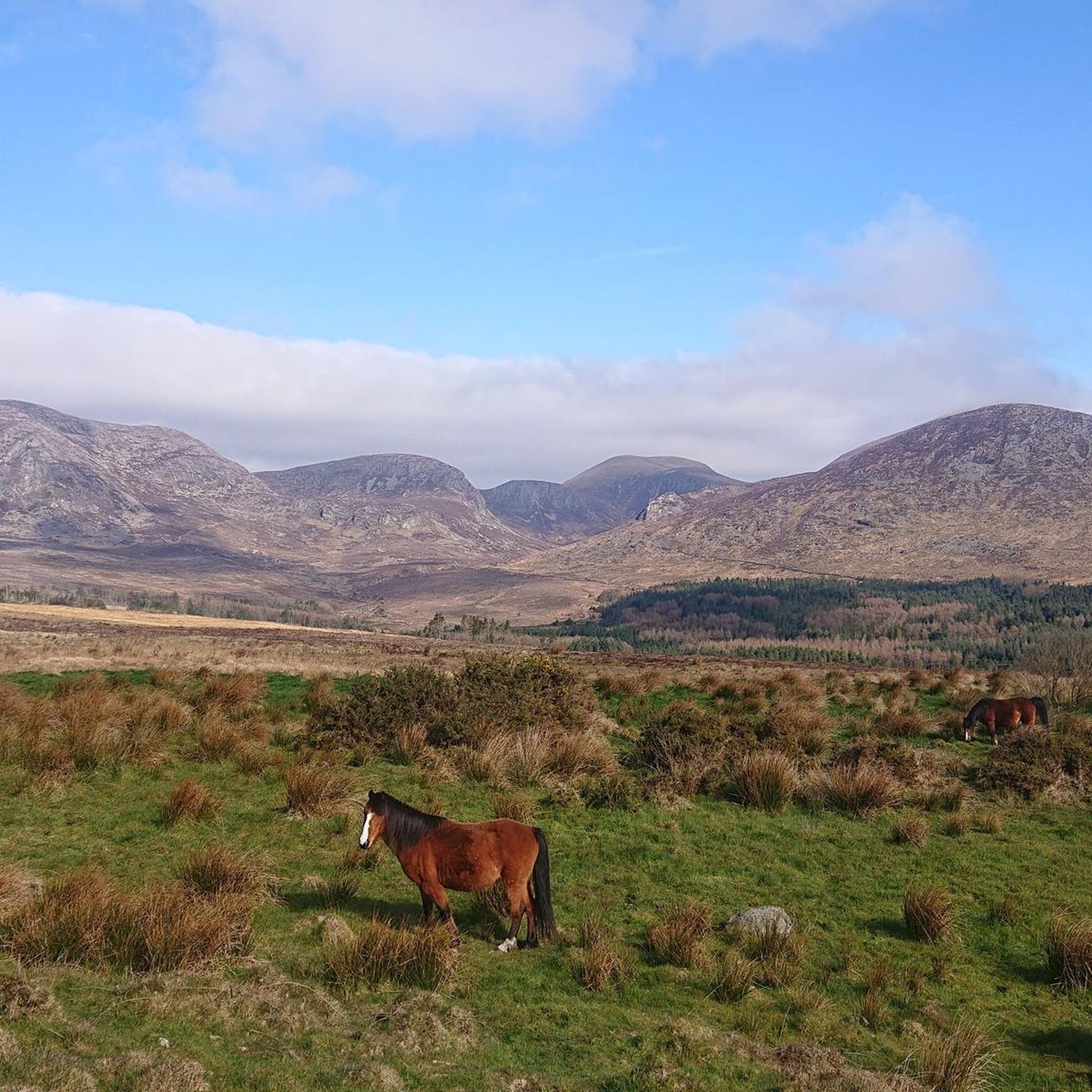
Mountain bike trails around Moneydorragh More Upper are situated within County Down, Northern Ireland, offering access to the rugged terrain of the Mourne Mountains. The landscape is characterized by mountainous features, dense vegetation, and varied underfoot conditions, providing diverse off-road experiences. This area serves as a gateway to the High Mournes, with elevated views and natural beauty. The region's natural environment is conducive to mountain biking, featuring both challenging climbs and descents.
Best mountain bike trails around Moneydorragh More Upper
- The most popular mountain bike trail is Castlewellan MTB Trails and Newcastle Way Loop, a 17.9 miles (28.8 km) trail that takes 2 hours 8 minutes to complete. This route offers a moderate challenge through varied forest and open landscapes.
- Another top favourite among local mountain bikers is Thomas's Quarry and Waterfall – Newcastle Harbour loop from Newcastle, an easy 7.9 miles (12.7 km) path. This trail features coastal views and passes by natural landmarks.
- Local mountain bikers also love the Tollymore Forest Park – Donard Park Waterfall loop from Bryansford, a 25.2 miles (40.5 km) trail leading through dense forest and mountainous terrain, often completed in about 3 hours 25 minutes.
- Mountain biking around Moneydorragh More Upper is defined by mountainous terrain, dense woodlands, and open moorland. The network offers options for different ability levels, from easy loops to more challenging ascents.
- The routes in Moneydorragh More Upper are highly rated by the komoot community with an average score of 4.2 stars from over 7 reviews. More than 100 mountain bikers have used komoot to explore Moneydorragh More Upper's varied terrain.
Last updated: September 30, 2026
3.0
(1)
8
riders
28.8km
02:08
360m
360m
Moderate mountain bike ride. Good fitness required. Suitable for all skill levels.
5.0
(1)
28
riders
31.9km
02:40
490m
490m
Moderate mountain bike ride. Good fitness required. Suitable for all skill levels.

15
riders
12.7km
01:09
300m
300m
Easy mountain bike ride. Great for any fitness level. Suitable for all skill levels.
4.5
(8)
12
riders
41.7km
03:31
860m
860m
Hard mountain bike ride. Good fitness required. Advanced riding skills necessary. Some portions of the route may require you to push your bike.
6
riders
10.5km
01:04
290m
290m
Easy mountain bike ride. Great for any fitness level. Suitable for all skill levels.
Our route recommendations are based on thousands of hikes, rides, and runs completed by other people on komoot.
Start today with a free account
Your next adventure awaits.
Other adventures around Moneydorragh More Upper

Tips from the Community

FACEBOOK (History of Newcastle, Co. Down, Hore's Bridge, 2026-08-15): https://www.facebook.com/HistoryofNewcastleCo.Down/photos/hores-bridge-over-the-spinkwee-river-sw-tollymore-was-built-in-1824-the-date-is-/754755631362196/ “… Hore's Bridge over the Spinkwee River, SW Tollymore, was built in 1824. …”
1
0
The stepping stones are currently fenced off. Please use the nearby bridges to cross the Shimna River.
2
0
Wikipedia (Tollymore Forest Park, 2026-08-14): https://en.m.wikipedia.org/wiki/Tollymore_Forest_Park “... Parnell Bridge, named in recognition of Sir John Parnell who visited Tollymore in the late 18th century, was constructed in 1842. It was the last stone bridge to be built in Tollymore. …”
2
0
Wikipedia (Tollymore Forest Park, 2026-08-14): https://en.m.wikipedia.org/wiki/Tollymore_Forest_Park “... The Hermitage is a small stone shelter designed by James Hamilton (2nd Earl of Clanbrassil) in the 1770s in memory to his friend the John Montagu, Marquess of Monthermer. It is built into the side of the gorge above the river and was used as a place for ladies to shelter while the men fished. There is an inscription in Greek within the Hermitage which translates as "Clanbrassil, to his very dear friend Monthermer 1770". …”
2
0
Wikipedia (Tollymore Forest Park, 2026-08-14): https://en.m.wikipedia.org/wiki/Tollymore_Forest_Park “... Horn Bridge crosses a small culverted burn (stream) and is crossed by a gravel road. The burn below the bridge is covered with a board walk connected to a path. It was built c.1770 by either the 1st or 2nd Earl. ...”
1
0

The park has no entry fee, you only have to pay 5 £ for parking.
1
0

Easy route no special gear required. Very scenic
0
0

The small, historic port provides a charming setting with views of the Mourne Mountains and the sea. The promenade is well maintained and is great for a relaxing cruise along the coast. However, it can get quite busy in good weather and at weekends, which can slow down the journey. A highlight is the proximity to Murlough National Nature Reserve, which is just a few kilometers away and is ideal for further exploration. Note, however, that some sections of the promenade can be slippery when wet, so care must be taken.
1
0
Frequently Asked Questions
How many mountain bike trails are available around Moneydorragh More Upper?
There are several mountain bike trails in the broader area around Moneydorragh More Upper, offering diverse experiences. The komoot community has documented over 5 routes in this region.
What kind of terrain can I expect when mountain biking around Moneydorragh More Upper?
The terrain around Moneydorragh More Upper is characterized by mountainous features, dense vegetation, and varied underfoot conditions, reflecting its position as a gateway to the High Mournes. You can expect rugged landscapes, challenging climbs, and exciting descents, with opportunities for both forest and open moorland riding.
Are there mountain bike trails suitable for beginners?
Yes, there are options for beginners. For example, the Thomas's Quarry and Waterfall – Newcastle Harbour loop from Newcastle is an easy 7.9-mile (12.7 km) path that features coastal views and passes by natural landmarks, making it a good choice for those starting out.
Are there challenging mountain bike trails for experienced riders?
Yes, experienced riders will find challenging routes. The area offers trails with significant elevation gain and technical sections. For instance, the Tollymore Forest Park – Donard Park Waterfall loop from Bryansford is a difficult 25.2-mile (40.5 km) trail leading through dense forest and mountainous terrain, often completed in about 3 hours 25 minutes.
What natural landmarks or viewpoints can I see along the mountain bike trails?
The region offers stunning natural beauty. You might encounter landmarks such as the Slieve Bearnagh viewpoint or the Summit of Slieve Donard. The Hare's Gap is another notable trail feature. Additionally, the Silent Valley Reservoir and Blue Lough offer scenic waterside views.
Are there any circular mountain bike routes in the area?
Many of the mountain bike routes in the region are designed as loops, allowing you to start and finish in the same location. Examples include the Castlewellan MTB Trails and Newcastle Way Loop and the Bannanstown Road Climb – Tollymore Forest Park loop from Bryansford.
What is the best time of year to go mountain biking in Moneydorragh More Upper?
The Mourne Mountains region, including Moneydorragh More Upper, is beautiful year-round. However, spring and autumn often provide the most pleasant conditions with milder temperatures and vibrant scenery. Summer can be great, but be prepared for more visitors. Winter riding is possible but requires appropriate gear for potentially wet and colder conditions.
What do other mountain bikers enjoy the most about mountain biking in Moneydorragh More Upper?
The area is highly rated by the komoot community, with an average score of 4.2 stars from over 7 reviews. Riders often praise the diverse terrain, from dense forests to open moorland, and the rewarding elevated views of the Mourne Mountains.
Are there any longer mountain bike routes for endurance rides?
Yes, for those looking for longer rides, the Tollymore Forest Park – Donard Park Waterfall loop from Bryansford covers 25.2 miles (40.5 km). Another substantial option is the Castlewellan MTB Trails and Newcastle Way Loop, which is 17.9 miles (28.8 km) long.
Where can I find waterfalls along the mountain bike trails?
The region is known for its natural beauty, including waterfalls. The Thomas's Quarry and Waterfall – Newcastle Harbour loop from Newcastle specifically highlights a waterfall as a feature along its route. The Tollymore Forest Park – Donard Park Waterfall loop from Bryansford also passes by a waterfall.
Are there any routes that offer coastal views?
Yes, given the region's proximity to the Irish Sea, some routes offer coastal vistas. The Thomas's Quarry and Waterfall – Newcastle Harbour loop from Newcastle is an easy trail that features scenic coastal views as part of its journey.
Most popular routes around Moneydorragh More Upper
Most popular attractions around Moneydorragh More Upper

Get inspired with the komoot mobile app


Explore more
Browse the best MTB trails in other regions.
