The best walks and hikes around Dunnaman
4.4
(449)
3,446
hikers
27
hikes
Hiking around Dunnaman offers a diverse landscape characterized by granite mountains, rolling hills, and scenic reservoirs. The region features a mix of challenging mountain trails and gentler paths through valleys and along waterways. Hikers can expect varied terrain, from rocky ascents to more even tracks, often with expansive views of the surrounding countryside.
Best hiking trails around Dunnaman
- The most popular hiking route is Mourne Wall Challenge — Mourne, a 21.6 miles (34.7 km) trail that takes 12 hours…
Last updated: July 10, 2026
4.5
(2)
32
hikers
34.7km
12:53
2,220m
2,230m
The Mourne Wall Challenge offers a highly demanding hiking experience through Northern Ireland's Mourne Mountains. This difficult route spans 21.6 miles (34.7 km) and involves an impressive 7300 feet (2225…
5
hikers
5.95km
01:55
260m
260m
Hike Wee Binnian in the Mourne Mountains for an easy 3.7-mile route with panoramic views and a glimpse into quarry history.

Sign up for free
4.5
(12)
194
hikers
Moderate hike. Good fitness required. Easily-accessible paths. Suitable for all skill levels.
4.1
(12)
69
hikers
12.6km
04:26
640m
640m
Moderate hike. Good fitness required. Easily-accessible paths. Suitable for all skill levels.
4.9
(16)
82
hikers
7.29km
01:56
70m
70m
Easy hike. Great for any fitness level. Easily-accessible paths. Suitable for all skill levels.
Get access to more routes and recommendations from other explorers.
Sign up for free
Already have an account?
Our route recommendations are based on thousands of hikes, rides, and runs completed by other people on komoot.
Start today with a free account
Your next adventure awaits.
Login or Signup
Popular around Dunnaman

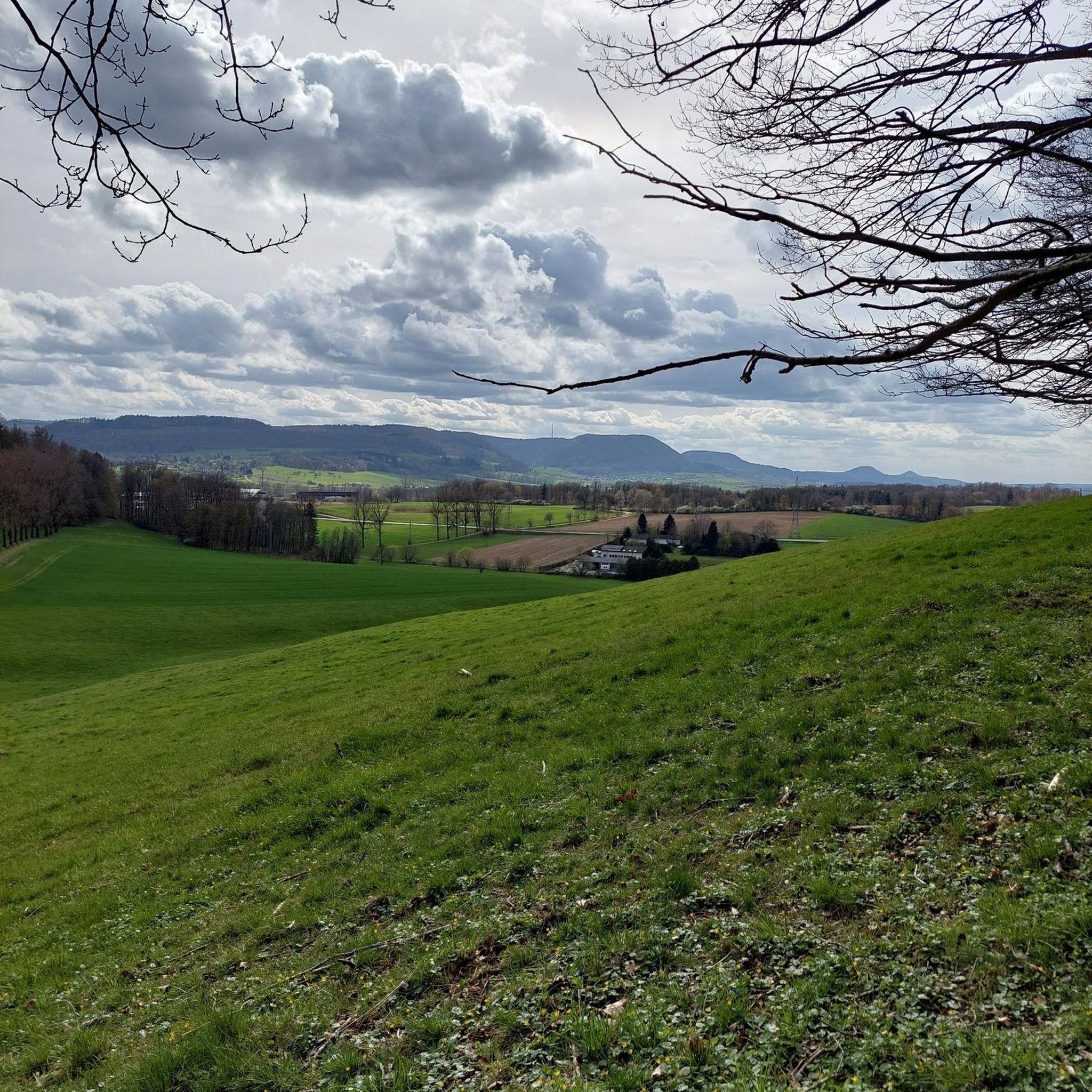

Tips from the Community

Slieve Binnian is absolute magic. Standing as the third-highest peak in Northern Ireland (747 meters), it easily claims the title for the most dramatic silhouette in the Mournes, thanks to the massive, weathered granite towers—called tors—that guard its summit. https://www.expresstollpass.com
0
0

The Binnian Tunnel (2.5 miles long) was constructed between 1947 and 1950/51 and is located under the Mourne Mountains in County Down, Northern Ireland. The main purpose of the tunnel is to divert water from the Annalong Valley to the Silent Valley Reservoir underneath Slieve Binnian, after which the tunnel was named.
0
0
The tunnel diverts the waters of the Annalong Valley catchment area into this reservoir and was opened on 28th August 1952
0
0

Hare's Gap is a dramatic mountain pass nestled in the heart of the Mourne Mountains. This striking pass, situated between Slieve Bearnagh and Slievenaglogh, offers hikers a blend of natural beauty and historical intrigue. From this vantage point, hikers are treated to panoramic views of the surrounding peaks and valleys. The pass itself is historically significant, having once served as a route for smuggling goods across the mountains, adding a layer of intrigue to the hike. Hare's Gap is a popular starting point for various hikes, including ascents of Slieve Bearnagh and Slieve Meelmore.
2
0
Starting from Carrick Little Car Park, the hiking path to Slieve Binnian offers a rewarding journey through the heart of the Mourne Mountains. This moderate to challenging loop, approximately 11.2 km in length, follows the Mourne Wall, a historic dry-stone structure built in the early 1900s, guiding hikers toward the summit of Slieve Binnian (747 m). The ascent is steady, with a mix of rocky terrain and scenic views. As you approach the summit, the path becomes more rugged, leading to the iconic South and North Tors. From the summit, panoramic vistas unfold, offering breathtaking views of the Silent Valley and the surrounding peaks.
1
0
The Duck Pond feels like a calm secret waiting to be discovered. Recommended by hikers and tucked into a protected area, it’s a gentle spot where water glimmers among reeds and mountains frame the quiet mirror below.
1
0
Reaching the summit of Slieve Meelbeg (716 m) feels like discovering a quiet treasure in the Mourne Mountains. From the top, you’re greeted by sweeping views of Slieve Bearnagh and Slieve Donard, their rugged forms unfolding across the horizon. The climb isn’t overly technical, making it accessible to many hikers.
1
0
Hare’s Gap is one of the most iconic passes in the Mourne Mountains, marked by its rugged stile and dramatic views that open up across the range. Once a historic smuggling route, it remains a natural gateway into the high Mournes, with steep paths and striking rock formations framing the way. From here, the landscape unfolds in every direction, making it a perfect spot to pause, take in the scenery, and appreciate the wild beauty of these mountains.
4
0
Frequently Asked Questions
How many hiking trails are available around Dunnaman?
Dunnaman offers a diverse network of over 25 hiking trails, catering to various skill levels. You'll find everything from challenging mountain ascents to more accessible valley walks.
Are there easy hiking trails suitable for beginners in Dunnaman?
Yes, Dunnaman features 8 easy hiking trails perfect for beginners or those seeking a relaxed walk. A popular choice is Wee Binnian, an accessible 3.7-mile (6.0 km) climb that still offers rewarding views of the surrounding mountains.
What are some family-friendly hiking routes in Dunnaman?
Many of the easier trails are suitable for families. The Cows in Mourne AONB – Stone Bridge in Mourne AONB loop from Kilkeel is an easy 4.5-mile (7.3 km) route with minimal elevation, making it a pleasant option for families.
Are there any circular walks around Dunnaman?
Yes, Dunnaman has several circular routes. A notable one is the Silent Valley Reservoir – Silent Valley Reservoir Road loop from Kilkeel River, a 6.5-mile (10.4 km) moderate trail that takes you through the serene Silent Valley.
What kind of views or landmarks can I expect to see on hikes in Dunnaman?
Hiking in Dunnaman offers expansive views of granite mountains, rolling hills, and scenic reservoirs. You can encounter historic stone walls, and highlights like the Silent Valley Reservoir, View of the Mourne Mountains, and Kodak Corner Viewpoint.
What is the best time of year to hike in Dunnaman?
The best time to hike in Dunnaman is generally during the spring, summer, and early autumn months when the weather is milder and the trails are less likely to be wet or icy. However, the region's diverse landscape offers unique experiences year-round, with winter hikes providing a different, often more dramatic, perspective.
Are there any dog-friendly walking routes in Dunnaman?
Many trails in Dunnaman are suitable for dogs, provided they are kept under control, especially around livestock. It's always best to check specific trail regulations before heading out, but generally, the less strenuous routes through valleys and along reservoirs are good options for walks with your canine companion.
What do other hikers enjoy most about hiking in Dunnaman?
The hiking routes in Dunnaman are highly rated by the komoot community, with an average score of 4.4 stars from over 400 reviews. Hikers frequently praise the region's diverse terrain, from challenging mountain paths to tranquil reservoir walks, and the stunning, expansive views of the surrounding countryside.
How long do hikes near Dunnaman typically take?
Hike durations vary significantly depending on the trail's length and difficulty. For example, an easy route like Wee Binnian can be completed in under 2 hours, while the challenging Mourne Wall Challenge — Mourne is a full-day endeavor, taking nearly 13 hours.
Are there any wild swimming spots near Dunnaman walks?
While the region is known for its reservoirs like the Silent Valley Reservoir, these are primarily for water supply and not typically designated for wild swimming. Always check local regulations and safety guidelines before considering any open water for swimming.
What are the parking options for hiking trails in Dunnaman?
Parking availability varies by trailhead. Many popular starting points for trails, especially those leading to major peaks or reservoirs, often have dedicated car parks. For specific routes, it's advisable to check the route details on komoot for information on nearby parking facilities.
Most popular routes around Dunnaman
Most popular attractions around Dunnaman

Get inspired with the komoot mobile app


Explore more
Browse the best Hikes in other regions.
