The best running trails around Mittelstetten
4.5
(302)
4,334
runners
404
runs
Jogging routes around Mittelstetten offer diverse natural landscapes, from tranquil lakeside paths to meandering river trails. The region features well-maintained routes suitable for various fitness levels, including the recreational area around Mandichosee (Lechstaustufe 23). The geological formation of the "Paardurchbruch bei Ottmaring" also provides unique natural scenery for running. These running trails often pass through open fields, forests, and along waterways, providing varied terrain for outdoor exercise.
Best jogging routes around Mittelstetten
- The most popular jogging route is Haspelmoor loop…
Last updated: July 11, 2026
9
runners
10.7km
01:07
50m
50m
Moderate run. Good fitness required. Mostly paved surfaces. Suitable for all skill levels.
9
runners
6.13km
00:38
20m
20m
Moderate run. Good fitness required. Mostly paved surfaces. Suitable for all skill levels.

Sign up for free
4.0
(1)
6
runners
4.93km
00:31
50m
50m
Easy run. Great for any fitness level. Mostly paved surfaces. Suitable for all skill levels.
10
runners
9.92km
01:02
60m
60m
Moderate run. Good fitness required. Mostly paved surfaces. Suitable for all skill levels.
8
runners
3.42km
00:21
20m
20m
Easy run. Great for any fitness level. Mostly paved surfaces. Suitable for all skill levels.
Get access to more routes and recommendations from other explorers.
Sign up for free
Already have an account?
Our route recommendations are based on thousands of hikes, rides, and runs completed by other people on komoot.
Start today with a free account
Your next adventure awaits.
Login or Signup

Tips from the Community

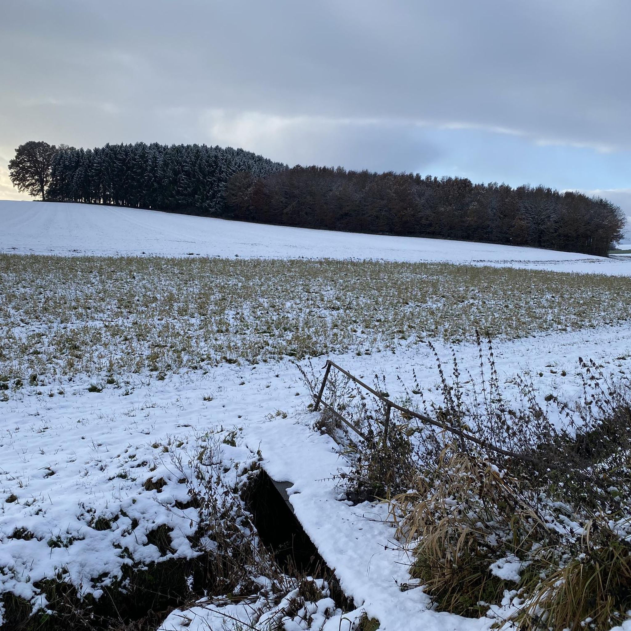
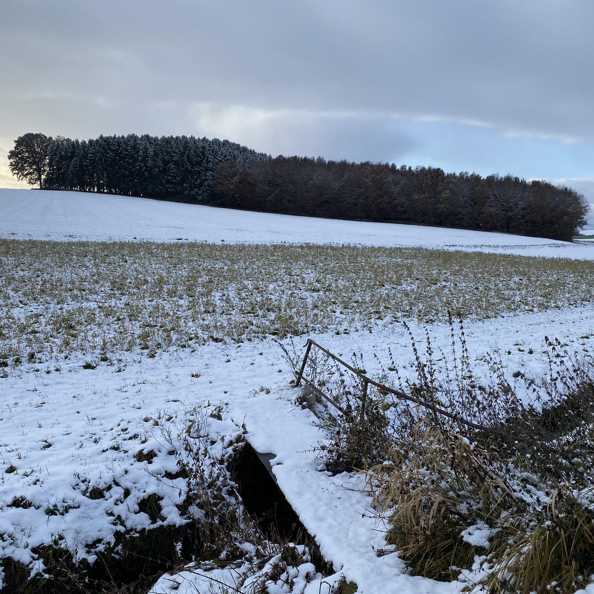
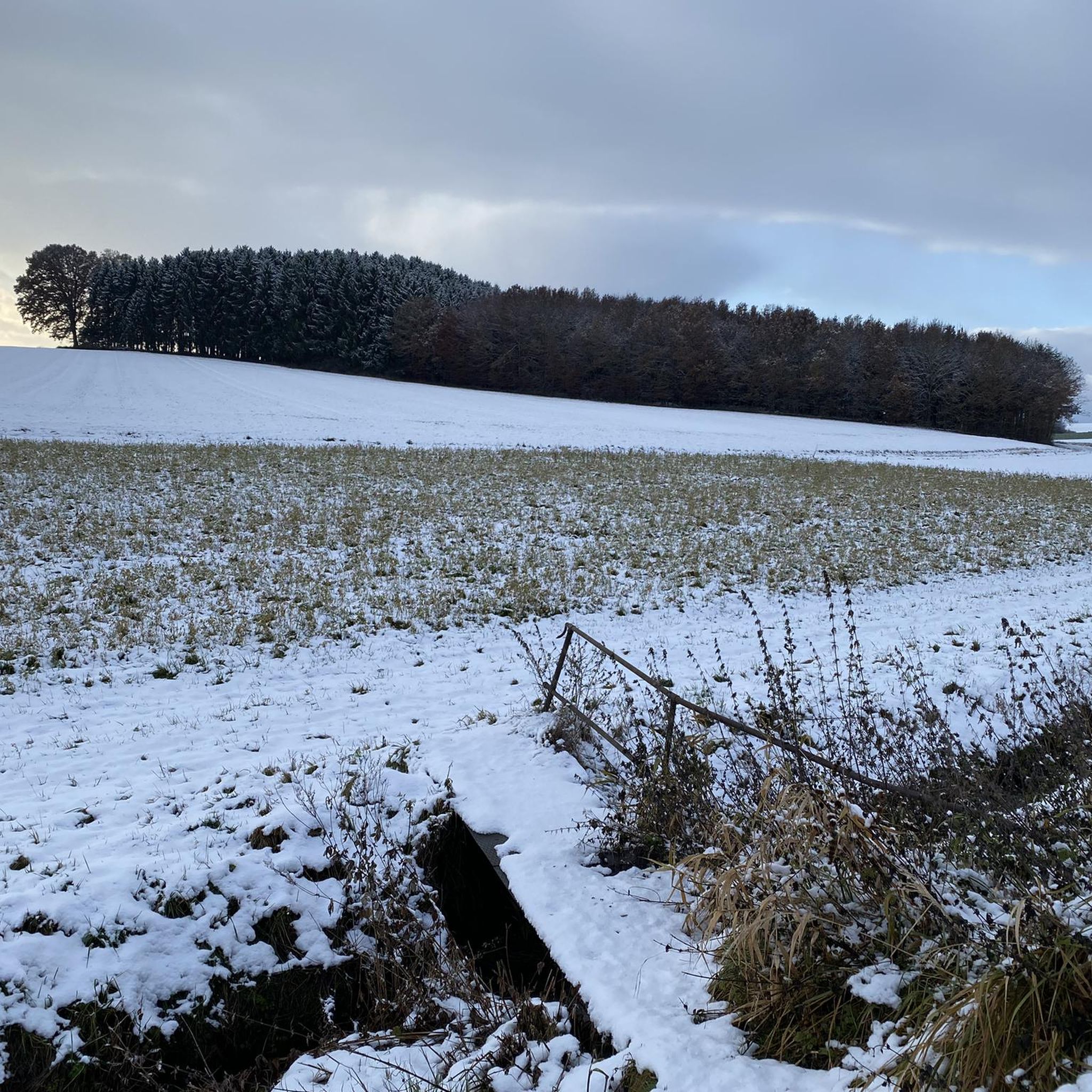
Small bridges, so you don't get wet feet
0
0

Nature reserve since 1985
0
0

Located in a dead ice basin, the Haspelmoor is the northernmost raised moor that was created by the Isar-Loisach foreland glacier. The first evidence of settlement confirms that people lived and hunted around the former meltwater lake 11,000 years ago. From the 17th century onwards, the lake, which has now silted up, was used as a pasture for cattle; the first peat cuttings can be found. With the construction of the first railway line from Munich to Augsburg (1838/1839), it was partially drained and the Haspelmoor train station was built. The good transport connections made it possible to extract peat on a large scale for the operation of locomotives. Up to 1,600 peat workers were employed for this at the time.
4
1

Anyone entering this beautiful moorland should be aware of their responsibility towards plants and animals and not disturb or uproot them. It would be nice if future generations could still admire this natural paradise.
2
0

Habitat Haspelmoor e.V. (nature reserve Haspelmoor, 2023-05-13): https://www.haspelmoor.de/lebensraum-haspelmoor/natur/ Administrative community Mammendorf (Haspelmoor nature reserve, 2023-05-13): https://www.gemeinde-hattenhofen.de/nreservation-haspelmoor Wikipedia (Haspelmoor (Moor), 2023-05-13): https://de.m.wikipedia.org/wiki/Haspelmoor_%28Moor%29 “… In the northern part are the Rote Moos and the Biermösl. …”
2
0
Habitat Haspelmoor e.V. (nature reserve Haspelmoor, 2023-05-13): https://www.haspelmoor.de/lebensraum-haspelmoor/natur/ Administrative community Mammendorf (Haspelmoor nature reserve, 2023-05-13): https://www.gemeinde-hattenhofen.de/nreservation-haspelmoor Wikipedia (Haspelmoor (Moor), 2023-05-13): https://de.m.wikipedia.org/wiki/Haspelmoor_%28Moor%29 “… In the northern part are the Rote Moos and the Biermösl. …”
3
0
Haspelmoor habitat e.V. (Haspelmoor nature reserve, 2023-05-13): https://www.haspelmoor.de/lebensraum-haspelmoor/natur/ Mammendorf administrative community (Haspelmoor nature reserve, 2023-05-13): https://www.gemeinde-hattenhofen.de/naturschutzgebiet-haspelmoor Wikipedia (Haspelmoor (Moor), 2023-05-13): https://de.m.wikipedia.org/wiki/Haspelmoor_(Moor) “… In the northern part are the Rotes Moos and the Biermösl. ...”
5
0

Small bridge in Haspelmoor
2
0
Frequently Asked Questions
How many running routes are available around Mittelstetten?
Mittelstetten offers a wide selection of running routes, with over 400 different trails available for you to explore. These routes cater to various preferences and fitness levels, ensuring there's something for everyone.
Are there easy jogging routes suitable for beginners or a relaxed run?
Yes, Mittelstetten has several easy jogging routes. There are 55 routes specifically rated as easy, perfect for beginners or those looking for a more relaxed pace. An example of an easy route is the Großes Holz loop from Althegnenberg, which is about 4.9 km long.
What kind of natural features can I expect to see while running in Mittelstetten?
The region boasts diverse natural features. You can enjoy tranquil lakeside paths, such as those around Lake Mandicho (Mandichosee), which is a versatile recreational area. Another unique feature is the 'Paardurchbruch bei Ottmaring,' where the river Paar meanders through a pristine backwater area with a silver willow forest, offering a scenic and idyllic landscape.
Are there any circular running routes in Mittelstetten?
Many of the running routes in Mittelstetten are circular, allowing you to start and end at the same point. For instance, the popular Haspelmoor loop from Haspelmoor is a 10.5 km circular trail through moorland. The 'Paardurchbruch bei Ottmaring' also features an approximately 9.8 km circular trail.
What do other runners say about the trails in Mittelstetten?
The running routes in Mittelstetten are highly regarded by the komoot community, holding an average rating of 4.5 stars from over 200 reviews. Runners often praise the well-maintained paths, the varied terrain including open moorland and riverine landscapes, and the options available for different ability levels.
Are there family-friendly running trails in the area?
Yes, many of the routes, especially the easier ones and those around recreational areas like Mandichosee, are suitable for families. The well-maintained paths and relatively flat sections make them enjoyable for all ages. Consider routes with amenities like kiosks and toilets for added convenience.
Can I bring my dog on the running routes around Mittelstetten?
Generally, dogs are welcome on many outdoor trails in the Mittelstetten area. The diverse natural landscapes, including open fields and forests, provide great opportunities for running with your canine companion. However, it's always advisable to keep dogs on a leash, especially in nature reserves or areas with wildlife, and to respect local regulations.
What is the best time of year to go jogging in Mittelstetten?
Mittelstetten is appealing for outdoor activities throughout much of the year. Spring and autumn offer pleasant temperatures and beautiful scenery. Summer is also great, especially for routes near lakes like Mandichosee where you can combine your run with a refreshing dip. Even in winter, some well-maintained paths can be suitable for jogging, offering a unique, crisp experience.
Are there any specific landmarks or points of interest along the running routes?
Beyond the natural beauty, you might encounter various points of interest. The Lake Mandicho area offers recreational facilities. You can also find charming huts and cabins nearby, such as the Erlauholz Hill and Forest Cabin, which can serve as interesting sights or rest stops along your run.
Where can I find parking for the running trails in Mittelstetten?
Many popular trailheads and recreational areas in Mittelstetten, such as those near Mandichosee or the starting points for routes like the Frozen Rotes Moos – Haspelmoor – Red Bog loop from Haspelmoor, offer designated parking facilities. It's recommended to check specific route details on komoot for precise parking information.
Can I reach the running trails in Mittelstetten using public transport?
While specific public transport connections to every trailhead might vary, Mittelstetten and its surrounding villages are generally accessible by local bus services. For routes starting from larger towns or villages, public transport can be a viable option. It's best to consult local transport schedules for the most up-to-date information on bus stops near your desired starting point.
Are there any routes that offer scenic viewpoints?
Yes, some routes provide excellent scenic viewpoints. For example, the View of Meringerzell loop from Ried is a 9.9 km trail specifically noted for leading through varied terrain with scenic vistas, allowing you to enjoy panoramic views of the surrounding landscape.
Most popular routes around Mittelstetten
Most popular attractions around Mittelstetten

Get inspired with the komoot mobile app


Explore more
Browse the best Running Trails & Routes in other regions.
