The best running trails around Tamnaharry
5.0
(20)
1,657
runners
94
runs
Jogging routes around Tamnaharry traverse a diverse landscape, featuring dense forests, scenic lough shores, and rolling hills. The region is characterized by its proximity to Carlingford Lough and the Mourne Mountains, offering varied terrain from riverside paths to more challenging forest trails. Kilbroney Park provides extensive routes through woodlands with views over the lough. Runners can explore both gentle, flat paths and routes with moderate elevation changes.
Best jogging routes around Tamnaharry
- The most popular jogging route is Carlingford Lough…
Last updated: June 27, 2026
5.0
(1)
13
runners
17.6km
02:00
270m
260m
Jog the difficult 10.9-mile Carlingford Lough Greenway and Ring of Gullion Loop, offering views of the lough and Mourne Mountains.
70
runners
Hard run. Very good fitness required. Mostly paved surfaces. Suitable for all skill levels.

Sign up for free
5.0
(2)
39
runners
10.2km
01:03
10m
10m
Moderate run. Good fitness required. Mostly paved surfaces. Suitable for all skill levels.
5.0
(1)
18
runners
5.33km
00:34
60m
60m
Moderate run. Good fitness required. Mostly paved surfaces. Suitable for all skill levels.
6
runners
5.55km
00:35
30m
30m
Moderate run. Good fitness required. Mostly paved surfaces. Suitable for all skill levels.
Get access to more routes and recommendations from other explorers.
Sign up for free
Already have an account?
Our route recommendations are based on thousands of hikes, rides, and runs completed by other people on komoot.
Start today with a free account
Your next adventure awaits.
Login or Signup



Tips from the Community

De An Bealach Glas (The Greenway) is a stunning, traffic-free greenway that connects Newry to the monumental Victoria Lock. This 6-kilometre-long 'green route' takes you along the tidal river Clanrye and the sea canal, with the impressive peaks of the Mourne Mountains to your left and Cooley Mountains to your right.
6
0
Once you leave the city of Newry behind, you cycle towards tranquility on An Bealach Glas, also known as the Carlingford Lough Greenway. This flat, smoothly asphalted path follows the banks of the canal and offers spectacular views of the river's mudflats along the way, where you can spot numerous wading birds and sometimes even a stray seal. The route is a true sensory experience: the salty sea air blows towards you while the mountains seem to get closer and closer. The absolute endpoint of this section is the historic Victoria Lock, an impressive lock complex from 1850 that marks the transition from the canal to the open waters of Carlingford Lough. It is the perfect place to get some fresh air and enjoy the maritime dynamics before continuing your journey to the coast.
6
0
De An Bealach Glas (The Greenway) is a beautiful, traffic-free cycle path connecting Newry to the monumental Victoria Lock. This 6-kilometer-long 'green route' takes you along the tidal river Clanrye and the sea canal, with the impressive peaks of the Mourne Mountains to your left and Cooley Mountains to your right.
5
0

The Carlingford Lough Greenway has a special atmosphere as you walk along this section of Newry. With the Newry Ship Canal to your left and the Newry River to your right, you're in the middle of two worlds. The calm waters of the canal reflect the sky, making the surroundings seem almost like a backdrop, while the riverbank on the other side is lush with greenery and wild flowers. The narrow path takes you past flowering gorse and you can smell the scent of the vegetation in the air. It's a route that has its charms in every season, whether it's clear skies or when grey clouds hang low and make the water seem almost mystical. The Greenway is perfect for a leisurely stroll or a leisurely bike ride, enjoying being close to nature - an ideal place to clear your head.
1
0

The start of the dual carriageway between Warrenpoint and Newry.
1
0

This church is relatively modern, as it was built between 1911 and 1916. It features a Romanesque design and serves as the Parish Church of Killeavy Upper in the Archdiocese of Armagh.
1
0
This is an impressive section of the Carlingford Lough Greenway as you arrive in Newry. The feeling is incredible as you walk along a path where on one side you have the Newry Ship Canal, and on the other, the Newry River.
1
0
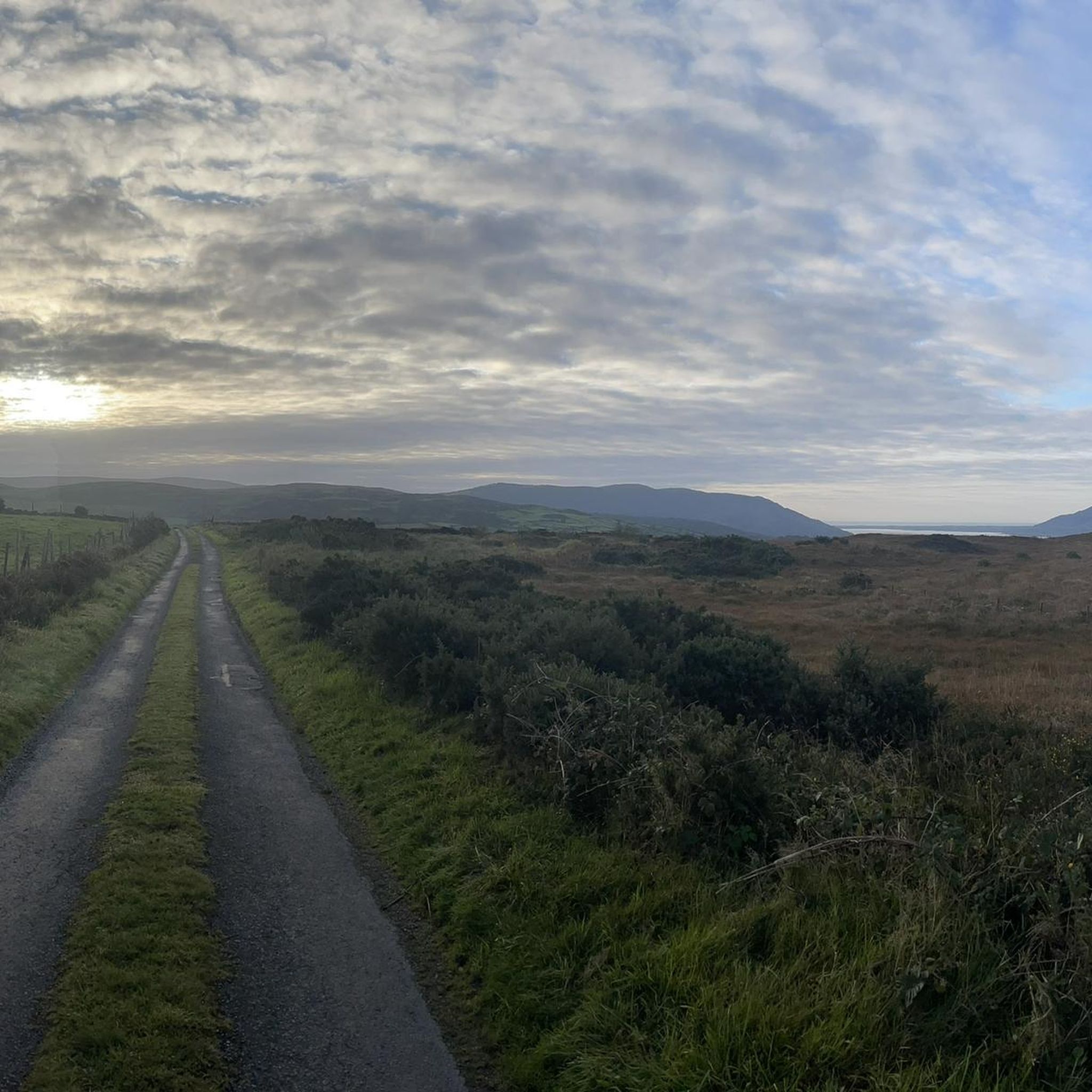
There are great views of Newry City, The Mourne Mountains, Carlingford Lough and The Cooley Moiuntains from up here. Flags were raised here to announce arriving boats coming into the lough, hence the name Flagstaff.
0
0
Frequently Asked Questions
How many running routes are available in Tamnaharry?
Tamnaharry offers a wide selection of running routes, with over 100 trails available for joggers of all abilities. These routes explore diverse landscapes, including dense forests, scenic lough shores, and rolling hills.
Are there easy running routes suitable for beginners or families in Tamnaharry?
Yes, Tamnaharry has several easy running routes perfect for beginners or families. An excellent option is the Clontygora Court Tomb loop from St Michael's, an easy 3.1-mile (4.9 km) path that passes by a historical court tomb. Another family-friendly choice is the Kilbroney Park – Fairy Glen loop from Rostrevor, a 2.9-mile (4.6 km) trail through Kilbroney Park.
What kind of terrain can I expect on Tamnaharry's jogging trails?
Jogging trails in Tamnaharry feature varied terrain, from flat riverside paths along the Newry River to more challenging forest trails with moderate elevation changes. Kilbroney Park offers extensive routes through woodlands, while areas like Clermont Carn provide rewarding climbs with expansive views. You'll find a mix of surfaces, including greenways, forest paths, and some sections with more rugged natural ground.
Are there any dog-friendly running routes in the Tamnaharry area?
Many of the outdoor areas in Tamnaharry, including parts of Kilbroney Park and the Newry and Fathom Forest, are generally dog-friendly. However, it's always recommended to keep dogs on a leash, especially in areas with livestock or wildlife, and to check specific park regulations before your visit. The Carlingford Lough Greenway and Ring of Gullion Loop is a popular option where dogs are often seen.
Where can I find parking for jogging trails in Tamnaharry?
Parking is generally available at key access points for popular jogging areas. For routes in Kilbroney Park, there are designated car parks within the park itself. For trails like the Carlingford Lough Greenway, you can often find parking in nearby towns or at specific greenway access points. It's advisable to check the starting point of your chosen route for specific parking information.
What are some notable landmarks or viewpoints along the running routes?
Tamnaharry's running routes offer stunning views and interesting landmarks. In Kilbroney Park, you can encounter the impressive Cloughmore Stone, which provides panoramic vistas over Carlingford Lough and the Mourne Mountains. Many trails also offer breathtaking views of Carlingford Lough and the majestic Mourne Mountains themselves. The Clontygora Court Tomb loop passes a historical site, adding cultural interest to your run.
Are there any circular running routes in Tamnaharry?
Yes, many of Tamnaharry's running paths are designed as circular routes, allowing you to start and finish at the same point. Examples include the Carlingford Lough Greenway and Ring of Gullion Loop, the Clontygora Court Tomb loop, and the Kilbroney Park – Fairy Glen loop from Rostrevor. These loops provide convenient options for exploring the region.
What do other runners enjoy most about jogging in Tamnaharry?
The running routes in Tamnaharry are highly rated by the komoot community, with an average score of 4.9 stars from over 19 reviews. Runners frequently praise the diverse scenery, from tranquil forest paths in Rostrevor Forest to stunning views over Carlingford Lough. The variety of terrain and options for different ability levels are also highly appreciated.
Can I find longer, more challenging running trails in Tamnaharry?
Absolutely. For those seeking a greater challenge, Tamnaharry offers several difficult routes. The Carlingford Lough Greenway and Ring of Gullion Loop is a demanding 10.9-mile (17.6 km) trail exploring both greenway and forested areas. Another challenging option is the Fairy Glen – Forest Trail in Mourne AONB loop from Rostrevor, which covers 15.4 miles (24.7 km) with significant elevation changes.
Are there places to eat or get refreshments near the running routes?
Yes, particularly around popular areas like Kilbroney Park and towns adjacent to the Carlingford Lough Greenway, you'll find amenities such as cafes, pubs, and shops. Rostrevor, for instance, which is a common starting point for routes in Kilbroney Park, offers several options for refreshments before or after your run.
What is the best time of year to go running in Tamnaharry?
Tamnaharry is beautiful for running year-round, but each season offers a different experience. Spring brings blooming wildflowers, while autumn showcases vibrant foliage in the forests. Summer provides longer daylight hours, and winter, though colder, can offer crisp air and unique misty views over the lough. Always be prepared for changeable weather, especially in the mountains.
Most popular attractions around Tamnaharry

Get inspired with the komoot mobile app


Explore more
Browse the best Running Trails & Routes in other regions.
