The best cycling routes around Slievenalargy
4.5
(14)
615
riders
53
rides
Touring cycling around Slievenalargy offers routes within the scenic Mourne Mountains range in County Down, Northern Ireland. This area is part of the Mourne Gullion Strangford UNESCO Global Geopark, characterized by mountainous terrain and rolling hills. The landscape features granite peaks, lush valleys, and a glacial legacy that shaped distinctive landforms. The region provides a mix of challenging climbs and varied countryside roads for touring cyclists.
Best touring cycling routes around Slievenalargy
- The most popular touring cycling route is Castlewellan…
Last updated: October 1, 2026
5.0
(1)
287
riders
15.7km
01:31
240m
240m
Moderate bike ride. Good fitness required. Mostly paved surfaces. Suitable for all skill levels.
3.0
(1)
18
riders
12.5km
01:08
270m
270m
Moderate bike ride. Good fitness required. Mostly paved surfaces. Suitable for all skill levels.

4.0
(1)
7
riders
62.1km
04:00
780m
780m
Hard bike ride. Very good fitness required. Mostly paved surfaces. Suitable for all skill levels.
5
riders
Moderate bike ride. Good fitness required. Mostly paved surfaces. Suitable for all skill levels.
4.0
(1)
4
riders
34.8km
02:29
410m
410m
Moderate bike ride. Good fitness required. Mostly paved surfaces. Suitable for all skill levels.
Get access to more routes and recommendations from other explorers.
Already have an account?
Our route recommendations are based on thousands of hikes, rides, and runs completed by other people on komoot.
Start today with a free account
Your next adventure awaits.
Tips from the Community

FACEBOOK (History of Newcastle, Co. Down, Hore's Bridge, 2026-08-15): https://www.facebook.com/HistoryofNewcastleCo.Down/photos/hores-bridge-over-the-spinkwee-river-sw-tollymore-was-built-in-1824-the-date-is-/754755631362196/ “… Hore's Bridge over the Spinkwee River, SW Tollymore, was built in 1824. …”
1
0
The stepping stones are currently fenced off. Please use the nearby bridges to cross the Shimna River.
2
0
Wikipedia (Tollymore Forest Park, 2026-08-14): https://en.m.wikipedia.org/wiki/Tollymore_Forest_Park “... Parnell Bridge, named in recognition of Sir John Parnell who visited Tollymore in the late 18th century, was constructed in 1842. It was the last stone bridge to be built in Tollymore. …”
2
0
Wikipedia (Tollymore Forest Park, 2026-08-14): https://en.m.wikipedia.org/wiki/Tollymore_Forest_Park “... The Hermitage is a small stone shelter designed by James Hamilton (2nd Earl of Clanbrassil) in the 1770s in memory to his friend the John Montagu, Marquess of Monthermer. It is built into the side of the gorge above the river and was used as a place for ladies to shelter while the men fished. There is an inscription in Greek within the Hermitage which translates as "Clanbrassil, to his very dear friend Monthermer 1770". …”
2
0
Wikipedia (Tollymore Forest Park, 2026-08-14): https://en.m.wikipedia.org/wiki/Tollymore_Forest_Park “... Horn Bridge crosses a small culverted burn (stream) and is crossed by a gravel road. The burn below the bridge is covered with a board walk connected to a path. It was built c.1770 by either the 1st or 2nd Earl. ...”
1
0

The park has no entry fee, you only have to pay 5 £ for parking.
1
0

Easy route no special gear required. Very scenic
0
0

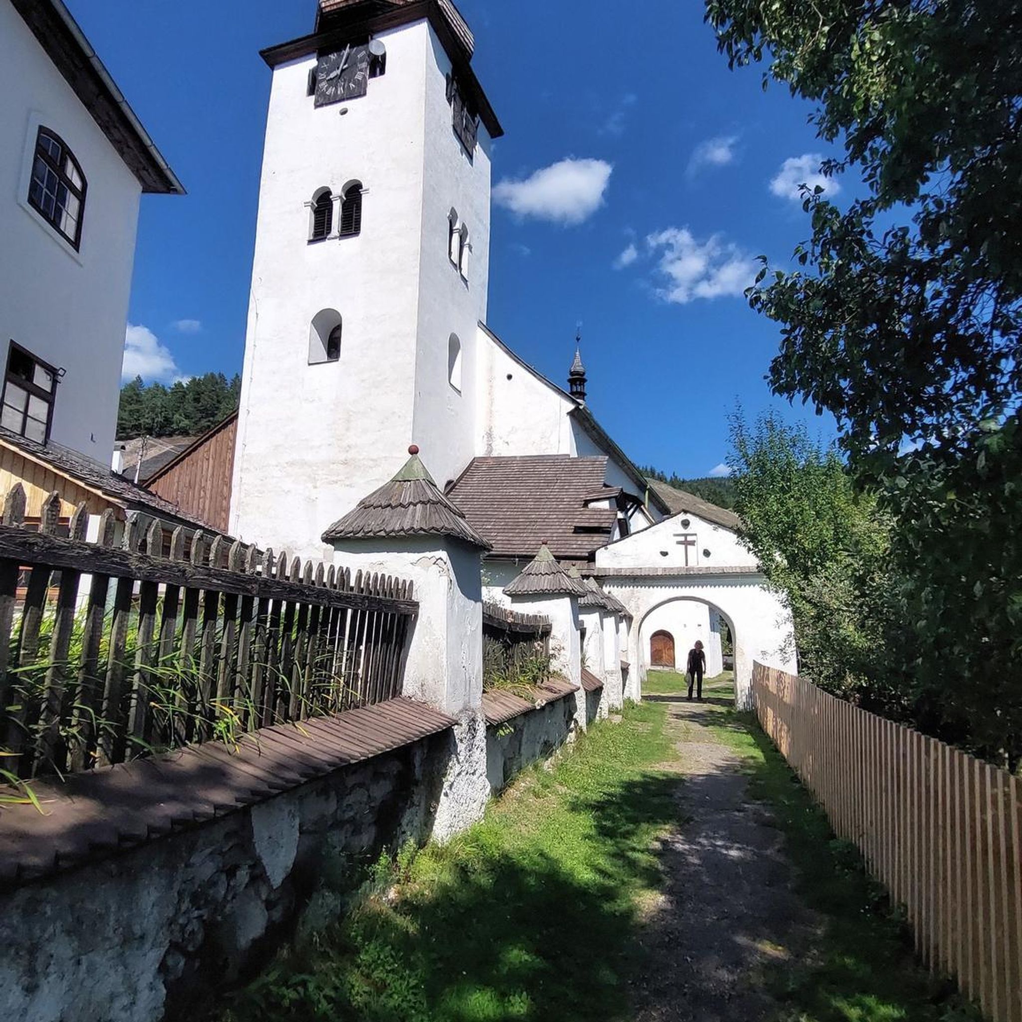
This historic 10th century tower stands in idyllic countryside and offers a fascinating insight into Ireland's early Christian history. Access is via narrow country lanes; there is a small car park but it is not always well signposted. The tower is on private farmland but access is usually permitted.
1
0
Frequently Asked Questions
How many touring cycling routes are available around Slievenalargy?
There are over 60 touring cycling routes in the Slievenalargy area, offering a diverse range of experiences within the scenic Mourne Mountains. These routes cater to various skill levels, from easy to difficult.
What kind of terrain can I expect on touring cycling routes in Slievenalargy?
Touring cycling around Slievenalargy features a mix of mountainous terrain and rolling hills. You'll encounter scenic road routes through diverse ecosystems, including granite peaks, lush valleys, and areas shaped by glacial activity. The region offers both challenging climbs and more gentle countryside roads.
Are there any easy touring cycling routes suitable for beginners or families?
Yes, Slievenalargy offers several easy touring cycling routes. For instance, the View of Castlewellan Castle – Abandoned Ice House loop from Leitrim is an easy 4.5-mile (7.2 km) path that provides views of Castlewellan Castle. Another accessible option is the Castlewellan Peace Maze loop from Castlewellan, a 4.6-mile (7.4 km) trail.
What are some notable landmarks or natural features to see along the touring cycling routes?
The routes often pass by significant natural and man-made features. You can enjoy views of Castlewellan Castle, explore the Castlewellan Peace Maze, or discover the Mourne Wall. The area is also home to beautiful lakes like Blue Lough and viewpoints such as Slieve Bearnagh.
Are there any circular touring cycling routes in the area?
Yes, many routes around Slievenalargy are designed as loops. An example is the View of Mourne AONB – Castlewellan Lake loop from Dollys Brae Car Park, which is an easy 4.5-mile (7.2 km) route offering scenic views.
What do other touring cyclists say about the routes in Slievenalargy?
The touring cycling routes in Slievenalargy are highly regarded by the komoot community, holding an average rating of 4.4 stars from over 14 reviews. Cyclists often praise the varied terrain, scenic views, and the opportunity to explore the unique landscapes of the Mourne Mountains.
Is Slievenalargy part of a larger protected area?
Yes, Slievenalargy is located within the Mourne Gullion Strangford UNESCO Global Geopark. This designation highlights the area's rich geological history, diverse landscapes, and commitment to preserving the natural environment, making it an excellent destination for sustainable outdoor activities like cycling. You can learn more about the Geopark on the UNESCO website.
Are there any longer or more challenging touring cycling routes for experienced cyclists?
For experienced cyclists seeking a challenge, Slievenalargy offers several difficult routes. An example of a moderate route is the Castlewellan Peace Maze – View of Castlewellan Castle loop from Castlewellan, which covers 9.9 miles (15.9 km) with significant elevation gain, providing a good workout and expansive views.
What is the best time of year to go touring cycling in Slievenalargy?
The Mourne Mountains region, including Slievenalargy, offers beautiful cycling conditions throughout much of the year. Spring and autumn generally provide pleasant temperatures and vibrant scenery. Summer is also popular, though routes can be busier. Always check local weather forecasts before heading out, as conditions can change rapidly in mountainous areas.
Are there any routes that pass through Tollymore Forest Park?
Yes, some routes extend into or near Tollymore Forest Park. For example, the Stepping Stones at Mourne AONB – Tollymore Forest Park loop from Tollymore Forest is a moderate 7.4-mile (11.9 km) route that includes features within the park.
Can I find cafes or pubs near the cycling routes for refreshments?
While specific amenities directly on every trail are limited, the wider Mourne Mountains area, including nearby villages like Castlewellan, Newcastle, and Bryansford, offers charming villages with cafes, pubs, and accommodation options where cyclists can refuel and relax. These can be easily integrated into your touring plans.
Most popular attractions around Slievenalargy

Get inspired with the komoot mobile app


Explore more
Browse the best Cycling routes in other regions.
