The best walks and hikes around Benagh
4.5
(88)
789
hikers
42
hikes
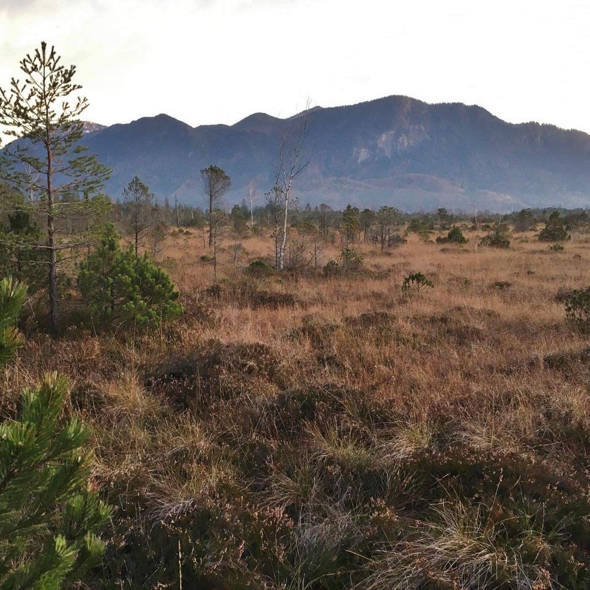
Hiking around Benagh offers access to diverse landscapes within or near the Mourne Mountains in County Down. The region features a mix of mountainous terrain, rolling fields, and forests, providing varied environments for outdoor activities. Hikers can expect rough terrain and tranquil nature, shaped by glacial activity, offering scenic vistas. This area provides an escape into natural surroundings.
Best hiking trails around Benagh
- The most popular hiking route is Fathom Wood loop — Ring of Gullion, a 4.8 miles…
Last updated: June 27, 2026
3.0
(2)
3
hikers
7.74km
01:48
210m
210m
Easy hike. Great for any fitness level. Easily-accessible paths. Suitable for all skill levels.
1
hikers
18.1km
04:53
240m
240m
Moderate hike. Good fitness required. Easily-accessible paths. Suitable for all skill levels.

Sign up for free
21
hikers
11.8km
02:58
10m
10m
Moderate hike. Good fitness required. Easily-accessible paths. Suitable for all skill levels.
21
hikers
10.2km
02:35
10m
10m
Moderate hike. Good fitness required. Easily-accessible paths. Suitable for all skill levels.
17
hikers
8.27km
02:08
50m
50m
Moderate hike. Good fitness required. Easily-accessible paths. Suitable for all skill levels.
Get access to more routes and recommendations from other explorers.
Sign up for free
Already have an account?
Our route recommendations are based on thousands of hikes, rides, and runs completed by other people on komoot.
Start today with a free account
Your next adventure awaits.
Login or Signup



Tips from the Community

De An Bealach Glas (The Greenway) is a stunning, traffic-free greenway that connects Newry to the monumental Victoria Lock. This 6-kilometre-long 'green route' takes you along the tidal river Clanrye and the sea canal, with the impressive peaks of the Mourne Mountains to your left and Cooley Mountains to your right.
6
0
Once you leave the city of Newry behind, you cycle towards tranquility on An Bealach Glas, also known as the Carlingford Lough Greenway. This flat, smoothly asphalted path follows the banks of the canal and offers spectacular views of the river's mudflats along the way, where you can spot numerous wading birds and sometimes even a stray seal. The route is a true sensory experience: the salty sea air blows towards you while the mountains seem to get closer and closer. The absolute endpoint of this section is the historic Victoria Lock, an impressive lock complex from 1850 that marks the transition from the canal to the open waters of Carlingford Lough. It is the perfect place to get some fresh air and enjoy the maritime dynamics before continuing your journey to the coast.
6
0
De An Bealach Glas (The Greenway) is a beautiful, traffic-free cycle path connecting Newry to the monumental Victoria Lock. This 6-kilometer-long 'green route' takes you along the tidal river Clanrye and the sea canal, with the impressive peaks of the Mourne Mountains to your left and Cooley Mountains to your right.
5
0
Saint Patrick and Saint Colman's Cathedral is the architectural jewel of Newry and one of Ireland's most impressive Neo-Gothic structures. Construction began in 1825, and upon its completion in 1829, the cathedral made history as the first Catholic cathedral to open in Ireland following the repeal of the penal laws (Catholic Emancipation). Built from local granite from the nearby Mourne Mountains, this edifice exudes a robust yet elegant power. The cathedral is world-renowned for its fabulous interior: the walls and ceiling are adorned with colourful mosaics, meticulously applied by hand by Italian master craftsmen in the early 20th century. For the cyclist, this is not only a visual highlight along the route but also a place of serene tranquility. Its detailed stained-glass windows and monumental tower make it one of the city's most photographed locations and a worthy endpoint (or starting point) for your tour along the Newry Canal Towpath.
6
0
As you enter Newry via the canal route, you are greeted by an impressive tribute to the fallen: the Newry War Memorial, marked by an authentic 25-pounder gun. This artillery piece, an icon of World War II, symbolizes the courage and sacrifice of the local people during global conflicts. The Gun: It is an Ordnance QF 25-pounder, the main British field gun of World War II, known for its versatility and mobility.
6
0

From the Flagstaff Viewpoint you can enjoy a stunning view of the expansive landscape where the Newry River gently curves its way to Carlingford Lough. The view stretches down to the fjord where the land meets the water and the hills in the distance form a picturesque backdrop. The valley opens up between the lush green conifers and you can watch the landscape unfold below you. From up here, the roads and fields look like little veins and patches that tie the whole picture together. It is a place to linger and enjoy the silence - a haven of calm that makes you feel above it all.
0
0
The Carlingford Lough Greenway has a special atmosphere as you walk along this section of Newry. With the Newry Ship Canal to your left and the Newry River to your right, you're in the middle of two worlds. The calm waters of the canal reflect the sky, making the surroundings seem almost like a backdrop, while the riverbank on the other side is lush with greenery and wild flowers. The narrow path takes you past flowering gorse and you can smell the scent of the vegetation in the air. It's a route that has its charms in every season, whether it's clear skies or when grey clouds hang low and make the water seem almost mystical. The Greenway is perfect for a leisurely stroll or a leisurely bike ride, enjoying being close to nature - an ideal place to clear your head.
1
0

Stunning cathedral built from local granite
2
0
Frequently Asked Questions
How many hiking trails are available around Benagh?
There are over 40 hiking routes available around Benagh, offering a variety of experiences. These include options for different skill levels, from easy walks to more challenging climbs within the diverse landscapes of County Down.
What kind of terrain can I expect on hikes near Benagh?
Hikers around Benagh can expect a mix of terrain. The region is situated near the Mourne Mountains, offering mountainous landscapes with significant elevation changes, as well as rolling fields, tranquil forests, and scenic vistas shaped by glacial activity. You'll find both rougher paths and more gentle trails.
Are there easy hiking options suitable for beginners or families?
Yes, Benagh offers several easy hiking options. For instance, the Fathom Wood loop — Ring of Gullion is an easy 4.8-mile trail that explores the natural beauty of the Ring of Gullion. Overall, 27 of the 43 available routes are classified as easy, making them suitable for less experienced hikers or families.
Are there any circular hiking routes around Benagh?
Yes, many routes around Benagh are designed as loops. Popular circular options include the Fathom Wood loop — Ring of Gullion and the Ring of Gullion and Carlingford Lough Greenway Loop, which combines natural landscapes with sections of the greenway.
What are some notable natural features or landmarks to see while hiking?
The region around Benagh is rich in natural beauty. You can explore areas like the Ring of Gullion, and enjoy views of Carlingford Lough. Nearby attractions include Camlough Lake and The Fairy Glen (Kilbroney River). For a broader view, consider the View of Carlingford Lough from Rostrevor Road.
Are there any trails that combine natural landscapes with other features, like greenways?
Yes, some trails offer a mix of natural scenery and developed paths. The Ring of Gullion and Carlingford Lough Greenway Loop is a great example, combining the natural beauty of the Ring of Gullion with sections of the Carlingford Lough Greenway for a varied hiking experience.
What do other hikers enjoy most about the trails around Benagh?
The trails around Benagh are highly rated by the komoot community, with an average score of 4.5 stars from over 100 reviews. Hikers often praise the diverse scenery, the tranquil nature, and the opportunity to escape into natural surroundings within or near the dramatic Mourne Mountains.
Are there any specific parks or forests to explore near Benagh?
Yes, you can explore areas like Eisler Park, featured in routes such as the Eisler Park loop from Newry. Additionally, Kilbroney Park and Rostrevor Forest are nearby attractions offering further opportunities for outdoor exploration.
Is there parking available for hikers in the Benagh area?
While specific parking details for every trailhead are not listed, the region is generally accessible for hikers. A notable spot for parking and a picnic area is the Yellow Water Picnic Area, which can serve as a starting point for some routes.
What is the best time of year to go hiking in Benagh?
The diverse landscapes around Benagh can be enjoyed throughout much of the year. Spring and autumn offer pleasant temperatures and beautiful scenery, with vibrant foliage or blooming wildflowers. Summer provides longer daylight hours, while winter hikes can offer a unique, rugged beauty, though conditions may be more challenging.
Are there any historical sites or unique attractions along the trails?
Yes, the area offers some interesting points of interest. For example, you might encounter Leitrim Lodge, which is also a Game of Thrones Filming Location, adding a unique historical and cultural element to your hike.
Most popular attractions around Benagh

Get inspired with the komoot mobile app


Explore more
Browse the best Hikes in other regions.
