The best walks and hikes around Mullan
4.6
(28)
180
hikers
12
hikes
Hiking around Mullan, Idaho, offers access to the mountainous terrain of the Panhandle, nestled within the Coeur d'Alene Mountains. The region features thick forests, clear streams, and views of the Idaho and Montana ranges. Hikers can explore diverse landscapes, including high alpine lakes and areas like Shoshone Park, which maintains a natural environment for outdoor enjoyment.
Best hiking trails around Mullan
- The most popular hiking route is Garvagh Forest loop, a 3.8 miles (6.1 km) trail that takes 1…
Last updated: June 25, 2026
4.4
(5)
18
hikers
6.11km
01:38
70m
70m
Explore the easy 3.8-mile Garvagh Forest loop, gaining 241 feet in 1 hour 38 minutes, featuring the unique Garvagh Pyramid.
5.0
(2)
27
hikers
Easy hike. Great for any fitness level. Easily-accessible paths. Suitable for all skill levels.

Sign up for free
5.0
(1)
19
hikers
5.43km
01:27
60m
50m
Easy hike. Great for any fitness level. Easily-accessible paths. Suitable for all skill levels.
5.0
(1)
13
hikers
6.74km
01:50
90m
90m
Easy hike. Great for any fitness level. Easily-accessible paths. Suitable for all skill levels.
3.0
(1)
12
hikers
3.23km
00:52
40m
40m
Easy hike. Great for any fitness level. Easily-accessible paths. Suitable for all skill levels.
Get access to more routes and recommendations from other explorers.
Sign up for free
Already have an account?
Our route recommendations are based on thousands of hikes, rides, and runs completed by other people on komoot.
Start today with a free account
Your next adventure awaits.
Login or Signup
Popular around Mullan
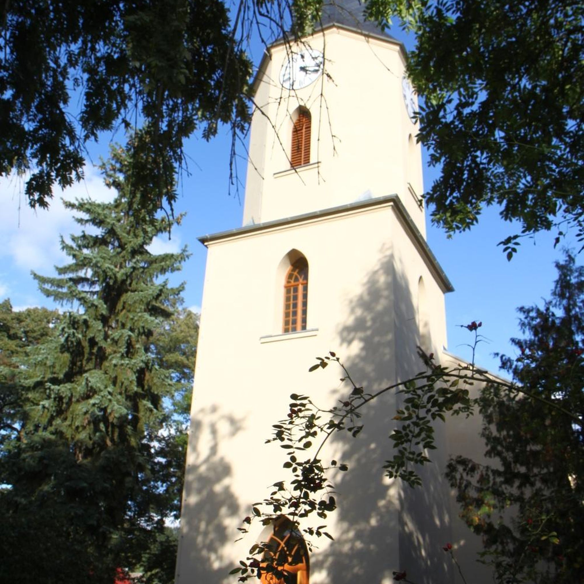
Tips from the Community

Mountsandel Fort is a prehistoric fort dating to the Mesolithic period that was reused in the Irish Middle Ages (10th to 11th centuries). Located in Coleraine, County Derry, the fort consists of a huge grassy mound hollowed out in the middle, overlooking the River Bann. A must-see for lovers of mysterious monuments!
1
0


Here lies a beautiful weaved structure of a pair of deer, one of the many fun and fascinating discoveries of the Garvagh Forest.
4
0
Garvagh Forest is filled with mysterious features. This one is a wood-carving of a rabbit and is situated on the western side of the park. Discovering the others is quite an adventure and makes a great day out for families.
2
0
It's quite an unusual experience stumbling into a pyramid in the middle of an Irish forest! This pyramid was built in the 19th century as a burial chamber for Lord Garvagh and is a lovelly feature to the forest today.
2
0


You can walk along a well defined forest path from the small car park near Coleraine Courthouse and from the Fort, you can see great views of the Salmon Leap (Weir) and Coleraine.
1
0
Frequently Asked Questions
How many hiking trails are available around Mullan?
There are over 10 hiking routes around Mullan, all of which are rated as easy. These trails offer a variety of experiences through the region's mountainous terrain and dense forests.
What kind of terrain can I expect on Mullan's hiking trails?
The trails around Mullan are characterized by mountainous terrain, thick forests, and clear streams. You'll find gentle elevation changes on most routes, making them accessible for various fitness levels. The region is nestled within the Coeur d'Alene Mountains, offering views of the Idaho and Montana ranges.
Are there any family-friendly hiking options in Mullan?
Yes, all 12 routes available around Mullan are rated as easy, making them suitable for families. Trails like the Garvagh Forest loop or the Springwell Forest loop from Rhee offer pleasant walks through woodland scenery with gentle elevation changes.
What do other hikers enjoy most about the trails in Mullan?
The hiking routes in Mullan are highly rated by the komoot community, with an average score of 4.6 stars from over 28 reviews. Hikers often praise the serene forest environments, the accessibility of the easy trails, and the opportunity to immerse themselves in the natural beauty of the Panhandle.
Are there any notable landmarks or attractions to see while hiking near Mullan?
Mullan is a gateway to several significant attractions. The easternmost trailhead of the Trail of the Coeur d'Alenes is located here, offering a long paved path. Just six miles east, you can access the renowned Route of the Hiawatha, famous for its tunnels and scenic views. Other nearby points of interest include the Mullan Road Historic Site and Shoshone Park.
Can I find circular hiking routes in the Mullan area?
Yes, several circular routes are available. For example, the Garvagh Forest Trails loop from Garvagh is a 3.4-mile path through varied forest terrain, and the Somerset Forest loop from Causeway Hospital offers another easy loop option.
What are some longer easy hikes available?
If you're looking for a slightly longer easy hike, the Springwell Forest loop from Rhee covers 4.2 miles (6.7 km) through pleasant woodland. Another option is the Garvagh Forest loop, which is 3.8 miles (6.1 km) long.
Are there any trails that offer views of rivers or lakes?
Yes, the region features clear streams and high alpine lakes like Lower Glidden Lake and Lake Elsie. While not directly on a komoot route listed, the View of the River Bann – Mountsandel Fort loop from Causeway Hospital offers scenic river views, and the broader area is known for its picturesque water features.
What is the best time of year to go hiking in Mullan?
Mullan offers outdoor opportunities year-round. While the paved Trail of the Coeur d'Alenes is used by snowshoers and Nordic skiers in winter, the best time for traditional hiking is typically from spring through fall when the mountain trails are clear of snow and the weather is mild, allowing full access to the diverse landscapes.
Where can I find more information about Mullan's history and local attractions?
For more on Mullan's rich history, including its mining past and the legacy of Captain John Mullan, you can visit the Captain John Mullan Museum. The town itself is nestled in a canyon of the Coeur d'Alene Mountains, offering a unique historical context to your outdoor adventures.
Are there any trails suitable for bikepacking or cycling near Mullan?
Yes, Mullan is well-known for trails that cater to both hiking and cycling. The Trail of the Coeur d'Alenes is a 73-mile paved trail ideal for both. Additionally, the NorPac Trail, particularly the section from the East Portal to the Old Dominion trestle, is noted for its smooth gravel and scenic views, making it suitable for bikepacking.
Most popular routes around Mullan

Get inspired with the komoot mobile app


Explore more
Browse the best Hikes in other regions.
