The best walks and hikes around La Besace
4.6
(156)
442
hikers
58
hikes
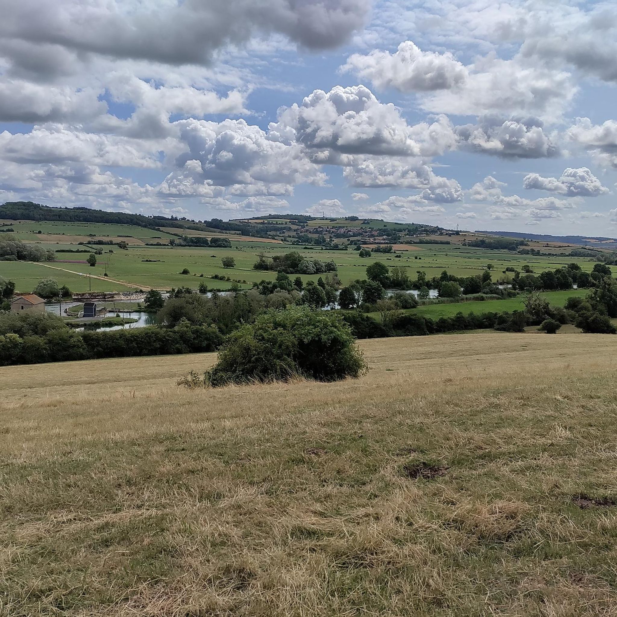
Hiking around La Besace offers routes through a landscape characterized by rolling hills and historical sites. The region features a mix of woodlands, open fields, and small villages. Trails often lead past significant landmarks and natural water features like ponds. The terrain generally presents moderate elevation changes, suitable for various hiking experiences.
Best hiking trails around La Besace
- The most popular hiking route is Hiking loop from Raucourt-et-Flaba, a 4.7 miles (7.6 km) trail that takes 2 hours 5…
Last updated: July 5, 2026
3.0
(1)
14
hikers
7.58km
02:06
140m
140m
Moderate hike. Good fitness required. Easily-accessible paths. Suitable for all skill levels.
5.0
(1)
14
hikers
16.3km
04:33
320m
320m
Moderate hike. Good fitness required. Easily-accessible paths. Suitable for all skill levels.

Sign up for free
5.0
(7)
7
hikers
Moderate hike. Good fitness required. Easily-accessible paths. Suitable for all skill levels.
14
hikers
10.9km
02:59
180m
180m
Moderate hike. Good fitness required. Easily-accessible paths. Suitable for all skill levels.
6
hikers
21.2km
05:46
300m
290m
Hard hike. Very good fitness required. Easily-accessible paths. Suitable for all skill levels.
Get access to more routes and recommendations from other explorers.
Sign up for free
Already have an account?
Our route recommendations are based on thousands of hikes, rides, and runs completed by other people on komoot.
Start today with a free account
Your next adventure awaits.
Login or Signup


Tips from the Community

After a visit to the Grande-Chartreuse in the Dauphiné, Odo, abbot of the Abbaye Saint-Remi in Reims, founded the first Carthusian monastery in France in 1132. It covered more than 12 hectares and was surrounded by a triple wall. The monastery, so close to Protestant Sedan, suffered during the religious wars, served as a prison during the French Revolution and was then partially demolished. In the open space at the foot of the Crêtes de l'Argonne there are eight sober 17th century buildings made of pink brick, with natural stone frames on doors and windows. It is all that remains of the former monastery.
1
0

This magnificent building is located in the center of Raucourt-et-Flaba. While its parish would have been founded in the year 400. The Saint-Nicaise church dates from 1061. The work has retained its appearance of the time, despite restorations in the 18th and 19th centuries. Inside, there are three altars and a remarkable baptismal font made up of a carved Givet stone tank.
3
0

It is a small pond surrounded by lush vegetation and wildlife, located near the historic Chartreuse du Mont-Dieu, a former monastery dating back to the 12th century. You can enjoy the tranquility of nature, admire the architecture of the ruins and maybe even spot fish or frogs in the water.
5
0
If you are looking for a peaceful and isolated hiking spot, you will enjoy visiting the Chartreuse du Mont-Dieu, a former monastery of the Carthusian order founded in 1132. This historic site is located in the heart of the Ardennes forest, surrounded by century-old trees and springs. You can explore the ruins of the monastery, which was rebuilt in the 17th century in a brick and stone style similar to that of Place Ducale in Charleville. You can also enjoy the natural beauty of the forest, where you may encounter wildlife such as deer, foxes or birds. The Chartreuse du Mont-Dieu is an ideal destination for a quiet and relaxing hike.
4
0


Just enjoy the soothing scenery.
2
0
Angecourt is a commune in the French department of Ardennes in the Grand Est region and has 391 inhabitants (2018). The place is part of the district of Sedan. The commune was part of the canton of Raucourt-et-Flaba until it was abolished on March 22 and communes were incorporated into the canton of Vouziers. The surface of Angecourt is 3.7 km², the population density is 94.6 inhabitants per km². Source: https://nl.wikipedia.org/wiki/Angecourt
2
1
Angecourt is a commune in the Ardennes department of France in the Grand Est region and has 391 inhabitants (2018). The place is part of the Sedan district. The surface of Angecourt is 3.7 km², the population density is 94.6 inhabitants per km². Source: https://nl.wikipedia.org/wiki/Angecourt
2
0
Frequently Asked Questions
How many hiking trails are available around La Besace?
La Besace offers a diverse range of hiking experiences with over 50 trails recorded on komoot. These routes cater to various skill levels, from easy strolls to more challenging treks.
Are there easy hiking trails suitable for beginners in La Besace?
Yes, La Besace has 17 easy hiking routes perfect for beginners or those looking for a relaxed walk. These trails typically feature gentle terrain and shorter distances, allowing you to enjoy the scenery without significant effort.
Can I find family-friendly hiking routes around La Besace?
Many of the easy and moderate trails in La Besace are suitable for families. The region's landscape of rolling hills and woodlands provides pleasant, manageable paths. Consider routes with historical sites or natural water features for added interest for children.
Are dogs allowed on the hiking trails in La Besace?
Generally, dogs are welcome on trails in the La Besace region, especially in rural and forested areas. However, it's always best to keep them on a leash, particularly near livestock or in nature reserves, and to clean up after them. Specific restrictions might apply in certain protected areas or private lands, so look for local signage.
Are there circular hiking routes available in La Besace?
Yes, La Besace features several excellent circular walks. For instance, the Angecourt Church – Angecourt Village and Church loop from Raucourt-et-Flaba is a moderate 6.8-mile (10.9 km) path that allows you to explore local culture and rural scenery without retracing your steps.
What kind of historical sites can I explore while hiking in La Besace?
The region around La Besace is rich in history. You can find trails that lead past significant landmarks such as the Chartreuse du Mont-Dieu, a former Carthusian monastery, or the Abbatiale Notre-Dame de Mouzon. The Battle of Stonne (1940) loop from Stonne also offers insights into the area's past.
What is the best time of year to go hiking in La Besace?
The best time for hiking in La Besace is typically from spring through autumn (April to October). During these months, the weather is generally mild and pleasant, and the natural landscapes are at their most vibrant. Autumn offers beautiful foliage, while spring brings blooming wildflowers.
Are there any trails with viewpoints or scenic overlooks in La Besace?
While specific named viewpoints are not highlighted, the rolling hills and varied terrain of La Besace naturally offer numerous scenic spots. Trails often pass through open fields and elevated sections, providing expansive views of the surrounding woodlands and villages. The Le Gros Chêne – Chartreuse du Mont-Dieu loop from Les Grandes-Armoises, for example, traverses varied terrain that includes elevated sections.
What do other hikers enjoy the most about hiking in La Besace?
The hiking trails in La Besace are highly rated by the komoot community, with an average score of 4.6 stars from over 140 reviews. Hikers often praise the region's mix of woodlands, open fields, and historical sites, as well as the well-maintained paths and the peaceful atmosphere.
Are there any trails that pass by water features or ponds?
Yes, the La Besace region is known for its natural water features. The Chartreuse du Mont-Dieu – Étang de la Barbière loop from Stonne is a prime example, leading past the Étang de la Barbière (Barbière Pond), offering serene views and opportunities to observe local wildlife.
What should I bring for a hike in La Besace?
For hiking in La Besace, it's advisable to bring appropriate footwear for varied terrain, water, snacks, and weather-appropriate clothing as conditions can change. A map or GPS device (like the komoot app) is also recommended, especially for longer routes, to navigate the mix of woodlands and open areas.
Are there less crowded hiking options in La Besace?
While some popular routes might see more foot traffic, La Besace has over 50 trails, offering plenty of opportunities to find quieter paths. Exploring some of the less-known moderate or difficult routes, or hiking during off-peak hours, can lead to a more solitary experience amidst the region's natural beauty.
Most popular attractions around La Besace

Get inspired with the komoot mobile app


Explore more
Browse the best Hikes in other regions.
