The best walks and hikes around Mont
4.6
(81)
391
hikers
74
hikes
Hiking around Mont offers a variety of trails through a landscape characterized by gentle hills and woodlands. The region features serene ponds and elevated points like the Signal of Mont, providing local viewpoints. Trails often traverse forested areas and open countryside, with modest elevation changes. This makes it suitable for hikers seeking accessible outdoor experiences.
Best hiking trails around Mont
- The most popular hiking route is Bourbon-Lancy – Breuil Pond loop from Bourbon-Lancy, a 3.6 miles (5.8 km) trail…
Last updated: July 2, 2026
4.8
(6)
60
hikers
5.55km
01:26
30m
30m
Easy hike. Great for any fitness level. Easily-accessible paths. Suitable for all skill levels.
4.7
(6)
11
hikers
5.67km
01:42
180m
180m
Easy hike. Great for any fitness level. Easily-accessible paths. Suitable for all skill levels.

Sign up for free
4.7
(3)
6
hikers
3.31km
00:56
70m
70m
Easy hike. Great for any fitness level. Easily-accessible paths. Suitable for all skill levels.
5
hikers
11.4km
03:16
280m
280m
Moderate hike. Good fitness required. Easily-accessible paths. Suitable for all skill levels.
5.0
(1)
3
hikers
2.42km
00:42
60m
60m
Easy hike. Great for any fitness level. Easily-accessible paths. Suitable for all skill levels.
Get access to more routes and recommendations from other explorers.
Sign up for free
Already have an account?
Our route recommendations are based on thousands of hikes, rides, and runs completed by other people on komoot.
Start today with a free account
Your next adventure awaits.
Login or Signup

Tips from the Community

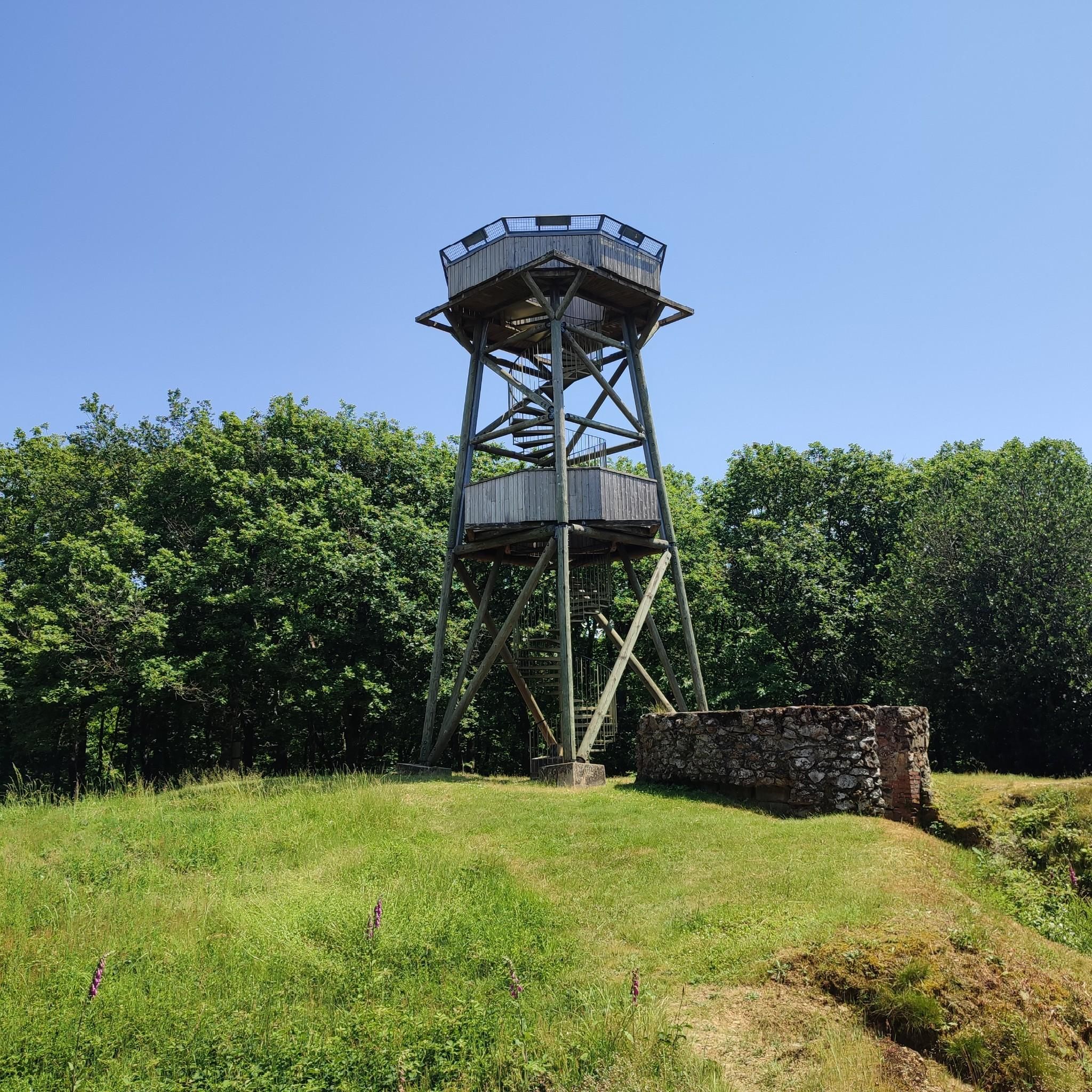
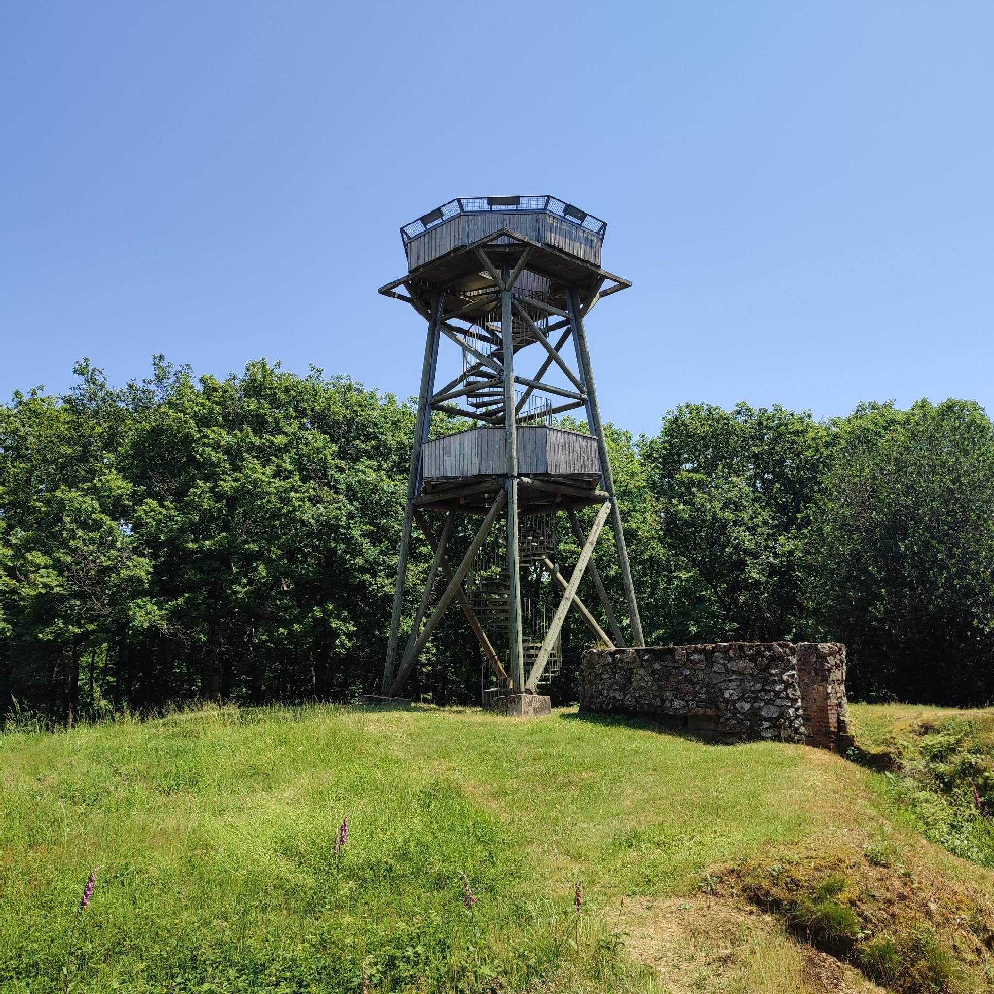
The Signal de Mont is located at an altitude of 469 meters. The observation tower is 12 meters high and offers a 360° panorama of the rolling Burgundy landscape. You can decipher the view thanks to the eight orientation tables. At the foot of the tower, you will find the remains of a World War II aircraft defense post.
0
0


This is a beautiful medieval town. There are a few restaurants and cafes - I can only recommend everyone to stop here, it's worth it!
0
0

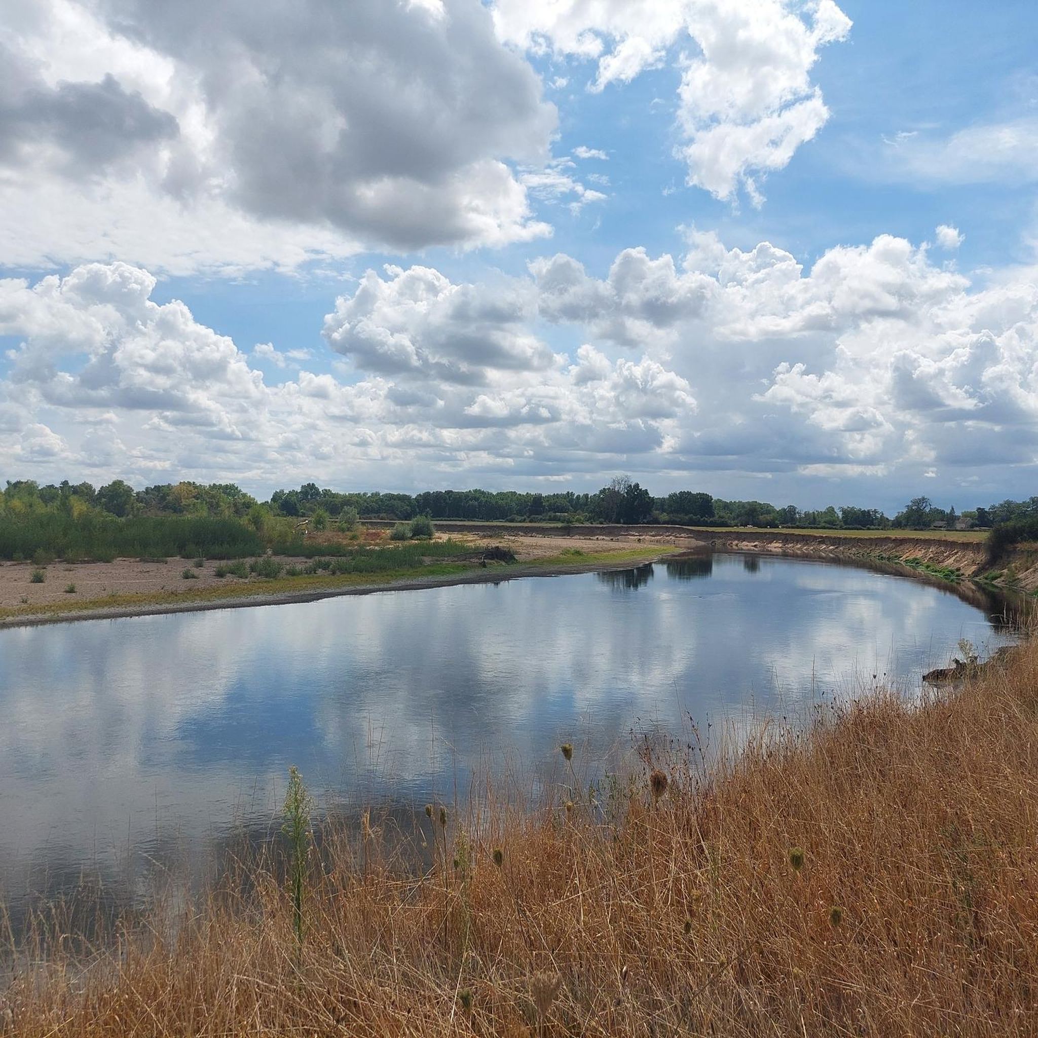
In the heart of Bourbon-Lancy, the Breuil lake is a must for Sunday walks. Nearby, the city campsite, open from spring to autumn, welcomes travelers on the GR 3.
1
0
The Bois de la Teugne is a beautiful forest area that is home to a mixture of deciduous and thorny trees. In the middle of the wood, the Signal de Mont culminates at 469 meters above sea level.
1
0
At 469 meters above sea level, the Signal de Mont is one of the remarkable peaks of southern Burgundy. A belvedere as well as an orientation table allow a beautiful reading of the surrounding countryside.
1
0
Renowned for the quality of its thermal waters, Bourbon-Lancy is a beautiful medieval town with colorful households full of history.
1
0
Frequently Asked Questions
How many hiking trails are available around Mont?
Mont offers a diverse selection of over 50 hiking trails. These routes cater to various skill levels, with a majority being easy or moderate, making the area accessible for many outdoor enthusiasts.
What kind of terrain can I expect on hikes around Mont?
Hiking around Mont is characterized by gentle hills, tranquil ponds, and dense woodlands. The trails typically feature modest elevation changes, providing accessible outdoor experiences through forested areas and open countryside.
Are there any easy hikes suitable for beginners or families in Mont?
Yes, Mont has numerous easy trails perfect for beginners and families. For instance, the Bourbon-Lancy – Breuil Pond loop from Bourbon-Lancy is an easy 3.6-mile route featuring a scenic pond and gentle terrain. Another great option is the Bourbon-Lancy loop from Bourbon-Lancy, a shorter 2.0-mile trail through the local countryside.
Are there any circular hiking routes in the Mont area?
Many of the trails around Mont are designed as circular routes, allowing you to start and end at the same point. Examples include the popular Bourbon-Lancy – Breuil Pond loop from Bourbon-Lancy and the more challenging Signal of Mont – Bois de la Teugne loop from Maltat.
What are some notable landmarks or points of interest to see while hiking in Mont?
While hiking in Mont, you can explore several interesting points. The Signal of Mont offers local viewpoints, and the serene Breuil Pond is a beautiful natural feature. Additionally, the historic Medieval quarter of Bourbon-Lancy is nearby for cultural exploration.
What do other hikers enjoy most about the trails in Mont?
The trails in Mont are highly rated by the komoot community, with an average score of 4.5 stars from over 76 reviews. Hikers often praise the quiet woodlands, gentle terrain, and the accessible nature of the routes, making them enjoyable for a wide range of abilities.
Are there any trails with good viewpoints in Mont?
Yes, for those seeking views, the Signal of Mont is a key elevated point in the region. The Signal of Mont – Bois de la Teugne loop from Maltat specifically includes a climb to this point, offering local panoramic views over the surrounding landscape.
Are the hiking trails around Mont suitable for dogs?
While specific regulations for dogs on every trail are not detailed, the general character of Mont's trails—gentle hills, woodlands, and open countryside—often makes them suitable for well-behaved dogs on a leash. It's always recommended to check local signage for any specific restrictions.
Is there public transport access to hiking trails in Mont?
The provided data does not specify direct public transport links to individual trailheads. Most visitors to regions like Mont typically rely on personal vehicles to access the starting points of hikes, especially for routes that traverse rural areas.
Where can I find parking for hiking trails in Mont?
While specific parking locations are not detailed for every trailhead, routes often start from towns or villages like Bourbon-Lancy or Maltat. It is generally advisable to look for designated parking areas within these communities or near popular trail access points.
Are there any moderate difficulty hikes for more experienced hikers in Mont?
Yes, for those looking for a bit more challenge, the Signal of Mont – Bois de la Teugne loop from Maltat is a moderate 7.1-mile path. This trail explores forested areas and includes a climb to the Signal of Mont, offering a more extended and engaging experience.
Most popular attractions around Mont

Get inspired with the komoot mobile app


Explore more
Browse the best Hikes in other regions.
