The best walks and hikes around Leucamp
4.4
(111)
662
hikers
31
hikes
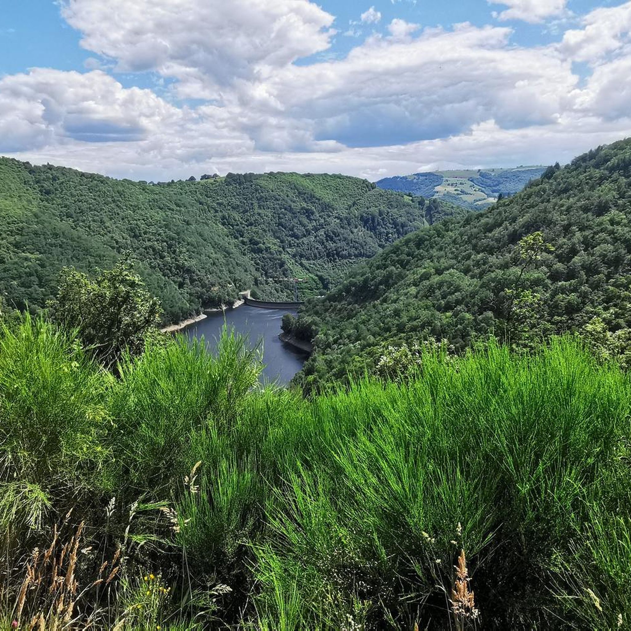
Hiking around Leucamp offers diverse landscapes in the Châtaigneraie Cantalienne region of Auvergne-Rhône-Alpes, France. Situated at an altitude of 610 meters, the area features lush Goul, Selves, Lot, and Dazes valleys, characterized by wooded areas, streams, and pine forests. The terrain includes mid-mountain rolling hills and provides views of the Monts du Cantal. Over 800 hectares of the commune are wooded, with trails winding through fir tree undergrowth and ancient chestnut groves.
Best hiking trails around Leucamp
- The most popular…
Last updated: June 29, 2026
5.0
(2)
39
hikers
2.61km
00:47
90m
90m
Easy hike. Great for any fitness level. Easily-accessible paths. Suitable for all skill levels.
4.3
(3)
15
hikers
7.44km
02:05
150m
150m
Moderate hike. Good fitness required. Easily-accessible paths. Suitable for all skill levels.

Sign up for free
4.3
(3)
14
hikers
9.09km
02:31
170m
170m
Moderate hike. Good fitness required. Easily-accessible paths. Suitable for all skill levels.
4.8
(5)
16
hikers
4.28km
01:15
130m
120m
Easy hike. Great for any fitness level. Easily-accessible paths. Suitable for all skill levels.
5.0
(2)
11
hikers
12.0km
03:36
370m
370m
Moderate hike. Good fitness required. Easily-accessible paths. Suitable for all skill levels.
Get access to more routes and recommendations from other explorers.
Sign up for free
Already have an account?
Our route recommendations are based on thousands of hikes, rides, and runs completed by other people on komoot.
Start today with a free account
Your next adventure awaits.
Login or Signup


Tips from the Community

Charming stream near Ladinhac.
0
0

An old stone bridge over a river with small waterfalls. Path with a beautiful view of the Château de Valon
0
0

Large forest, which spreads out from the village of Murols, where eight generations of blacksmiths have succeeded each other! Forest tracks, paths, and beautiful viewpoints over the Goul valley.
1
0
Strange metal sculptures that mark out the "trail of the Imagination of Fire and Wind" in the forest of Murol. Follow the markings made of small iron dragons.
1
0
Frequently Asked Questions
How many hiking trails are available around Leucamp?
There are over 30 hiking routes around Leucamp, catering to various difficulty levels. You'll find a good mix of easy strolls and moderate treks, with a few more challenging options as well. Specifically, there are 15 easy, 13 moderate, and 3 difficult routes to explore.
What kind of terrain can I expect on hikes in Leucamp?
Leucamp's hiking terrain is characterized by lush, green valleys like the Goul, Selves, Lot, and Dazes, offering frequent scenic viewpoints. You'll hike through wooded areas, streams, and pine forests, often encountering ancient chestnut groves. The landscape features rolling, verdant hills and provides views of the distant Monts du Cantal, giving it a mid-mountain feel.
Are there any hikes with waterfalls near Leucamp?
Yes, the region is home to the beautiful Cascade du Saut du Chien. You can find trails that lead to this natural attraction. For example, the Small Bridge and Waterfall loop from Gally is an easy 4.3 km route that includes a waterfall. You can also find a dedicated highlight for the View of the Saut du Chien waterfall.
Are there family-friendly hiking options in Leucamp?
Absolutely. Leucamp offers several easy routes perfect for families. The Sculptures - Forêt de Murols loop from Murols is an easy 2.6 km trail that explores wooded areas and takes less than an hour, making it ideal for younger hikers. Many trails wind through shaded forests, which are pleasant for families, especially in summer.
Can I bring my dog on the trails in Leucamp?
While specific regulations for dogs on every trail are not detailed, generally, dogs are welcome on many hiking trails in the Auvergne-Rhône-Alpes region, especially if kept on a leash. The varied terrain with wooded areas and streams provides a great environment for walks with your canine companion. Always ensure your dog is under control and respect local signage.
What historical or cultural sites can I explore while hiking in Leucamp?
Leucamp has a rich mining past and cultural heritage. You can explore trails like the 'Du granit au wolfram' which commemorates the area's tungsten mining history. The 'Chemin des Écoliers' is a 10.73 km loop that passes by the Saint-Amans fountain and the Croix de Trapouet. Nearby, you can also visit the impressive Valon Castle, which is a notable landmark in the region.
Are there any circular walks around Leucamp?
Yes, many of the trails around Leucamp are designed as circular routes, allowing you to start and end in the same location. Examples include the Ruisseau de Cances loop from Ladinhac, a moderate 7.4 km path, and the Ruisseau de Cances loop from La Croix de Lasplagnes, a 9.1 km trail. These loops are excellent for exploring the diverse landscapes without needing to retrace your steps.
What is the best time of year to go hiking in Leucamp?
The region is beautiful throughout much of the year. The wooded areas and ancient chestnut groves provide shaded routes that are especially pleasant during the summer months. Spring and autumn offer vibrant colors and milder temperatures, making them ideal for hiking. While winter hikes are possible, conditions can vary, so it's always best to check local weather forecasts.
What do other hikers say about the trails in Leucamp?
The trails around Leucamp are highly regarded by the komoot community, with an average rating of 4.4 stars from nearly 100 reviews. Hikers often praise the quiet woodlands, the varied terrain, and the well-marked paths that lead through scenic valleys and past natural features. Over 600 hikers have used komoot to explore this beautiful area.
Are there any good viewpoints or scenic spots on the trails?
Yes, the Goul valley offers frequent scenic viewpoints, and from various points, you can enjoy views of the Monts du Cantal. The Laussac peninsula, with its splendid chapel, is another iconic site within hiking distance that provides picturesque vistas. Many trails wind through areas described as having 'pure, unspoilt beauty'.
Are there places to stop for a break or picnic along the trails?
Yes, you'll find several convenient spots for breaks. The Croix de Trapouet, along the 'Chemin des Écoliers' trail, is noted as a pleasant picnic area. Additionally, the Plan d'eau du Maurs, about 5 kilometers from Leucamp, offers a tranquil natural setting with picnic facilities, though swimming is prohibited. Many villages and hamlets along the routes also feature traditional built heritage where you might find a spot to rest.
Is there parking available at the trailheads in Leucamp?
While specific parking locations for every trailhead are not detailed, Leucamp and its surrounding villages are generally accessible by car. It is common for trailheads in rural French communes to have designated parking areas, often near village centers or popular starting points. We recommend checking the individual tour pages on komoot for specific parking information related to your chosen route.
Most popular attractions around Leucamp

Get inspired with the komoot mobile app


Explore more
Browse the best Hikes in other regions.
