The best mountain hikes around La Llagonne
4.7
(11)
67
hikers
15
hikes
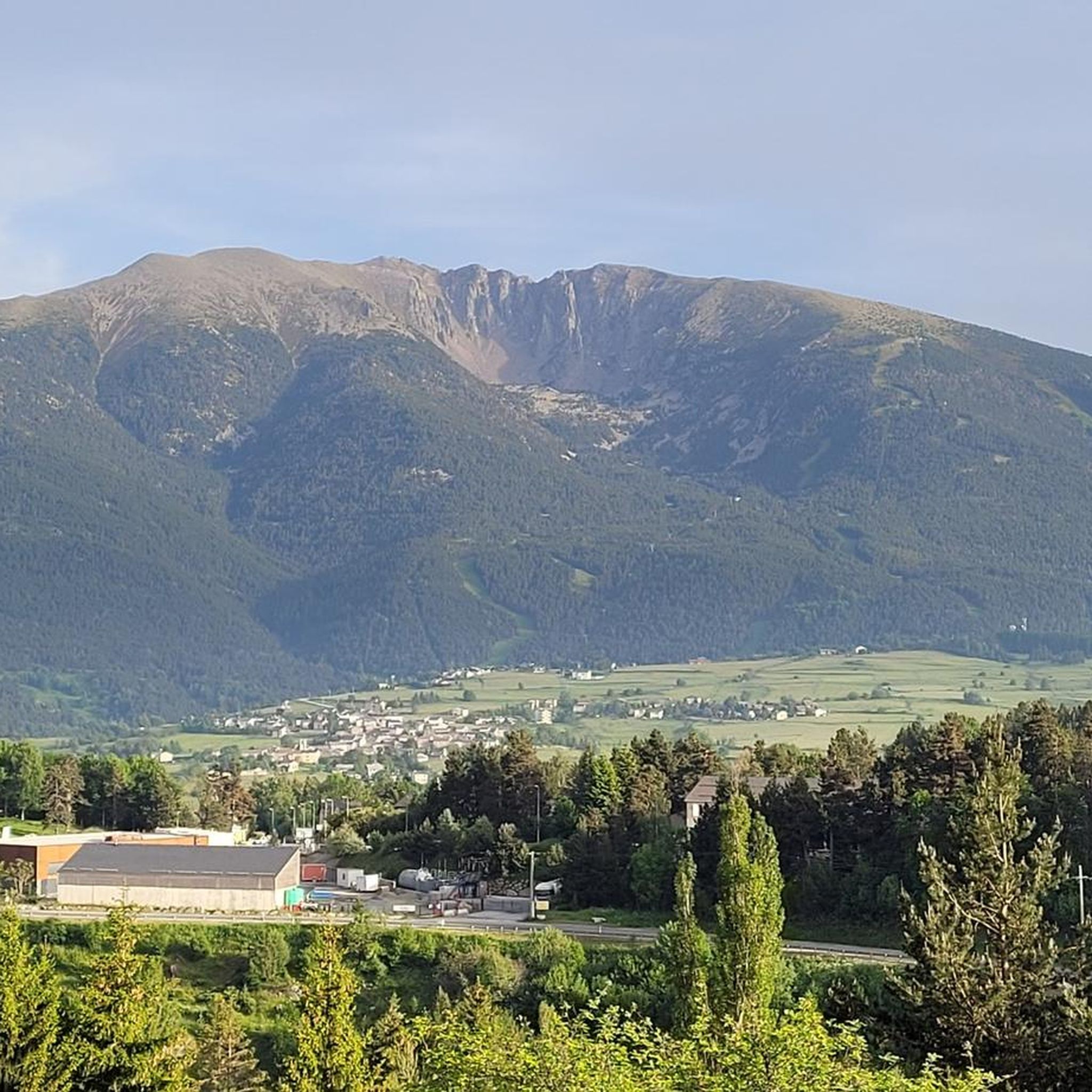
Mountaineering routes around La Llagonne traverse a landscape characterized by the rugged peaks of the Pyrenees-Orientales, offering varied terrain for ascents. The region features high-altitude lakes, alpine meadows, and rocky summits, providing a challenging environment for mountaineers. Elevations in the area can reach significant heights, with routes often involving substantial vertical gain and exposed sections.
Best mountaineering routes around La Llagonne
- The most popular mountaineering route is Les Bones Hores Bar & Restaurant – Peak Carlit loop from Lac des…
Last updated: July 15, 2026
5.0
(1)
9
hikers
11.5km
04:46
920m
920m
Hard mountaineering route. Very good fitness required. Easily-accessible paths. Suitable for all skill levels.
5.0
(2)
9
hikers
8.03km
02:54
260m
260m
Moderate mountaineering route. Good fitness required. Mostly accessible paths. Sure-footedness required.

Sign up for free
5.0
(1)
6
hikers
19.2km
08:34
1,270m
1,270m
Hard mountaineering route. Very good fitness required. Sure-footedness, sturdy shoes and alpine experience required.
4.7
(3)
10
hikers
12.6km
04:34
370m
370m
Moderate mountaineering route. Good fitness required. Mostly accessible paths. Sure-footedness required.
3.0
(1)
3
hikers
5.45km
01:34
140m
140m
Easy mountaineering route. Great for any fitness level. Easily-accessible paths. Suitable for all skill levels.
Get access to more routes and recommendations from other explorers.
Sign up for free
Already have an account?
Our route recommendations are based on thousands of hikes, rides, and runs completed by other people on komoot.
Start today with a free account
Your next adventure awaits.
Login or Signup
Tips from the Community

The L'abri de la Jasse is an open hut that allows you to stop for the night, but also to take a break sheltered from the sun or rain. It is set in a magnificent, peaceful natural setting, in the middle of a clearing dotted with pine trees.
0
0

At the top but at the end the loop back on the left side at the level of the waterfall is not accessible in late spring because there is still too much snow, you will have to go through the other side.
0
0

A superb lake reflecting the neighboring peaks. The morning light amplifies this mirror effect.
0
0

Nestled in a glacial basin, this small lake often lies dry in summer, revealing an impressive mineral setting, surrounded by meadows and imposing peaks. The trails leading to the lake offer magnificent views of the surrounding mountains and allow you to enjoy the tranquility of this timeless place.
1
0
This small high-altitude lake, accessible by hiking trails, offers a preserved natural setting, ideal for a contemplative break. The calm, crystal-clear waters reflect the surrounding peaks.
1
0

Carlit Peak is part of the Capcir granite massif, which is dotted with 27 lakes and small lakes in the Occitania region, northwest of Font-Romeu. Its summit is located at 2921 meters, allowing you to observe an immense panorama (from Canigó to the Central Pyrenees).
1
0

Beautiful loop from the Eyne ski resort
0
0

just a magnificent hike to take in to take in the views 💕
0
0
Frequently Asked Questions
How many mountaineering routes are available around La Llagonne?
There are over 15 mountaineering routes documented around La Llagonne, offering a variety of challenges and scenic experiences in the Pyrenees-Orientales.
What is the best time of year for mountaineering in La Llagonne?
The ideal time for mountaineering in La Llagonne is typically from late spring to early autumn (June to September). During these months, the weather is generally more stable, and high-altitude trails are free of snow, making for safer and more enjoyable ascents. Winter mountaineering is possible but requires specialized equipment and experience due to snow and ice conditions.
Are there any easier mountaineering routes suitable for beginners?
Yes, La Llagonne offers some routes suitable for those new to mountaineering. There are 3 easy routes and 6 moderate routes available. For a moderate option that offers stunning views without extreme difficulty, consider the Lac de la Coumasse – View of the lakes loop from Lac des Bouillouses, which is 8 km long.
What kind of terrain can I expect on mountaineering routes around La Llagonne?
Mountaineering routes around La Llagonne traverse a diverse landscape characterized by the rugged peaks of the Pyrenees-Orientales. You can expect high-altitude lakes, alpine meadows, and rocky summits, often involving substantial vertical gain and exposed sections. The terrain provides a challenging environment for mountaineers.
Are there circular mountaineering routes in the area?
Yes, many mountaineering routes around La Llagonne are designed as loops, allowing you to start and finish at the same point. For example, the Cambre d'Aze Summit loop from Eyne is a popular circular trail that leads through alpine terrain to a prominent summit.
What natural attractions can I see along the mountaineering routes?
The routes often pass by beautiful natural attractions. You can encounter several high-altitude lakes, such as Lake Bouillouses, Viver Lake, and Estany del Castellar. Some routes also cross mountain passes like Col de la Llose, offering expansive views.
Where can I find parking near mountaineering trailheads?
Many popular mountaineering routes, especially those starting near Lac des Bouillouses or Eyne, typically have designated parking areas. It's advisable to check specific route descriptions on komoot for detailed information on trailhead access and parking availability, as some areas might have seasonal restrictions or require a fee.
Are there places to eat or stay overnight near the mountaineering routes?
Yes, there are several refuges and huts in the vicinity that can serve as places to rest, eat, or even stay overnight. Notable options include En Beys Refuge, Bouillouses Refuge, and Ras de la Carança Refuge. These can be excellent stops on longer expeditions.
What should I wear or bring for mountaineering in La Llagonne?
Given the high-altitude and variable conditions in the Pyrenees, it's crucial to be well-prepared. Always bring layers of clothing, including waterproof and windproof outer shells, sturdy mountaineering boots, a map and compass (or GPS device), sufficient water and food, sun protection, and a first-aid kit. Depending on the season, ice axe and crampons might be necessary for higher, snow-covered sections.
Are permits required for mountaineering in La Llagonne?
Generally, no specific permits are required for day mountaineering trips in the La Llagonne area. However, if you plan to access certain protected areas or undertake multi-day expeditions involving overnight stays in designated refuges, it's always wise to check with local authorities or refuge guardians for any specific regulations or booking requirements.
What do other mountaineers say about the routes in La Llagonne?
The mountaineering routes in La Llagonne are highly rated by the komoot community, with an average score of 4.7 stars from over 20 reviews. Mountaineers often praise the challenging ascents, the stunning panoramic views from the summits, and the serene beauty of the alpine lakes and meadows.
Are there any particularly challenging routes for experienced mountaineers?
For experienced mountaineers seeking a significant challenge, the Cambre d'Aze Summit – Pic d'Eyne (2,789 m) loop from Eyne is a demanding option. This difficult route covers over 19 km and involves more than 1200 meters of elevation gain, offering extensive mountain views and a substantial physical test.
Most popular routes around La Llagonne
Most popular attractions around La Llagonne

Get inspired with the komoot mobile app


Explore more
Browse the best Mountain Hikes & Routes in other regions.
