The best walks and hikes around Étréchy
4.6
(85)
371
hikers
54
hikes
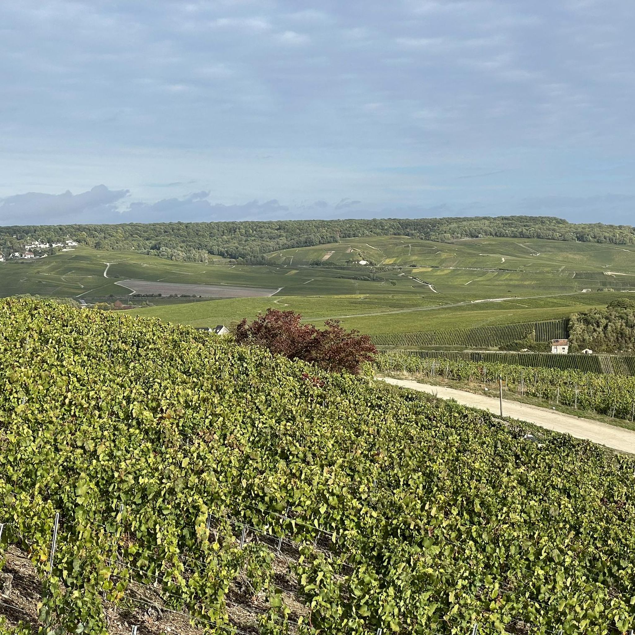
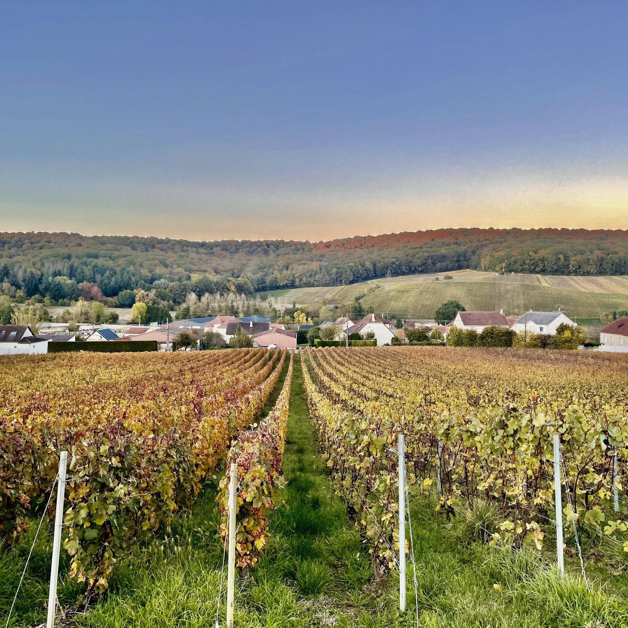
Hiking around Étréchy offers access to a landscape characterized by gentle rolling hills, agricultural fields, and pockets of woodland. The terrain typically features moderate elevation changes, making it suitable for various activity levels. The region's trails often traverse open countryside, providing views of the rural environment.
Best hiking trails around Étréchy
- The most popular hiking route is Loop around Vert-Toulon — Menhir de l'étang de Chénevry, a 13.4 miles (21.6 km) trail that takes 5 hours 43 minutes to…
Last updated: July 9, 2026
2
hikers
21.6km
05:44
210m
210m
Hard hike. Very good fitness required. Easily-accessible paths. Suitable for all skill levels.
4.7
(3)
18
hikers
13.4km
03:35
150m
160m
Moderate hike. Good fitness required. Easily-accessible paths. Suitable for all skill levels.

Sign up for free
4.0
(4)
20
hikers
15.3km
04:06
180m
180m
Moderate hike. Good fitness required. Easily-accessible paths. Suitable for all skill levels.
7
hikers
6.04km
01:41
110m
110m
Easy hike. Great for any fitness level. Easily-accessible paths. Suitable for all skill levels.
5.0
(4)
11
hikers
8.34km
02:13
80m
80m
Moderate hike. Good fitness required. Easily-accessible paths. Suitable for all skill levels.
Get access to more routes and recommendations from other explorers.
Sign up for free
Already have an account?
Our route recommendations are based on thousands of hikes, rides, and runs completed by other people on komoot.
Start today with a free account
Your next adventure awaits.
Login or Signup


Tips from the Community

A beautiful complex, including a hotel, where you can even just enjoy a drink in the castle courtyard. A very pleasant place for a break. Only the champagne, at €12.50 a glass, is a bit overpriced.
0
1

Beautiful view of Champagne, some passages at 13/14°.
0
0

A hill with an altitude of 240 meters. It offers beautiful panoramic views of the Côte des Blancs vineyards, the surrounding villages and the fields.
0
0
Very beautiful Romanesque church. Very beautiful organ. The most spectacular are the crypts which you should not hesitate to discover: they are very well preserved. A very beautiful room is dedicated to Saint Anne. You can also discover an ancient sarcophagus. You can also see swans in the pond in front of the church.
1
1
It is a Gothic church in the Romanesque style, it has been classified as a Historic Monument since July 30, 1934. The beginning of the construction dates from the 12th century.
1
0
Menhir is a monument formed by a standing stone. This menhir is isolated and dates from the Neolithic period. It is classified as a historical monument and seems to indicate an ossuary located nearby (according to the anthropological society of Paris).
0
0
It is a hotel built in the 17th century. It has its own park and cellar.
1
0

The moated castle from the 17th century is surrounded by a 18-hectare park. It has housed a hotel and a restaurant since the 1990s. Unfortunately nothing for the small purse 😕
1
0
Frequently Asked Questions
How many hiking trails are there in Étréchy?
There are nearly 50 hiking trails available around Étréchy, offering a variety of options for different skill levels and preferences. These routes are well-regarded by the komoot community.
Are there easy hiking routes suitable for beginners in Étréchy?
Yes, Étréchy offers a good selection of easy hikes, with 21 routes specifically categorized as easy. An example is the Mont Aimé Viewpoint – Mont-Aimé loop from Bergères-lès-Vertus, which is 3.7 miles (6.0 km) long and typically takes about 1 hour 40 minutes to complete.
What kind of terrain can I expect on hikes around Étréchy?
The hiking terrain around Étréchy is characterized by gentle rolling hills, expansive agricultural fields, and charming pockets of woodland. You'll generally find moderate elevation changes, making the trails accessible for various fitness levels. Many routes traverse open countryside, providing pleasant views of the rural landscape.
Are there any long-distance trails in the Étréchy area?
While Étréchy is known for its diverse range of trails, it also includes options for longer excursions. For example, the Loop around Vert-Toulon — Menhir de l'étang de Chénevry is a challenging 13.4 miles (21.6 km) trail that takes approximately 5 hours 43 minutes to complete.
Can I find circular hiking routes around Étréchy?
Yes, many of the hiking routes in Étréchy are circular, allowing you to start and end at the same point. Popular examples include the Eglise St. Martin and Swan – Porte Baudet loop from Vertus and the Étoges Castle loop from Beaunay.
What are some interesting places to see along the hiking trails in Étréchy?
Hikers in Étréchy can discover several points of interest. You might encounter historical sites like the Eglise St. Martin and Swan, or the impressive Étoges Castle. For those interested in ancient history, the Menhir de l'étang is a notable monument. Additionally, some trails offer scenic views, such as the View of Avize and Champagne Bottle Sculpture.
What do other hikers say about the trails in Étréchy?
The trails around Étréchy are highly rated by the komoot community, with an average score of 4.5 stars from over 70 reviews. Hikers often praise the varied terrain, which includes open fields and woodlands, and appreciate the well-maintained paths suitable for different ability levels.
Are the hiking trails around Étréchy suitable for families with children?
Many of the trails in Étréchy, particularly the 21 easy routes, are suitable for families. The gentle elevation changes and varied landscapes provide an enjoyable experience for children. Consider shorter, well-marked circular routes for a family-friendly outing.
What is the typical duration for hikes in Étréchy?
Hiking durations in Étréchy vary widely depending on the route's length and difficulty. You can find short walks lasting around 1 hour 40 minutes, like the Mont Aimé Viewpoint – Mont-Aimé loop, to longer, more challenging trails that can take over 5 hours, such as the Loop around Vert-Toulon.
Is there public transport access to the hiking trailheads in Étréchy?
Étréchy is served by local public transport options, primarily buses, which can connect you to various points within the region. It's advisable to check local bus schedules and routes in advance to plan your access to specific trailheads.
Where can I park when hiking in Étréchy?
Parking is generally available in and around the villages that serve as starting points for hikes in Étréchy. Look for designated parking areas in village centers or near popular trailheads. It's always a good idea to arrive early, especially on weekends, to secure a spot.
What is the best season to hike in Étréchy?
The best seasons for hiking in Étréchy are typically spring and autumn. During these times, the weather is mild, and the natural scenery is particularly beautiful, with blooming flowers in spring and vibrant foliage in autumn. Summer can also be pleasant, but it's advisable to start early to avoid the midday heat.
Most popular attractions around Étréchy

Get inspired with the komoot mobile app


Explore more
Browse the best Hikes in other regions.
