The best road cycling routes around Charnod
4.6
(45)
922
riders
77
rides
Road cycling routes around Charnod traverse diverse landscapes, featuring well-paved surfaces and varied elevation profiles suitable for different fitness levels. The region includes areas with scenic views across reservoirs and surrounding hills, offering a mix of terrains from gentle slopes to more challenging climbs. Cyclists can expect routes that wind through natural areas, providing a range of experiences.
Best road cycling routes around Charnod
- The most popular road cycling route is Viaduct Cize-Bolozon – Cize Viaduct loop from Aromas,…
Last updated: July 18, 2026
4.7
(3)
24
riders
39.5km
01:50
460m
460m
Moderate road ride. Good fitness required. Mostly well-paved surfaces and easy to ride.
6
riders
64.2km
03:05
900m
900m
Hard road ride. Very good fitness required. Mostly well-paved surfaces and easy to ride.

Sign up for free
5.0
(1)
6
riders
35.2km
01:48
630m
630m
Moderate road ride. Good fitness required. Mostly well-paved surfaces and easy to ride.
4
riders
55.1km
02:41
720m
720m
Moderate road ride. Good fitness required. Mostly well-paved surfaces and easy to ride.
6
riders
55.5km
02:43
770m
770m
Moderate road ride. Good fitness required. Mostly well-paved surfaces and easy to ride.
Get access to more routes and recommendations from other explorers.
Sign up for free
Already have an account?
Our route recommendations are based on thousands of hikes, rides, and runs completed by other people on komoot.
Start today with a free account
Your next adventure awaits.
Login or Signup

Tips from the Community

pretty little stone viaduct with 2 superimposed lanes, one for cars with 6 arches and one for the train with 11 arches. Atypical.
0
0
The bridge separates two departments, the Jura and the Ain. "Iron bridge. For several centuries, the Ain was crossed at Thoirette using a ferry, called Christouphe's ferry, named after the commune where the passenger resided. From 1808 to 1811, the riparian communes contributed to building a bridge in place of this ferry. The project had been drawn up by Mr. Cordier, from Orgelet, an engineer then in charge of directing the works for the Simplon road. Various obstacles opposed the execution of this work. It was not until 1829 that an iron bridge was built, which collapsed in 1843. The Ain department has just replaced it with an iron bridge currently open to traffic". Statistique de la France - 1855 - Ministère de l'Agriculture by Imprimerie Impériale in Paris - p53.
0
0
Old washhouse in Courtouphle: facing Thoirette whose bridge separates two departments, the Jura and the Ain.
0
0
The bridge separates two departments, the Jura and the Ain. "Iron bridge. For several centuries, the Ain was crossed at Thoirette by means of a ferry, known as the bac de Christouphe, the name of the commune where the passenger resided. From 1808 to 1811, the riparian communes clubbed together to build a bridge in place of this ferry. The project had been drawn up by Mr. Cordier, of Orgelet, an engineer then in charge of the direction of the Simplon road works. Various obstacles opposed the execution of this work. It was only in 1829 that an iron bridge was built, which collapsed in 1843. The department of Ain has just replaced it with an iron bridge currently open to traffic". Statistique de la France - 1855 - Ministère de l'Agriculture par Imprimerie Impériale à Paris - p53.
0
0

Pretty little viaduct which is a real must-see!
0
0
Magnificent viaduct, nice spot for an outing in Ain.
0
0

Definitely worth a visit, you simply have to include this double-decker bridge in your itinerary.
0
0

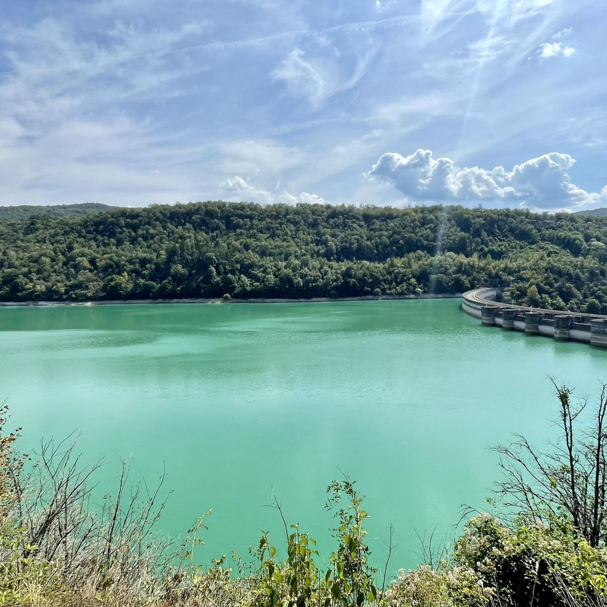
This magnificent lake lies at the confluence of the Ain and Valouse rivers. It is located at the foot of the medieval Château de Conflans.
0
0
Frequently Asked Questions
How many road cycling routes are available around Charnod?
There are over 70 road cycling routes in the Charnod region, offering a wide variety of experiences. These routes are highly rated by the komoot community, with an average score of 4.7 stars.
What kind of terrain can I expect when road cycling in Charnod?
Road cycling around Charnod features diverse landscapes, from well-paved surfaces to varied elevation profiles. You'll find a mix of terrains, including gentle slopes, more challenging climbs, and scenic views across reservoirs and surrounding hills, characteristic of the Jura region.
Are there road cycling routes suitable for beginners or families in Charnod?
Yes, Charnod offers several routes suitable for beginners, with 6 easy routes available. While specific family-friendly routes are not highlighted, these easier options often provide a good starting point for less experienced cyclists.
Where can I find challenging road cycling routes around Charnod?
For experienced cyclists seeking a challenge, Charnod has 17 difficult routes. A notable option is the Thoirette on the Ain River – Arinthod loop from Montfleur, which is 39.9 miles (64.2 km) long and features significant climbs through varied terrain.
What natural attractions can I see along road cycling routes in Charnod?
The Charnod area is rich in natural beauty. You can encounter stunning features like the Quinquenouille Waterfall and the Valouse Waterfall. Other natural highlights include the Grotte de Corveissiat and the scenic Mont Myon.
Are there any historical or cultural landmarks to explore while cycling in Charnod?
Yes, the region offers several points of interest. You might pass by historical sites such as the Oliferne Castle Ruins, the beautiful Church of Saint-Hymetière, or the serene Chartreuse de Sélignac.
What do other road cyclists say about their experience in Charnod?
The komoot community highly rates road cycling in Charnod, with an average score of 4.7 stars from over 30 reviews. Cyclists often praise the varied terrain, scenic views across reservoirs, and the network of routes suitable for different ability levels.
Are there circular road cycling routes available in Charnod?
Many of the road cycling routes in Charnod are designed as loops, allowing you to start and finish at the same point. For example, the popular Cize-Bolozon Viaduct – Cize Viaduct loop from Aromas is a moderate 26.0 miles (41.8 km) circular route.
What is the best time of year for road cycling in the Charnod region?
Given its likely location in the Jura region, the best time for road cycling in Charnod is typically from late spring through early autumn (May to October). During these months, the weather is generally mild and pleasant, and the natural landscapes are at their most vibrant.
Are there any specific routes that offer a good mix of scenery and moderate challenge?
Absolutely. The Arinthod – Saint-Julien loop from Val-Suran is a great option. This moderate 21.9 miles (35.2 km) route takes you through rural landscapes, offering a balanced experience of scenic views and manageable climbs.
Can I find longer distance road cycling routes in Charnod?
Yes, Charnod offers several longer routes for those looking to cover more distance. The Grotto of La Balme-d'Épy loop from Val-Suran, for instance, is a moderate 34.2 miles (55.1 km) route that provides an extended cycling experience.
Most popular attractions around Charnod

Get inspired with the komoot mobile app


Explore more
Browse the best Road cycling routes in other regions.
