The best walks and hikes around Augea
4.4
(102)
638
hikers
60
hikes
Hiking around Augea reveals a landscape characterized by distinct geological formations, including deep "reculées" or blind valleys, often carved into limestone. The region features a mix of dense woodlands and open areas, providing varied terrain for exploration. Trails frequently lead to elevated viewpoints, offering expansive perspectives of the surrounding countryside. The elevation changes across the routes contribute to diverse hiking experiences.
Best hiking trails around Augea
- The most popular hiking route is The reculée of Gizia — loop via Chatel…
Last updated: July 6, 2026
4.7
(14)
81
hikers
6.07km
02:08
250m
260m
Moderate hike. Good fitness required. Mostly accessible paths. Sure-footedness required.
3.4
(5)
11
hikers
11.8km
03:31
350m
350m
Moderate hike. Good fitness required. Mostly accessible paths. Sure-footedness required.

Sign up for free
5.0
(2)
4
hikers
15.9km
05:06
560m
560m
Hard hike. Very good fitness required. Mostly accessible paths. Sure-footedness required.
5.0
(2)
27
hikers
17.3km
05:15
570m
570m
Hard hike. Very good fitness required. Easily-accessible paths. Suitable for all skill levels.
4.5
(2)
7
hikers
10.6km
03:11
300m
300m
Moderate hike. Good fitness required. Mostly accessible paths. Sure-footedness required.
Get access to more routes and recommendations from other explorers.
Sign up for free
Already have an account?
Our route recommendations are based on thousands of hikes, rides, and runs completed by other people on komoot.
Start today with a free account
Your next adventure awaits.
Login or Signup


Tips from the Community

Beautiful little old town. There is an excellent gas-fired pizza place in town that we like to visit when we pass through. Everything is fresh and prepared on site. 🍕🍕🍕
2
0

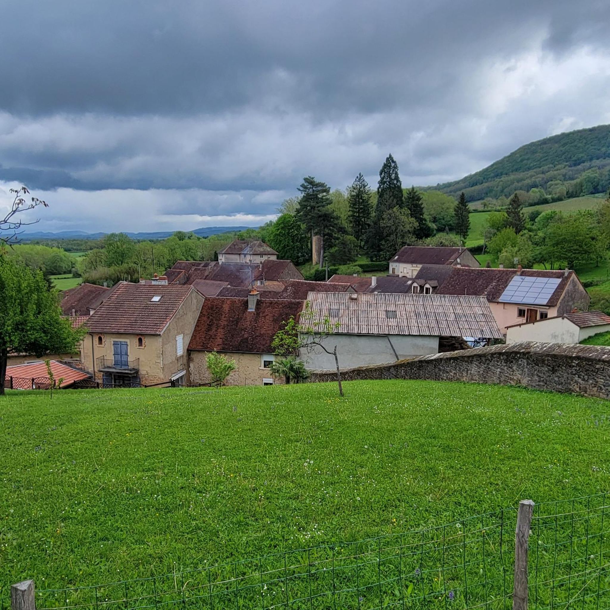
This small, remote village hosted a large religious community, including the Benedictines of Gigny from 974 to 1359.
1
0
The Chanelet belvedere or Gizia cross belvedere offers superb views of the valley, the Bresse plain, and even the Côte-d'Or on a clear day.
0
0
Perched between Bresse and Revermont, this small village is home to the eponymous castle. Dating from the 12th century, the building dominates the Bresse plain from its rocky promontory located at an altitude of 470 meters. Largely in ruins, it can be visited free of charge all year round.
0
0

Châtel is intimately linked to the history of the Via Cluny paths. This quiet little village has housed a large religious community. Marked by the presence of the Benedictines of Gigny from 974 to 1359, Manassès III de Coligny made Châtel a Benedictine priory linked to the abbey of Gigny. The abbey of Cluny then named "the prior of Châtel", while the church of Saint-Etienne de Châtel became the seat of a vast parish.
1
0
Charming Romanesque style church.
0
0
The pretty medieval village of Cuiseaux is an ideal place for a stroll along its narrow streets and its walkway. Its remains dating from the Middle Ages testify to its past: 12th century fortified gate known as the "orchard gate", Renaissance houses with mullioned windows, castle of the Princes of Orange, watchtower house, washhouse, Saint-Thomas church with remarkable wooden stalls and its black Madonna, winegrowers' houses...
0
0
Frequently Asked Questions
How many hiking trails are available around Augea?
There are over 50 hiking trails around Augea, offering a variety of experiences from easy strolls to more challenging routes. The komoot community has explored 58 distinct tours in the area.
Are there easy hiking trails suitable for beginners in Augea?
Yes, Augea offers 23 easy routes perfect for beginners or those looking for a relaxed walk. A good option is the Mossy Woods Trail loop from Beaufort-Orbagna, which is 2.8 miles (4.5 km) long and features gentle elevation changes.
Are there family-friendly hiking options around Augea?
Many of the easier trails in Augea are suitable for families. The region's diverse landscapes, including woodlands and scenic viewpoints, offer engaging experiences for all ages. Look for routes with shorter distances and less elevation gain for younger hikers.
Can I bring my dog on the hiking trails in Augea?
Most trails in the Augea region are dog-friendly. However, it's always recommended to keep your dog on a leash, especially in areas with wildlife, livestock, or near agricultural land, to ensure safety and respect for the environment.
What kind of natural features can I expect to see on hikes around Augea?
Hiking around Augea reveals a landscape characterized by distinct geological formations known as "reculées" or blind valleys, often carved into limestone. You'll also find extensive woodlands, open areas, and elevated viewpoints offering expansive perspectives of the surrounding countryside.
Are there any circular hiking routes in Augea?
Yes, many of the trails around Augea are designed as circular routes, allowing you to start and end at the same point. An example is The Gizia Reculée – Chanelet Viewpoint loop from Cuisia, a moderate 7.3-mile (11.8 km) path.
What are some challenging hiking routes in Augea?
For those seeking a challenge, Augea offers 5 difficult routes. One moderate option that provides a good workout is the Chevreaux – Chanelet Viewpoint loop from Cousance, which is 9.6 miles (15.5 km) long with significant elevation changes.
What are some interesting landmarks or attractions to see near the hiking trails?
While hiking, you can explore several interesting landmarks. The Chanelet Viewpoint offers panoramic views, and the historic Chevreaux Castle is another notable site. Some routes also pass through charming settlements like Châtel.
What do other hikers enjoy the most about hiking in Augea?
The area is highly rated by the komoot community, with an average score of 4.4 stars from over 90 reviews. Hikers often praise the distinctive reculées, extensive woodlands, and the variety of scenic viewpoints that offer diverse and rewarding experiences.
How long do the hiking trails around Augea typically take to complete?
Hiking durations vary significantly depending on the route's length and difficulty. For example, the moderate The reculée of Gizia — loop via Chatel typically takes around 2 hours 8 minutes, while longer routes like the Chevreaux – Chanelet Viewpoint loop from Cousance can take approximately 5 hours.
Are there less crowded hiking trails in Augea?
While some popular routes can see more foot traffic, Augea has a network of trails, and exploring some of the less-known paths or hiking during off-peak hours can offer a more secluded experience. Look for routes that are not highlighted as 'most popular' to find quieter options.
What is the best time of year to go hiking in Augea?
The best time for hiking in Augea is generally from spring to autumn, when the weather is mild and the natural scenery is at its most vibrant. Spring brings blooming flora, while autumn offers beautiful foliage. Winter hiking is possible but may require appropriate gear for colder conditions.
Most popular attractions around Augea

Get inspired with the komoot mobile app


Explore more
Browse the best Hikes in other regions.
