The best walks and hikes around Préveranges
4.5
(104)
447
hikers
41
hikes
Hiking around Préveranges offers exploration through a rural, hilly, and wooded environment in the southern Cher department of France. The area features diverse topography, including the highest point of the central region, Le Magnoux at 504 meters, and tranquil spots like the communal pond, Étang André Grymonprez. Nearby gorges present unique submontane vegetation, while the Source de l'Indre provides a peaceful natural site. This varied landscape provides a scenic backdrop for numerous hiking trails.
Best hiking trails around Préveranges
- The…
Last updated: July 11, 2026
4.0
(1)
3
hikers
11.8km
03:11
150m
150m
Hike the moderate 7.3-mile La Source de l'Indre loop near Saint-Priest-la-Marche, featuring 508 feet of elevation gain and the source of the
5.0
(2)
11
hikers
11.1km
02:59
140m
140m
Moderate hike. Good fitness required. Easily-accessible paths. Suitable for all skill levels.

Sign up for free
5.0
(2)
7
hikers
6.62km
01:48
100m
100m
Easy hike. Great for any fitness level. Easily-accessible paths. Suitable for all skill levels.
11
hikers
23.7km
06:24
310m
310m
Hard hike. Very good fitness required. Easily-accessible paths. Suitable for all skill levels.
5.0
(1)
6
hikers
8.60km
02:20
120m
120m
Moderate hike. Good fitness required. Easily-accessible paths. Suitable for all skill levels.
Get access to more routes and recommendations from other explorers.
Sign up for free
Already have an account?
Our route recommendations are based on thousands of hikes, rides, and runs completed by other people on komoot.
Start today with a free account
Your next adventure awaits.
Login or Signup

Tips from the Community

Hello, can we do the trail by mountain bike? Thank you.
0
0

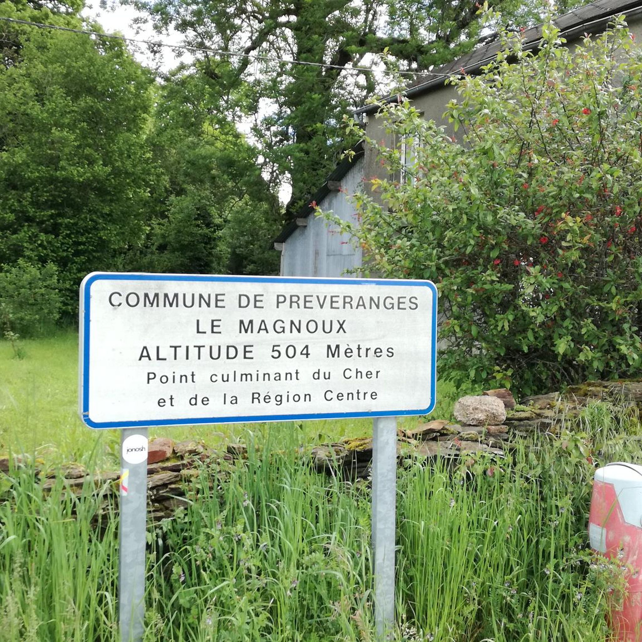
You are here, at the highest point in the Cher department and the Centre-Val de Loire region. It rises to an altitude of 504 meters. The roads leading there are quiet and peaceful.
0
0
Near Saint-Priest-La-Marche, at a place called Beddes in Cher (18) at an altitude of 454 m, discover the source of the Indre river which crosses the department of the same name (36) passing through the towns of Sainte Sévère, La Châtre, Ardentes, Châteauroux (prefecture), Buzançais. It is a tributary of the Loire.
0
0

good walking shoes
0
0

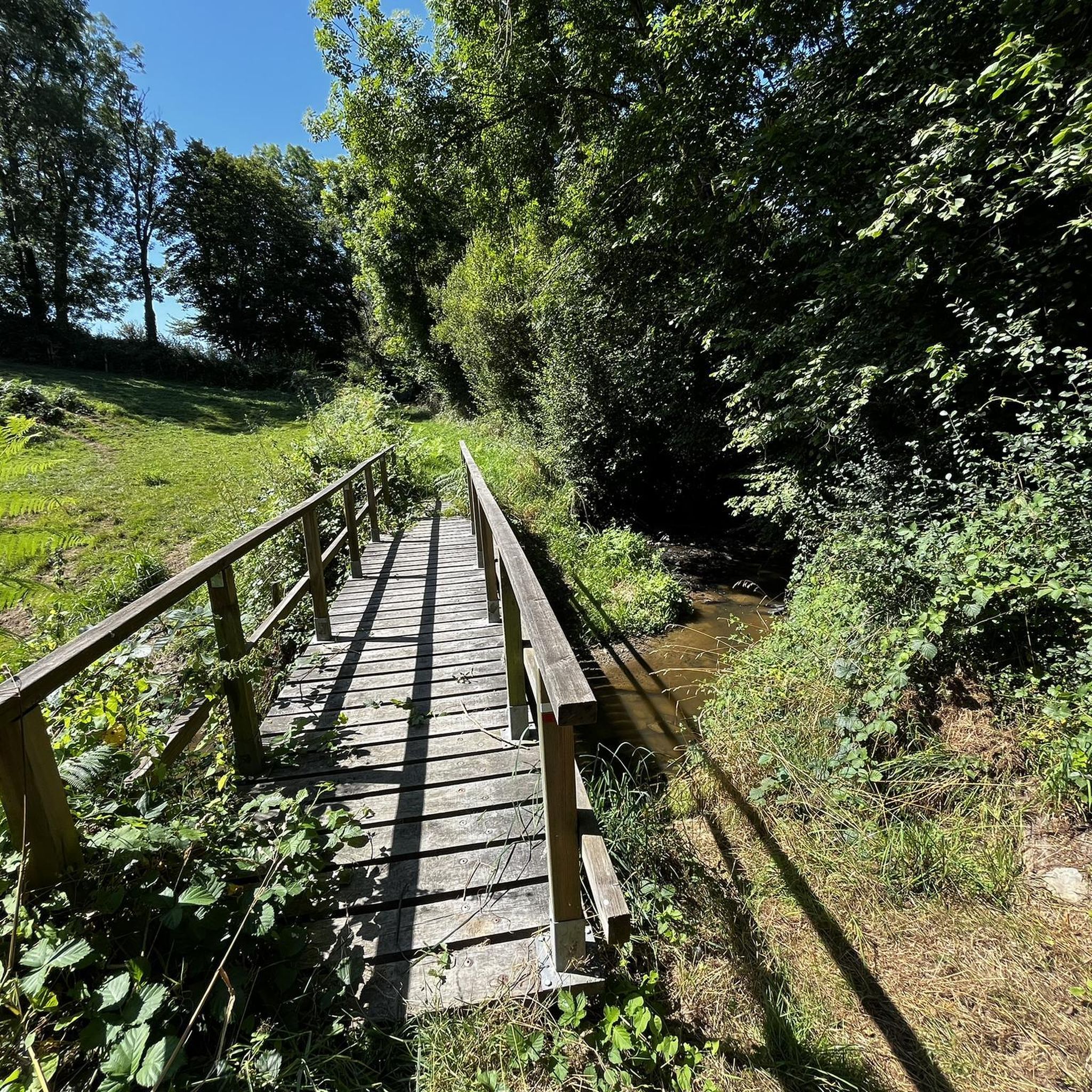
One of the pretty trails of the GR de Pays "On the path of the Maîtres Sonneurs", which is inspired by George Sand's book of the same name and is maintained on a daily basis by an association.
1
0
Source of the Indre, which confluences with the Loire 265km further, after crossing the departments of Cher, Indre and Indre-et-Loire. One of the particularities of the Indre is that its banks are private, belonging to the owners of neighboring land.
0
0
Frequently Asked Questions
How many hiking trails are available in Préveranges?
There are over 35 hiking routes around Préveranges, offering a variety of options for different skill levels and preferences. The area is known for its rural, hilly, and wooded environment, providing a scenic backdrop for exploration.
What are the different difficulty levels for hiking trails in Préveranges?
Préveranges offers a range of hiking difficulties. You'll find 12 easy routes, 19 moderate routes, and 6 difficult routes. This variety ensures there's something for everyone, from leisurely strolls to more challenging ascents.
Are there any easy hikes suitable for families or beginners?
Yes, Préveranges has several easy hikes perfect for families or beginners. One such option is the Source de l'Indre loop from Saint-Priest-la-Marche, an approximately 6.6 km trail that takes around 2 hours to complete. These easier paths often lead through tranquil wooded areas or past features like the communal pond, Étang André Grymonprez.
Can I find circular hiking routes in Préveranges?
Many of the trails in Préveranges are circular, allowing you to start and end at the same point. A popular example is the Source of the Indre Loop, which is a moderate 11.8 km route exploring the natural site of the Indre's source. Another option is the Hiking loop from Préveranges, an 11.1 km trail through the local countryside.
What natural features or landmarks can I expect to see while hiking?
Préveranges offers diverse natural features. You can explore the tranquil Source de l'Indre, discover unique submontane vegetation in nearby gorges, or enjoy views from Le Magnoux, the highest point of the central region. The area also features the peaceful communal pond, Étang André Grymonprez. For a more challenging hike with scenic views, consider trails around Lac de Sidiailles.
Are there any historical sites or attractions near the hiking trails?
Yes, the region around Préveranges is rich in history. You can explore the medieval Ruins of the Château de la Roche-Guillebaud, hidden among moss and rocks, which local lore suggests had an underground passage. Other nearby attractions include Boussac Castle and Château de Culan, offering glimpses into the area's past.
What is the best time of year to go hiking in Préveranges?
The period between Easter and All Saints' Day (roughly spring through autumn) is generally considered ideal for hiking in Préveranges. During these months, the weather is most favorable for outdoor activities, allowing you to fully enjoy the diverse landscapes and natural sites.
Are the hiking trails in Préveranges dog-friendly?
While specific regulations can vary by trail or protected area, many rural paths in Préveranges are generally dog-friendly. It's always recommended to keep dogs on a leash, especially near livestock or in nature reserves, and to clean up after them. The extensive network of paths through wooded and hilly terrain provides ample space for walks with your canine companion.
What do other hikers enjoy most about hiking in Préveranges?
The hiking routes in Préveranges are highly rated by the komoot community, with an average score of 4.4 stars from over 90 reviews. Hikers often praise the peaceful, varied landscapes, the well-marked paths through hilly and wooded terrain, and the opportunity to discover tranquil spots like the Source de l'Indre and the communal pond.
Are there any long-distance hiking trails that pass through Préveranges?
Yes, Préveranges is notably crossed by the GR 41, a long-distance hiking trail. Additionally, the path of the "Masters ringers" (GRP® des Maîtres Sonneurs) offers significant trekking opportunities, allowing for extended exploration of the region's diverse landscapes and cultural heritage.
Is there parking available near the trailheads in Préveranges?
As a rural commune, Préveranges typically offers parking options in or near the village center, and often at popular trailheads or points of interest. It's advisable to check local signage upon arrival for specific parking regulations and designated areas.
What kind of terrain can I expect on the hikes around Préveranges?
The terrain around Préveranges is predominantly rural, hilly, and wooded. You can expect a mix of sunken paths, trails through forests, and open countryside. Some areas feature unique gorges with diverse vegetation, while others offer elevated viewpoints, such as those around Le Magnoux, the highest point of the central region.
Most popular attractions around Préveranges

Get inspired with the komoot mobile app


Explore more
Browse the best Hikes in other regions.
