The best walks and hikes around Dinéault
4.4
(397)
1,794
hikers
19
hikes
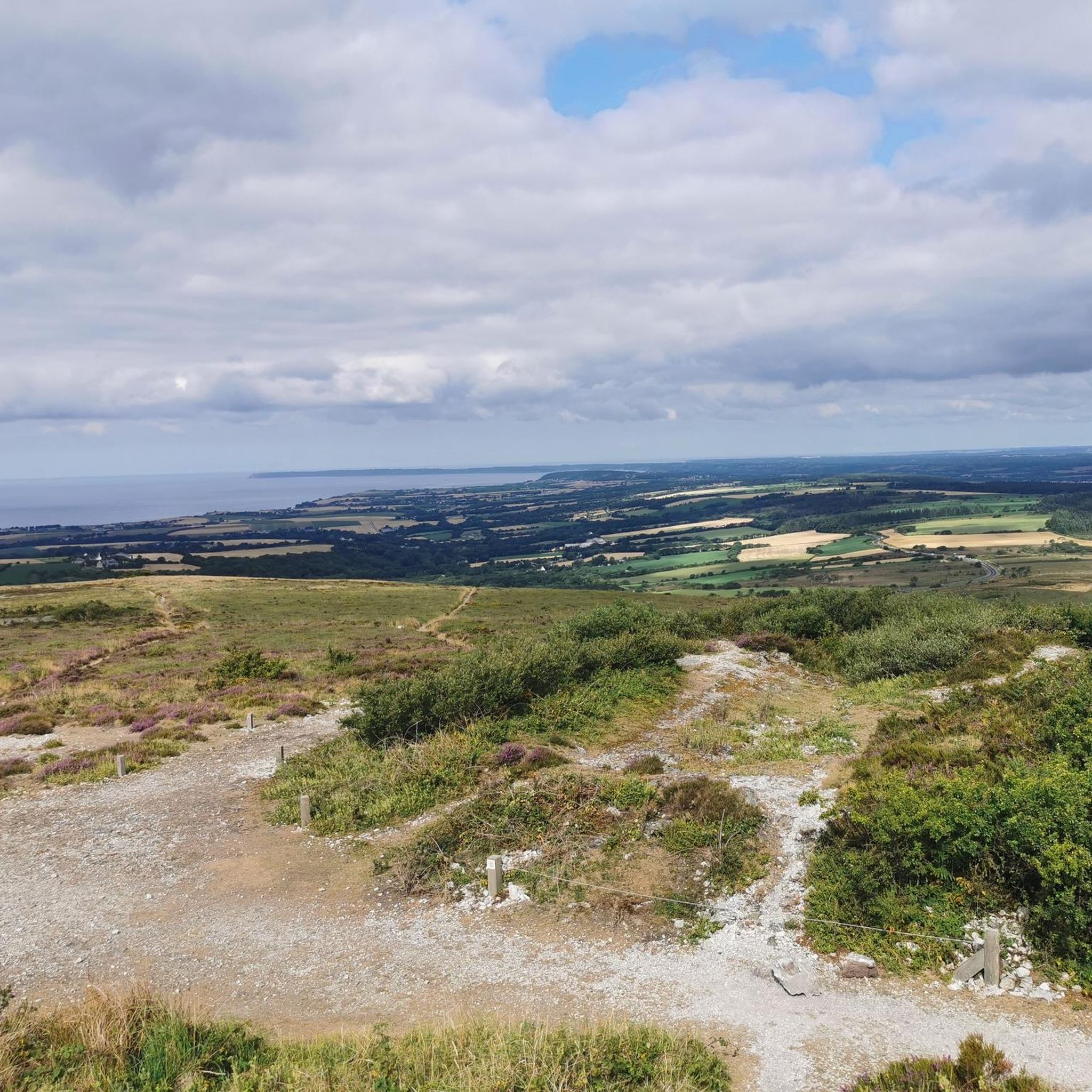
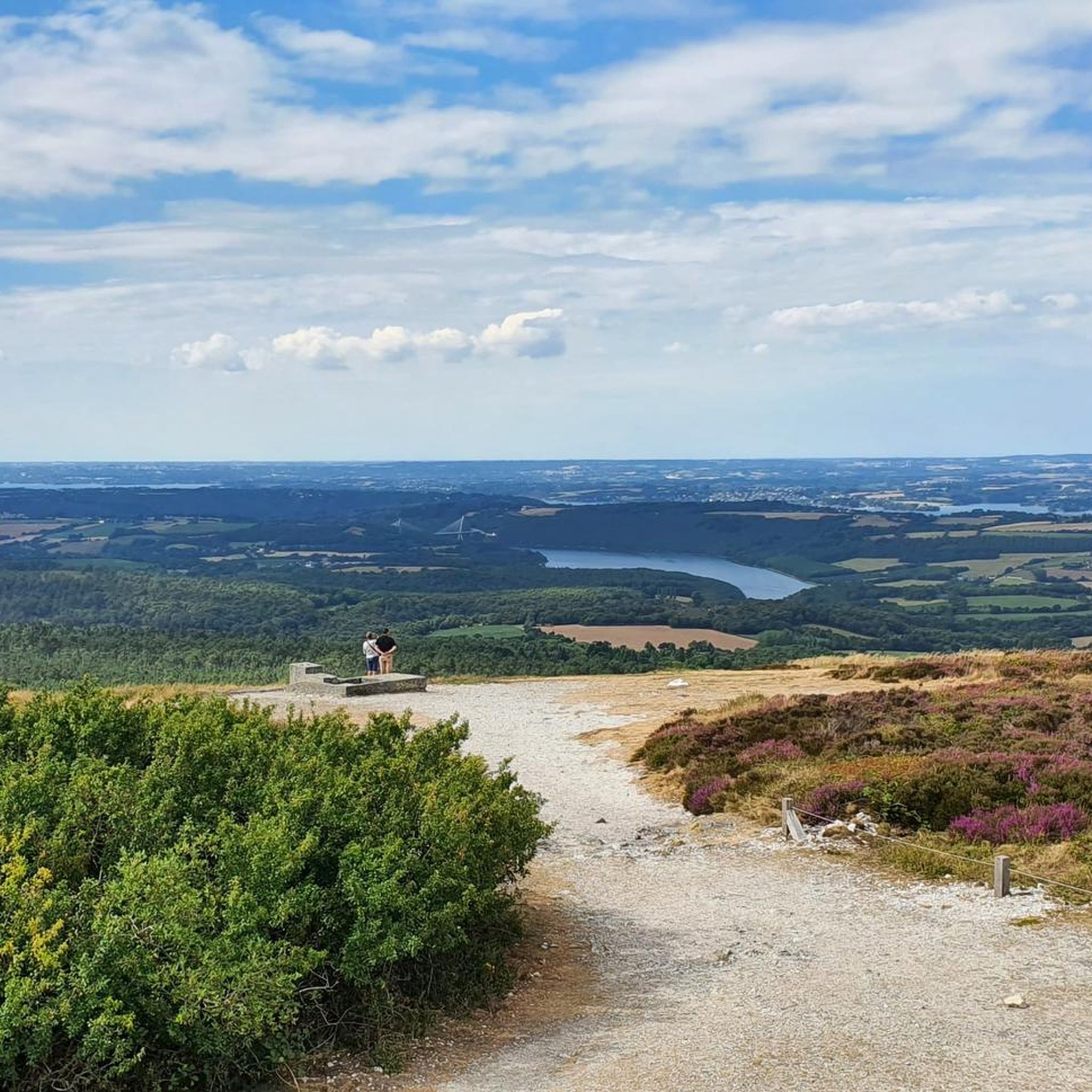
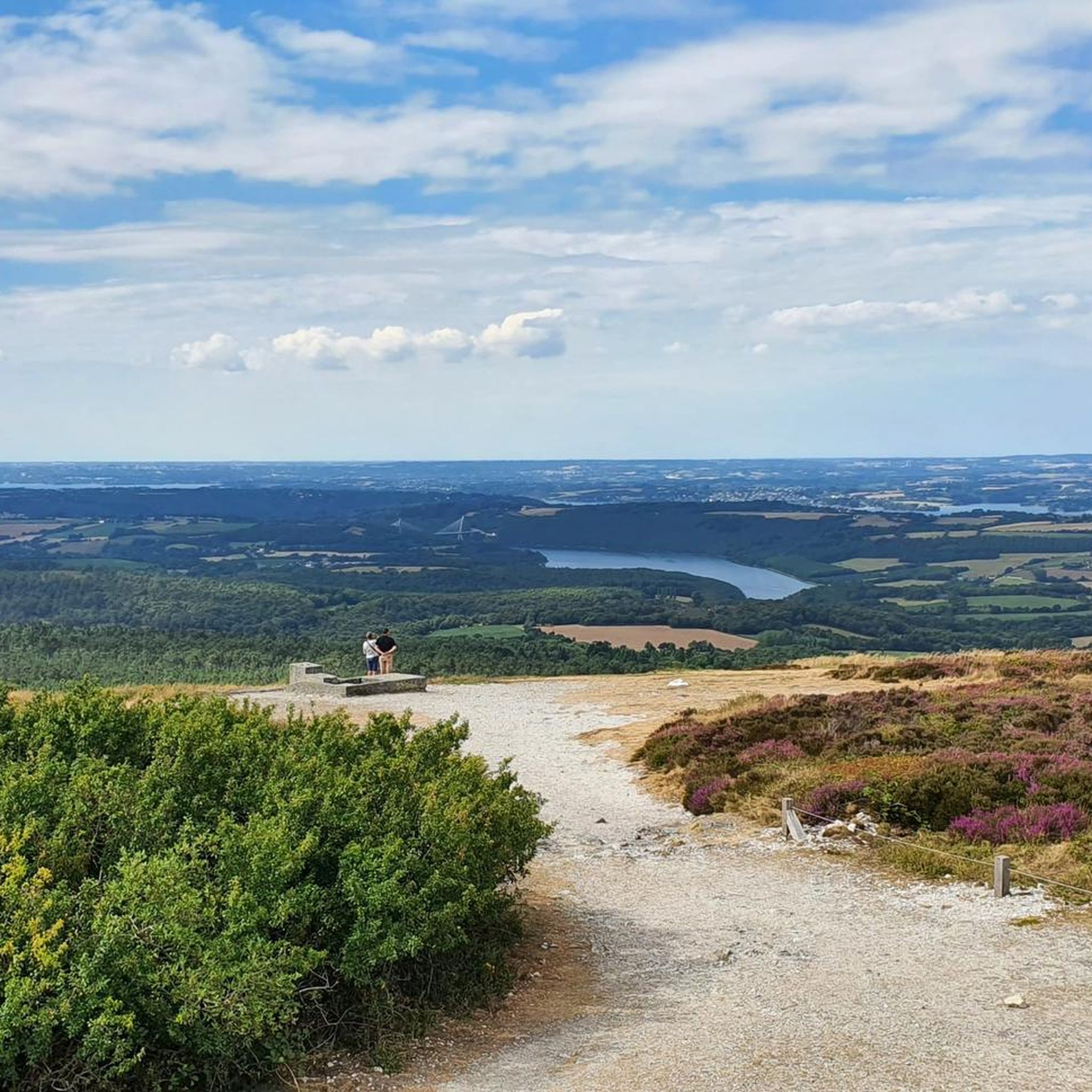
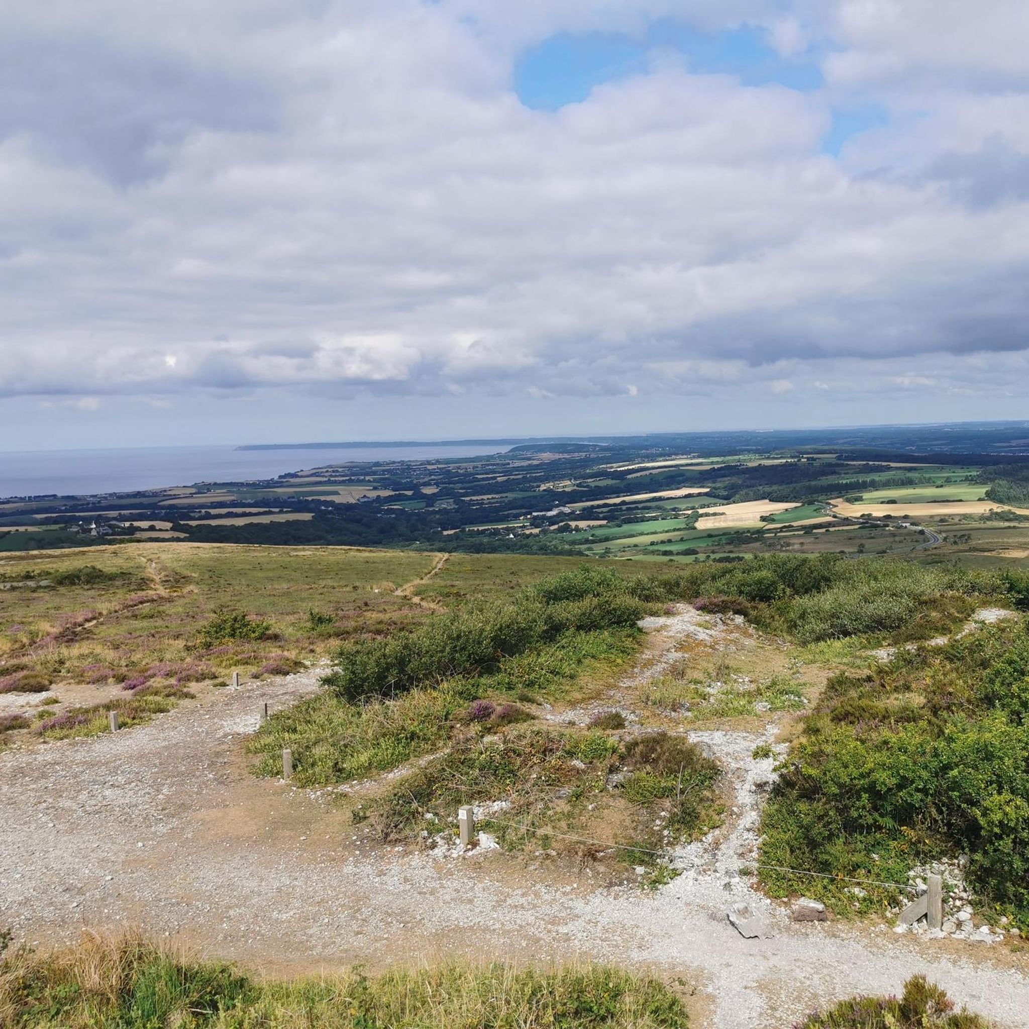
Hiking around Dinéault offers diverse landscapes within the Parc Naturel Régional d'Armorique in Finistère, Brittany. The region is characterized by the prominent Ménez-Hom, a 330-meter hill providing 360-degree panoramic views, and the meandering Aulne Maritime river. Additionally, the Rosconnec Marsh presents a significant biodiversity reservoir with reedbeds and a protected area for migratory birds.
Best hiking trails around Dinéault
- The most popular hiking route is Ménez-Hom trail – View from Ménez-Hom loop from Ménez-Hom, a 9.3 miles (14.9 km) moderate trail that takes about 4 hours 20 minutes to complete, offering expansive views from the Ménez-Hom summit.
- Another top favourite among local hikers is Ménez-Hom Summit and Viewpoint – Summit of Ménez Hom loop from Ménez-Hom, a moderate 4.0 miles (6.5 km) path. This route leads through varied terrain around the Ménez-Hom, providing scenic overlooks.
- Local hikers also love the Ménez-Hom Summit and Viewpoint – Menez Hom loop from Ménez-Hom, a 2.5 miles (4.0 km) easy trail leading through the foothills of Ménez-Hom, often completed in about 1 hour 5 minutes.
- Hiking around Dinéault is defined by the panoramic views from Ménez-Hom, the tranquil Aulne Maritime river valleys, and the biodiverse Rosconnec Marsh. The network offers options for different ability levels, from easy strolls to more challenging moderate routes.
- The routes in Dinéault are highly rated by the komoot community with an average score of 4.4 stars from more than 380 reviews. More than 1,700 hikers have used komoot to explore Dinéault's varied terrain.
Last updated: June 26, 2026
5.0
(2)
16
hikers
Moderate hike. Great for any fitness level. Mostly accessible paths. Sure-footedness required.
4.0
(3)
12
hikers
Moderate hike. Great for any fitness level. Mostly accessible paths. Sure-footedness required.

Sign up for free
5.0
(3)
7
hikers
Moderate hike. Good fitness required. Easily-accessible paths. Suitable for all skill levels.
8
hikers
11.9km
03:23
260m
260m
Moderate hike. Good fitness required. Easily-accessible paths. Suitable for all skill levels.
12
hikers
12.7km
03:20
90m
90m
Moderate hike. Good fitness required. Easily-accessible paths. Suitable for all skill levels.
Get access to more routes and recommendations from other explorers.
Sign up for free
Already have an account?
Our route recommendations are based on thousands of hikes, rides, and runs completed by other people on komoot.
Start today with a free account
Your next adventure awaits.
Login or Signup
Tips from the Community

A nice peak with an unpronounceable name. The road from the north is covered in graffiti to encourage cyclists.
0
0
From the south, a short, steep climb on mostly good asphalt. Only the last 100 meters are a bit of gravel on the road. At the top, you're rewarded with a unique view over Finisterre.
1
0

In summer, set off as early as possible. There's no shade, and there's a chance of haze under the sun!
0
0

a little steep climb but a nice view of the harbor of Brest
0
0

Built on the hillside on the north-west face of a mound which was a fortified point from the 10th century, the Notre-Dame chapel dominates the channeled course of the Aulne by 35 m. Its oldest parts date back to the beginning of the 13th century. At the time, it was the parish church of a small village established on a nearby hillock of which the place called “Le Vieux-Bourg” remains. The structure of the chapel will evolve over the next 5 centuries according to the different styles of the moment. But despite all these changes, a certain unity emerges which makes this church a small masterpiece of Breton architecture. The church, the triumphal arch, the cross and the ossuary are classified historic monuments.
0
0

Superb view of the whole point of Crozon! To be explored in good weather, of course!
2
0

This small hilltop is not as high as the Menez Hom, but from here you can see the entire Baie de Douarnenez "undisturbed". From the Menez Hom you can see exactly this small hilltop. In addition, there is much less going on here than on Menez Hom, which you can almost easily drive to.
0
0

Built on the slope on the northwest side of a hill which has been a fortified point since the 10th century (in the 11th century the cartulary of the Benedictine abbey of Landévennec refers to this place by the name "Montagne de Nin near the bank of the river Hamn" ) the Notre-Dame chapel dominates the course of the canalized Aulne from a height of 35 m Its oldest parts date back to the beginning of the 13th century. At that time it was the parish church of a small village built on a nearby hill, from which the place called "Le Vieux-Bourg" survives. The structure of the chapel will evolve over the next 5 centuries according to the different styles of the moment. But despite all these changes, a certain unity emerges that makes this church a small masterpiece of Breton architecture. Source: https://fr.m.wikipedia.org/wiki/Chapelle_Notre-Dame_de_Ch%C3%A2teaulin
1
0
Frequently Asked Questions
How many hiking trails are available around Dinéault?
There are over 18 hiking trails around Dinéault, catering to various skill levels. You'll find 5 easy routes, 12 moderate routes, and 1 difficult trail to explore the diverse landscapes of the Parc Naturel Régional d'Armorique.
What are the main natural features to see while hiking in Dinéault?
The primary natural feature is Ménez-Hom, a 330-meter peak offering exceptional 360-degree panoramic views. You can also explore the tranquil valleys of the Aulne Maritime river and the biodiverse Rosconnec Marsh, known for its reedbeds and migratory birds. The marsh includes the unique Pointe du Couple, a landform resembling a tongue surrounded by water.
Are there any easy hiking routes suitable for families in Dinéault?
Yes, Dinéault offers several easy routes perfect for families. An example is the Ménez-Hom Summit and Viewpoint – Menez Hom loop from Ménez-Hom, an easy 4.0 km (2.5 miles) trail that takes about 1 hour 5 minutes to complete, leading through the foothills of Ménez-Hom.
What kind of views can I expect on the trails around Ménez-Hom?
From Ménez-Hom, you can expect expansive 360-degree panoramic views. On clear days, you can see from the Crozon peninsula to the Monts d'Arrée, including the Brest roadstead, the Térénez bridge, Locronan mountain, and the Bay of Douarnenez. The terrain varies from moorland on the ridges to forests in the plains.
Are there any circular walks available in Dinéault?
Many trails around Dinéault are designed as circular routes. For instance, the Ménez-Hom trail – View from Ménez-Hom loop from Ménez-Hom is a moderate 14.9 km (9.3 miles) loop offering extensive views from the summit.
What are some interesting landmarks or attractions near the hiking trails?
Beyond the natural beauty, you can visit the Summit of Ménez Hom itself, or explore religious heritage like the Saint-Sauveur Church of Le Faou or the Saint-Pierre-et-Saint-Paul Church of Argol. The Pont de Térénez is also a notable nearby landmark.
What do other hikers say about the trails in Dinéault?
The trails in Dinéault are highly rated by the komoot community, with an average score of 4.4 stars from over 380 reviews. Hikers often praise the panoramic views from Ménez-Hom, the tranquil river valleys, and the diverse natural environment.
Are there any protected areas or wildlife to observe?
Yes, the Rosconnec Marsh is an exceptional reservoir of biodiversity and a protected area. It serves as a vital stopover and feeding ground for migratory birds, including the rare Aquatic Warbler. An observatory within the marsh allows for birdwatching and wildlife contemplation.
What is the typical difficulty level of hikes in Dinéault?
The majority of hikes in Dinéault are classified as moderate, with 12 out of 18 routes falling into this category. There are also 5 easy options and 1 difficult trail, ensuring choices for various fitness levels.
Can I find longer, more challenging hikes in the area?
Yes, for a longer and more challenging experience, consider routes like the Menez Hom – Summit of Ménez Hom loop from Ménez-Hom, a moderate 9.2 km (5.7 miles) trail that offers significant elevation changes and takes approximately 2 hours 40 minutes to complete.
What activities, besides hiking, are popular around Ménez-Hom?
Ménez-Hom is a popular spot for paragliding and model airplanes, thanks to its elevated position and open spaces. The area also hosts events like the 'Route du sable' or 'Route de l'Ardoise – Hent Glaz' along the Aulne Maritime, where you can observe boats.
Most popular attractions around Dinéault

Get inspired with the komoot mobile app


Explore more
Browse the best Hikes in other regions.
