The best running trails around Mérilheu
4.6
(65)
3,151
runners
165
runs
Jogging around Mérilheu offers a variety of routes through the region's diverse landscape. The area is characterized by rolling hills and valleys, with routes often starting from nearby towns like Pouzac and Bagnères-de-Bigorre. These running routes provide opportunities to explore the natural surroundings, featuring a mix of gentle gradients and moderate ascents. The terrain is suitable for various fitness levels, from casual jogs to more challenging runs.
Best jogging routes around Mérilheu
- The most popular jogging route is Running loop…
Last updated: August 28, 2026
5.0
(1)
27
runners
6.91km
00:55
230m
230m
Moderate run. Good fitness required. Mostly accessible paths. Some sure footedness required.
4.5
(2)
15
runners
5.46km
00:39
140m
140m
Moderate run. Good fitness required. Mostly paved surfaces. Suitable for all skill levels.

Sign up for free
5.0
(1)
17
runners
11.0km
01:14
280m
280m
Moderate run. Good fitness required. Mostly paved surfaces. Suitable for all skill levels.
5.0
(1)
10
runners
6.71km
00:43
50m
50m
Moderate run. Good fitness required. Mostly paved surfaces. Suitable for all skill levels.
11
runners
Moderate run. Good fitness required. Mostly paved surfaces. Suitable for all skill levels.
Get access to more routes and recommendations from other explorers.
Sign up for free
Already have an account?
Our route recommendations are based on thousands of hikes, rides, and runs completed by other people on komoot.
Start today with a free account
Your next adventure awaits.
Login or Signup



Tips from the Community

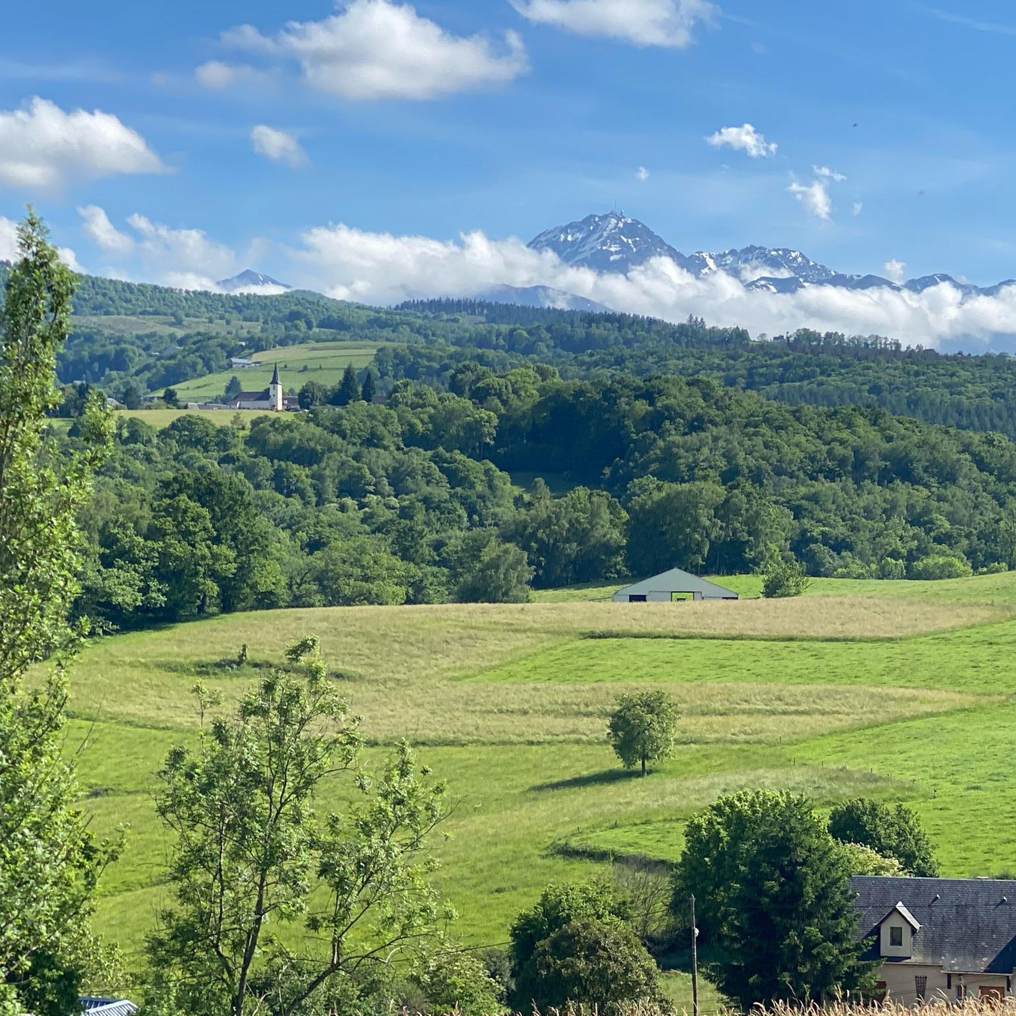
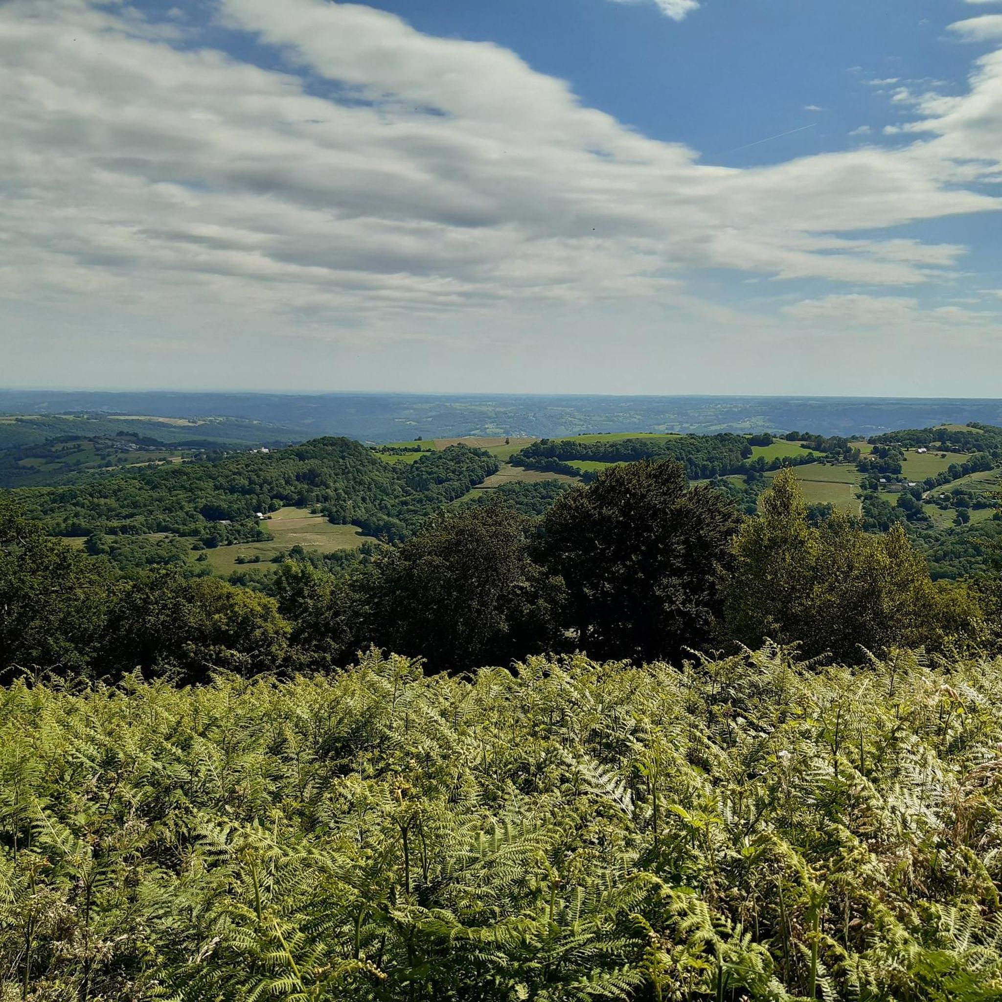
Superb, very beautiful view over the plain, Tarbes, Pau, ...
0
0


Very worth seeing, you have to see it
0
0


Small road pass, at an altitude of 810 meters, which allows entry into the Pyrenees Baronnies from Bagnères-de-Bigorre. Little borrowed, with a beautiful coating.
2
0

it's totally different from that of the north
0
0

Bagnères-de-Bigorre is located at the foot of the emblematic Pic du Midi. This spa town, which dates back to ancient times, is located in a peaceful natural setting. The town is located about thirty kilometers from the Col du Tourmalet. The Col d'Aspin, another legend of the Tour de France, is also not very far away.
2
0

Nice little Col. Great views.
0
0
Frequently Asked Questions
How many running routes are available around Mérilheu?
There are over 150 running routes around Mérilheu, offering a wide variety of options for different fitness levels and preferences. The region features a mix of easy, moderate, and challenging trails.
Are there easy running routes suitable for beginners in Mérilheu?
Yes, Mérilheu offers several easy running routes perfect for beginners. While most routes are moderate, there are at least 5 identified as easy. These typically feature gentler gradients and shorter distances, ideal for those new to running or looking for a relaxed jog.
What are the typical distances for running routes around Mérilheu?
Running routes in Mérilheu vary in distance. You'll find options ranging from shorter loops around 3-4 miles (5-6 km) to longer trails exceeding 6 miles (10 km). For example, the Running loop from Bagnères-de-Bigorre is about 3.4 miles (5.5 km), while the Palomières Pass loop from Bagnères-de-Bigorre extends to 6.9 miles (11.0 km).
Is parking available near the running trails in Mérilheu?
Many running routes in the Mérilheu area start from nearby towns like Pouzac and Bagnères-de-Bigorre, where public parking is generally available. It's advisable to check local parking options in these towns before heading out for your run.
Can I reach running routes in Mérilheu using public transport?
Yes, several running routes are accessible via public transport, particularly those starting from larger towns like Bagnères-de-Bigorre. These towns often serve as hubs for local bus services, making it possible to reach trailheads without a car.
Are there family-friendly running options in Mérilheu?
For families looking to jog together, consider routes with less elevation gain and shorter distances. While specific 'family-friendly' designations aren't always available, easier routes starting from towns like Pouzac or Bagnères-de-Bigorre often provide suitable terrain for a pleasant family outing.
Are dogs allowed on the running trails in Mérilheu?
Generally, dogs are welcome on many outdoor trails in the Mérilheu region, provided they are kept on a leash and owners clean up after them. However, it's always best to check specific local regulations or signage at trailheads, especially in protected natural areas.
What can I see along the jogging routes around Mérilheu?
The running routes often pass through scenic rolling hills and valleys. You might encounter historical sites or natural landmarks. For instance, some routes are near the town of Bagnères-de-Bigorre or offer views towards the Palomières Pass. The wider region also features attractions like the Ascent of the Hourquette d'Ancizan or the Pic du Midi.
What do other runners enjoy the most about jogging in Mérilheu?
The running experience in Mérilheu is highly rated by the komoot community, with an average score of 4.7 stars from over 50 reviews. Runners often praise the diverse landscape, including rolling hills and scenic valleys, and the variety of routes connecting local towns. The well-maintained paths and opportunities to explore natural surroundings are frequently highlighted.
Are there any circular running routes in Mérilheu?
Yes, many of the running routes around Mérilheu are designed as circular loops, allowing you to start and finish at the same point. Examples include the popular Running loop from Pouzac and the Bagnères-de-Bigorre loop from Pouzac, which are convenient for exploration.
What is the best time of year for running in Mérilheu?
The best time for running in Mérilheu generally spans from spring through autumn, when the weather is mild and the natural scenery is vibrant. Summer offers longer daylight hours, but spring and autumn provide cooler temperatures ideal for longer runs. Winter running is possible, but some higher elevation trails might be affected by snow or ice.
Are there any running routes with cafes or refreshment stops along the way?
Routes that start or pass through towns like Pouzac or Bagnères-de-Bigorre often have access to cafes, bakeries, or other refreshment stops. For example, the Bagnères-de-Bigorre loop from Bagnères-de-Bigorre would allow you to easily access amenities in the town before or after your run.
Most popular attractions around Mérilheu

Get inspired with the komoot mobile app


Explore more
Browse the best Running Trails & Routes in other regions.
