Top 10 Mountain Passes around Chavornay
Best mountain passes near Chavornay are accessible from this municipality in the Jura-Nord Vaudois district of Vaud, Switzerland. Chavornay is located on the eastern edge of the Orbe valley, serving as a gateway to the wider mountainous regions of the Vaud canton and the broader Swiss Alps. While no major mountain passes are directly within Chavornay, the area provides access to diverse alpine experiences.
Best mountain passes around Chavornay
- The most popular mountain pass is Col de Ballon (929 m), a mountain pass that is 14.1 km long with an average gradient of 5%. This pass can be ascended from Virieu-le-Grand or Tenay.
- Another must-see spot is Charbemènes Pass, a mountain pass at 1316 meters. This pass is located a few kilometers south of the Grand Colombier, at the intersection of the Arvière valley, the Grand Colombier, and the Sur Lyand ridges.
- Visitors also love Col du Grand Colombier, a challenging mountain pass. This pass, just over 1,500 meters high, offers ascents along small roads with minimal traffic and many panoramic views.
- Chavornay is known for challenging climbs, scenic viewpoints, and forested trails. The region offers a variety of mountain passes to explore, ranging from intermediate routes to demanding ascents.
- The mountain passes around Chavornay are appreciated by the komoot community, with more than 220 upvotes and over 140 photos shared.
Last updated: July 10, 2026
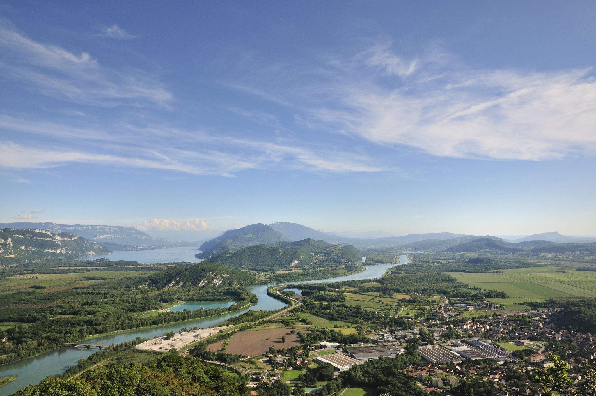
Col du Grand Colombier
Highlight • Mountain Pass
Showing Translation
Tip by

Ascent of Col du Grand Colombier from Culoz
Highlight (Segment) • Climb
I prefer this side because it allows for the switchbacks that made this pass famous.
Translated by Google •
Tip by

Sign up now to discover places like this
Get recommendations on the best single tracks, peaks, & plenty of other exciting outdoor places.
Sign up for free
Col de Ballon (929 m)
Highlight • Mountain Pass
Translated by Google •
Tip by

Charbemènes Pass
Highlight • Mountain Pass
Translated by Google •
Tip by

Col du Grand Colombier Ascent from Anglefort
Highlight (Segment) • Climb
Translated by Google •
Tip by

Sign up for free to discover even more mountain passes around Chavornay.
Sign up for free
Already have an account?
Start today with a free account
Your next adventure awaits.
Login or Signup

Other adventures around Chavornay

Tips from the Community

Of the four access routes to the Col du Grand Colombier, the ascent from Anglefort is probably the most difficult, especially over the first ten kilometers, which average 10%. The last five kilometers are less steep, with even a short flat section at the eleventh kilometer.
1
0

A few kilometers south of the Grand Colombier, this pass at 1316 meters is at the intersection of the Arvière valley, the Grand Colombier and the Sur Lyand ridges.
0
0

Pass at 929 m altitude, ascent from Virieu-le-Grand or Tenay.
1
0

Every second Saturday in June, July, August and September. from 7 a.m. to 3 p.m., the climb to the Grand Colombier from Culoz is reserved for cyclists, without registration.
3
0

Long and difficult climb, fantastic views along the way. Spicy increase percentages.
5
0
Long and difficult climb, fantastic views along the way. Spicy increase percentages.
4
1

Discovered by the Tour de France, it is now a legendary mountain. I recommend the climb from Culoz with its spectacular hairpin bends and great views of Lac du Bourget. 17 km ascent, partly up to 14% incline, but with 2 longer flat sections that allow some relaxation. Wonderful all-round view at the summit, with snack bar and souvenir shop in the nice season.
3
1

The Col de Ballon is 14.1km long with an average gradient of 5%, although there is a slight descent at the 11th km which reduces the overall average gradient.
6
0
Frequently Asked Questions
What are some of the most popular mountain passes accessible from Chavornay?
While Chavornay itself doesn't have major passes directly within its borders, it serves as a gateway to several notable ones. Popular choices include Col de Ballon (929 m), known for its 14.1 km length and average 5% gradient, and the challenging Col du Grand Colombier, which offers stunning panoramic views from over 1,500 meters high.
Are there any historically significant mountain passes near Chavornay?
Yes, while a bit further afield, the Grand Saint Bernard Pass (Col du Grand-Saint-Bernard) is one of the most historically significant passes in the Western Alps. Used for over 3000 years by Roman troops and Napoleon's army, it offers majestic scenery and is home to the Great St. Bernard Hospice, with mentions dating back to 812 AD.
What kind of views can I expect from the mountain passes in the region?
The passes offer diverse and spectacular views. For instance, Col du Grand Colombier provides magnificent panoramic views of the Jura, the Alps, and Lake Bourget, with Mont Blanc visible on clear days. The Simplon Pass is known for its sweeping curves and stunning views of lush, tree-lined valleys on the Italian side and snowy peaks in Switzerland.
Are there challenging mountain passes for experienced cyclists or hikers?
Absolutely. The Col du Grand Colombier is renowned for its challenging ascents, with routes like the Ascent of Col du Grand Colombier from Culoz featuring slopes of almost 15%. Another challenging option is Col de la Biche, which also offers steep sections and beautiful views of the Mont Blanc range.
What are some less-traveled or picturesque passes to explore?
For a more intimate experience with nature, consider Charbemènes Pass, located a few kilometers south of the Grand Colombier at 1316 meters, offering a picturesque route through meadows and forests. La Baudichonne Pass, though not a Komoot highlight, is also noted for its less-traveled route through blossoming meadow landscapes.
What outdoor activities can I do near these mountain passes?
The region around Chavornay and its passes is excellent for various outdoor activities. You can find numerous routes for gravel biking, road cycling, and hiking. These guides offer routes ranging from moderate to difficult, allowing you to explore the diverse terrain.
Are there any mountain passes suitable for scenic drives or cycling in the Vaud region?
Yes, the Col de la Givrine (1232 m) in the Vaud region is frequently traveled between Lake Geneva and the Jura Mountains. It's an accessible pass suitable for scenic drives or cycling, connecting significant natural areas and offering some views towards Lake Geneva.
What is the best time of year to visit the mountain passes around Chavornay?
While specific 'best times' vary by pass and activity, summer generally offers ideal conditions for exploring, with blossoming meadow landscapes, especially around passes like La Baudichonne. For passes at higher altitudes, late spring to early autumn typically provides the most accessible and pleasant weather for hiking and cycling.
What do visitors appreciate most about the mountain passes in this area?
Visitors frequently praise the challenging climbs, the minimal traffic on many routes, and the many magnificent panoramic views. The ability to enjoy the scenery in a relaxed manner, especially from less crowded summits, is also highly valued. The komoot community has shown its appreciation with over 220 upvotes and more than 140 photos shared for the mountain passes around Chavornay.
Are there any passes that offer unique engineering marvels?
The Simplon Pass is notable for its engineering. Beyond its stunning natural beauty, it features the Simplon Tunnel, constructed in 1906 for year-round traversal, and the impressive Ganter Bridge, which spans the Ganter Valley 150 meters high, offering vast views.
Can I find mountain passes that are accessible by means other than driving or cycling?
Yes, for example, the La Chaux-Ronde Summit (2028 m), located in the western Bernese Alps, functions similarly to a pass in terms of access and views. It is accessible by railway or ski lift, offering stunning panoramic views of the surrounding valleys and mountains without requiring a car or bike for the ascent.
Most popular routes around Chavornay
Most popular attractions around Chavornay

Get inspired with the komoot mobile app


Explore more
See even more epic mountain passes by checking out these guides around Chavornay:
